Val Veny


Edited by:
Ivano Ruffoni
Updated at: 17/05/2025
Introduction
The itinerary offers a route between suggestive views of Mont Blanc and its glaciers.
Description
Follow the tarmac road that, after two hairpin bends, skirts, on the right, the base of the Miage glacier moraine and reaches the Combal bridge (2020m) (where the remains of an old dam used for military purposes to hinder French invasions are visible). Cross the bridge and, immediately afterwards, a steep path, marker , branches off to the left, shortly leading to Arp Vieille Inferiore (2073m). Continue on the path until you come to a fork where you follow the track to the right, marker . Continue on towards the gully of gravel and broken rocks, paying attention to the sections where the trail is partially collapsed. At times, it is worth stopping and looking northwards at the magnificent panorama of the Mont Blanc chain and the Miage lake and glacier.
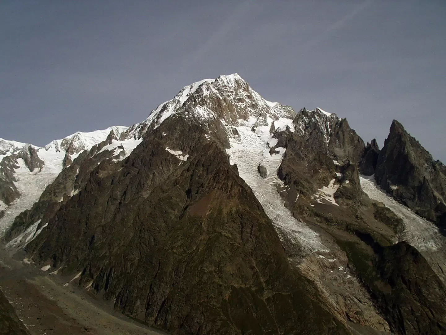
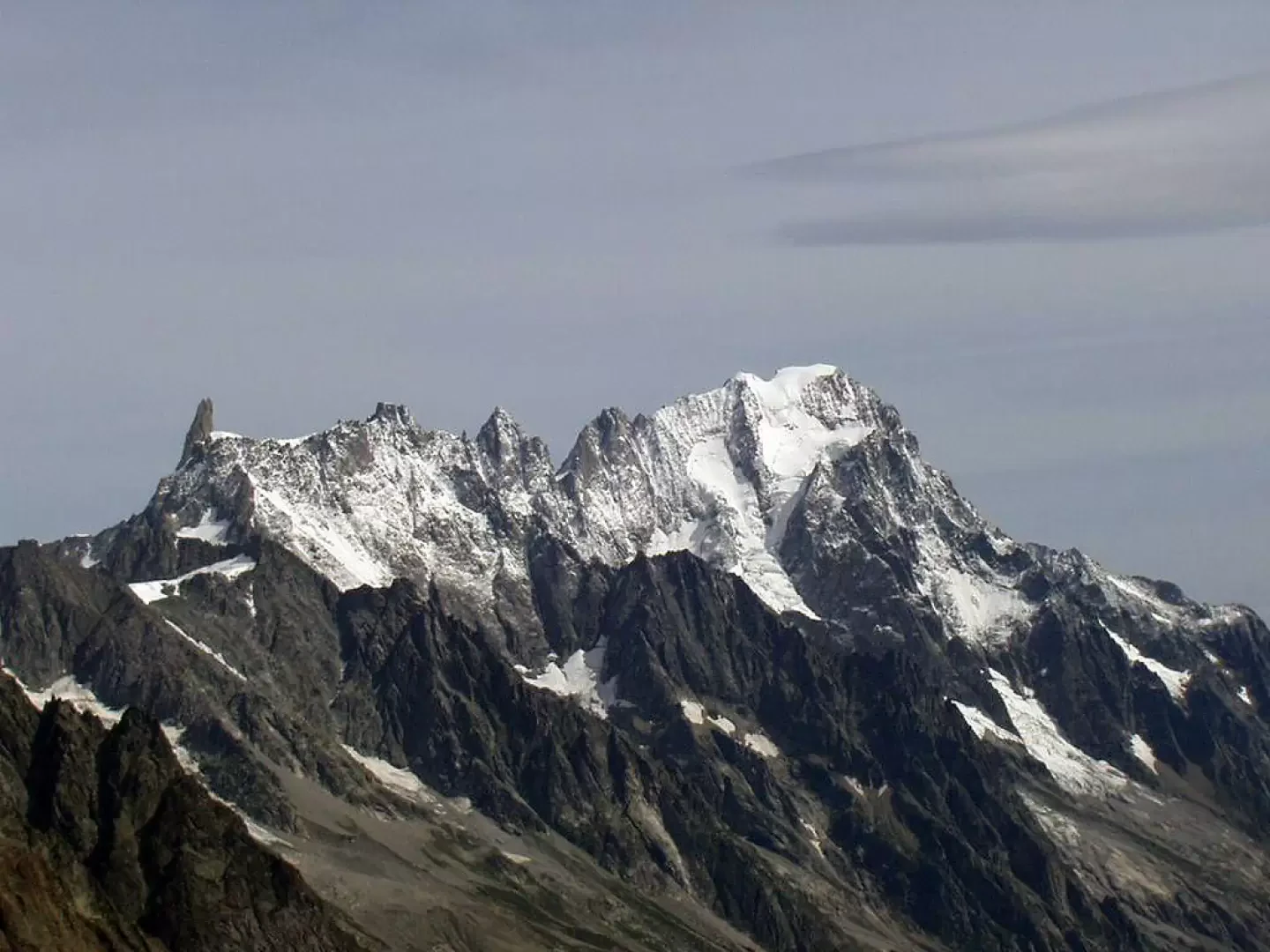
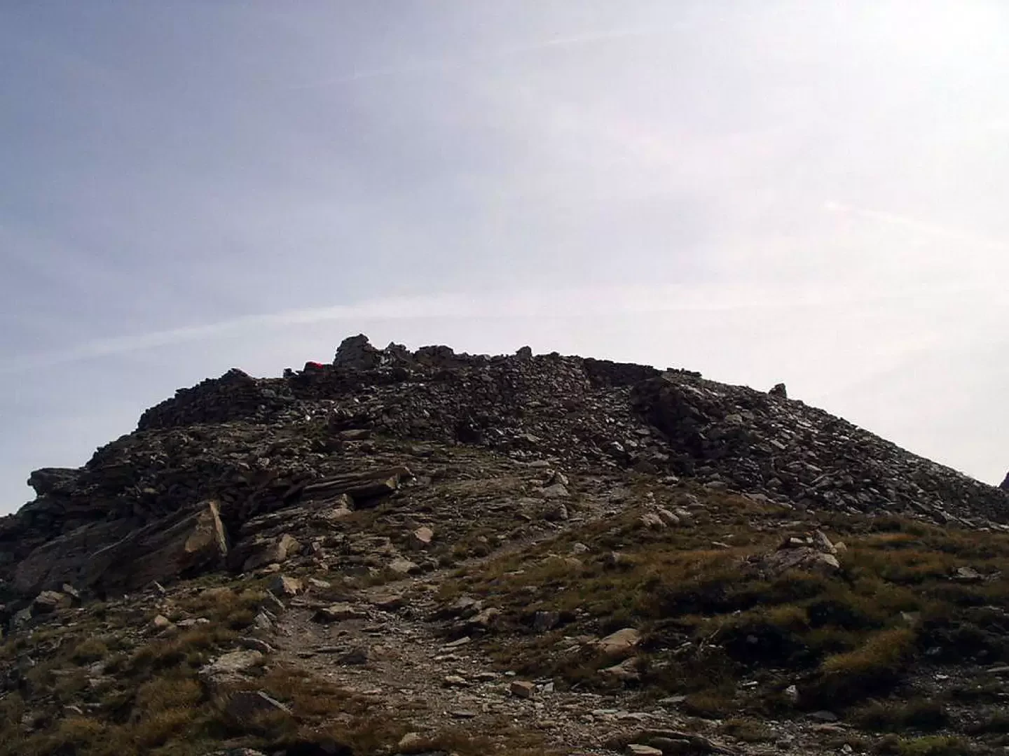
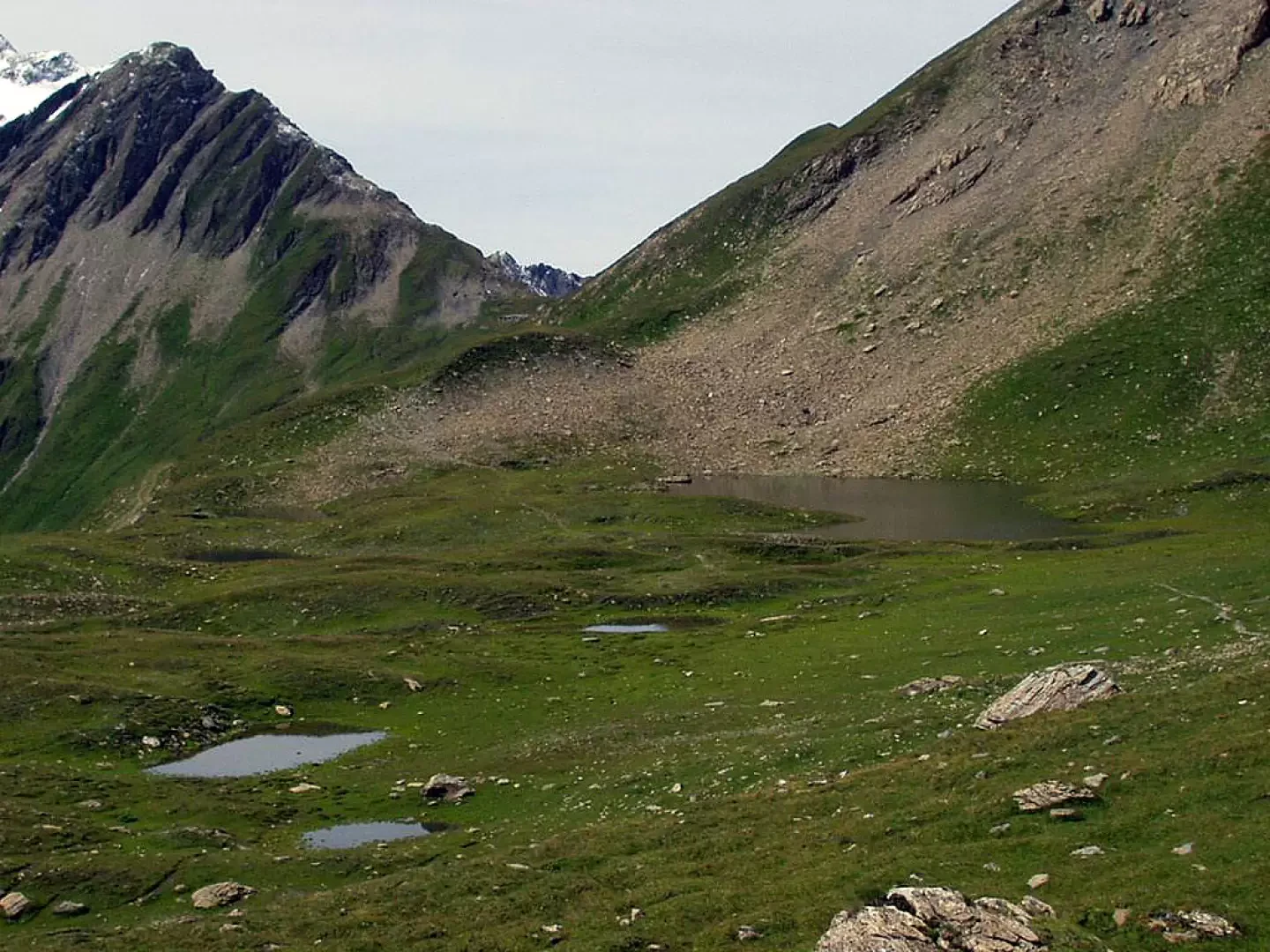
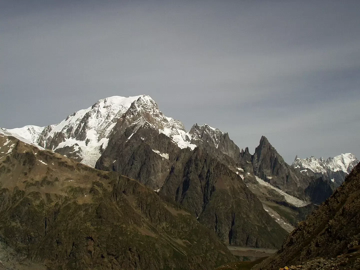
The ascent in the final part is very steep and leads to the rounded summit of Monte Fortin (2758m), where the remains of a military shelter can be found. From the summit, aided by an observation post installed there, you can spot and observe many peaks of the Mont Blanc group (to the north), Les Grandes Jorasses (to the northeast) and, in good visibility conditions, the Grand Combin (to the northeast). We now proceed towards the south-west, halfway up the slope, on a grassy path that skirts several small lakes lying between Mont Fortin and Mont Percé until we reach the dirt track of the Vallone des Chavannes. Almost on the level, you reach the Col des Chavannes (2603m), from where there is another magnificent viewpoint over the Pyramides Calcaires, the Aiguille des Glaciers, the Aiguille de Trèlatête, Mont Blanc, the Aiguille Noire de Peutérey and gradually all the peaks towards the north-east as far as visibility permits. Now proceed westwards (if you wish, you can descend along the Alta Via 2 directly to the Vallone de la Lex Blanche) under the northern slopes of Mont Lechaud.
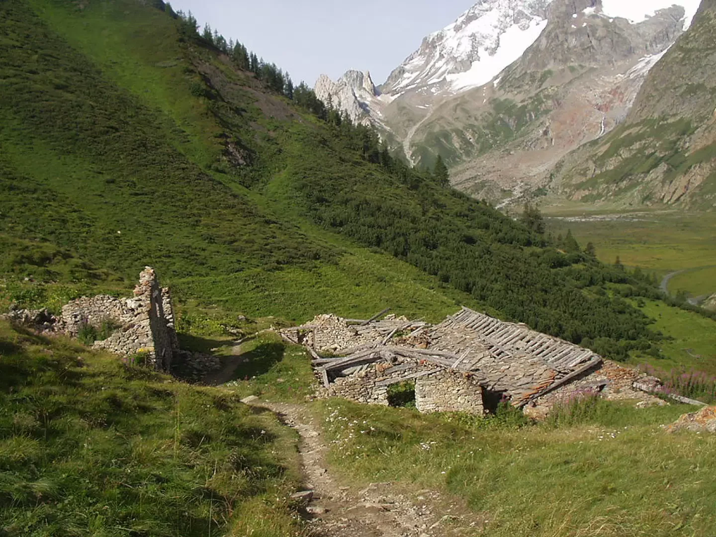
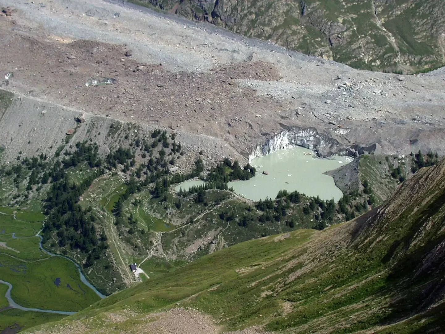
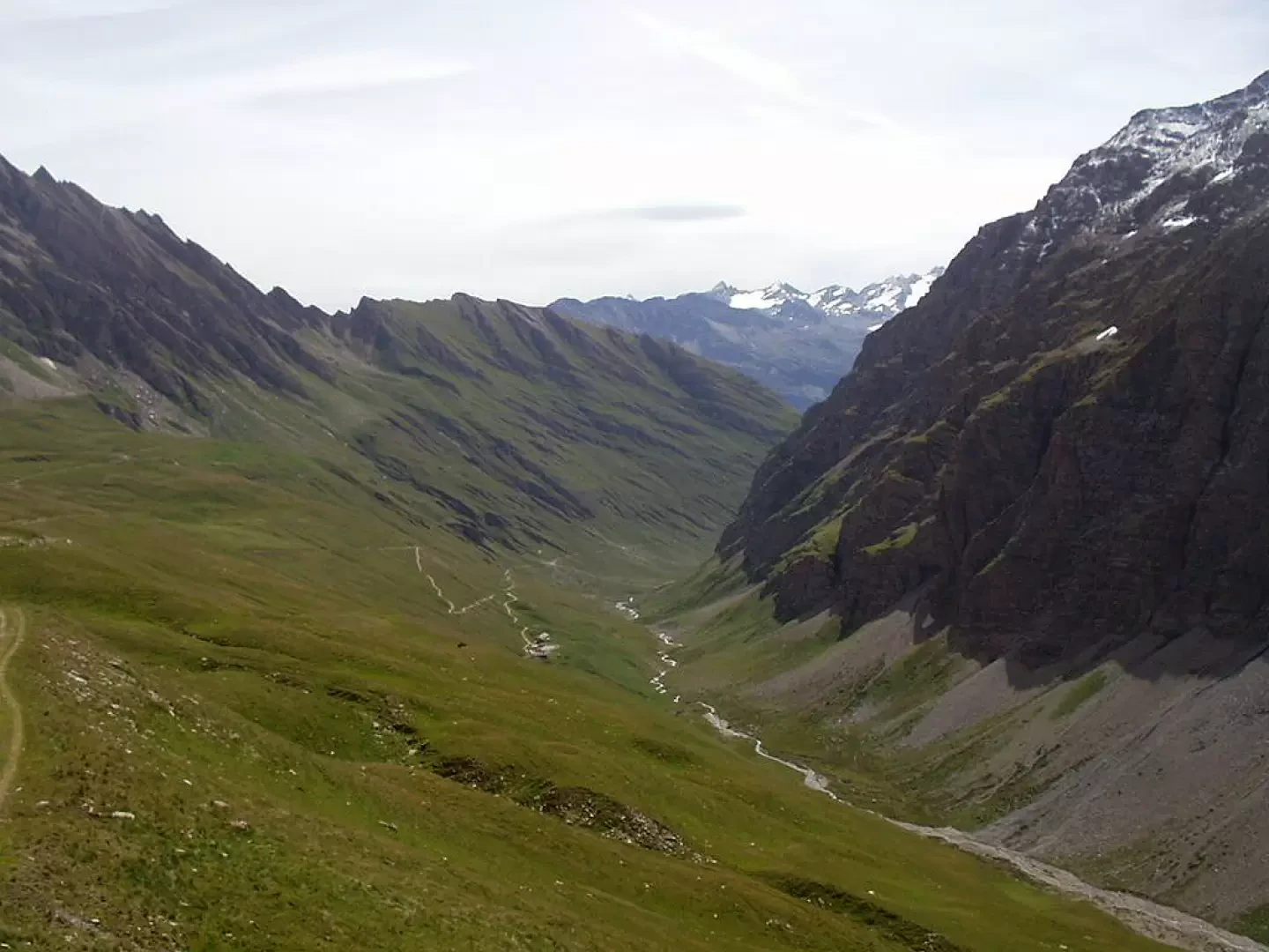
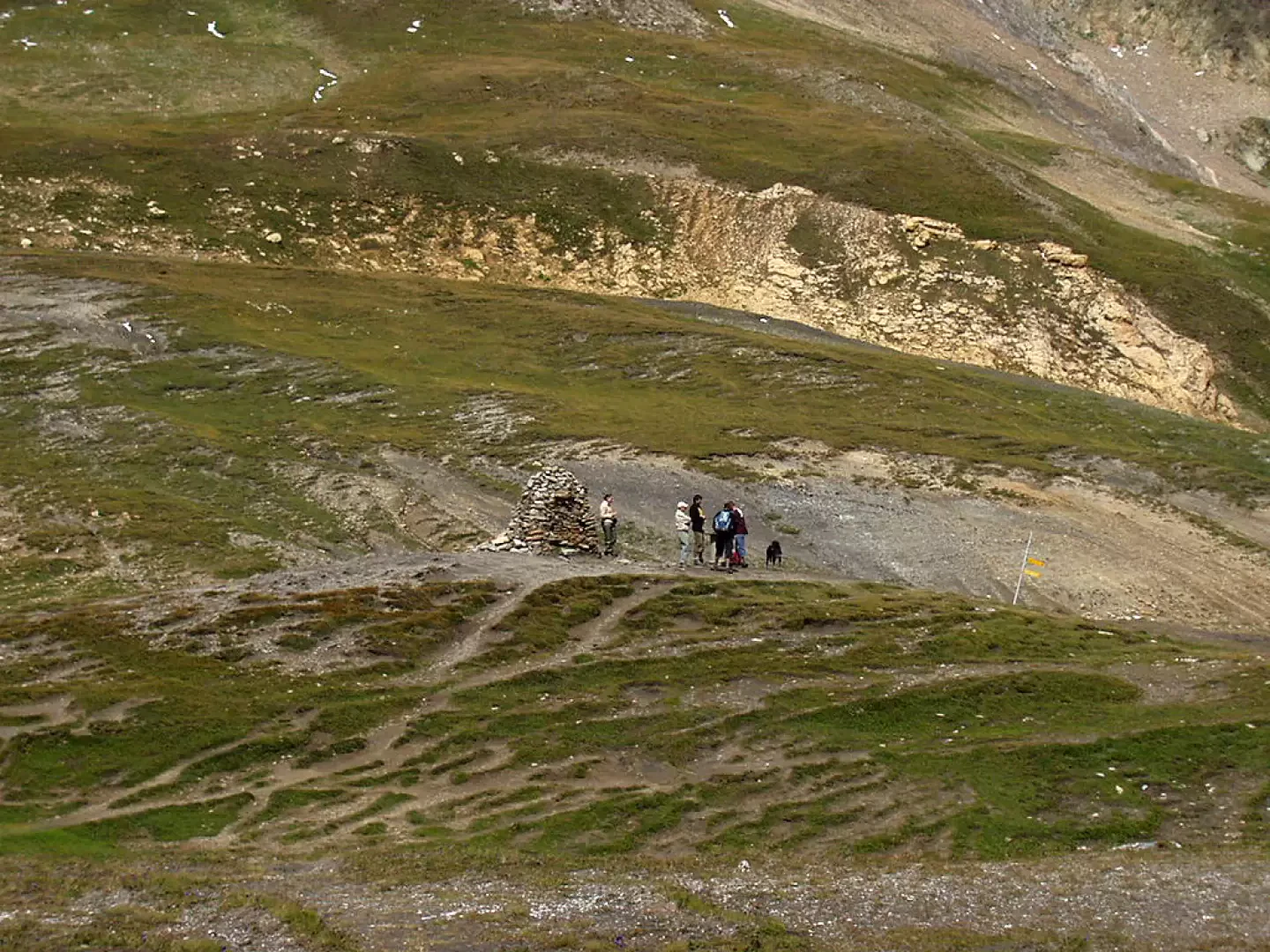
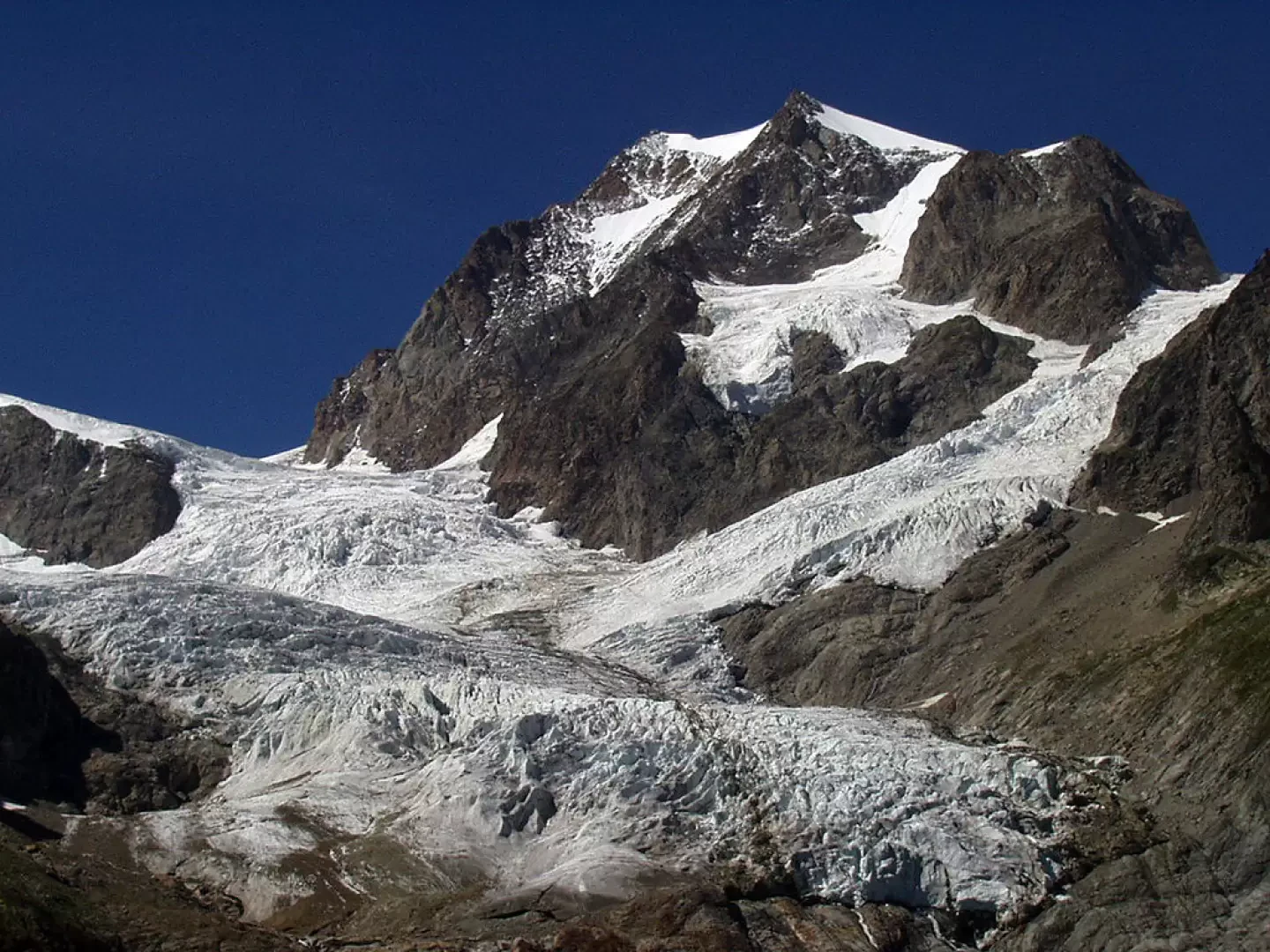
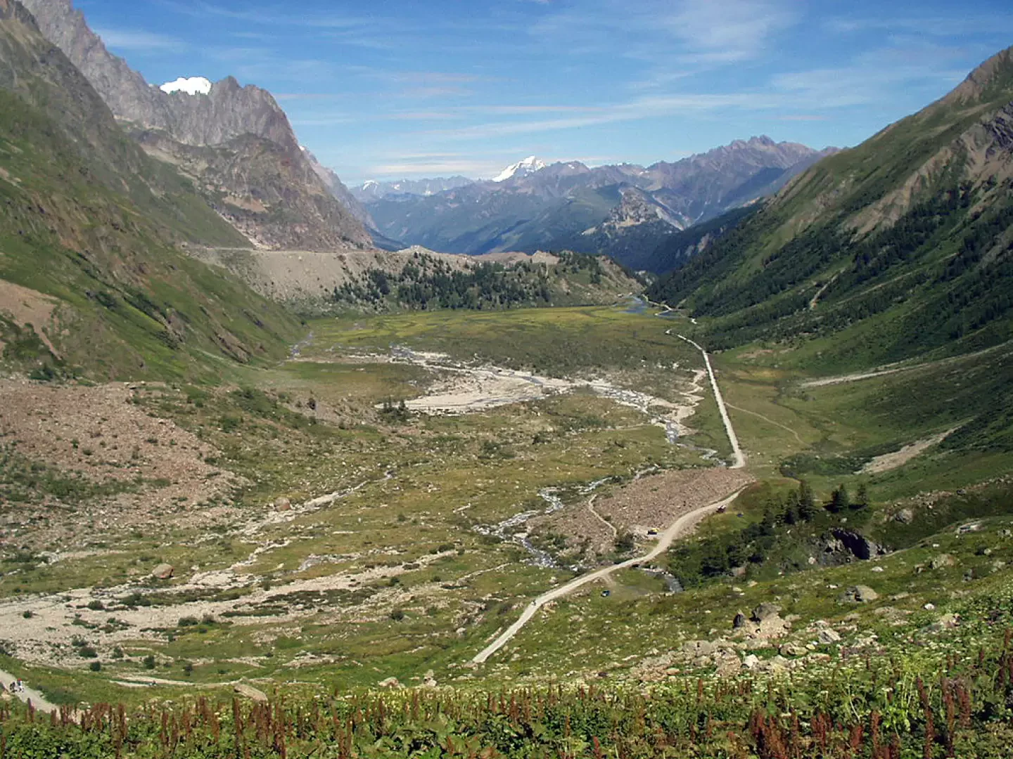
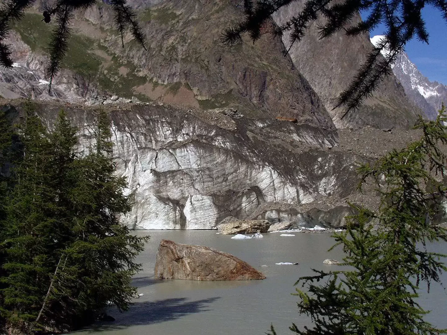
In the initial part, the path is very slippery (be even more careful in case of snow) and in places only well indicated by stone cairns. You reach a grassy jump and, almost level, the track leads close to a ruin where it crosses the path coming up from the Vallone de la Lex Blanche. A few minutes and you are at Col de la Seigne (2512m), where there is a boundary stone between Italy and France and a large stone cairn (visible even from the Combal bridge). Here too, the panorama stretches over the entire Mont Blanc chain and, in the distance, the Grand Combin is again visible in good weather conditions. The descent is along the path leading to a ruined barracks and then to the Alpe Superiore de la Lex Blanche (2282m). The dirt track now skirts the south-east faces of the Pyramides Calcaires and leads to the Alpe Inferiore de la Lex Blanche (2156m), just below the Elisabetta Soldini hut (2200m). Descend with a few twists and turns along the dirt track until reaching the Combal Lake plain. Admire the imposing and magnificent Lex Blanche glacier to the left, heading northwest. After a couple of kilometres in the Combal Lake marshland, you are back at the Combal bridge. A short ascent to Lake Miage on the left is recommended. Some signs remind you not to get too close to its shores, as very dangerous rogue waves can be generated due to the sudden collapse of stones and ice from the northern serac. We descend back to the Combal bridge and continue on the dirt track that leads to the barrier where our hike began..
Photo gallery
Comments (0)
Sign in to leave a comment