Val Pilotera, from Donadivo


Edited by:
Paolo Erba
Updated at: 27/11/2025
Access
From Milan, take state road 36 to Colico, then continue on to Chiavenna and when you reach Novate Mezzola turn left for Gordona. Continue until you reach the village of Gordona where a tourist sign indicates the Bodengo valley, be careful to buy the pass required to enter the valley! We then follow the road past the Dunadiv restaurant, where we descend and just past the new, ugly, concrete bridge on the right we find an open space for parking.
.Introduction
Trail leading to high alpine pastures that are still partly loaded today and that were used by smugglers when crossing into neighbouring Switzerland. It is also possible to make treks lasting several days.
Description
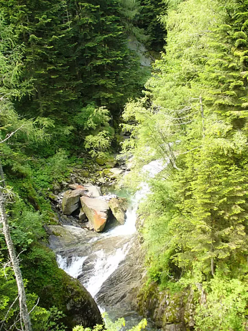
Leaving the car behind, we proceed along the obvious mule track, which is very well maintained, up to the hamlet of Barzena. We cross the houses upwards and enter the dense forest. Always following the evident track, even if it is poorly signposted, you rise to the Pilotera valley with beautiful views of the torrent, the Chiavenna valley floor and the other side.
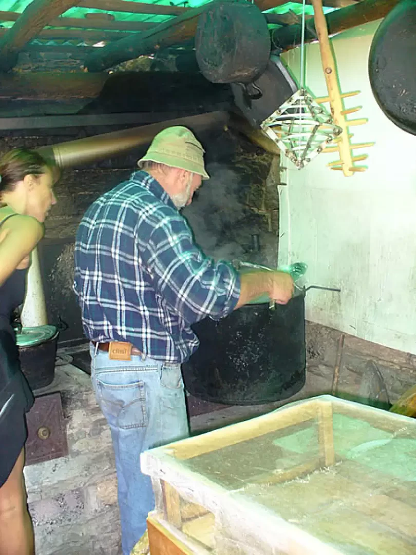
After about an hour you arrive at the hut belonging to Signor Duilio, who still makes cheese and ricotta using the methods of the past.
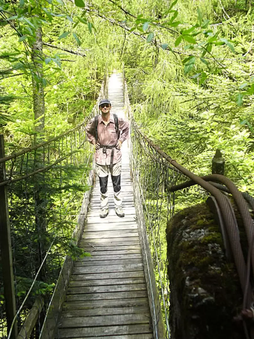
After greeting Duilio, you enter a beautiful beech wood and shortly afterwards the short but steep descent begins that leads to the typical Tibetan bridge that joins the two banks. When you reach the other side, ignore the signpost that goes to the left, which, although shorter, is uncomfortable, and climb up to the right until you meet the path that climbs from Alpe Orlo. You now turn left and begin to climb up the valley. The ascent at first proceeds with little gradient, crossing the pastures, low and high, and the Gandascia huts.
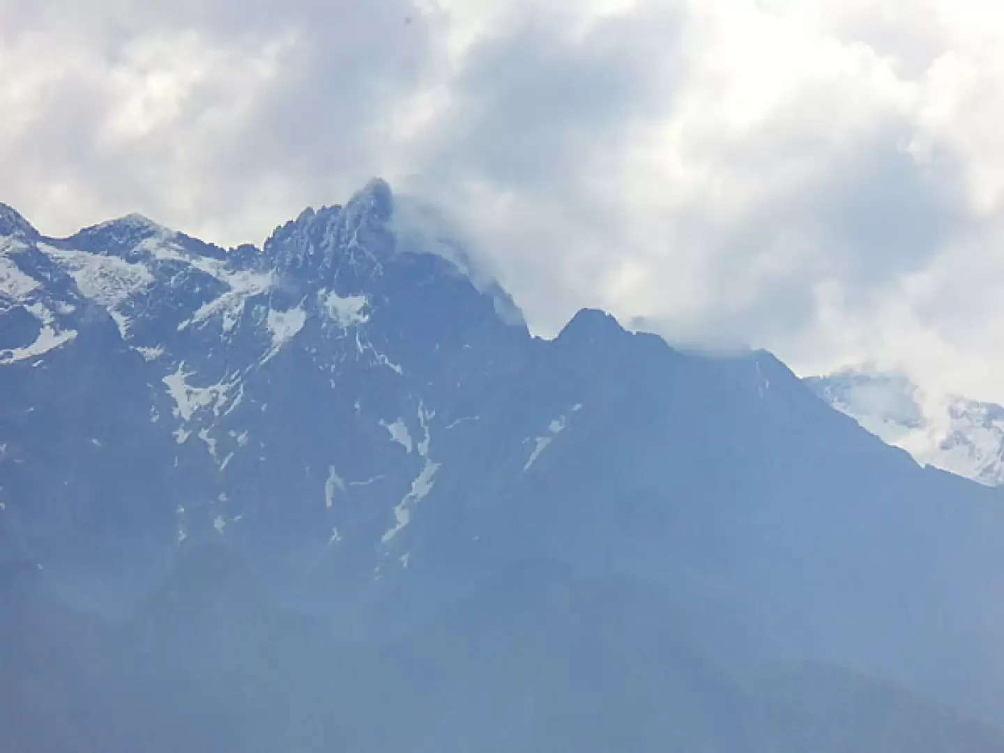
At the bottom, a rampart rises up in front of us, which must be climbed with a strenuous path to the right. We can already see the cross that indicates the area where the Lavorerio bivouac stands, our destination. With steep hairpin bends, we proceed through the larch and rhododendron forest until we come out onto the pastureland of the Lavorerio alp. We cross to the left, always uphill, until we reach a semi-puddled area, where a signpost indicates the bivouac just a few minutes away. The return journey is along the same path to the junction for the Tibetan bridge. When you get here, continue straight on in the direction of Alpe Orlo with splendid views of the valley below and the Rhaetian Alps in front.
When you get to the alp, take the historic mule track to the right of the dirt road that unfortunately seems about to be asphalted, which descends quickly among the chestnut trees. Having crossed the road, follow it for a few dozen metres, paying attention at the second bend where the mule track turns left. All that remains now is to descend, arriving right next to the Dunadiv where it is worth stopping to eat Pasqualino's pizzoccheri chiavennaschi.
.Photo gallery
Comments (0)
Sign in to leave a comment