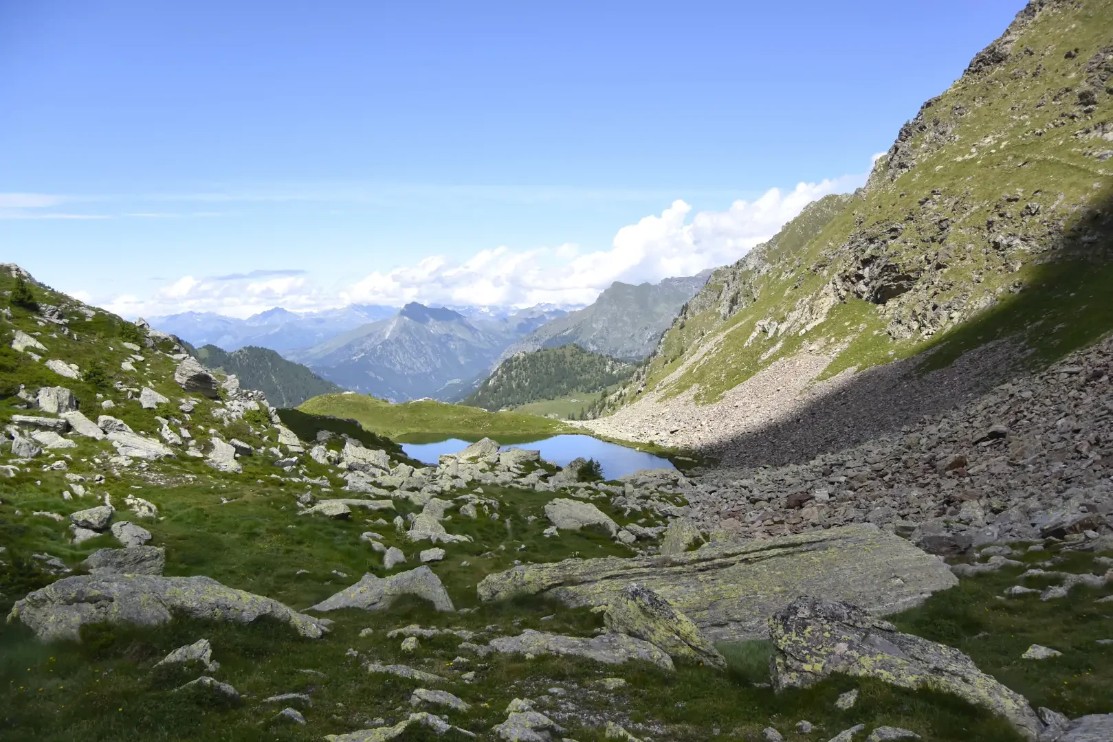
Tour of the Frudière lakes, from Fenillettaz

Access
All’uscita dello svincolo autostradale di Verrès, entrare nella rotatoria e prendere la seconda uscita, in direzione del centro storico. Proseguire per circa 300 metri, quindi svoltare a sinistra per imboccare la Strada Regionale in direzione Val d’Ayas. Seguire la regionale per 16,5 chilometri, superando i caratteristici borghi di Challand-Saint-Victor e Challand-Saint-Anselme, fino a raggiungere Brusson. Attraversare il centro abitato di Brusson e, poco prima del bivio per il Col de Joux, svoltare a destra per prendere la strada comunale per Estoul. Continuare a seguire la strada comunale per circa 7 chilometri, oltrepassando il piccolo villaggio alpino di Estoul, fino a raggiungere un ampio parcheggio 🅿️, dove è possibile lasciare l’auto.
🚫 Il punto di partenza dell’itinerario non è raggiungibile con i mezzi pubblici, quindi è necessario utilizzare un mezzo privato.
Distanza e tempo di percorrenza
🕒 Tempo di percorrenza: 38 minuti
📏 Distanza: 22,5 km
Navigazione GPS
📍 Come arrivare con Google Maps
📍 Come arrivare con Apple Maps
ℹ️ Nota importante
Le indicazioni fornite sono state verificate alla data del rilievo dell’itinerario. Prima della partenza, è consigliabile verificare eventuali variazioni del percorso. Per ottenere indicazioni aggiornate e dettagliate, si consiglia l’uso di Google Maps o Apple Maps.
Introduction
A very long tour, about 15 km, straddling the Gressoney and Ayas valleys, offering beautiful views of Monte Rosa and the two valleys. The Gressonaro side is very little frequented. We set off from Col Ranzola, go around the Punta della Regina on the left to Prà Bianco, descend to the arrival of the Wisomatto-Weissmatten lifts, climb to the Taf pass, descend to the Frudiera lakes, climb to the col above Alpe della Garda and return to Col Ranzola. The route is on the whole strenuous because of the numerous ascents, and after the pass to the left of Monte Taf it is protected by railings and equipped with chains for about 20 m, then it descends in twists and turns across very steep slopes; wide, but exposed. This section is not suitable for children, dogs, or those suffering from vertigo. I absolutely do not recommend this route if it is snowy or begins to snow. There is no water until the springs next to the second Frudiere lake.
.Description
Leaving the car behind (at 1930 m), take the road that leads to Alpe Finestra, cutting the hairpin bends on tracks, and then follow the path to Col Ranzola (2170 m). At the pass there is a little chapel, a plaque commemorating the transit of the poet Leo Tolstoy, a madonnina and a little wall built for military purposes; the "via dei Milanesi" passed through this pass, a route taken by the people of Valsesia after the Valdobbia pass to descend into the Val d'Ayas valley and go into the Valais. Pass on the Gressonaro side and continue to the right on path , among rhododendrons and larches, crossing the slopes below the punta della Regina in ups and downs to the Gombetta basin, where you ignore the path that climbs to the right to the colle della Garda, continuing to the left on path . The path is almost flat, but the slopes on which it is marked become steeper and steeper. There is also a section equipped with a safety cable, which is perhaps more useful in snowy terrain than in summer. The route descends to the Prà Bianco alpine pasture and then to the arrival point of the Weissmatten chairlift (2046 m, 1h 30').
Continue downhill along the ski slope, almost immediately finding path 1A on the right, at first barely visible, then more marked; after crossing a first scree slope, you come to a second one of large boulders, which you cross by means of a marked path and a wooden footbridge, then ascend in wide bends to the eastern slope of Mount Taf, descend to another scree slope that must be crossed, and ascend to the Taf col (2410 m, 2h00'). Here the view is spectacular; the col is a balcony, protected by a railing, overlooking the Frudiere lakes and facing Mont Nery. We descend to the right, on the , there are about twenty metres of chains, then the path turns left and descends quite wide but on very steep slopes, almost overlooking the lake below. Be very careful when walking along this stretch. The Frudiere pass is signposted by a large cairn; descend to the upper lake and walk along it in a clockwise direction, turning towards the lower lake amidst rhododendrons and other flowers; pass an alpine pasture and head for the huts next to the outlet of the lower lake, in a stupendous position; along the way there are some springs where you can finally get water. At this point, continue to descend until you reach an altitude of 1920 m, then, to avoid losing further height difference, take a little path that reaches a passage under a cliff, and between larch trees and scree, arrives at a damp area, where the track gets lost; keep to the left and continue to climb, passing by the Alpe della Garda, following path (the signpost leads to the Colle della Garda); you will reach a depression below the Punta della Regina, and from here descend to the Alpe Fenetre, which is now visible, from where you return to the starting point by dirt track (3h30' from the Colle del Taf, 6h30' in total).