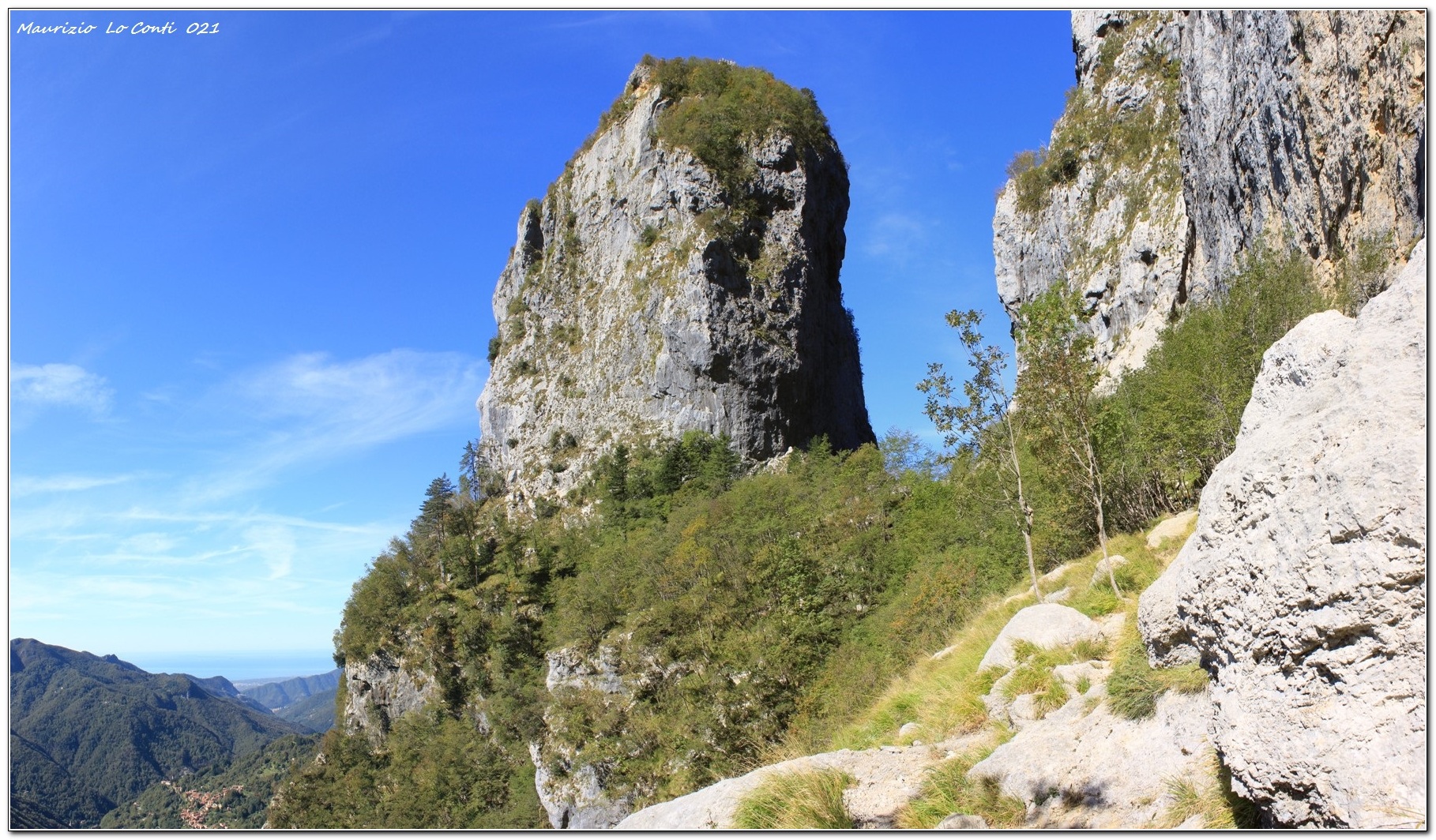
The base of the Procinto


Edited by:
Maurizio Loconti
Updated at: 03/11/2025
Access
You take the A12 motorway, exiting at Versilia and passing a hideous dolphin sculpture at a roundabout. At the next one, you turn inland for Ripa and Ponte Stazzemese. We climb towards Stazzema until we turn right (in the direction of Rif. Forte dei Marmi) to where the path begins (520 m); parking is paid (€3 per day).
Introduction
The Forte dei Marmi shelter is in a good location for eating and resting. The meal, like the previous time, is excellent, with a varied menu, compared to the standard, spartan fare usually found in Tuscan refuges.
Description
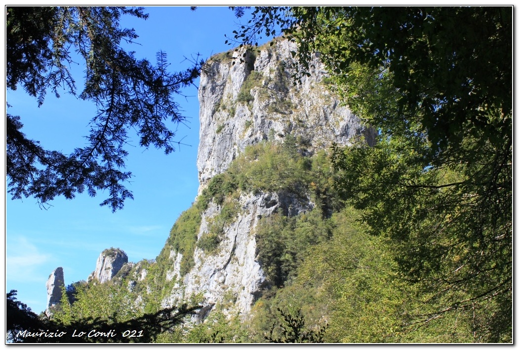
We begin the tour, climbing up a nice cobbled road.... Some fallen trees complicate the progression with the view reaching the sea. We rise again beyond the BeB Casa Giorgini, with a view of the Pania Croce. Omitting two detours to the refuge, we take the third, passing almost under the vertical rock. After about 40', we detour to see the base of the Procinto (1000 m), which is reached in 25', at the height of the shaky little bridge. The Procinto is an immense vertical tower, 1177 m high, and all access routes to the summit are reserved for mountaineers, including a via ferrata to the south. The walls are vertical and you go back for a break from the Forte dei Marmi hut (868 m - tot. one way 2h30).
On the way back, there is a beautiful panorama towards Monte Matanna. In 1h, you reach the car park again.
In summary. Dif. E - 3h30 Total (2h30 out and 1h return excluding breaks) - 7.5 km - height difference +500 m. Convenience: poor, especially on the return journey. Best period: autumn and spring. Tour interest: high. Time: excellent
If you want, here's the pdf photo file, with a bit more news:
http://www.cralgalliera.altervista.org/RifForteDeiMarmi021.pdf
... and a few single shots as well:
http://www.cralgalliera.altervista.org/2110B1PanoramaSuPaniaCroce.jpg
http://www.cralgalliera.altervista.org/2110B2BaseProcinto.jpg
http://www.cralgalliera.altervista.org/2110B3GuglieEProcinto.jpg
Photo from previous outing in the area:
http://www.cralgalliera.altervista.org/RifForteDeiMarmi017A.pdf
http://www.cralgalliera.altervista.org/RifForteDeiMarmi017B.pdf
http://www.cralgalliera.altervista.org/GiteApuaneAltaToscana.htm
http://www.cralgalliera.altervista.org/anno2021.htm
http://www.cralgalliera.altervista.org/altre2021.htm
NB: In the case of an excursion, always check with FIE, Cai, any park authority or other institutions, pro loco, etc., that there have been no changes to the route, that there have been no changes that have increased the difficulties! No liability is accepted. The present text is purely indicative and not exhaustive.
Info Hiking Section Cral Galliera: http://www.cralgalliera.altervista.org/esc.htm
trips 2021 at the link: http://www.cralgalliera.altervista.org/gite021.pdf
Comments (0)
Sign in to leave a comment