Durmont Peak


Edited by:
Maurizio Loconti
Updated at: 03/11/2025
Access
From Spiazzo (TN - 650 m), leave the state road, enter the village and cross the river via an overpass. At the second fork, go right (via Al Ponte, dei Cavai and Ches), bearing in mind that there are NO useful road signs on site! Follow the carriageway, which gains height with a series of hairpin bends to Passo Daone (1290 m - almost 8 km from the valley floor with ). Nearby is the Capanna Durmont inn, temporarily closed in summer 2020, and park.
Introduction
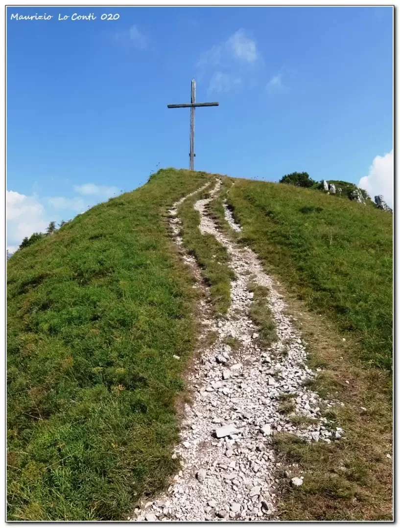
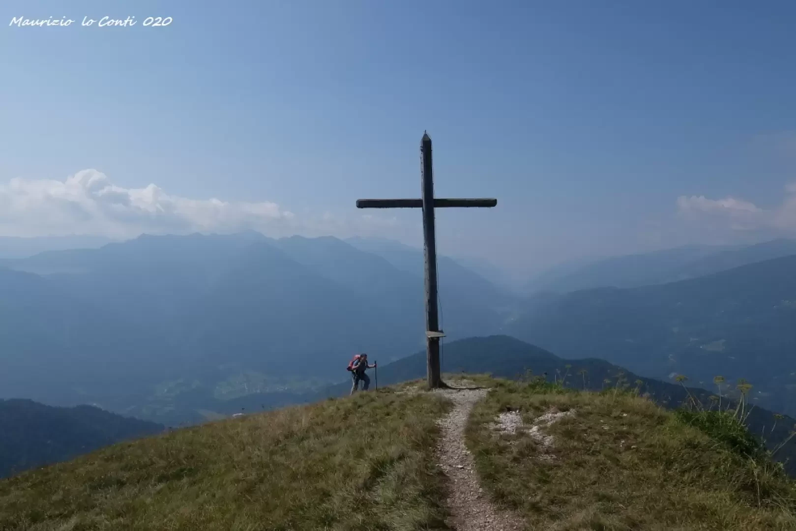
The summit cross of the Durmont summit is in a very panoramic position.
Description
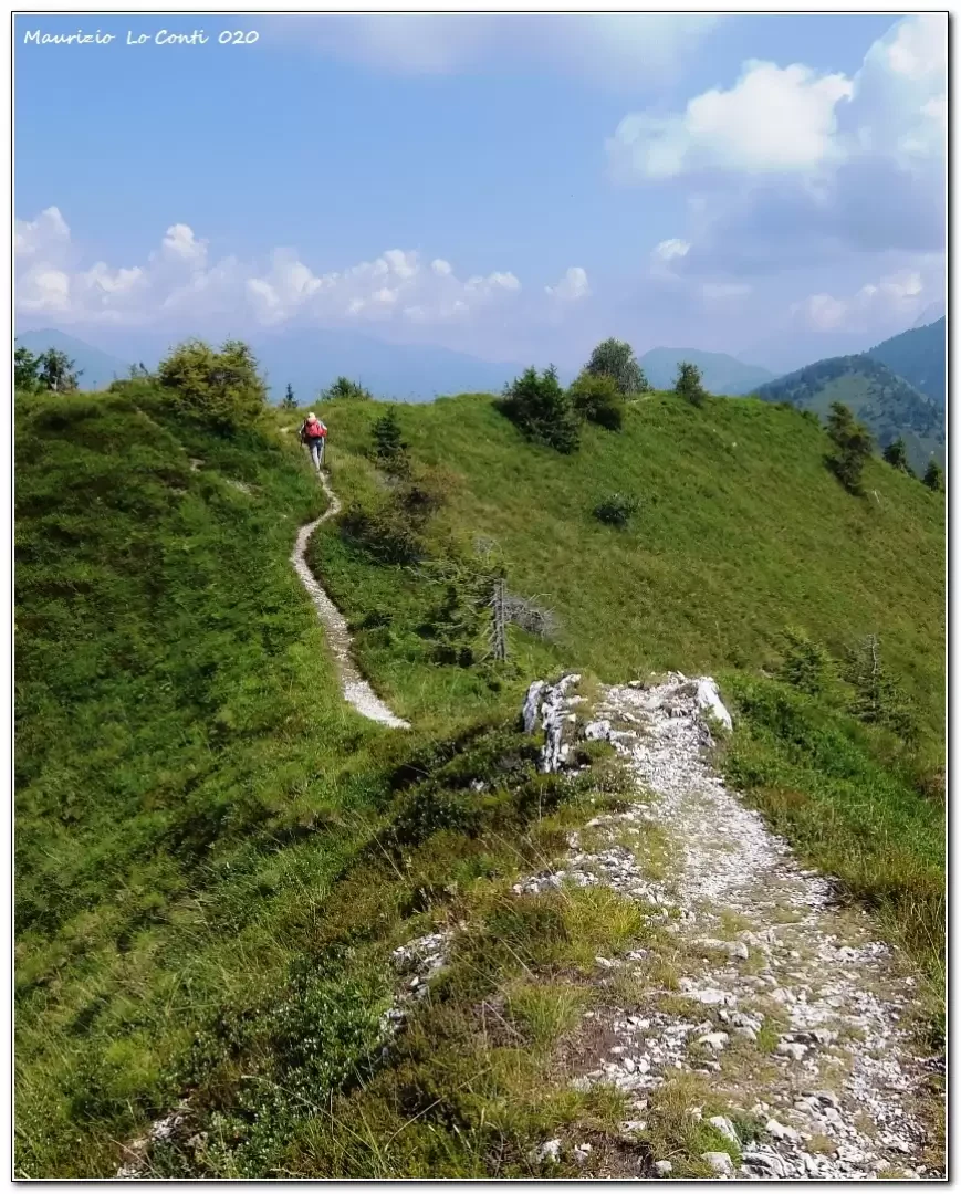
We set off on foot, crossing a beautiful forest and passing several hamlets. We persevere through the dense vegetation, climbing up until we come to a grassy area. With a final effort, the summit cross of the Durmont peak (1835 m -1h30) is reached. You now face the ridge and afterwards lose altitude a little steeply through the trees, reaching the Campiol pass 1671 m. Here, turn right along a forest road (no symbols!). In about 15 minutes, at a hairpin bend, a turnoff to the right comes off (the vertical signs have been lost). The flags are not visible and one proceeds with some doubt. After 10', you find a left fork at which you leave the road. The signs reappear and help you continue. There is a stretch where one notices the disasters of the 2018 blizzard (on either side, felled trees) and then finds a watering hole. One continues for a long time in the forest on a single track. Beyond a fork in the road, we turn right slightly uphill until we reach Pramarciu. From here, with the morning route, return to the car park (15' - 2h30 from Cima Durmont).
In summary: discrete day; difference in altitude 600m; 12km; Dif. E for approx. 4h Total + all the breaks to see the various sights. Average ride comfort: more than sufficient.
If you want, here is the photo pdf file, with a bit more news:
http://www.cralgalliera.altervista.org/VacEst020A.pdf
http://www.cralgalliera.altervista.org/year2021.htm
http://www.cralgalliera.altervista.org/altre2020.htm
NB: in case of an excursion, always check with FIE, Cai, any park authority or other institutions, pro loco, etc., that there have been no changes that have increased the difficulties! No liability is accepted. This text is purely indicative and not exhaustive.
Info Hiking Section Cral Galliera: http://www.cralgalliera.altervista.org/esc.htm
trips 2021 at the link: http://www.cralgalliera.altervista.org/gite021.pdf
Photo gallery
Comments (0)
Sign in to leave a comment