Blisie Pass, from Fabbrezza


Edited by:
Franco Pelosato
Updated at: 15/03/2025
Access
The natural starting point for the Salarno Valley is Fabrezza. To reach the locality of "Fabrezza", take state road 42, which climbs along the Valcamonica, until you pass Cedegolo and then, at the village of Demo, turn right onto the provincial road for Cevo and Saviore. You travel about 14 km uphill to reach Saviore, then continue along an easy tarmac road for another 4 km or so to Fabrezza, where you can park.
Introduction
A loop hike suitable for observing the complex variation of vegetation depending on altitude and exposure: from mixed deciduous and coniferous forests, to herbaceous ecosystems of pastureland and low shrubland, to cliffs and macerations.
Description
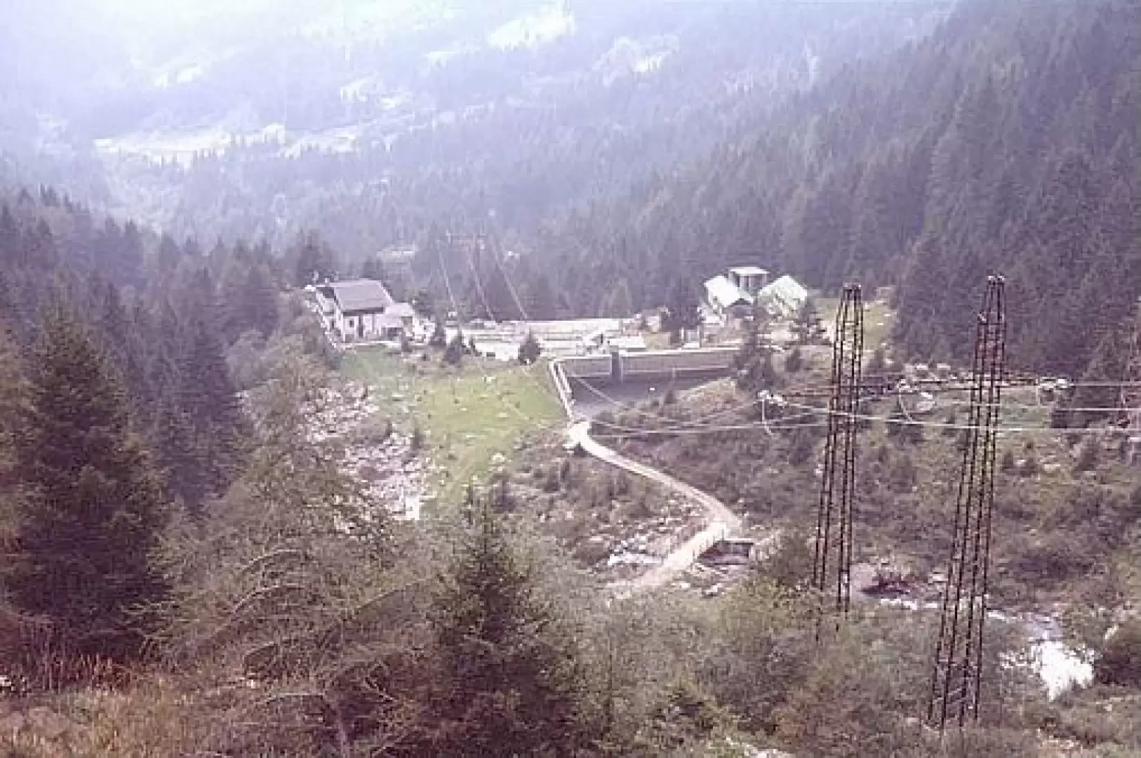
We set off from Fabrezza, following the signpost [14]: it is a mule track about 3m wide which can also be used by off-road vehicles (traffic with private vehicles is however forbidden and the road is normally closed by a bar). At the first hairpin bend, we meet the junction of path [87], which is the path from which we will return.
We then climb up the glacial step, along numerous hairpin bends; after a short, very steep section, an almost level section follows, where there is also the memorial plaque in memory of Anselmo Ronchi (who died during a planned excursion in Adamello of the alpine association, in July 1965 - altitude approx. 1650m), until the junction of the path to Bos Lake (signpost [87B] - just before, on our right, a little stream descends and the road crosses it with a newly built wooden bridge - it is the emissary of the little lake -. We then ascend this path to the right, leaving the road/muletrack, through numerous zig - zags. After about an hour's walk, you reach the beautiful Bos Lake.
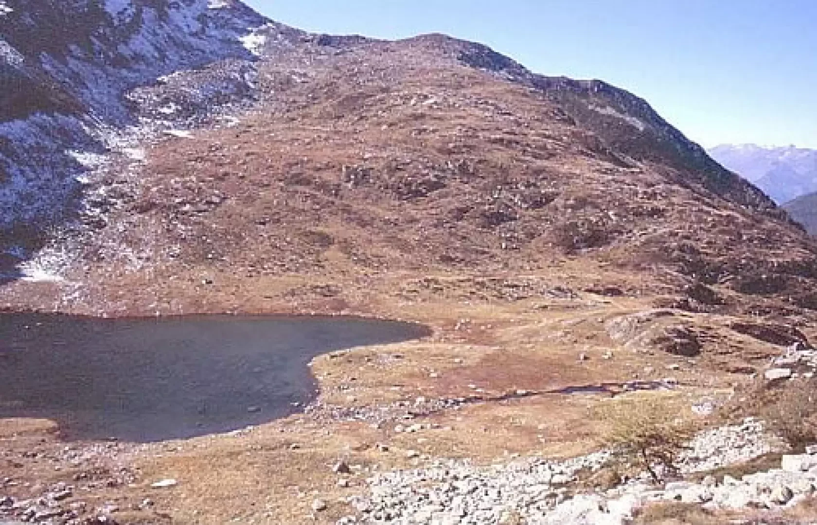
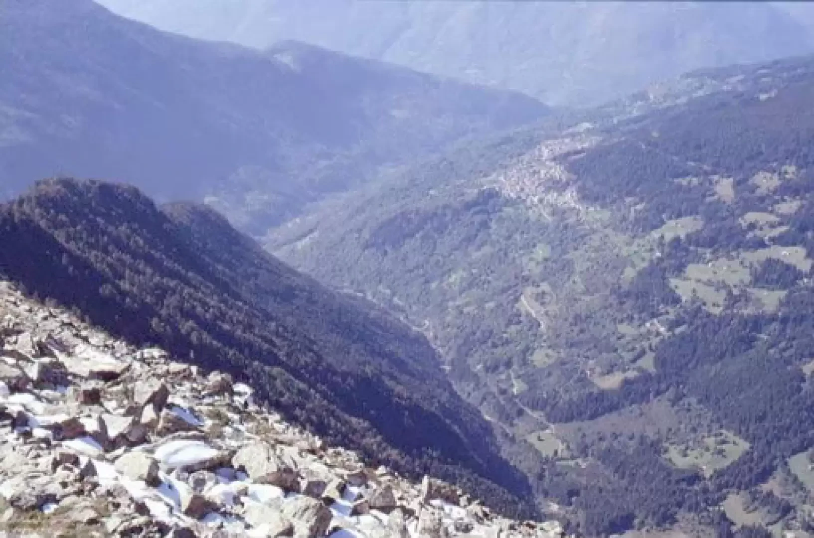
In the final part of the ascent, at the end of the tree vegetation (green alder shrubs and rare, scattered larch trees), the path runs parallel to the small stream that is the outflow of the lake for a while and then turns left and, through a couple of hairpin bends, 'crosses' the spur on the orographic right, joining the path coming from the Macesso hut above. The small lake is situated in a hollow between the two rocky spurs that branch off, almost perpendicularly, from the chain of mountains separating the Salarno valley from the Adamé valley. In the past, the Bos basin was home to alpine pastures; in fact, along the first flat stretch of the drainage, on the orographic right bank, there were two 'baite' (mountain huts), usable and intact until the early 1950s and now practically completely demolished. After observing the small lake and the environment surrounding it, perhaps by going round the entire body of water, in order to head towards the Blisie Pass, climb the slope on the left bank of the drainage, opposite the (former) "baite" (huts); initially, the CAI path [87] is not always clearly identifiable, but as you approach the top of the slope, it becomes visible and signposted. When you reach Passo Blisie, you have a breathtaking view of Valsaviore, in particular of the entire orographic right bank, from Salarno to Piz Olda, of Monte Elto and the mountains of the Paisco valley.
The path at this point descends, in hairpin bends, in the form of a mule track (of military construction - Great War - ), before penetrating into the arboreal vegetation, where, even for long stretches, as it is little frequented, only a narrow path remains that is not always clearly identifiable, although, objectively speaking, the risk of 'losing it' does not seem high. The path develops amidst rich vegetation, both trees and shrubs, thus in an environment not of "high altitude" but more of a "shepherds'" or "hunters'" path; in fact, there are many chances of encountering game, especially birds. We join, at the end of the route of path [87], with path [14] just above Fabrezza.
General Information
Street:from Fabrezza
Signposts:14, 87B, 87
Type of route: circular
Recommended period: June, July, August, September, October
Sun exposure:southwest, west
Photo gallery
Comments (0)
Sign in to leave a comment