Ru du Pan Perdu


Edited by:
Gian Mario Navillod
Updated at: 04/05/2026
Access
From the Châtillon-St.Vincent motorway exit, follow the signs for Cervinia until, after about 10 km, you reach the village of Antey.
Park your car in the large square in front of the chalet that houses the tourist information office, where you can purchase, for the symbolic price of one euro, a map of the main hiking trails in the mountain community.
Introduction
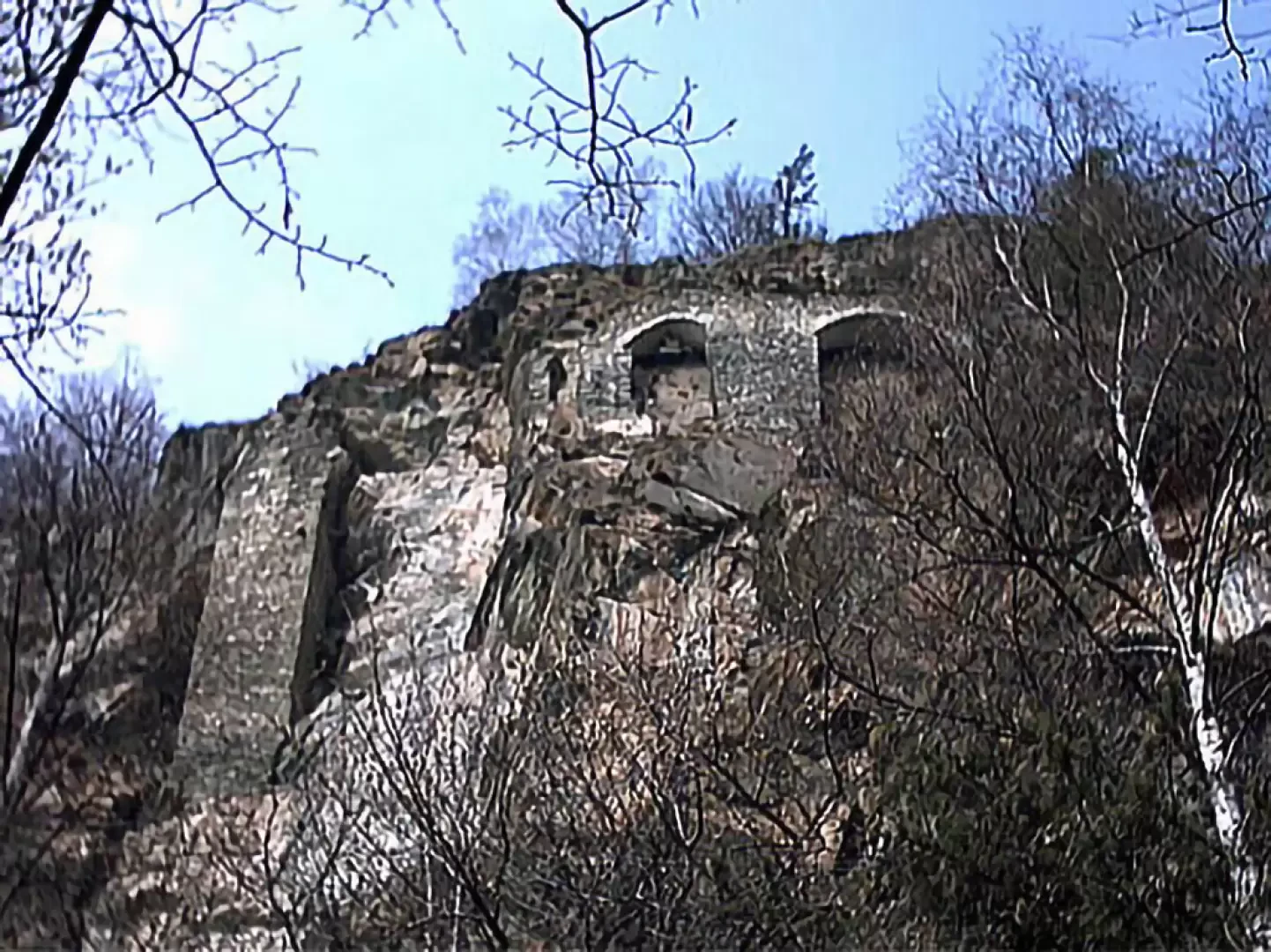
This short itinerary leads to the foot of one of the main pillars of the ru du Pan Perdu, the irrigation canal some 20 km long that brought the waters of the Marmore torrent to the arid plains of the commune of Verrayes. The exact date of construction of this imposing work is not known, but it is likely that work was carried out between the 13th and 14th centuries. In fact, around 1250, the ru de Joux was built, deriving water from the Saint Barthélemy stream and carrying it to Verrayes, while the ru du Pan Perdu in Châtillon, which carried water from the Marmore stream from Antey to Saint-Vincent, was donated to Pietro di Challant, and therefore existed, in 1325.
Description
Leaving the car behind, cross the regional road and, following the signs for the path , you reach the small oratory dedicated to the Madonna.
Then go up to the left and, after about thirty metres, turn right along the path that passes behind the small group of houses clinging to the steep slope. In a few minutes, you arrive at the fork where the paths for the little church of Navillod and the Pan Perdu ru divide. Continue on the right, level, crossing the pastures in the shade of a few ash trees until you reach the small metal bridge that crosses the Torgnon stream at the foot of the regional road wall.
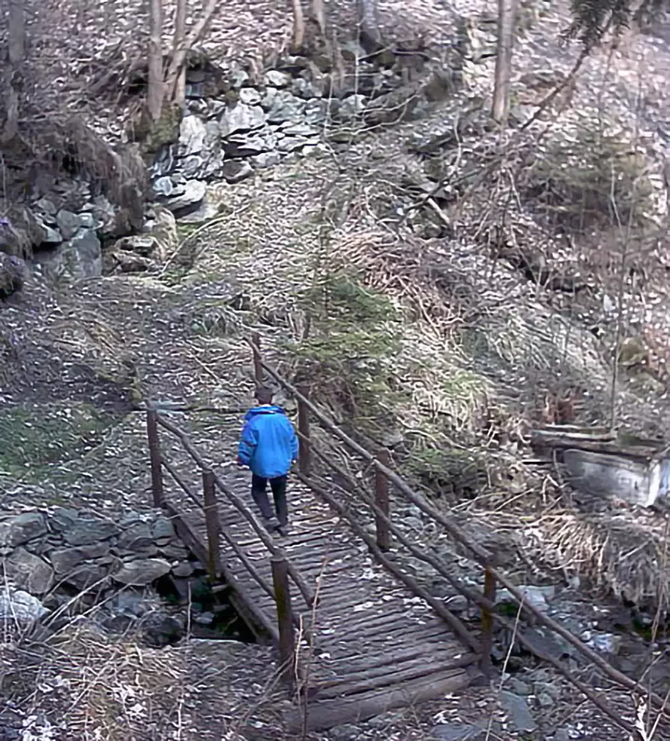
You cross the stream, then climb along a section of the old Antey-Torgnon road and after crossing the regional road, immediately after the bridge of the new road, take the path on the right that climbs steeply along the embankment until you reach the little wooden bridge over the water. From this point, the path becomes much less strenuous, the slope reduces and we continue zigzagging, first between the cut slabs of the old marble quarry and then between the boulders of an ancient landslide colonised by periwinkle with its beautiful blue flowers. Shortly after the end of the landslide, arriving at the foot of the rock face, the pillars supporting the route of the ru can be glimpsed high up among the trees.
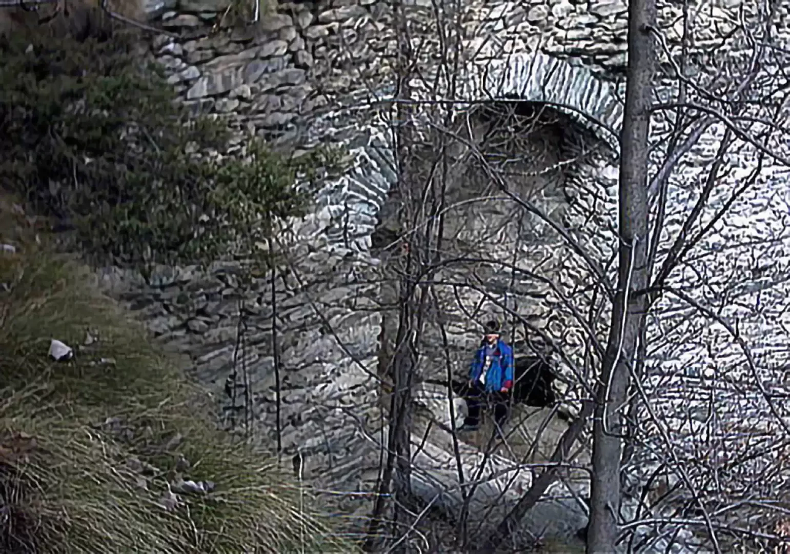
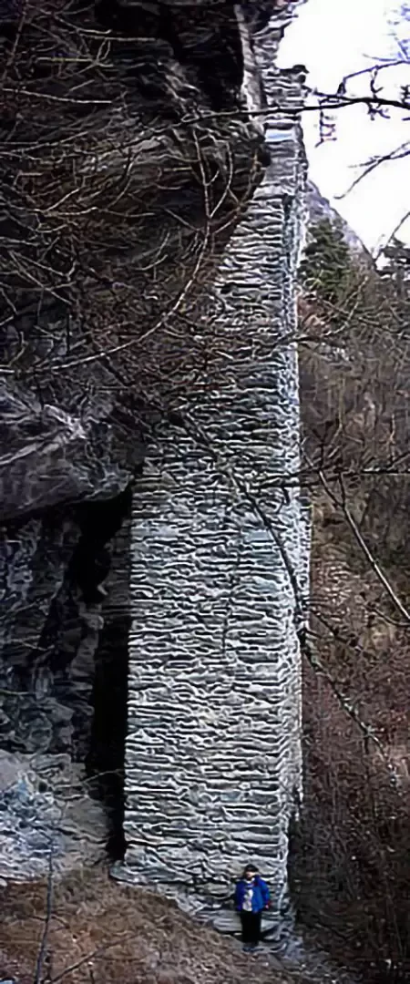
The path continues almost level, and at the side of the path, on a large stone of the uphill wall, one notices the curious engraving "1879 7B" which indicates with a little play on words the year and month in which the work was completed: 1879 7(m)B(re) = September. A little further on, among the sparse pines, there is a beautiful view of the village of Antey, with the Tantané peak in the background. Continue for a few minutes to reach the first hairpin bends, and at the height of the fourth, just before a large rock on which a yellow marker is traced, leave the path to the left, right on the bend, and following the track for about 40 metres that zigzags its way up through the woods, you reach the base of the monumental square-section pillar of about 2.20 by 2.80 m that propped up the rocks where the ru passed. Those who wish to do so, paying particular attention to falling stones, can walk along the original route of the gully; it is necessary to pass behind the old pillar and ascend the slope in front of the two arches until you reach the small handkerchief of flat land where the route ends in the shade of a small pine tree.
Curiosities
Some writings attribute the construction of ruins and towers to the Saracens who are said to have sojourned in the Aosta Valley around the year 1000, is it possible these imposing vestiges were built under Arab rule? Certainly not. In fact, the only document attesting to the activity of the aforementioned population on this side of the Alps is found in the 'chronicle of Novalesa' written around the middle of the year 1000, which describes the occupation and sacking of the monastery in the Susa Valley in the early 10th century by bands of 'Saracens'. Beginning in the 13th century, this is the origin of the legend, the use began to spread in the Alps of indicating as Saracens objects or remains of ancient factories or those made with techniques that were no longer customary: in 1327, in fact, the Roman walls of Susa were indicated as Saracen, and towards the middle of the 14th century, near Ivrea, the old tiles used in Roman constructions were indicated as tegule saracenorum. Numerous scholars from the 17th century onwards applied a good dose of fantasy to the subject by inventing apocryphal chronicles that attributed works and activities to the Saracens that have no historical basis.
Curiosity
In some writings, the construction of ruins and towers is attributed to the Saracens who are said to have stayed in the Aosta Valley around the year 1000. Is it possible that these imposing vestiges were built under Arab rule? Certainly not. In fact, the only document attesting to the activity of the aforementioned population on this side of the Alps is found in the 'chronicle of Novalesa' written around the middle of the year 1000, which describes the occupation and sacking of the monastery in the Susa Valley in the early 10th century by bands of 'Saracens'.
From the 13th century onwards, this is the origin of the legend, the use of indicating as Saracens objects or remains of ancient factories or those made with techniques that were no longer customary began to spread in the Alps: in 1327, in fact, the Roman walls of Susa were indicated as Saracen, and towards the middle of the 14th century in Ivrea, the old tiles used in Roman constructions were indicated as tegule saracenorum.
Numerous scholars from the 17th century onwards applied a good dose of fantasy to the subject by inventing apocryphal chronicles that attributed works and activities to the Saracens that have no historical basis.
Author
- Consults all hiking reports by Gian Mario Navillod
- Consults the page of [[Gian Mario Navillod]]
Riferimenti Bibliografici
- Passeggiando lungo i ru - Patrick Barrel Annalisa Bovio Flavio Dalle - Martini Multimedia Editore, Saint-Vincent, 2008
- U. Torra, la Valtornenche, le sue antichità - - Tipografia Eporediese 1973
- La valle del Cervino - Ronc M.C. - Torino 1990
- la tradizione inventata: i saraceni nelle alpi marittime, in L'Alpe n° 3 - Settia A. - Ivrea 2000
- Le testimonianze grafiche … , in Lo Coucou n° 17 - Sanna C. - Verrès 2002
- Valtournenche, Monte Cervino e Val d'Ayas ovest, Carta dei sentieri foglio 7, scala 1:25.000 - - L'Escursionista Editore, Rimini, 2005
- Carta Media Valle (2) scala 1:25000 - Comunità Montana Monte Cervino -
Photo gallery
Comments (0)
Sign in to leave a comment