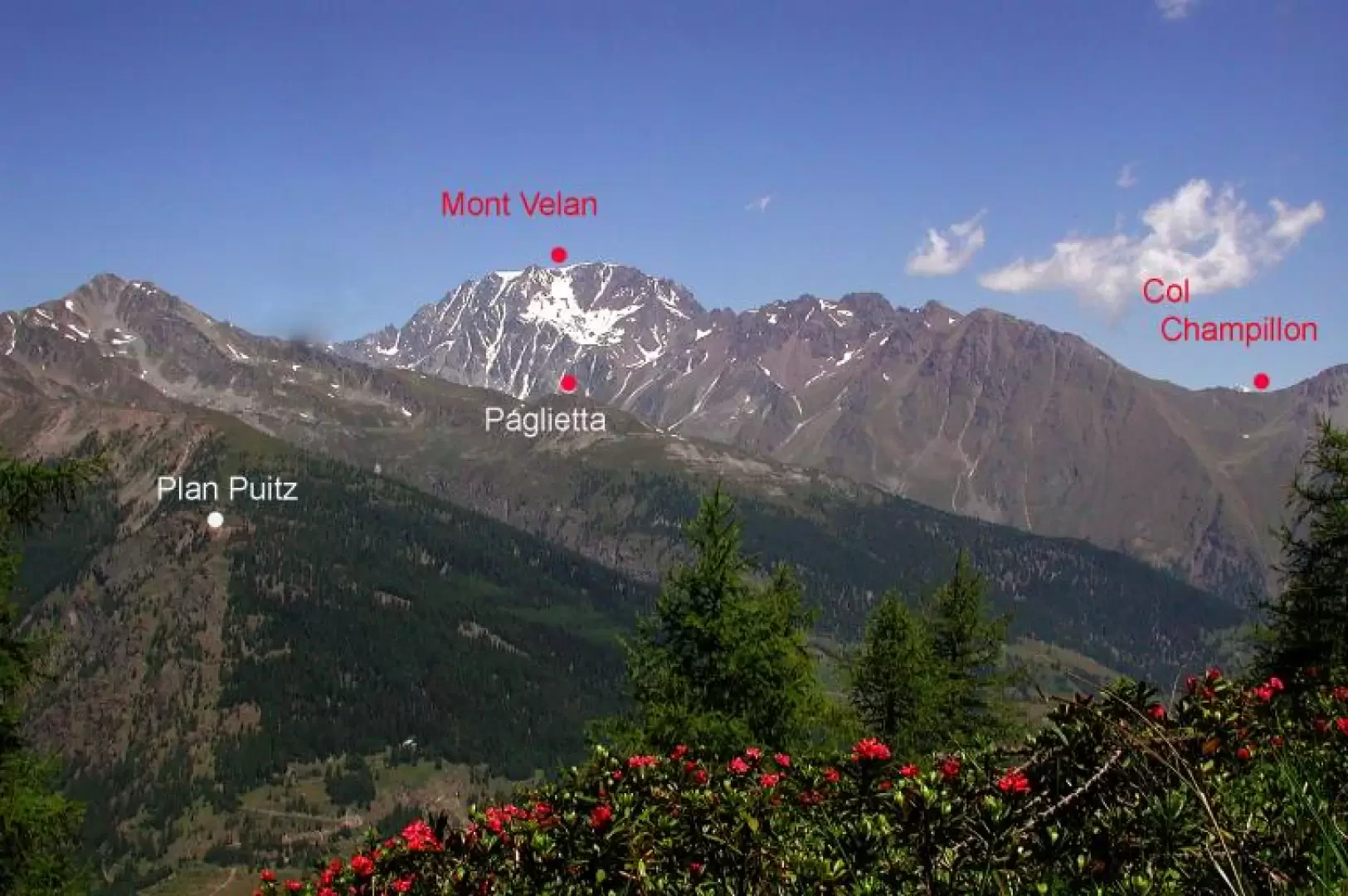
Plan Puitz, from Saint-Rhémy

Edited by:
Maria Grazia Schiapparelli
Updated at: 18/11/2025
Introduction
It is a very scenic route, not tiring, which can also be covered with snowshoes, and by mountain bike, if you wish; under the summit, where unfortunately an ugly pylon stands, there are tunnels and emplacements of the Cadorna Line, which can still be visited, the Plan Puitz batteries. If you ever feel like visiting them, a sign warns of the risk of collapse. They were built between 1916 and 1917, when an invasion of Italy by Germany through Switzerland was feared.
Description
Leaving the car, take the main road that leads to the Great St. Bernard Pass and at the first hairpin bend, continue to the right, along the road that is also the route of the Alta via n. 1 and the Tour de Combin. The road is very wide, forbidden to cars, but wide enough to allow authorised vehicles to pass; the gradient is very slight, and we found no paths that would allow us to cut through the very long hairpin bends. The route is all shaded by conifers. At the first fork, leave the descent along the Via Francigena Aosta-Martigny to the right and continue to the left; there are other forks in the road, in principle keep to the main road, which is also the one that always climbs, although very gently. At the end of the road there is a clearing where the tunnels open out, and a small path that climbs up to the summit. Exceptional view of the last section of the road leading to the Great St Bernard pass, Col Champillon, Mont Velan, and in front of Emilius, Grivola, and the valleys of Flassin, Citrin, Serena (2 hours because of the 7 km...) Descent by the same route as the ascent; after the first few hundred metres we found a path that connects the hairpin bends and which saved us a lot of walking. There is the possibility from the summit to take a path that connects to the one that descends from the Great St Bernard to Saint Rhemy, and which then descends to the hamlet, allowing us to make a loop. Cartography
- [[Great St. Bernard, Ollomont]], Trail map sheet 5, 1:25000, L'Escursionista Editore, Rimini, 2005