Salarno Pass, from Fabrezza
Access
The natural starting point for the Salarno valley is Fabrezza
To reach the locality of Fabrezza, take state road 42, which climbs along the Valcamonica, until you pass Cedegolo, then, at the village of Demo, turn right onto the provincial road for Cevo and Saviore. You travel about 14 km uphill to reach Saviore, then continue along an easy tarmac road for another 4 km or so to Fabrezza, where you can park.
Introduction
A hike that includes the ascent, up to the summit watershed, of the Salarno valley with the Pian di neve (Adamello acrochorus); given the altimetric excursion, it is possible to observe the complex variation of vegetation according to altitude and exposure: from mixed deciduous and coniferous forests, to conifers, to herbaceous pasture ecosystems and low shrublands, to alpine cliffs and macerations, to permanent glaciers.
Description
Starting from Fabrezza, follow the
signpost: it is a mule track about 3m wide that can also be used by off-road vehicles (traffic with vehicles is in any case forbidden and the road is normally closed by a bar). After a hundred or so metres, cross the Salarno stream, then climb the glacial step, going up numerous hairpin bends; a less steep section follows, where there is also a memorial stone in memory of Anselmo Ronchi (who died in 1965 during a planned ascent to the Adamello) (altitude around 1650m), until the junction of the path for Bos Lake (signpost [87B] - just before, on our right, a little stream descends and the road crosses it with a small bridge). We cross the Salarno torrent again, pass by the huts (recently rebuilt) of the Macesso di Sotto malga (1735m) and the path becomes steep again; we meet a couple of hairpin bends, then, after crossing two small streams which descend from the Coppo valley, we reach, on our right, the (modernised) hut of the Macesso di Sopra malga (1935m).
After a short, almost flat stretch, we are in sight of the Salarno dam and all the outbuildings. The road at this point shifts further to our left and, after passing a long dam wall crossing the valley, skirts a large plain: the former Macesso Lake.
Until 1935, a natural lake existed in this plain (Lake Macesso, still marked on some outdated topographical maps) is shallow and was completely filled with sand and silt artificially and hydraulically drained from both the Dosazzo plain (about 1.2 million cubic metres) and Lake Salarno (over 500 thousand cubic metres). A small dam wall was built at Dosazzo, and then, starting from the valley, a tunnel was excavated (the entrance can be seen on the glacial step separating Macesso from Salarno) that reached the bottom of the alluvial plain and through it more than a million cubic metres of sand was drained, thus obtaining, even with the above-mentioned wall, the lake's reservoir. This operation, according to the plans of the Adamello Society, should have ended with the construction of a real dam, which, in addition to containing the waters of the Salarno Valley, would have been connected to a planned intake in the upper Adamé Valley; the advent of World War II prevented its realisation. Half a million cubic metres of sand coming directly from Lake Salarno were also dumped into this former Lake Macesso, hydraulically to increase the reservoir capacity of the lake itself, in the years 1936-37. After skirting the former lake of Macesso, the mule track climbs with comfortable hairpin bends up to the altitude of the Salarno dam (approx. 2070m); along the hairpin bends, some buildings of the hydroelectric plant can be seen; the utilisation of the waters of Lake Salarno is part of an interesting hydroelectric system known as the 'Poglia system'.
Further along, first on the shore of Lake Dosazzo, on a former military mule track, which is flat until beyond the lake and then climbs gradually, with very few steep sections; you pass an alpine hut and after about an hour's walk
(from Salarno), you reach the Prudenzini hut at an altitude of 2235m. Continue along the path [14]; after about 10 minutes, you pass the former Salarno hut, a characteristic granite construction; it stands next to an enormous erratic boulder, now in a precarious state of preservation. It was the first alpine refuge built in the Brescia Alps, dating back to 1881; although it was not inaugurated until 1883. In 1887 it was enlarged, adding another room (now destroyed) that had access to the first one and could accommodate 8 people.
It had no luck, however, as Laeng, before the end of the 19th century, described it as follows:
"little more than a cave, a room carved out behind a gigantic boulder and covered with a board of granite blocks; it drips from all sides and gives the impression of collapsing at any moment".
After a few minutes, you cross the valley until you reach the moraine on the left (orographic) side on which you climb up to an altitude of 2,500 metres. The path then zig-zags along the line of maximum slope, crosses a small stream and moves to our right, then ascends along a grassy slope to its summit (altitude 2650m "praulì"). For a stretch, we pass over a steep moraine, then move to the right to the beginning of the "bowl", climb up to the top of the moraine on our right to below the rocks, then diagonally to the right, always staying close to the rocks until we come to a spur outcropping on the large moraine (altitude around 2850m): we are facing, looking down the valley, the summit of Monte Zuccone. At this point we can see, high up on our left, the Salarno pass (immediately to the right of the Cornetto di Salarno spur), we climb up the large moraine diagonally following the red CAI signs, or the most convenient route depending on the residual snow conditions at the time.
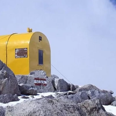
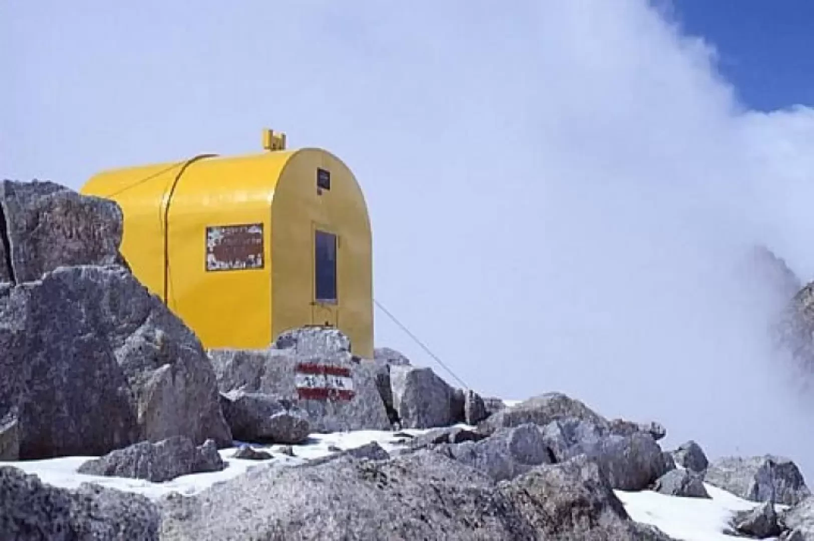
At the pass, an exciting spectacle appears: on the left, on the promontory of the Cornetto di Salarno, the Giannantonj bivouac stands out, in the background the Miller horn, the Salarno horn, the Adamello, Mount Falcone, the Corno Bianco, the vedretta del Mandrone, the Lobbie, the Croce ridge, the dosson di Genova and Mount Fumo!!
