Bettaforca Pass, from Staffal


Edited by:
Alberto Rota
Updated at: 08/06/2026
Access
Leaving the motorway at the Pont-Saint-Martin exit, after 100m turn right and you will come to a first roundabout, take the second exit. A little further on you come to a second roundabout: take the third exit, and you enter the town of Pont-Saint-Martin. After a few hundred metres you come to the start of the road to the Valle del Lys: turn right and drive along the regional road for 38.3km, passing the villages of Lillianes, Fontainemore, Issime, Gaby, Gressoney-Saint-Jean and Gressoney-la-Trinité until you reach the village of Staffal: in front of the Gabiet cable cars you will find a large free car park 🅿️ where you can leave your car.
[0h54'] - [38.3km]
How to get there with GMaps
How to get there with Apple Maps
The indications given here have been verified at the time of the survey of the itinerary. Before setting off, it is advisable to ensure that no substantial changes have occurred on the route to the starting point. We therefore recommend the use of the satellite navigation apps provided by Google or Apple for up-to-date and detailed directions.
Introduction
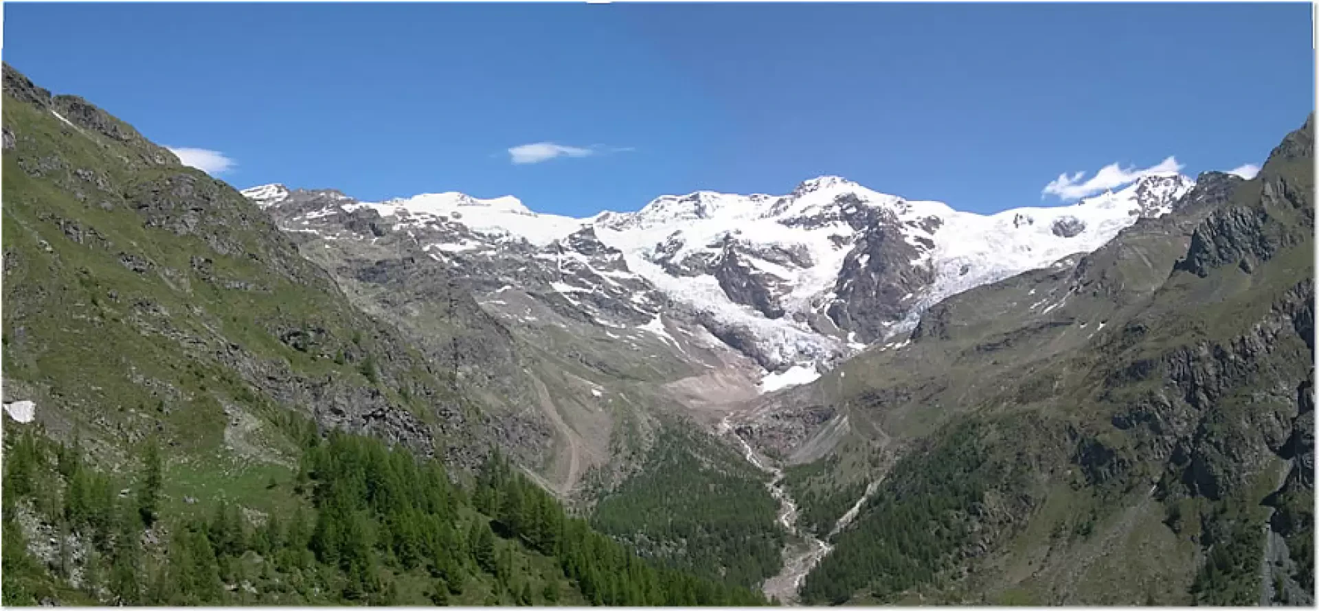
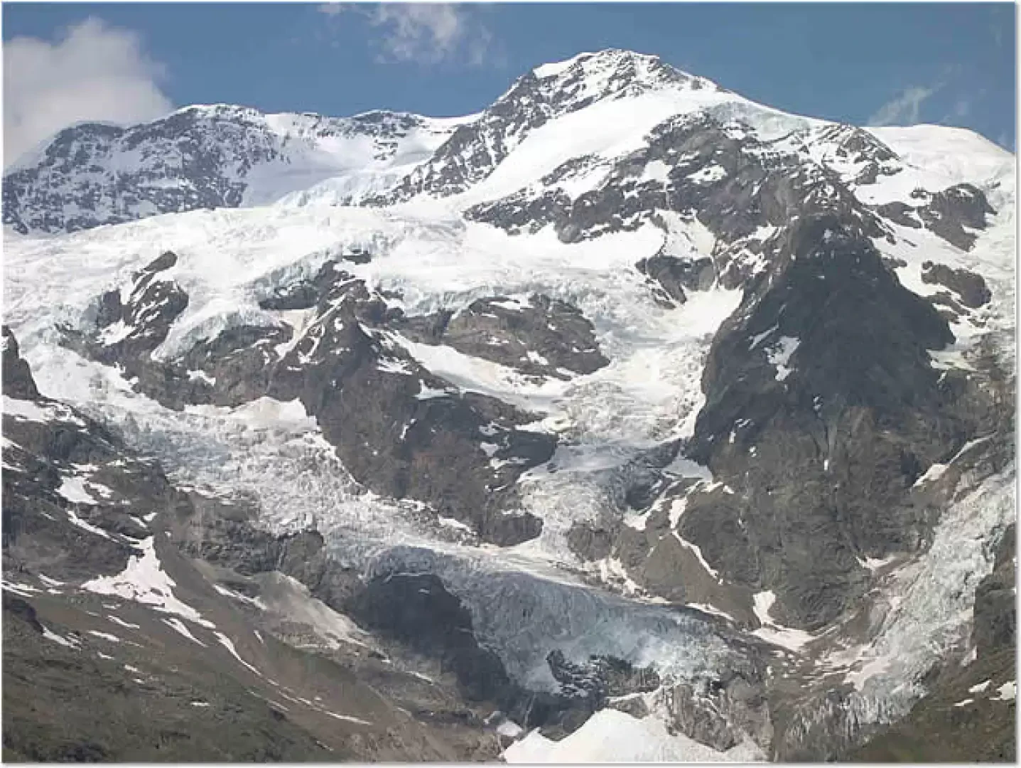
This itinerary starts from Staffal and leads to the Colle della Bettaforca, the pass point towards the Val d'Ayas, along the Tour du Mont Rose. Although it is possible to reach the pass using the ski lifts, it is worth reaching it on foot, to better admire the splendid panorama of the Rosa group and the peaks on the left side of the Lys valley.
Description
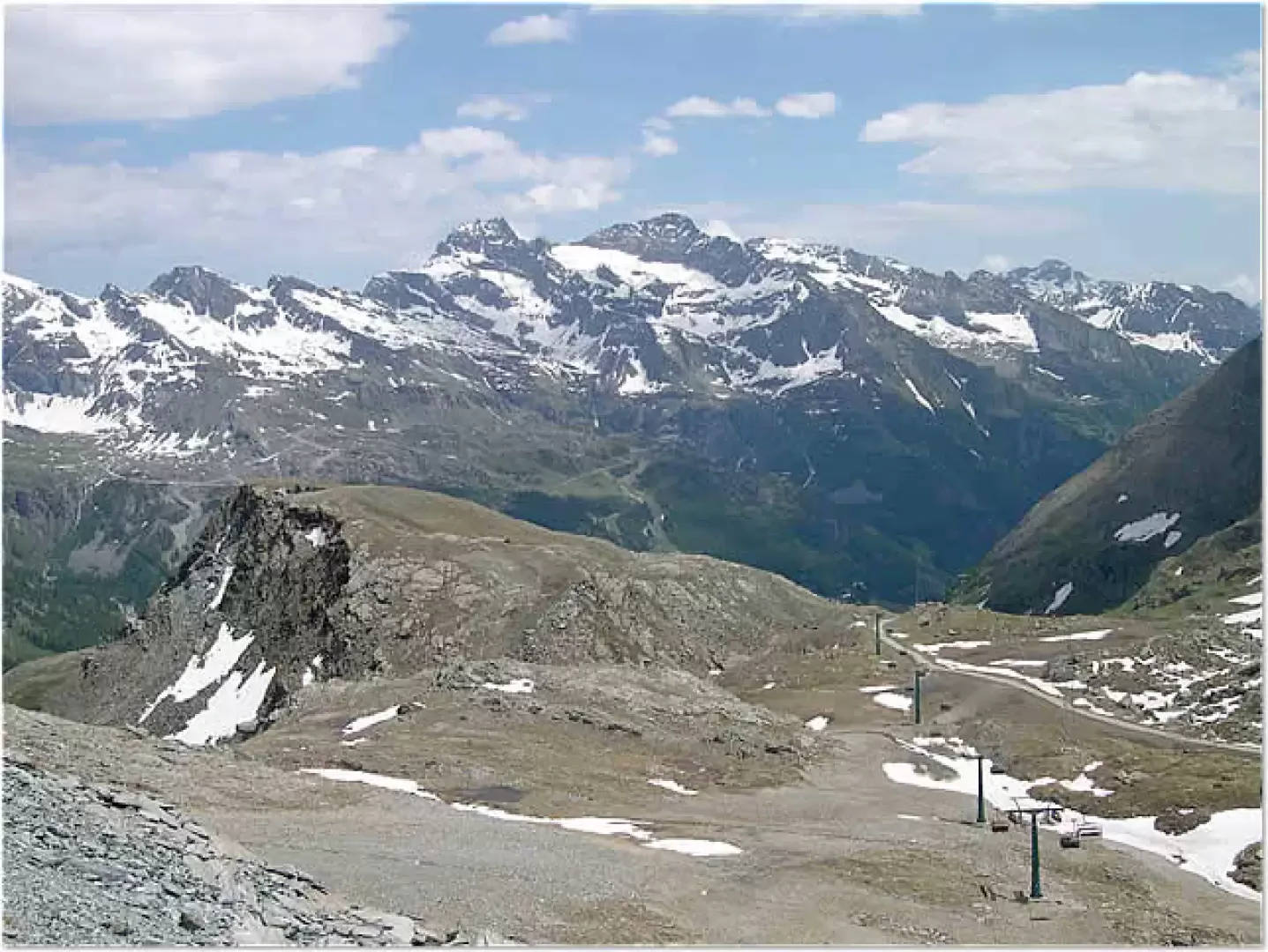
Leaving the car in the parking area at Staffal, at the end of the road that climbs the Gressoney valley, reach the bridge over the Lys and take the path that climbs the stream on its right-hand side, near a building with a bar and other shops. Once past this building, turn immediately left, taking a path that, having passed a clearing, enters a larch grove and begins to climb steeply. This path, a dirt track that can be travelled as far as Colle Bettaforca by authorised off-road vehicles, overcomes the first 300 metres of difference in height by means of a series of hairpin bends and is moderately steep. Gradually coming out of the larch wood, we come to a straighter section, at the end of which we reach the altitude of the cable car arrival station (approx. 2150m). Instead of proceeding straight ahead towards the latter, follow the path by turning right and, after a short ascent, begin to climb parallel to the chairlift, which starts a little further down. After a straight stretch, at a double bend, at an altitude of around 2300m you come to Alpe Sitten, at which there is a bar-restaurant. From this point there is a splendid panorama of Monte Rosa. Continuing along the path, which now proceeds in a more linear fashion, you will come to a small lake on your right at an altitude of around 2450m. A slightly flatter section precedes the final stretch that quickly leads to the pass, at 2672m. From here, there is an excellent view towards the Val d'Ayas, as well as of the Rosa massif and the peaks of the Lys valley (Corno Bianco and nearby summits). From the pass, heading to the right (northwards) and following the path that climbs steeply, it is possible to reach the bar-restaurant located in front of the arrival station of the chairlift at an altitude of 2727m.
.Photo gallery
Comments (0)
Sign in to leave a comment