Passo del Paradiso, from Passo del Tonale


Edited by:
Ivano Ruffoni
Updated at: 05/06/2025
Access
At the Ospitaletto exit of the [A4] motorway, follow the local signs for Valle Camonica following the [SP 19] and [SP 510]. Near Pian Camuno, go up the valley with the [SS 42] del Tonale e della Mendola to Edolo, turn right towards the Passo del Tonale, pass Incudine, Vezza d'Oglio, Temù and Pontedilegno. Continue along the [SS 42] until you reach the Passo del Tonale.
From the Tonale Military Memorial, descend into the Val di Vermiglio for about 2.2 km and park near a widening on the right
Note
The Tonale Pass can also be reached with the SS42 from Valtellina - via the Aprica (SS39) and Gavia (SS300) passes - or from Trentino - going up the Val di Sole and the Val di Vermiglio.
.Introduction
Description
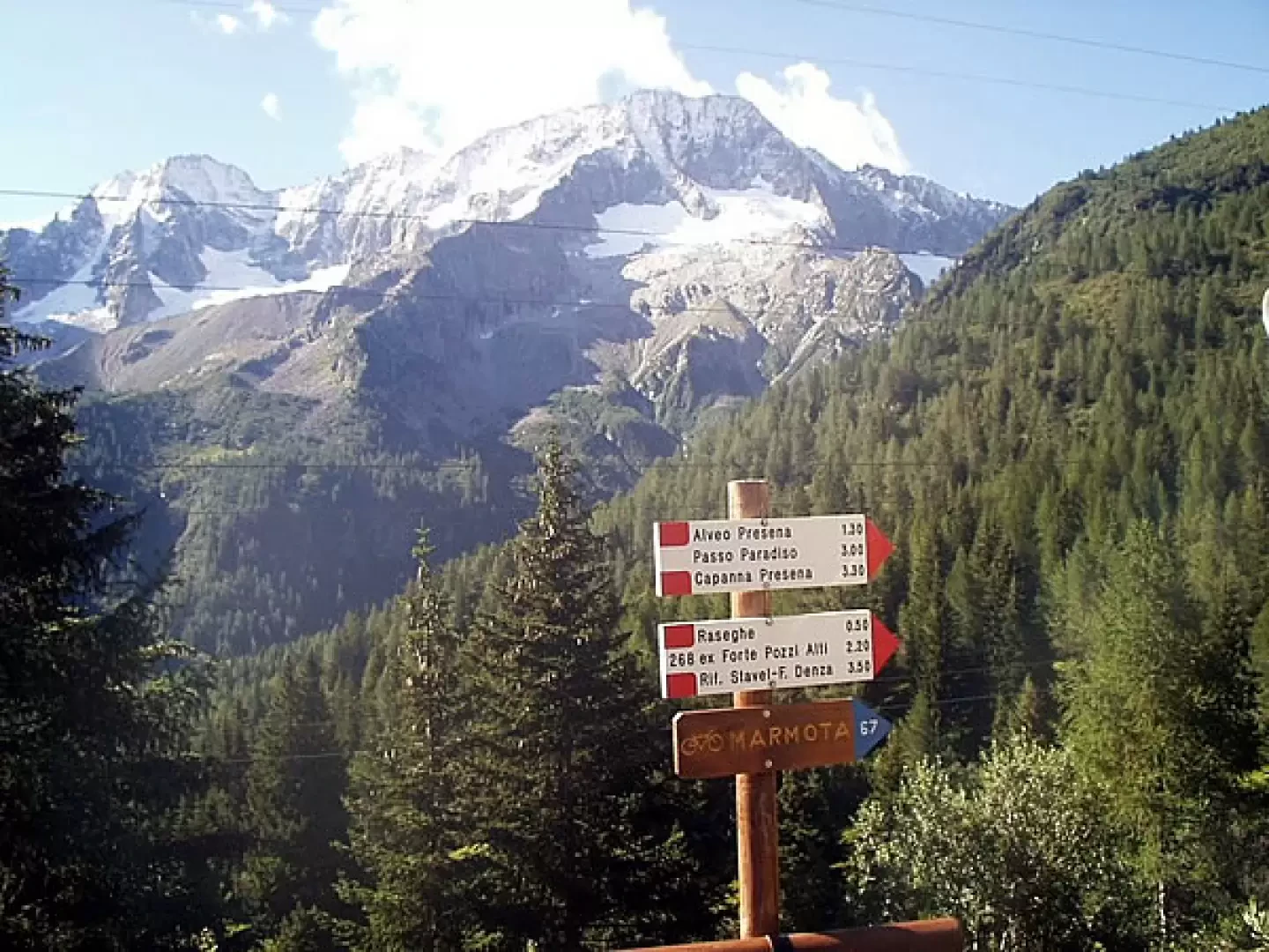
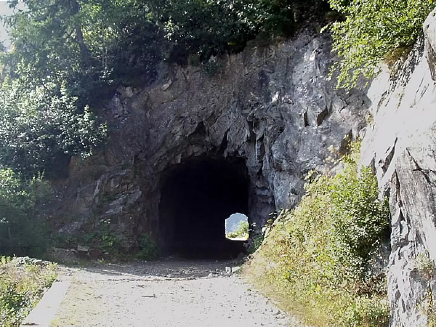
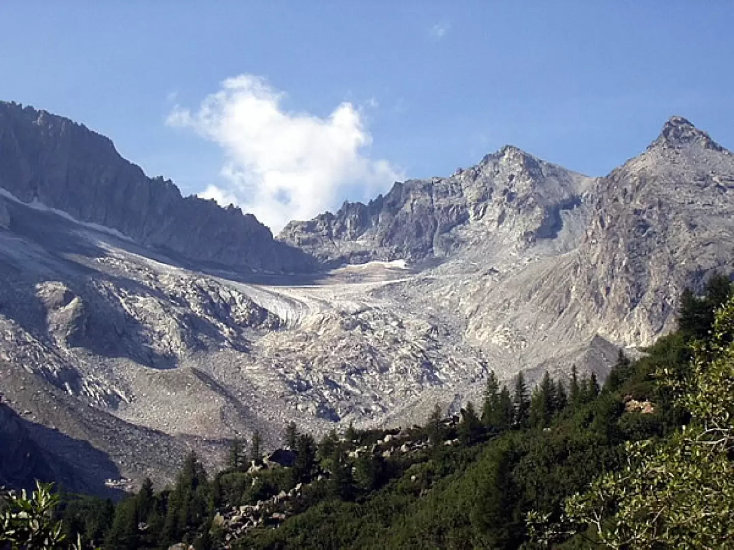
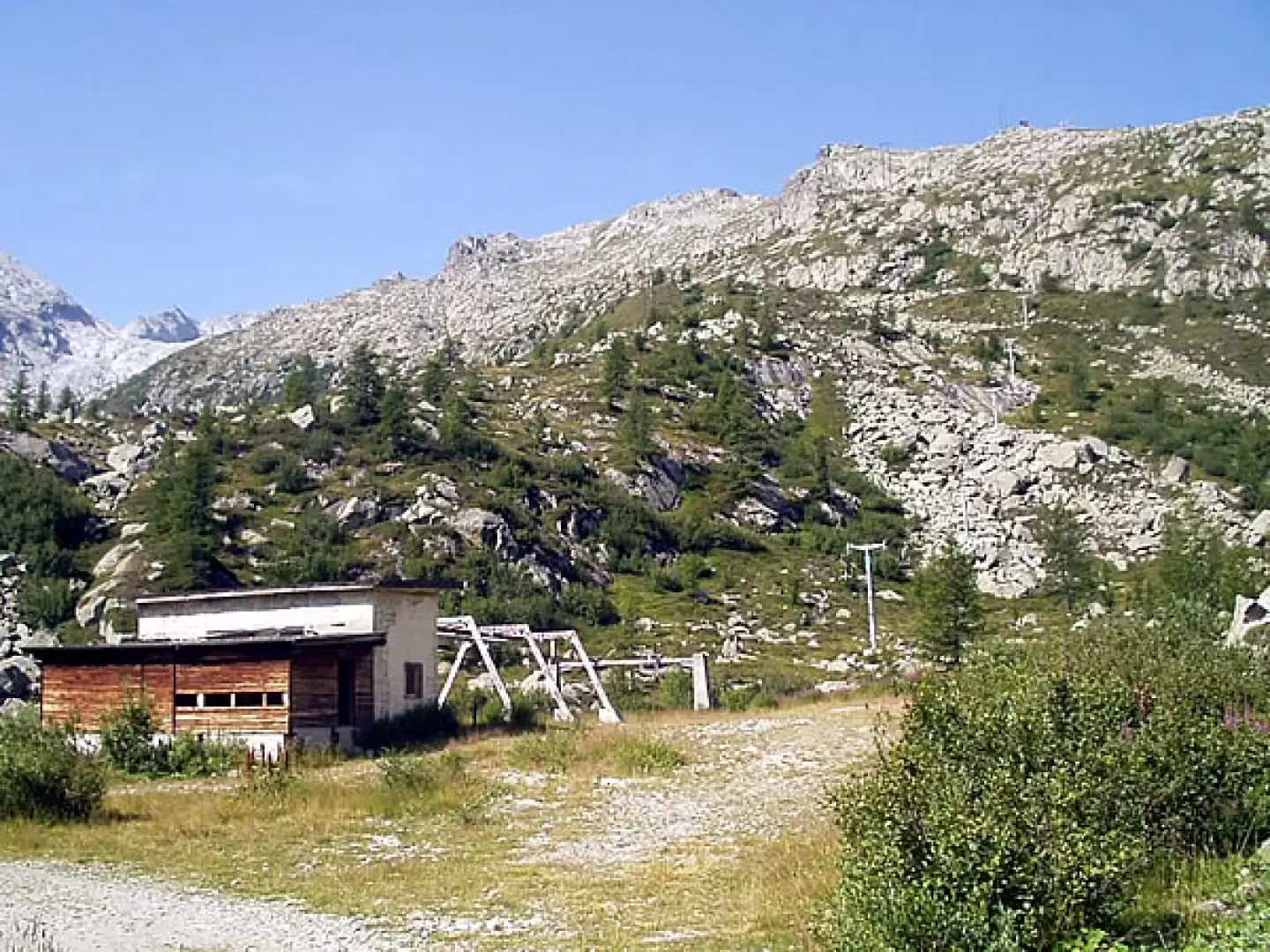
0h00' From the car park near the [SS42] (about 1858m) go down the tarmac road with signs [281cai] (for the Presena alveo and Passo del Paradiso) and [268cai] (for the ex Forte Pozzi Alti). A couple of minutes later, leave signpost [268cai] to your left and descend to cross the Vermigliana stream on a bridge. Shortly afterwards, ignore the mule track to the left, still marked [268cai], which joins the road to Raseghe, formerly Forte Pozzi Alti and Rifugio Stavel-F. Denza, and proceed through the fir forest. After a further five minutes' walk, the right-hand road for Passo del Tonale is disregarded and the road climbs, with a moderate gradient, to a hairpin bend. The road goes around the slopes of Monticello and reaches a tunnel (at the exit of which there is a view of the remains of Vedretta Busazza and Vedretta Presena). The track continues through the sparse fir forest as far as the station of the old (and disused) Alveo Presena chairlift (2160m).
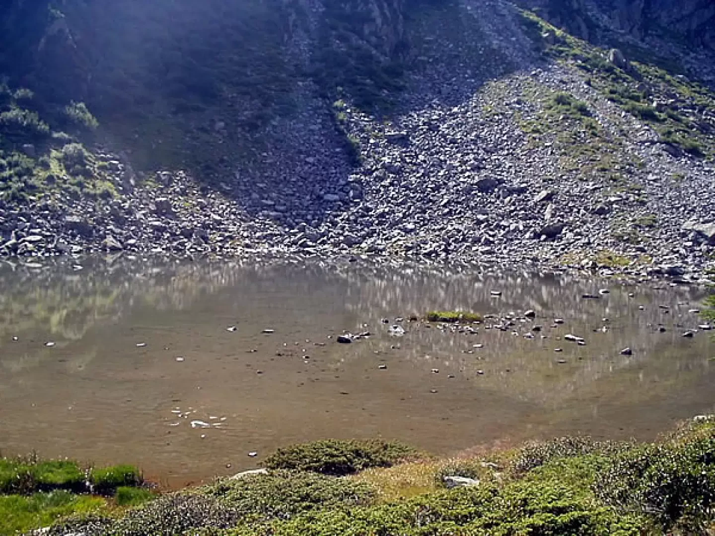
1h20' It is suggested to continue as far as the old cable car and to choose one of the two paths, which, with a few ups and downs, lead respectively to the two ends of the Presena lake bed.
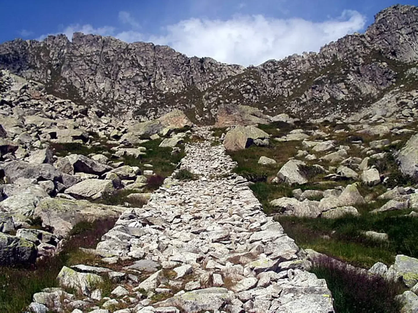
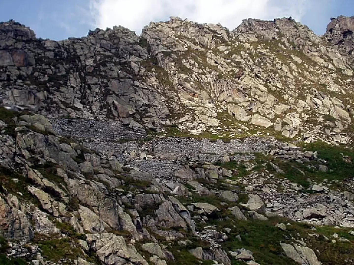
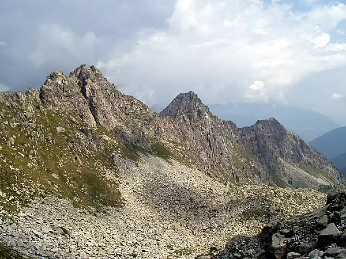
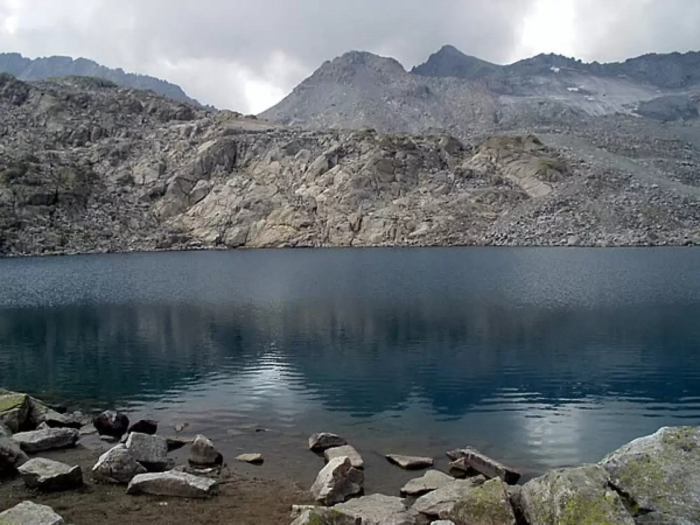
1h50' Having retraced your steps to the chairlift station (2160m), go up the mule track (marker [281cai] - Sentiero della Pace - made during the First World War) a hump of grass, rocks and a few fir trees until you reach a plateau. Go around the hollow to the right, climb up another hump and face a second long plateau to the left. The mule track ascends an area of mounded rocks, proceeds through grass, boulders and debris and leads to the left of military fortifications. It follows an almost flat stretch to the left until it reaches a military cavern, then, with ups and downs, it reaches another area of mounded rocks and continues until it crosses the grassy and rocky saddle that precedes a small lake and the Passo del Paradiso (or Monticello) pass (2573m, 3h00'), where the Passo del Paradiso cable car also arrives.
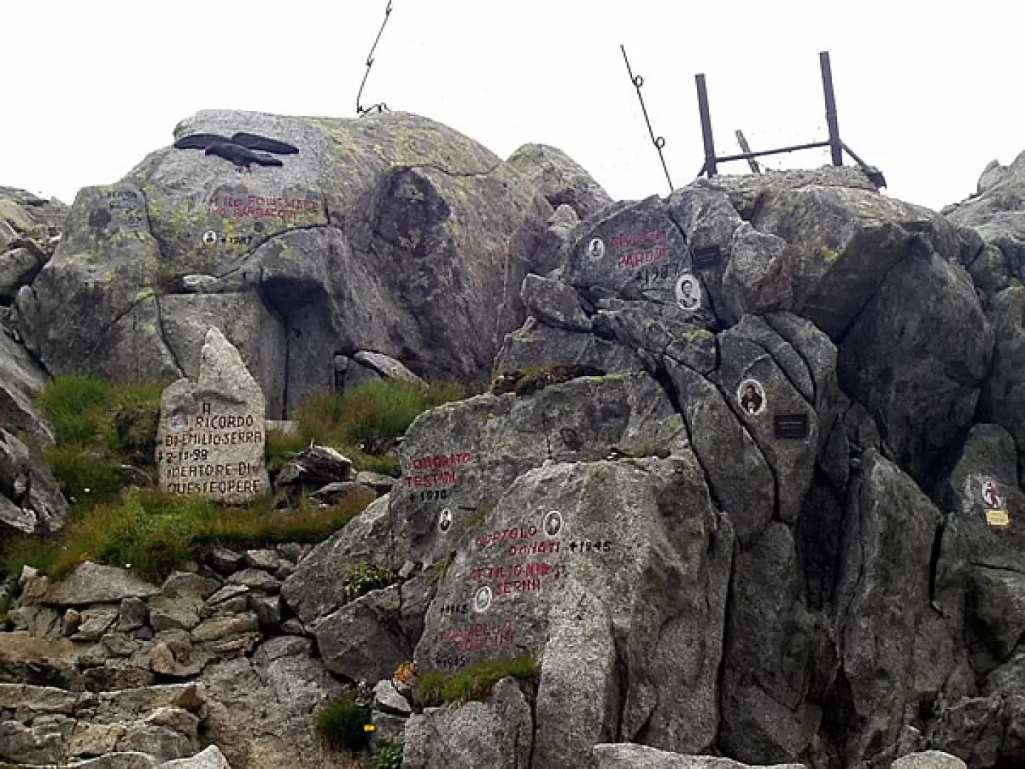
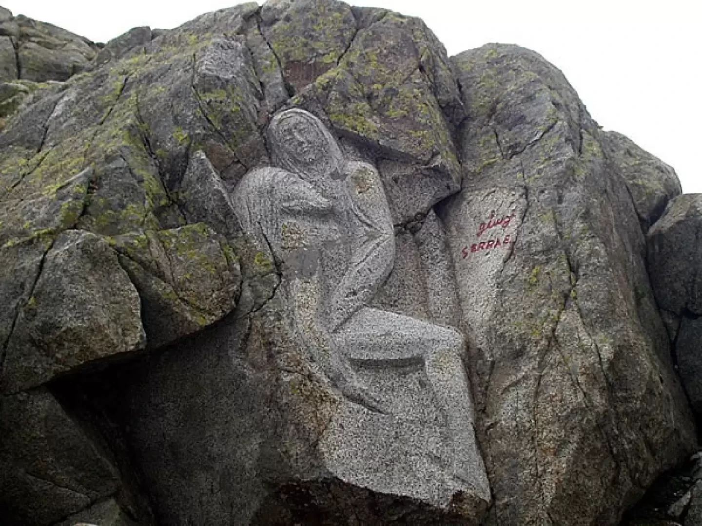
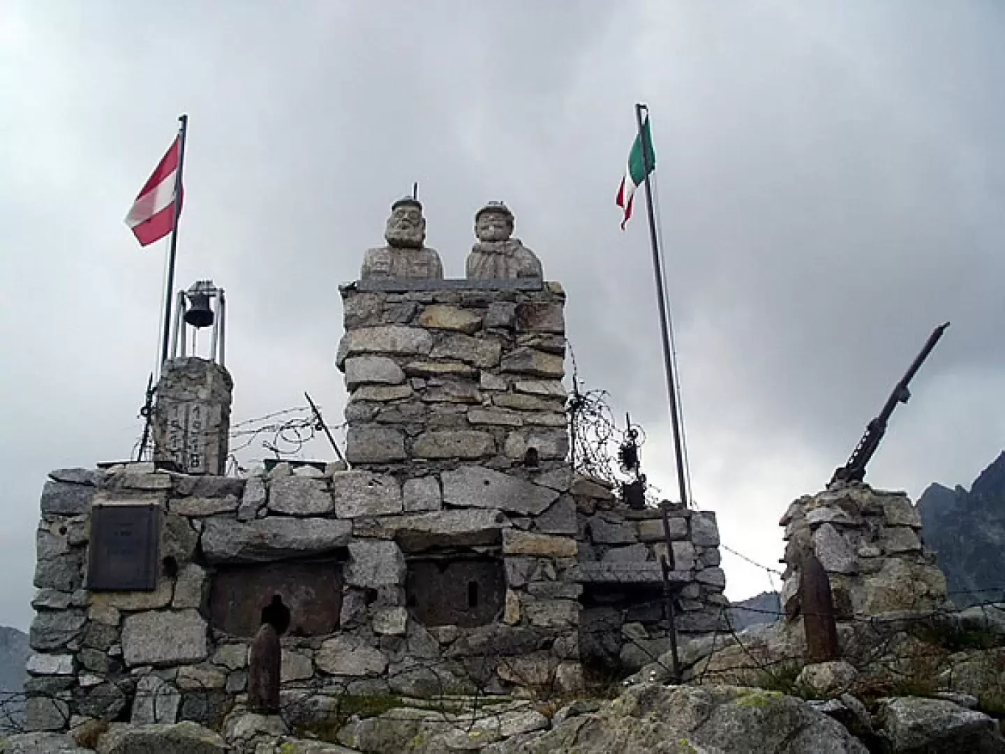
Now proceed southwards along a dirt track: you will pass a rock that reminds you of the brotherhood festival with the KAISERSCHÜTZEN, then the M. llo Ivo Barbacovi Rock Garden.llo Ivo Barbacovi at the Piazza della Fratellanza (the granite sculpture is valuable), and finally the Monument to the Brotherhood, right by Lake Monticello (2599m, 3h10').
The return journey is along the same itinerary: having reached Passo del Paradiso (2573m, 0h10'), we descend to the station of the old Alveo Presena chairlift (2160m, 1h10') and, retracing the dirt track, return to the car park near the [SS 42] (1858m, 2h10').
.General Information
Path:
Signposting:
Type of route: a/r
Recommended period: June, July, August, September
Sun exposure:Northeast
Photo gallery
Comments (0)
Sign in to leave a comment