Monte Penice, from Passo Scaparina

Edited by:
Maurizio Loconti
Updated at: 17/03/2026
Access
From Genoa, by car, drive up the SS 45; then after the panel at km 75 (beyond Ottone) turn left (Brallo pass). After reaching this locality, turn right for Pregola up to p.so Scaparina 1110 m (Sp89), 100 km from the city.
Introduction
Mount Pénice is in the northernmost area of the Antola group, the last bastion on the edge of the Po Valley.
Description
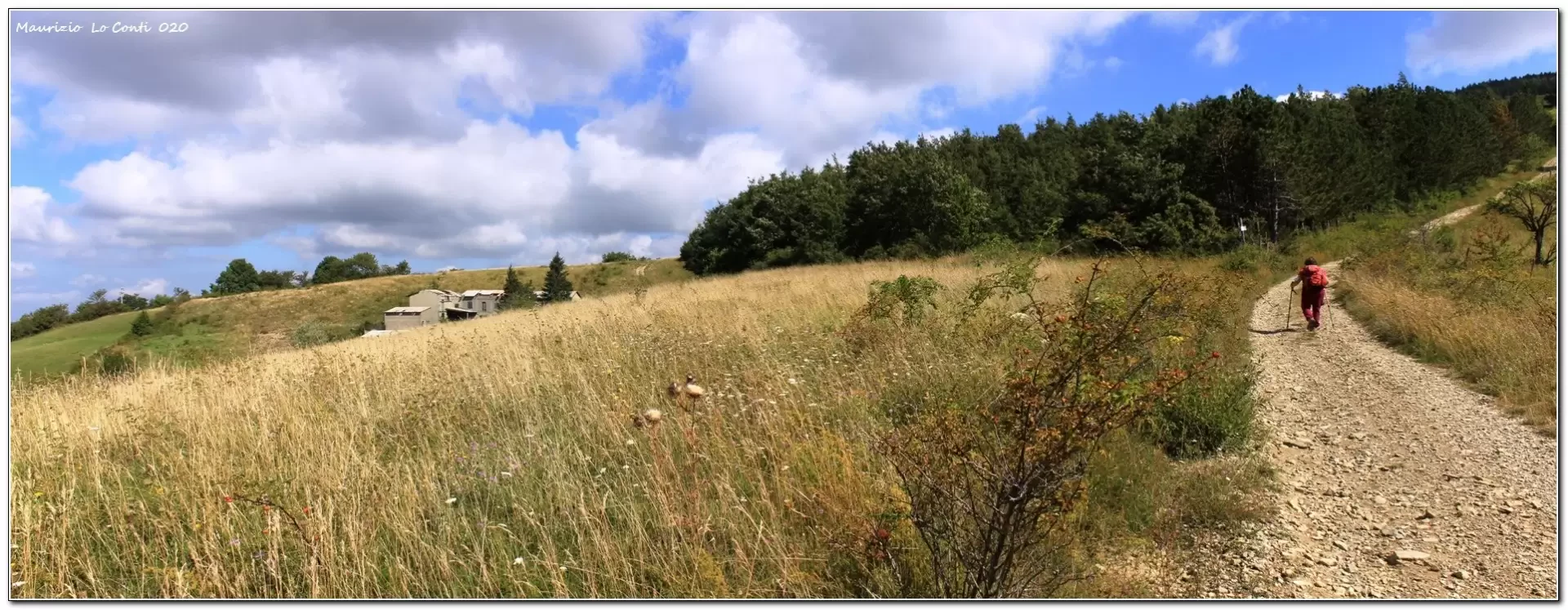
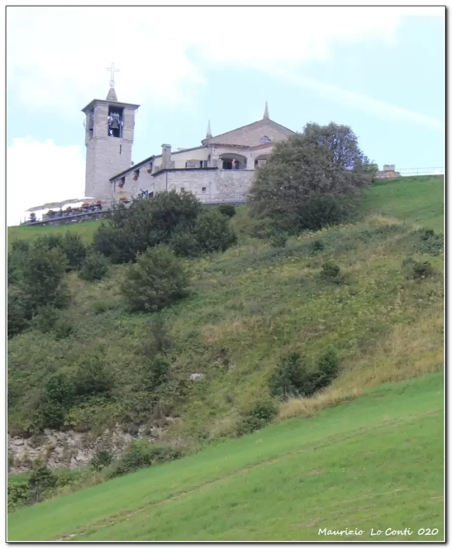
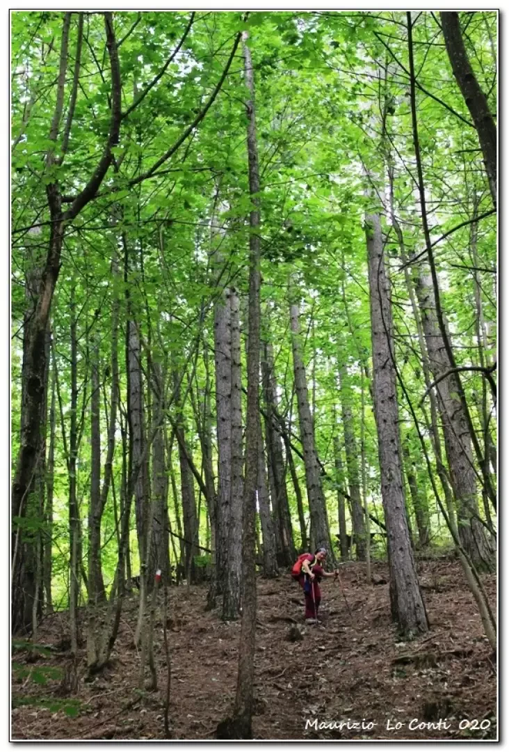
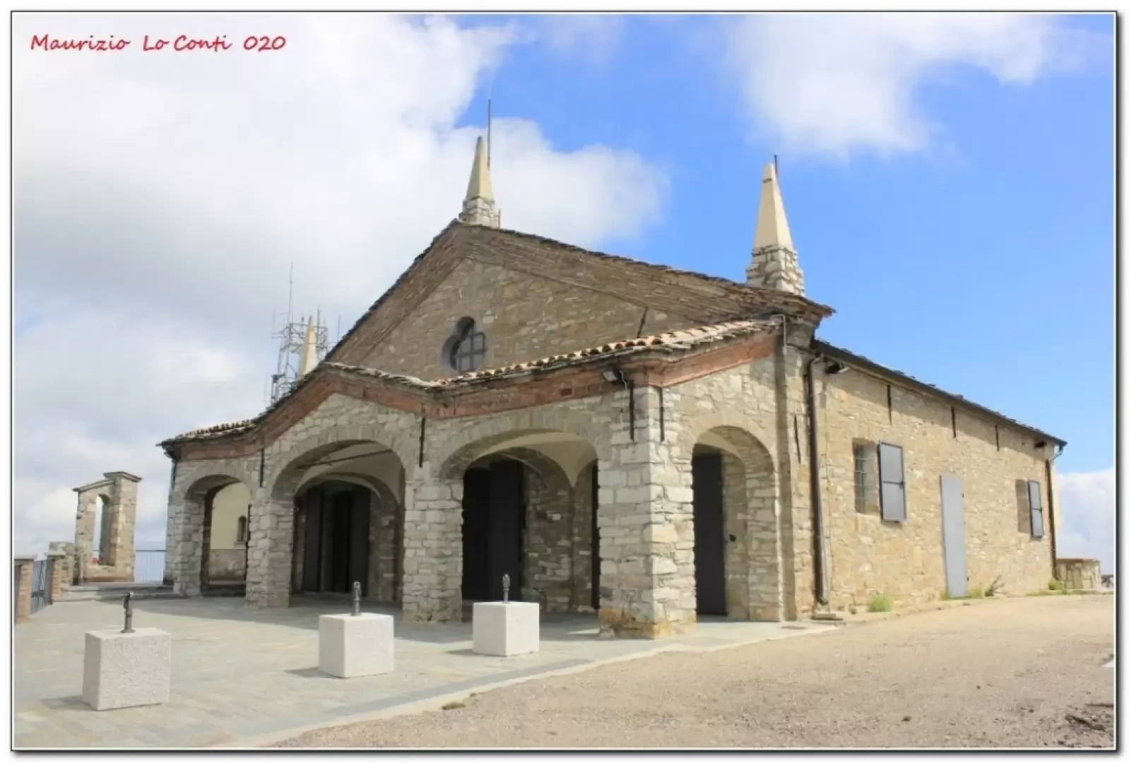
From the pass, follow the cai symbols that lead to a cart track that climbs into a dense forest. You pass Casa Prato del Broglio, which is now just a crumbling ruin. The mule track, which is somewhat ruined, climbs steeply and relentlessly along the wooded ridge; when it finally flattens out, you cross a stretch where there are several trunks on the ground, not very pleasant to look at, that have obliterated the road, some variations allow you to overcome the difficulty. One comes into sight of the sanctuary. The religious building is reached in 1h20 at an altitude of 1460. The summit is disfigured by several television repeaters and an asphalt road. Fortunately, the view sweeps in all directions with beautiful scenery.
After a break (there is also a bar), we descend to the Penice pass, still following the flags. There may be alternatives but you continue on that route. In 50' you are at the pass; here you go left on an asphalt road (Sp 461 - boring, watch out for cars) and after 20' you turn left again onto a secondary road with very little traffic (Sp89) which takes you back to the car in 1h.
In short: Diff. T/E - Disl. 350 m - 3h30 AeR - 11 km. Average ride comfort: sufficient/good.
Best period: spring to autumn.
as well as the pdf photo file, with a bit more info:
http://www.cralgalliera.altervista.org/Penice020.pdf
http://www.cralgalliera.altervista.org/anno2020.htm
http://www.cralgalliera.altervista.org/altre2020.htm
NB: in the case of an excursion, always check with Fie, Cai, any park authority or other institutions, pro loco, etc., that there have been no changes that have increased the difficulties! No liability is accepted. This text is purely indicative and not exhaustive.
General information
Tour:
Signposts:
Tour type:circular
Recommended period: March, April, May, September, October, November
Sun exposure:East
Objective Danger:none
Exposed Trails:none
Useful Equipment:normal daily hiking equipment
Galleria fotografica