Monte de Lor


Edited by:
Giancarlo Beretta
Updated at: 03/09/2024
Description
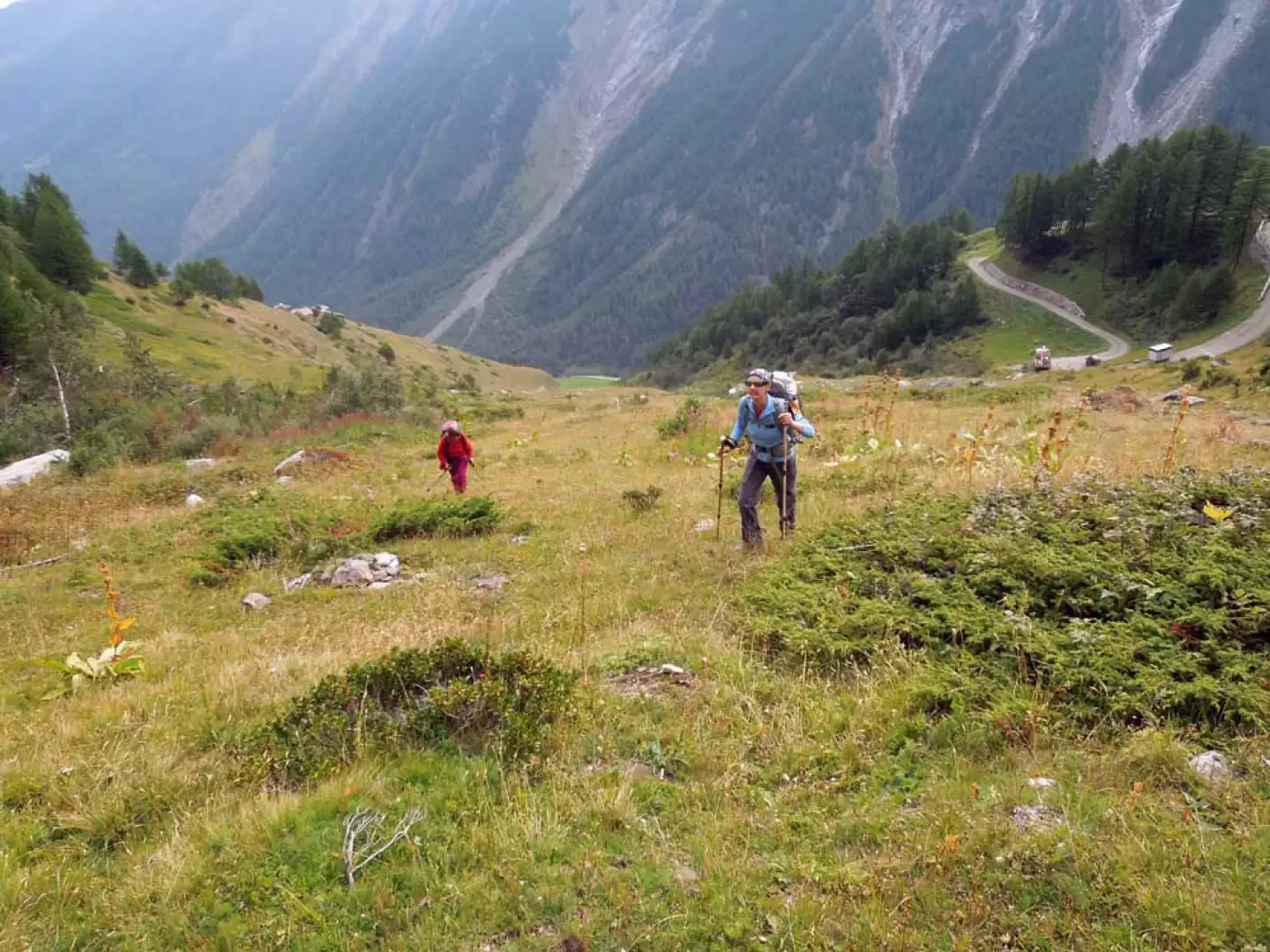
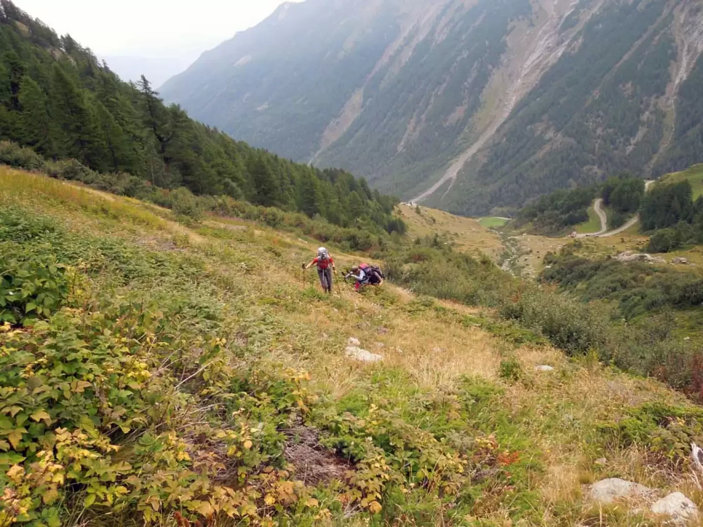
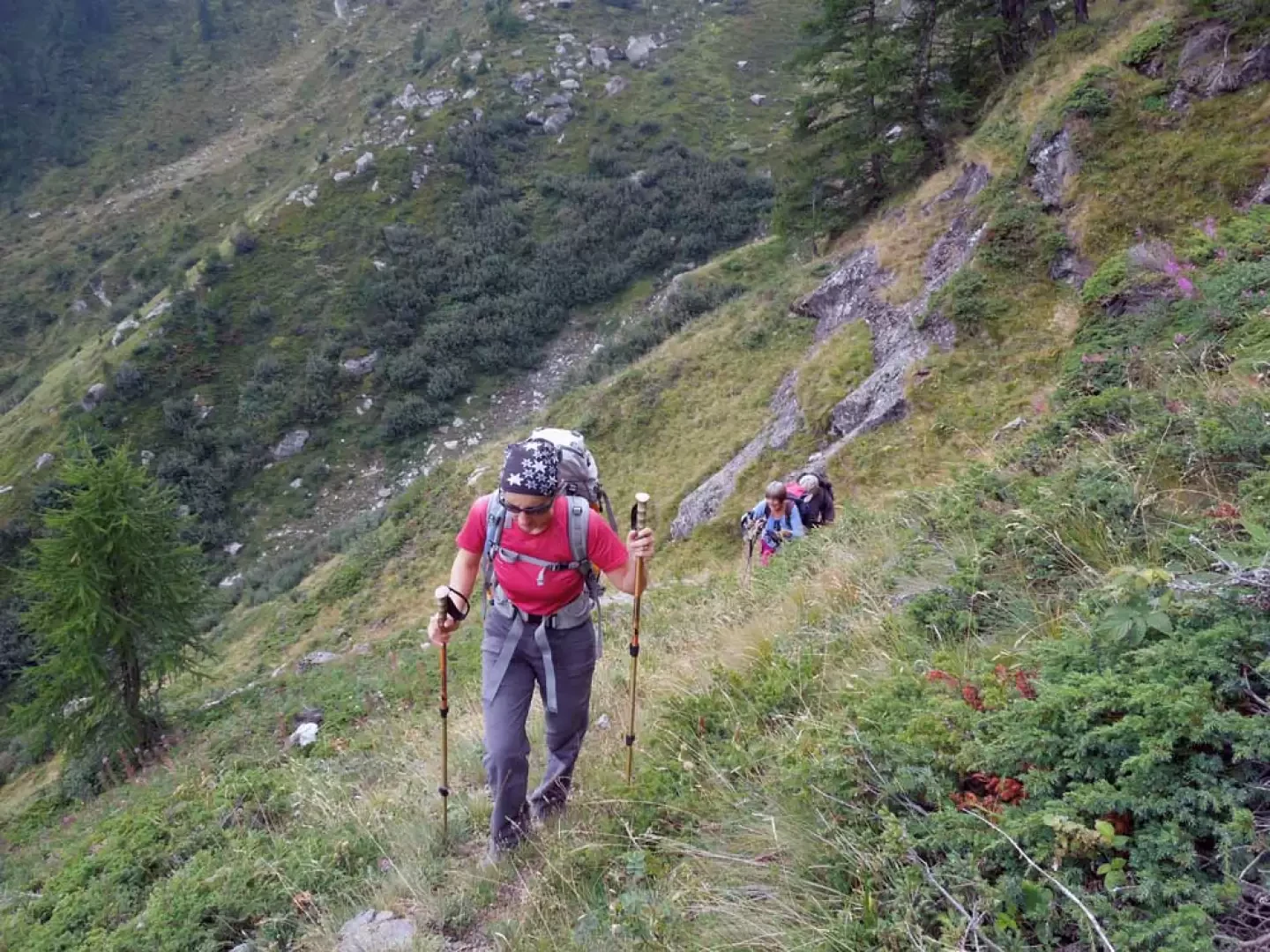
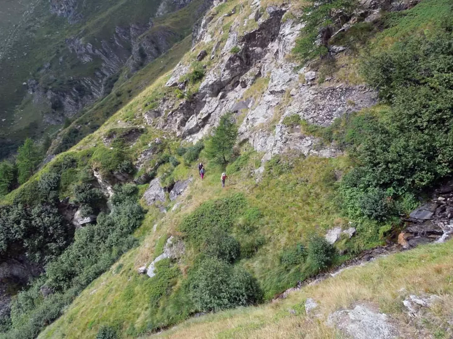
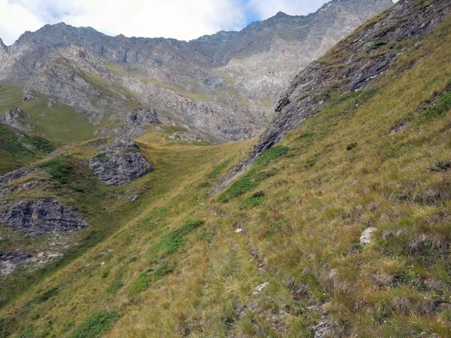
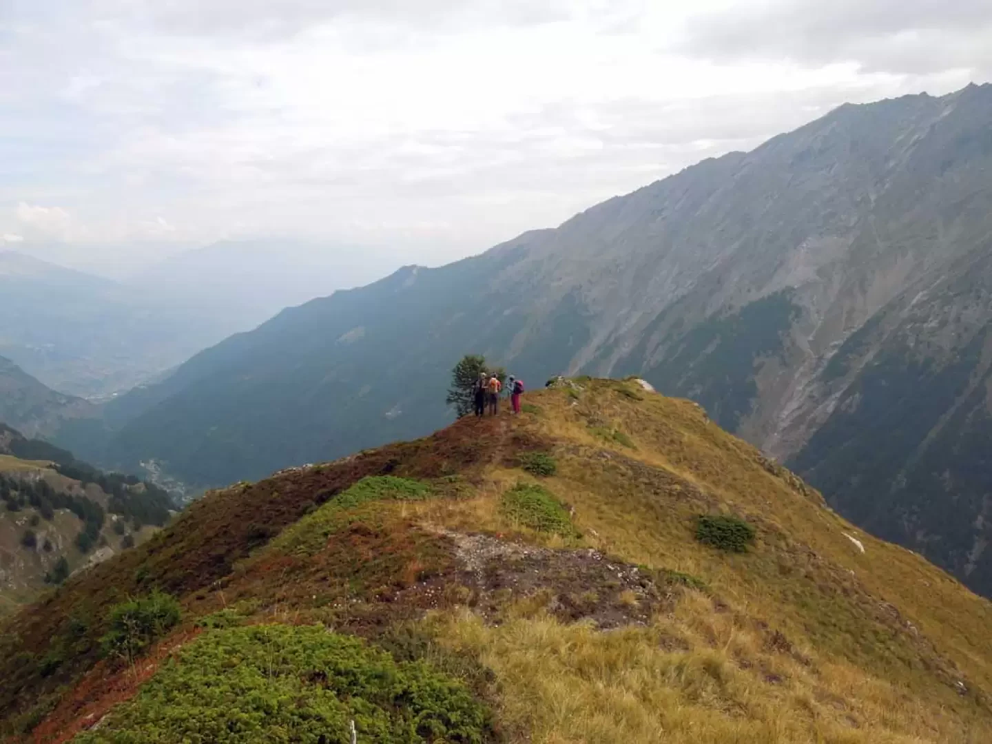
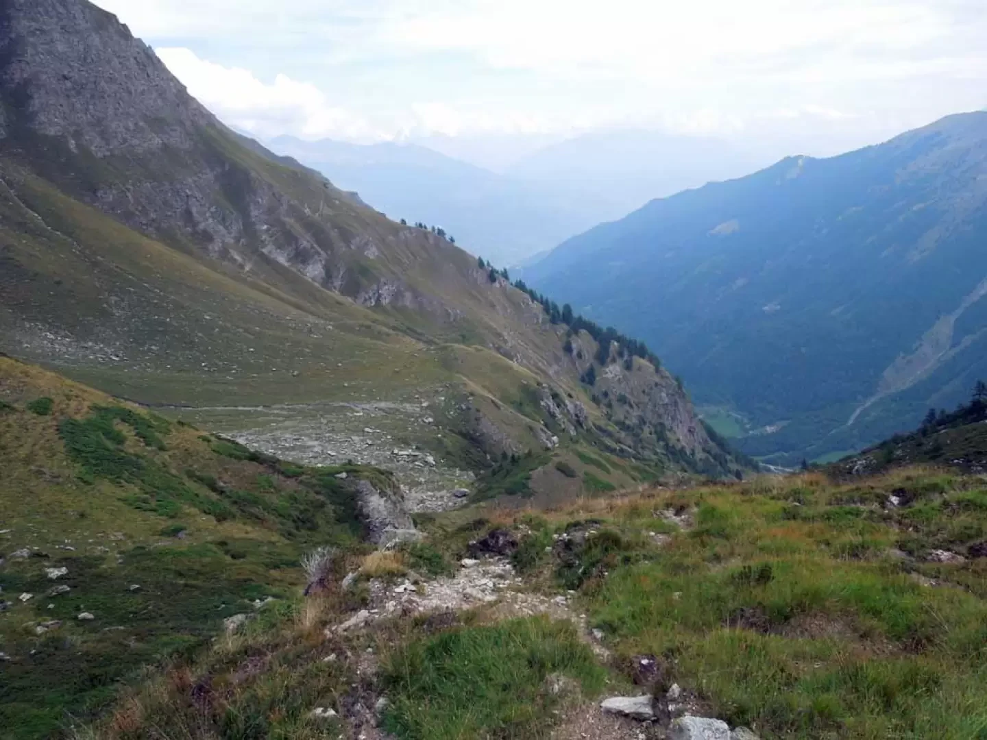
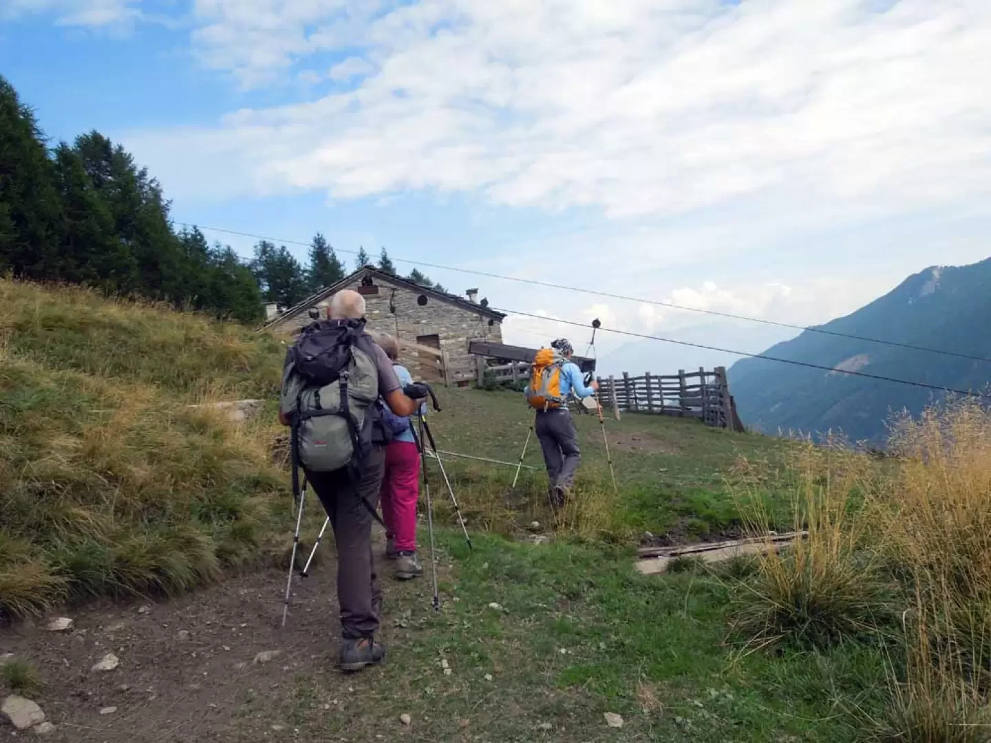
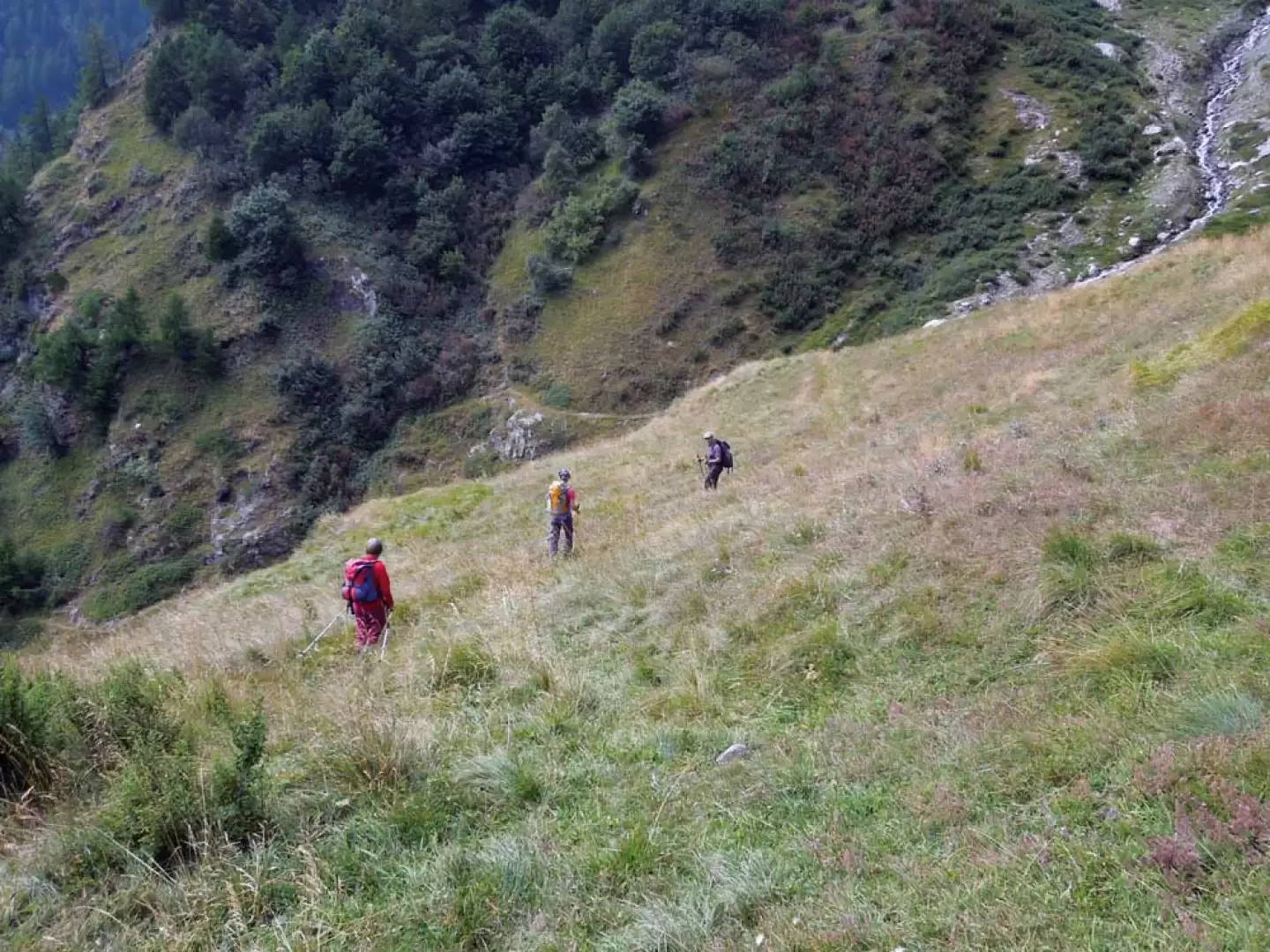
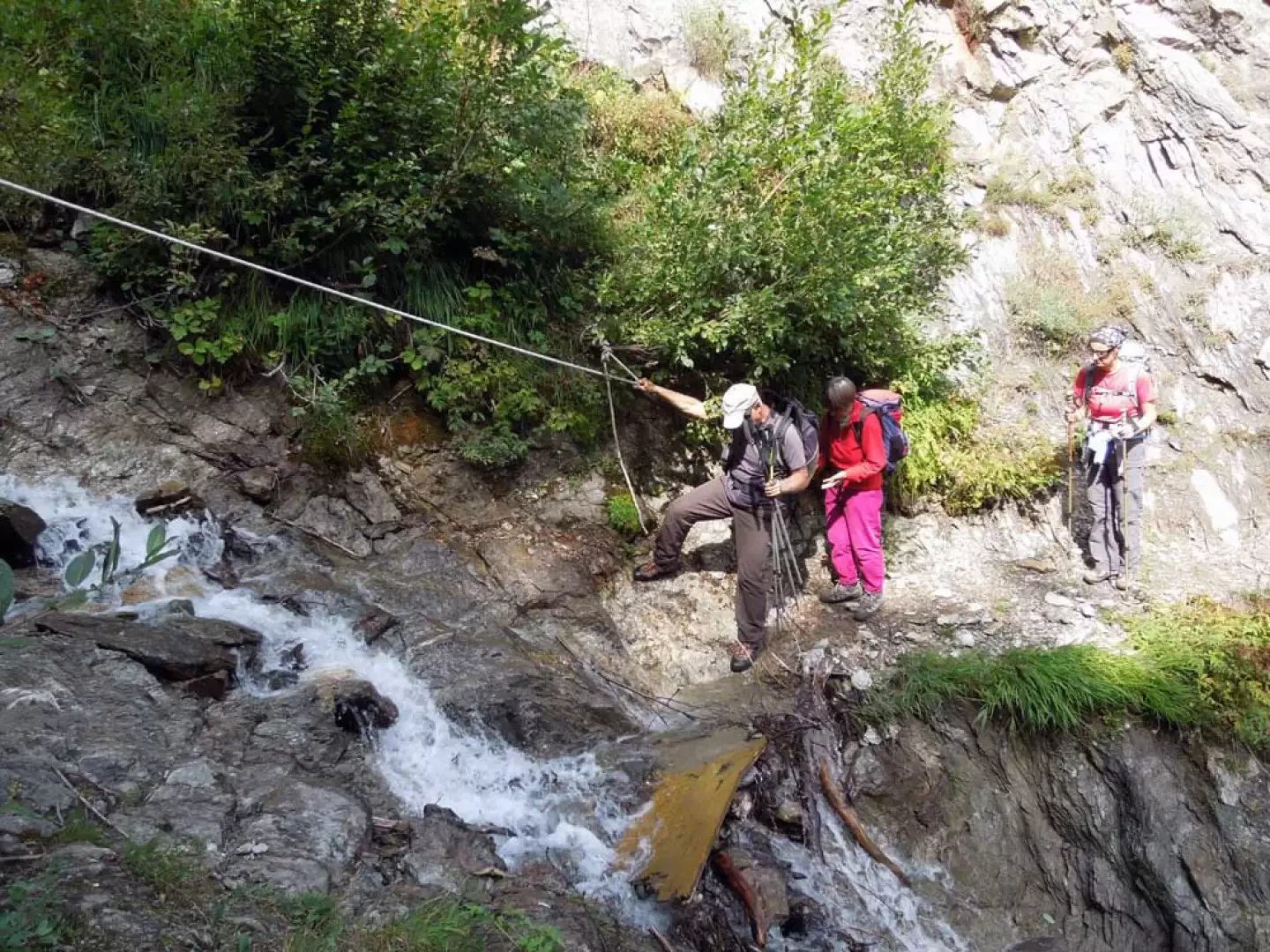
This circular excursion presents a not excessive difference in altitude and a relatively short route (just over 8.5 km), but it crosses wild and little-visited environments once we have left the farmstead. After a strenuous ascent with practically no signs, it takes us to the large, steep grassy slopes that are the characteristic habitat of high mountain fauna. The track is lost in the vegetation just after the farmstead, but the route is logical on the ascent of the grassy gully; from the point at which, almost at the top of the slope, we turn right, the itinerary is always clear with a few slightly exposed traverses. The descent is then truly beautiful, crossing large pastures surmounted by high rocky bastions dominated by the becca di Tos. It is advisable to do the tour in the direction described in order to avoid the steep descent to the Lor damon track, which is difficult to progress through the thick vegetation and slippery grass. From the summit, the panorama towards the south is very beautiful and close over the crest of the Chamoussiére, Ran and Bioula peaks as far as the Entrelor peak, while on the opposite side, it is imposing due to the high rocky ramparts that reach from the Feluma peak to the Grand Revers. Description From the post, take the track and follow it slightly uphill, first ignoring a track going uphill to the left (1,784 m) and then a track coming from the right near a bend (1,841 m). After a few bends, you reach a hairpin bend (1,893 m) just below the Lor Damon pastureland, where you leave the track and take a path that rises slightly in the grassy gully towards the Courthoud stream. Cross it at its best point and you will spot a faint track that skirts the watercourse on the right (orographic left) and begins to climb directly up the steep slope. One climbs up very laboriously, walking not only on steep terrain, but also through dense vegetation both high and low, which completely hides the track. Sensing the logical but not very evident route, one moves a little away from the Courthoud stream and then approaches it again, passing a small stream and arriving at an altitude of about 2,140 m, from where, near a low rocky crag that is a little blackish, one takes the now evident track that veers decisively to the right. We now begin to traverse on grassy ground slightly uphill, first passing a small promontory with a small stone cairn (2197 m) and then, having passed a short stretch of thick vegetation, arriving at a small bank from which we traverse on somewhat exposed ground. Now ford another stream and ascend again with the path over steep terrain, arriving near a grassy ridge from which you cut across the slope to reach the Col du Mont de Lor (2328 m); from the crest, turn right and, after a few dozen metres, reach the panoramic peak. For the return trip, you again reach the nearby col from where you take the evident path that descends to the right and leads towards the centre of the wide valley below; here, having passed the bed of a stream that is usually dry, you take the track that deviates to the right and descends into the pastures (2252 m) passing between some boulders and arriving at the lower part of the plateau; Go around a low grassy rib and continue along a traverse to head towards a small wood that you pass, then descend slightly to ford a stream after which, after a slight ascent, you arrive at a panoramic knoll where the Dzette hut (1945 m) is located. Just before the building, descend along a grassy track that crosses a steep slope and arrives at the stream just below the previous ford; having crossed the stream again, continue downhill to its right and, having skirted the ridge, once again arrive at a stream where there is a rope to help you cross it. Past a ruin is a junction at which you descend to the left (1817 m) and, after a few hairpin bends, the path turns into a comfortable mule-track, and after a short walk you come to a crossroads with an asphalted road near a post; go up it on the right for a few minutes and you will reach the starting point again, thus closing the loop.
.Photo gallery


Comments (0)
Sign in to leave a comment