Mount Carone

Edited by:
Ivano Ruffoni
Updated at: 07/06/2025
Access
Uscita Brescia Ovest dell'autostrada A4. Si prosegue verso est lungo la Tangenziale Sud/SS11 e poi sulla SS45 bis/Gardesana Occidentale. Si lascia a destra la deviazione per Salò, e, lungo la costa del Lago di Garda, si traversano Gardone Riviera, Fasano, Maderno, Toscolano, Bogliaco e Villa. Poco dopo l'incrocio per Gargnano, la strada sale leggermente. Costeggiando il lago si prosegue in direzione di Riva del Garda. Superate alcune gallerie, sulla sinistra, si alza la SP38 per Tignale. Giunti a Tignale si procede verso Tremosine. Oltrepassato il bivio per Prabione la strada diventa piu' stretta e tortuosa, scende e risale una valle, ed entra nel comune di Tremosine. In prossimità di Vesio, si svolta a sinistra per risalire la Valle di Bondo fino a Passo Nota (1205 m) (attenzione: in prossimità del passo la strada diventa molto sconnessa). Lasciata a sinistra la strada per Tremalzo, e a destra quella per Corna Vecchia, in piano si segue la stradina militare fino a Passo di Bestana (1274 m). Scendere poi a destra seguendo le indicazioni per Bocca dei Fortini e al successivo bivio trascurare a destra la deviazione per Corna Vecchia. Si percorre ora un tratto di strada scavato nella roccia, al bivio si svolta a destra, e in leggera discesa si arriva a Bocca dei Fortini (1243 m). Successivamente seguire la destra e raggiungere uno slargo attrezzato ad area picnic, proprio in fronte all'inizio del segnavia - Sentiero Agostino Tosi.
Nota: qualora le condizioni della stradina militare da Passo Nota non fossero adatte alla marcia in automobile (nota: le 4x4 dovrebbe riuscirci sempre), conviene parcheggiare presso il rifugio di proprietà dell'ANA di Vesio (si noti, nei pressi, un cannone della Seconda Guerra Mondiale ed il Cimitero di Guerra), vicinissimo al Passo Nota. Considerare circa 40 minuti di cammino per raggiungere lo slargo nei pressi della Bocca dei Fortini.
Description
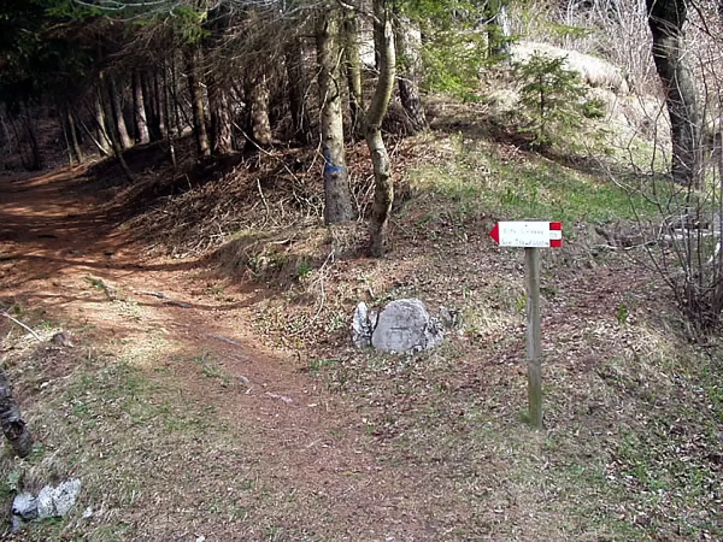
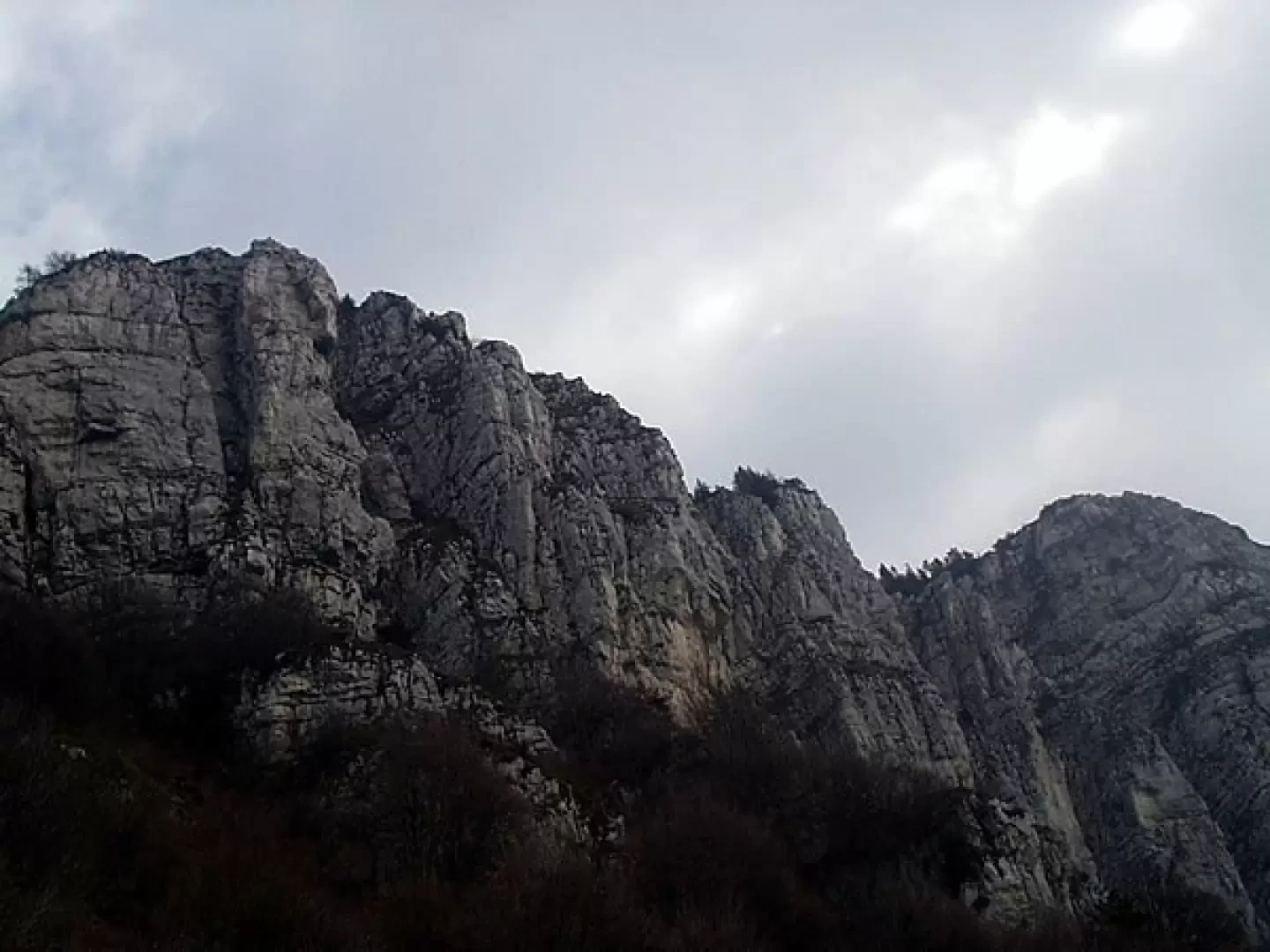
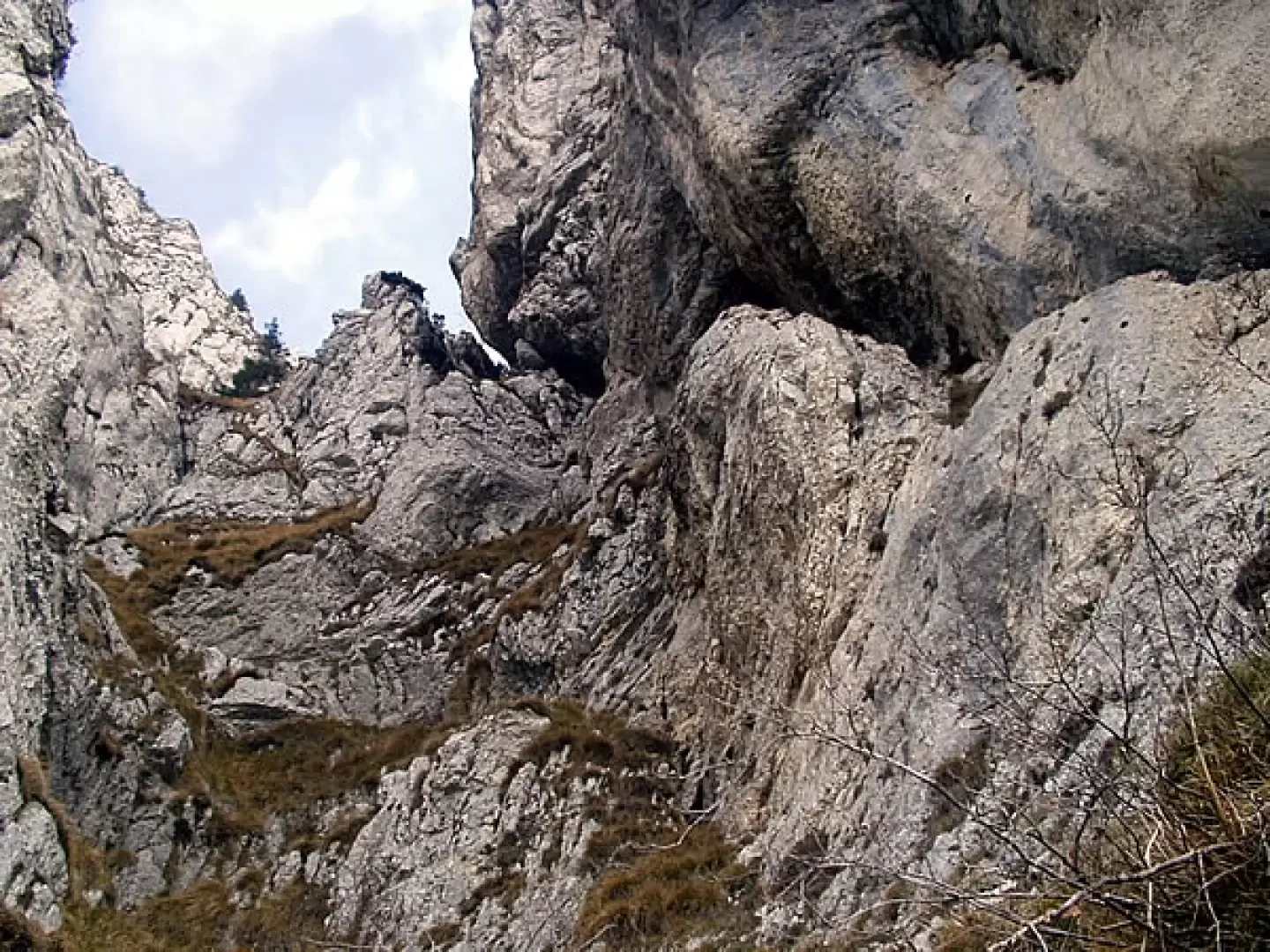
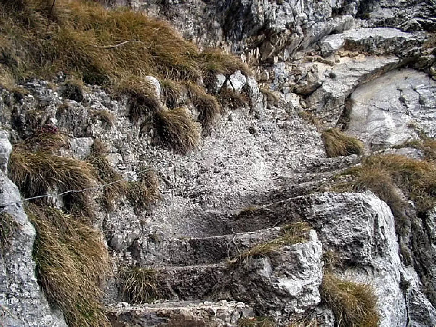
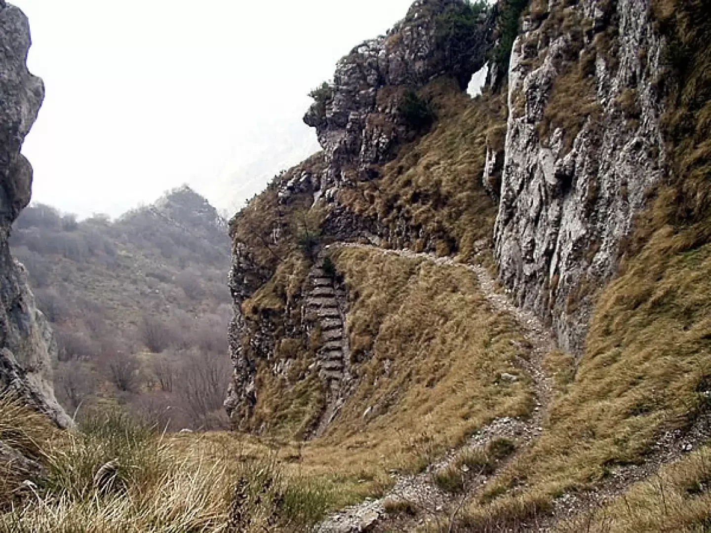
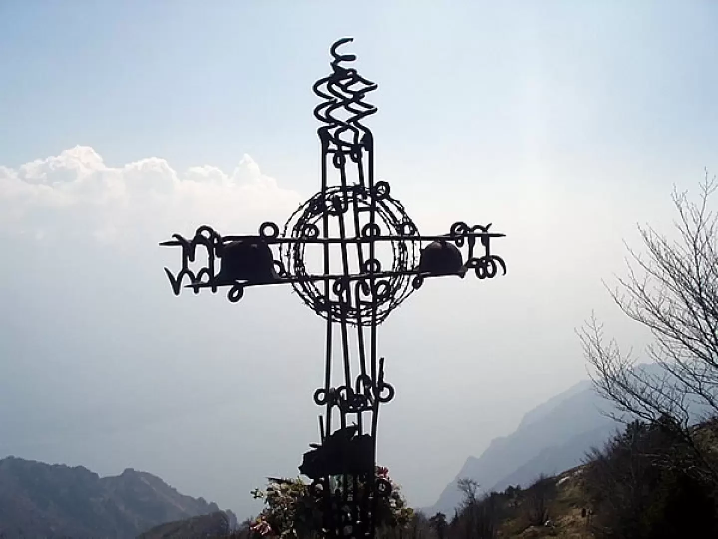
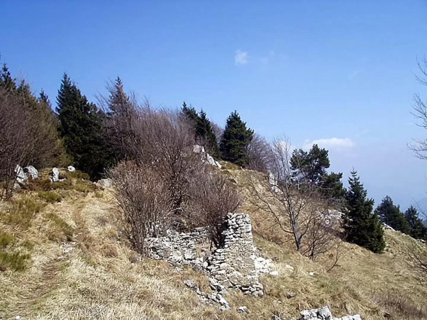
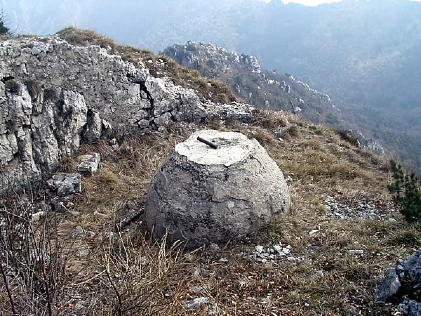
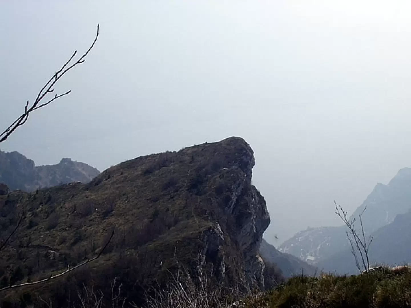
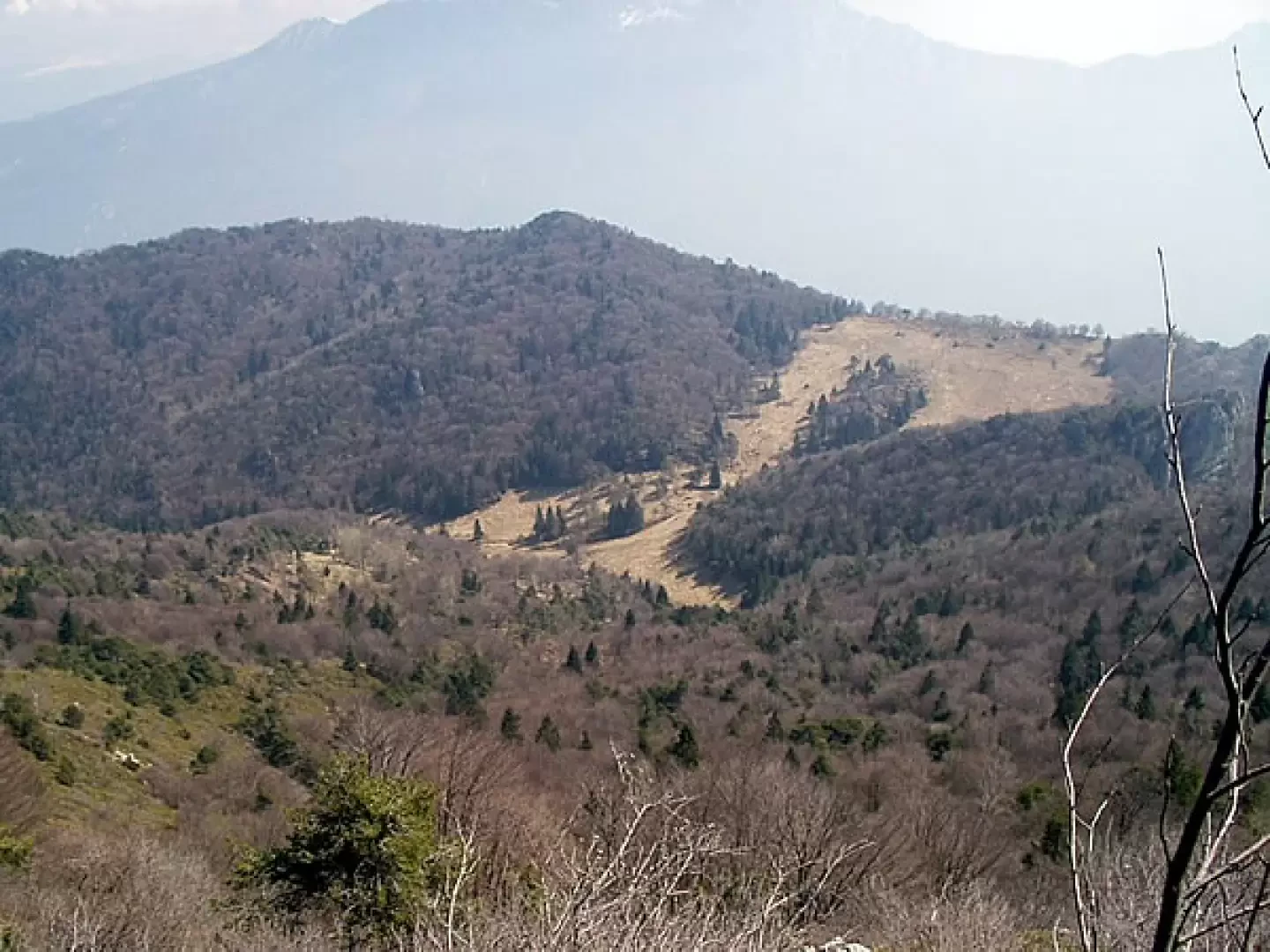
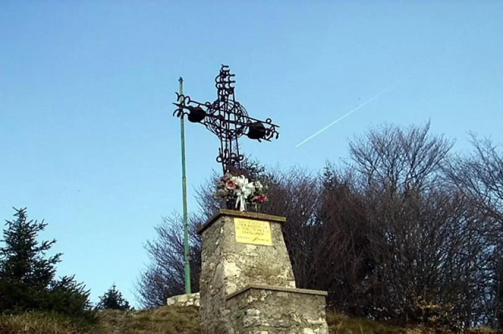
From the car park (1243m), go up the track (marker - Sentiero Agostino Tosi) that climbs into the woods. Immediately you pass military ruins and continue along hairpin bends with a view of the southern limestone walls of Monte Carone. After climbing a few steps, the path leads to the base of a steep gully. A track (at times stepped) carved into the rock and equipped with metal cables by the ANA climbs the gorge. At the exit, in a few minutes, past the remains of some military constructions on various levels, you leave the signpost for Passo Guil and Baita Segala, and ascend to the left to the cross of Monte Carone. Following, to the right, above other ruins, the path along the ridge, we reach the tripod (1621m, 1h00') and the anti-aircraft artillery post in a couple of minutes. Down a few dozen metres, continue on the signpost and descend left into the wood (note the characteristic Punta Mois). Then leave the path and continue to the left (path ), descending to the Malga Vil basin. To the right, a half-hill path joins the main track leading to the Passo di Guil (1208m, 0h55'). Now turn right, signposted , onto the dirt road which, after having gone round the rocks of the Punta Mois, leads to the Bonaventura Segala bivouac (nearby we suggest a visit to the little church dedicated to San Giovanni Nepomuceno) and to the starting point (1243m, 1h35').
Galleria fotografica