Monte Capo Noli


Edited by:
Maurizio Loconti
Updated at: 03/11/2025
Access
You exit Spotorno from the motorway, reach the sea and continue to Noli. At the end of the built-up area, from the Hotel Monique, turn right and look for a car park in Piazza Vivaldo (a charge in the summer months, from May to September).
Introduction
The Monte di Capo Noli loop, a tour of history amidst exceptional views.
Description
From the former Convent of St Francis Church, one ascends towards the promontory, with a multitude of signposts that can be a little confusing for the less knowledgeable. One then ascends passing between dry stone walls and ignoring some branches to the right. You pass the ancient Lazzareto and, with a diversion to the left, in 1' you will see the remains of the 13th-century church of San Lazzaro (0h20').
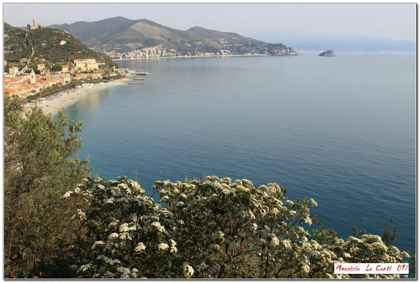
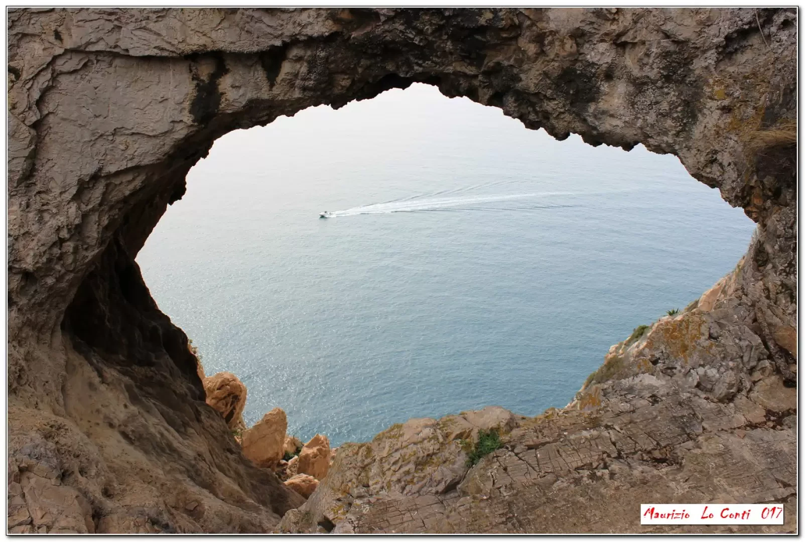
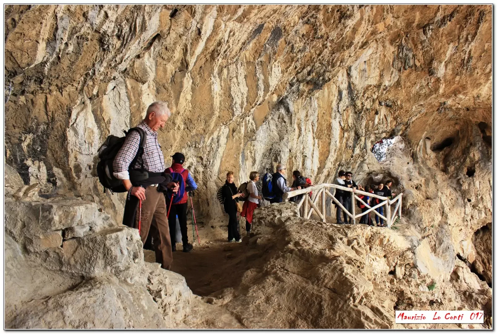
You ignore the FIE sign, again to the right, which goes directly up to the Semaforo area, and reach a rock that offers a beautiful view of the coast with a view of the sea and the castle of Monte Ursino. Further on, there are the remains of the 14th-century church of Santa Margherita (20'), with another fine balcony offering a remarkable view. One ignores the uphill route and a level path leads to the hermitage of Captain D'Albertis (late 19th century). You can continue for a few metres, but be very careful where you put your feet, because of the spikes and the sheer path! From the uphill side of the house, which is totally abandoned, a winding track climbs up to the main road (15'), where you must then keep to the left. For a moment, however, one descends to the right, for a few metres, and finds a faint track, again to the right, that climbs up to the summit, where about a century ago the Torre della Vittoria (Victory Tower) stood out, with an exceptional view (5') and an inscription dated 1914! In short, you return to the previous crossroads and continue on level ground to a bend, where you can descend to the Antro dei Falsari. With a quick and steep descent (there is also another panoramic terrace beforehand), you are at the mouth of the cave. Through an opening, you enter inside (very careful, danger of slipping!) which has a wooden railing. The place is very special, beautiful and open to the sea (10'). Afterwards you return to the crossroads (15') and slowly climb up a nice cart track to the Semaforo (276 m - 30'). Continue along the road and after 100 metres turn left for the 16th century Torre delle Streghe (Witches' Tower) (15'). To the right, a few metres down, is a viewpoint (lunch break - tot. 2h10).
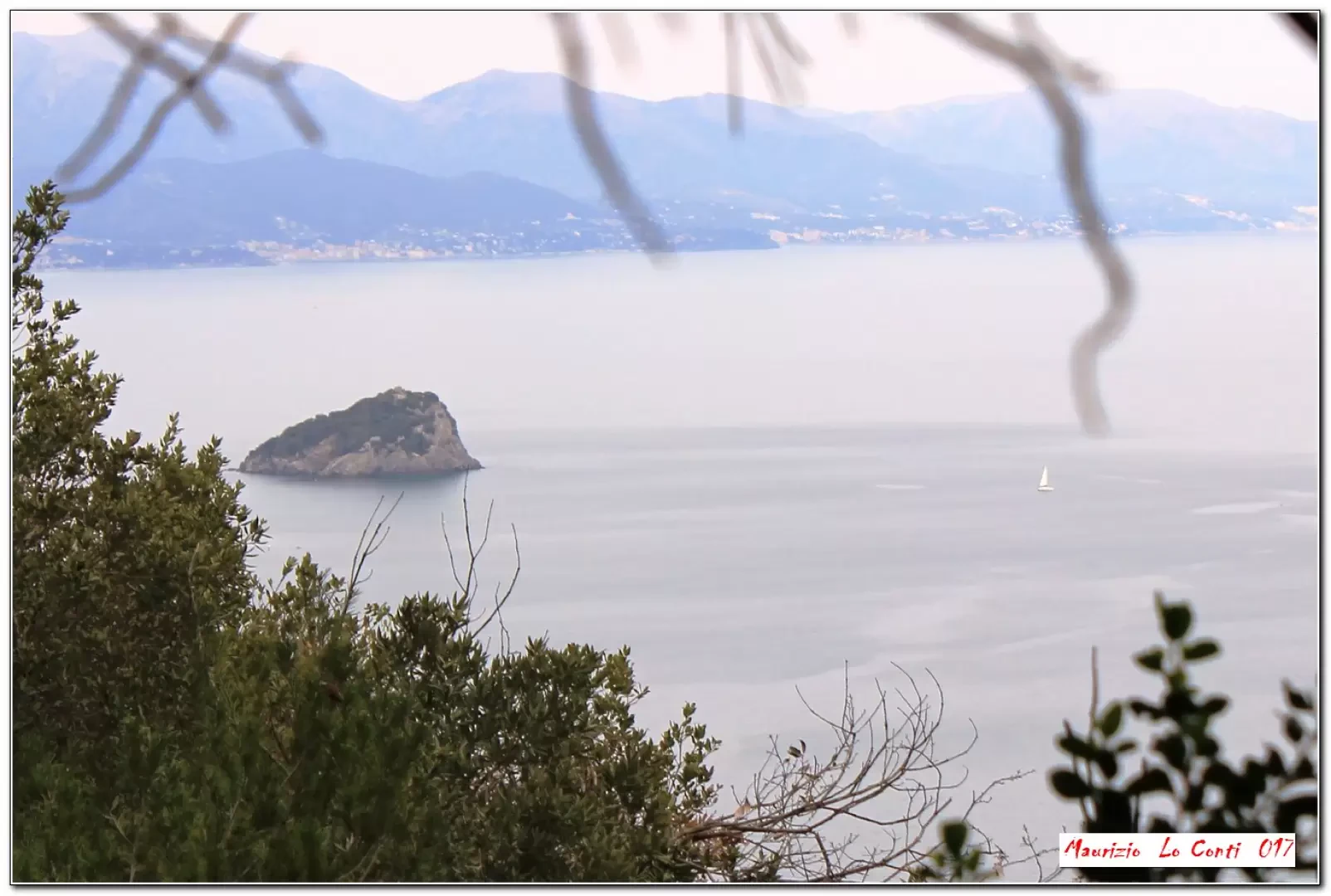
Just a little further on, there is a beautiful promontory overlooking the blue, with a spectacular view (5'). Next, climb briefly back up to the ridge and, at an important junction, bear right twice in a few metres (15'). Follow the dirt track for 100 m and go left, always straight ahead, ignoring the forks. You lose metres and then turn left with the route becoming a little technical and to be taken with due care! Continuing downhill, you come to the ruins of the 11th-century church of S. Michele (40'). We descend (bottom a little ruined) to the houses of Noli (20' - tot. return 1h20). Only after wandering around the narrow streets of the village do we return to the car. To be noted, among many other things, are the towers of Noli, which in the 13th century reached a substantial number: over seventy!
All in all: a beautiful day, gradient almost 400 m Dif. E - 8 km for about 3h30 Total + the long breaks to see the various places encountered.
Trip Photos:
http://www.cralgalliera.altervista.org/CapoNoli017.pdf
http://cralgalliera.altervista.org/anno2017.htm
Trip Photos 2016:
http://www.cralgalliera.altervista.org/1612A1TorreDiNoli.jpg
http://www.cralgalliera.altervista.org/1612A2IsolaBergeggi.jpg
http://www.cralgalliera.altervista.org/1612A3RuderiChiesaSMargherita.jpg
http://www.cralgalliera.altervista.org/1612A4NoliBergeggi.jpg
http://www.cralgalliera.altervista.org/1612A5AntroFalsari.jpg
http://www.cralgalliera.altervista.org/altre2016.htm
Pdf file of the 2016 inspection with some shots other than the single photos:
http://cralgalliera.altervista.org/AnelloCapoNoli016.pdf
NB: in case of an excursion, always check with FIE, Cai, eventual Park Authority or other Institutions, pro loco, etc., that there have been no changes that have increased the difficulties! No liability is accepted. This text is purely indicative and not exhaustive.
Info Hiking Section Cral Galliera: http://www.cralgalliera.altervista.org/esc.htm
trips 2017 at link: http://www.cralgalliera.altervista.org/gite2017.pdf
General information
Trail signposts: marked paths
Type of route: circular
Recommended period: October, November, December, January, February, March, April
Photo gallery
Comments (0)
Sign in to leave a comment