Lago Litteran

Edited by:
Vittorio Martini
Access
Leaving the motorway at the Verrès exit, enter the roundabout and take the second exit. Proceed in the direction of the town centre and, after 300m, turn left onto the regional road for Val d'Ayas. Follow the regional road for 16.5 kilometres, passing the villages of Challand-Saint-Victor and Challand-Saint-Anselme before reaching Brusson. Pass the village and, just before the junction for Col de Joux, turn right to take the communal road to Estoul. Continue on the communal road for about 7 kilometres, passing the village of Estoul before meeting a large car park 🅿️ where you can leave your car.
[0h38'] - [23km]
How to get there with GMaps
How to get there with Apple Maps
The information provided here has been verified as of the date of the survey of the route. Before setting off, it is advisable to ensure that no substantial changes have occurred on the route to the starting point. We therefore recommend the use of the satellite navigation apps provided by Google or Apple for up-to-date and detailed directions.
Introduction
Una facile passeggiata alla portata di tutti. La semplicità e la non eccessiva lunghezza la rendono un'escursione molto appetibile per i neofiti dell'escursionismo.
Description
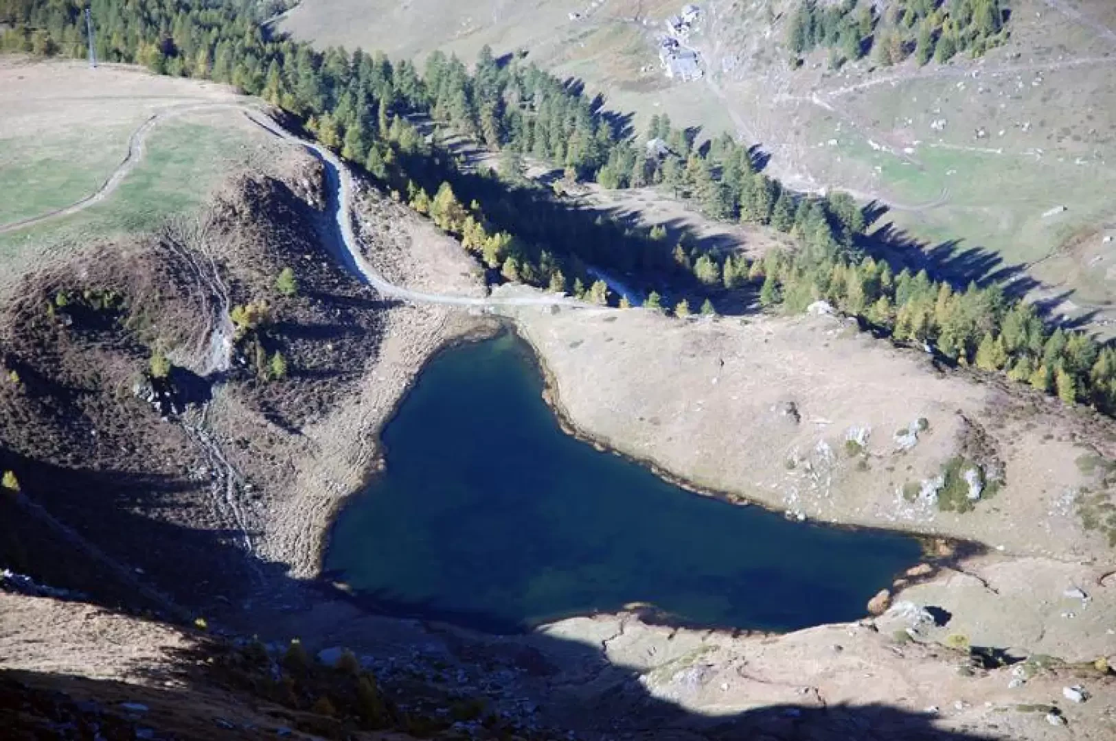
In cima al parcheggio si incontrano le paline segnaletiche che indicano le principali mete della zona: seguire le indicazioni per il Rifugio Arp, imboccando la strada poderale che diparte sulla sinistra. Procedere lungo la pista per circa 200m, poi svoltare a destra e proseguire nel lariceto sempre su comoda poderale. Dopo alcuni minuti di marcia, si incontra un secondo bivio: proseguire diritto seguendo le indicazioni per il Rifugio Arp. Poco prima di Fontaine si incontra una pista da sci, si svolta a destra e si inizia a risalire il pendio su di un'ampia mulattiera. Si trascura il sentiero (6B) che diparte sulla destra e si raggiunge in breve la strada poderale (1992m, 0h20'). Prendere la strada verso sinistra e percorrere la stessa, passando al di sopra dei casolari di Chanlochère (2012m): interessanti scorci sulla bassa Val d'Ayas e la zona dell'Avic. procedere sempre sulla strada che, con un paio di svolte prende quota e conduce in breve a Chavanne (2107m, 0h30'). Si attraversa il piccolo abitato e, poco dopo, la strada svolta a destra inserendosi nel vallone che precede il rifugio. La strada risale il vallone, prende quota con alcuni tornanti e raggiunge il bivio per il lago Litteran ed il Mont Bieteron (2165m, 0h45'): svoltare a destra seguendo il segnavia (6). La strada risale abbastanza ripidamente e con tre tornanti si porta all'altezza del Lago Litteran che troveremo sulla nostra sinistra (2226 m, 1h15'). Il Lago Litteran, situato ai piedi del Mont Bieteron, è un lago naturale dall'ottima pescosità e un bel colore verde scuro.