Cross of the Horse, from Boretta

Edited by:
Giancarlo Beretta
Updated at: 03/09/2024
Access
You take the A26 Genova-Gravellona Toce motorway and, at its end at Gravellona, continue on the motorway, exiting at the junction for Valle Anzasca-Macugnaga. Take the valley road to reach the municipality of Calasca-Castiglione; after passing a few hamlets, turn right and follow the sign for Antrogna where, just before the village, the road for Boretta branches off to the right. Reach and pass the road for a short distance until you reach the barrier that closes the road, where you can leave your car in the small adjacent open spaces.
.Introduction
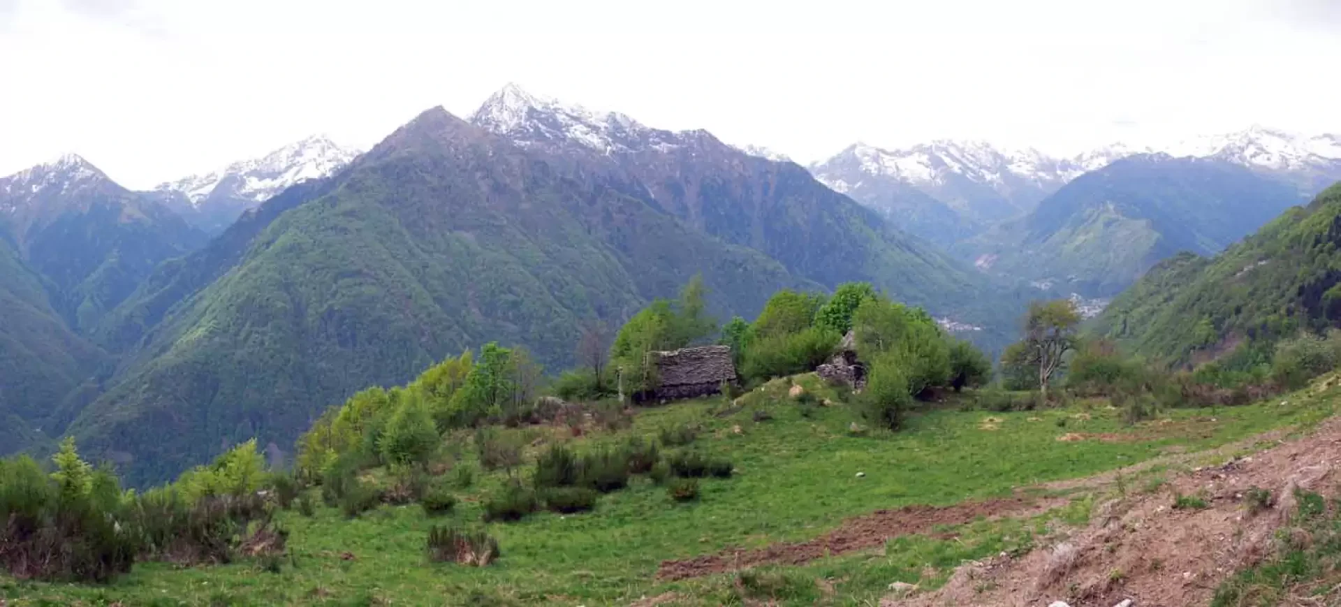
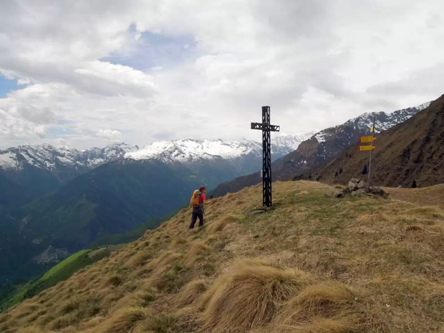
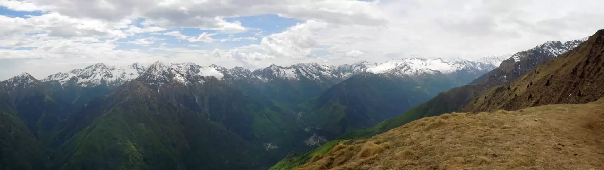
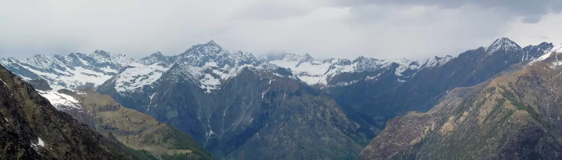
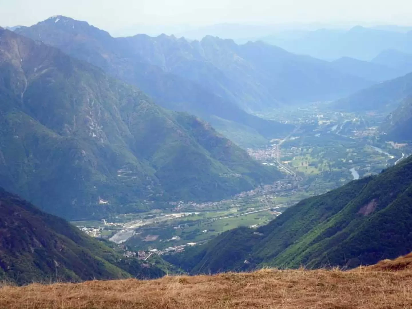
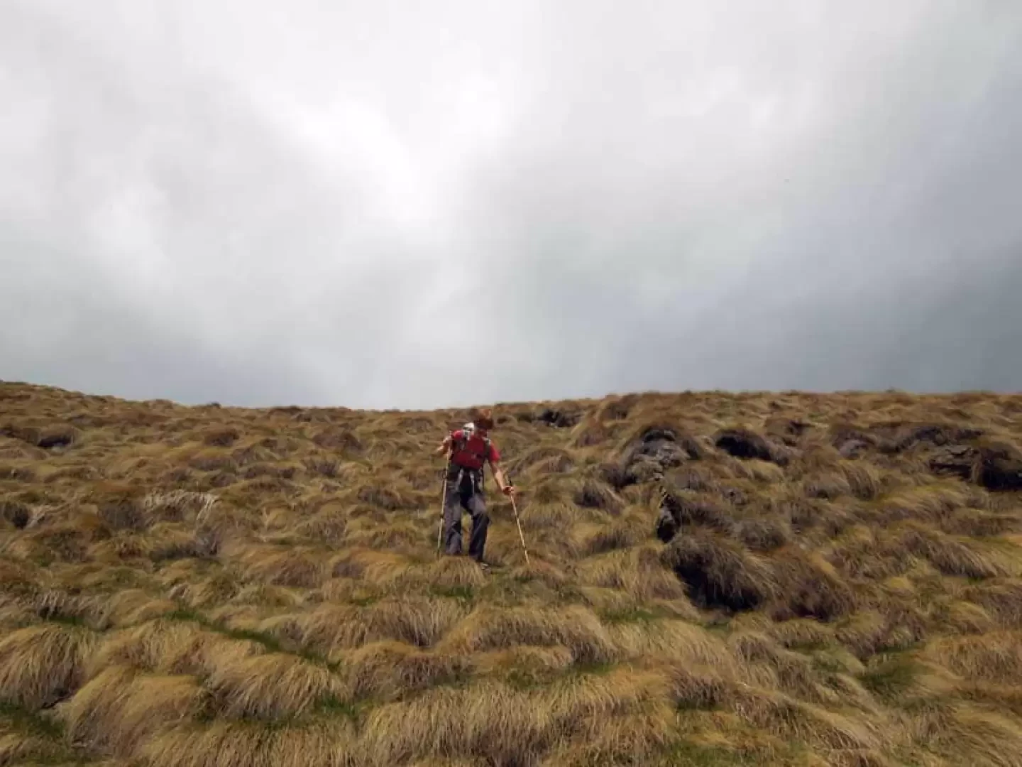
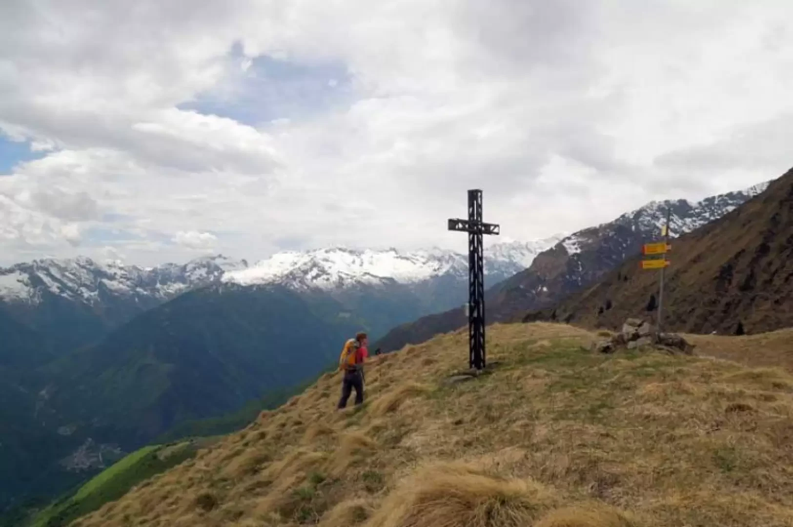
The Croce del Cavallo is a little-pronounced peak of the lower Ossola valley located on the watershed separating the Anzasca valley, to the south, from the Antrona valley, to the north, and its ascent is recommended, precisely because of the altitudes at which it takes place, at the beginning or end of the hiking season. From the summit, where there is a large metal cross, the panorama is however open to the north towards the pre-Alps of the Antrona Valley where Pizzo d'Andolla stands out, to the east on the peaks of the Macugnaga area, while to the south are the peaks separating the Anzasca Valley from the Strona and Sesia Valleys. The trail follows somewhat forgotten paths up a long, steep forested rib where the paint marks are often faded and the track, evident in the beech woods, is often lost near the few alpine pastures and small grassy plateaus. In the steep final section, in the event of thawing or recent rain, attention must also be paid to the slippery oline grass that covers the ridge.
Description
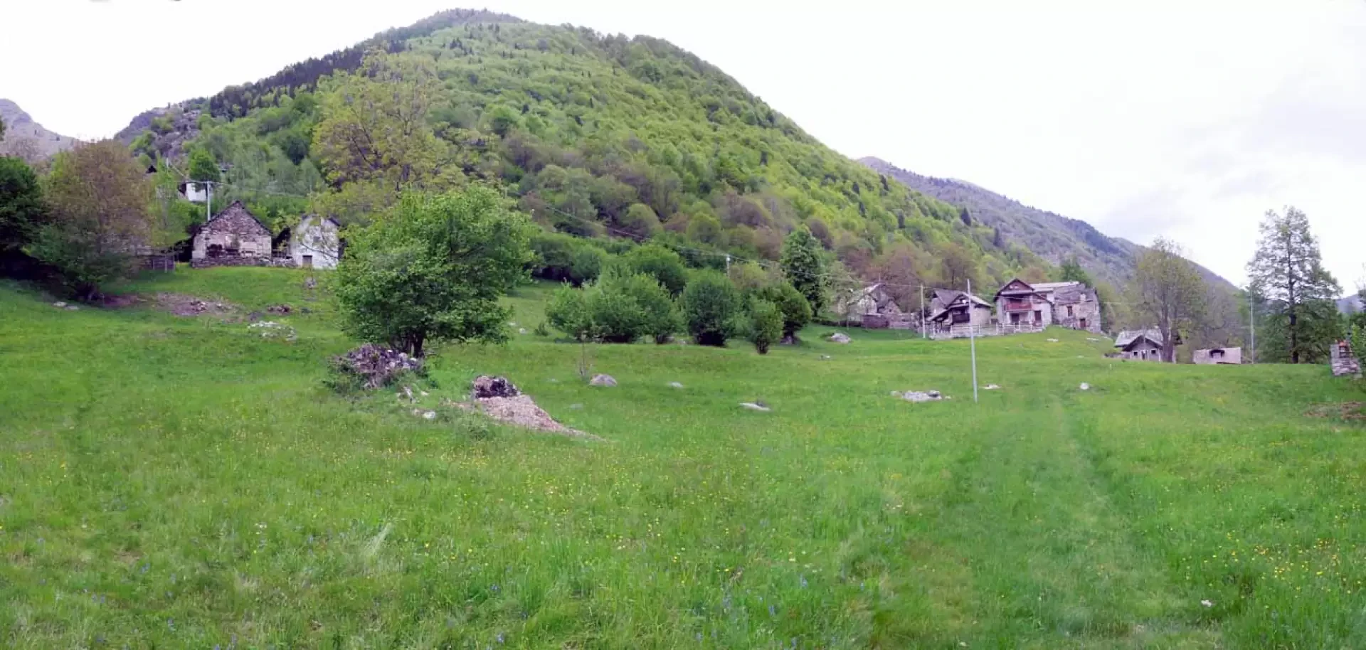
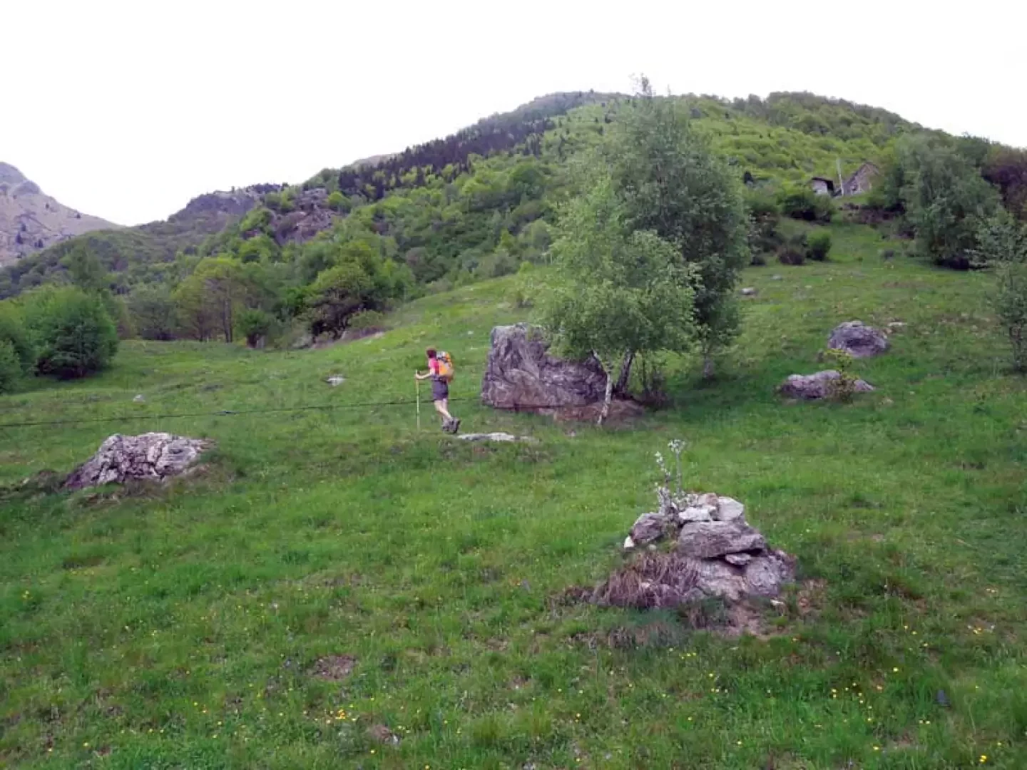
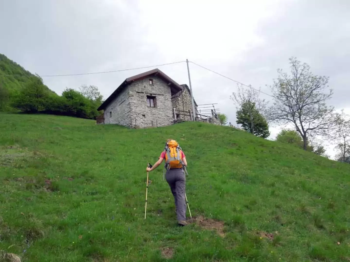
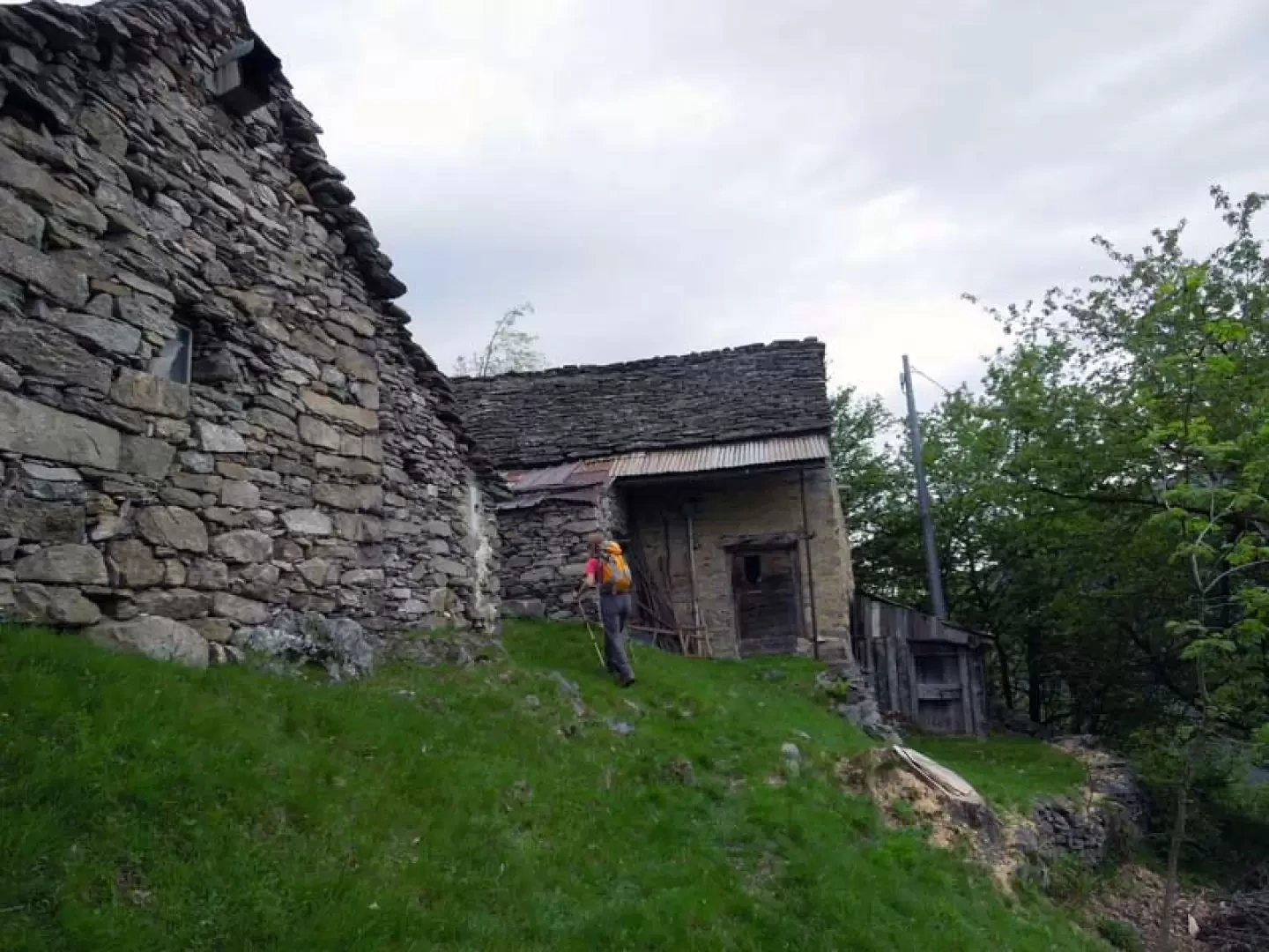
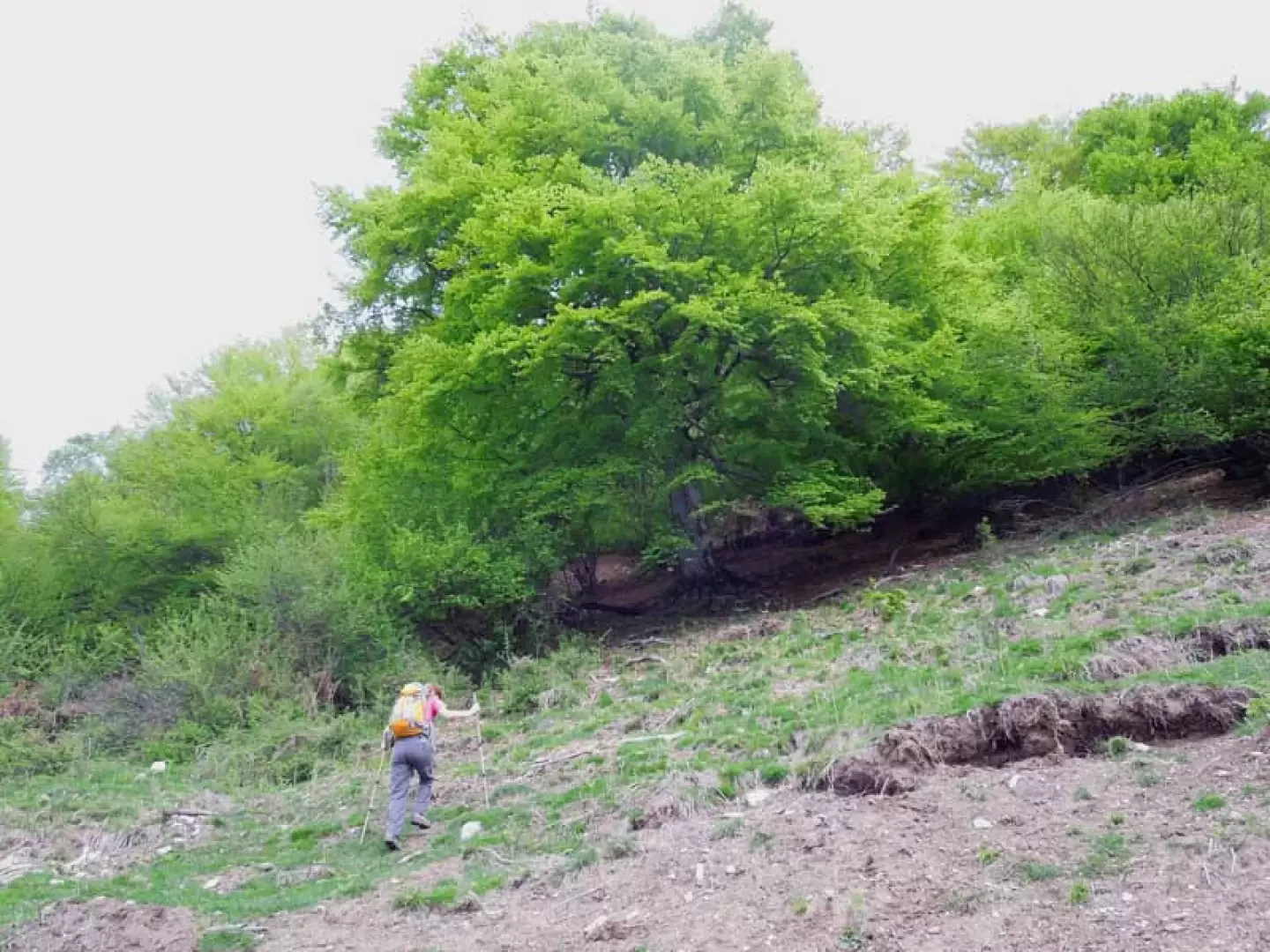
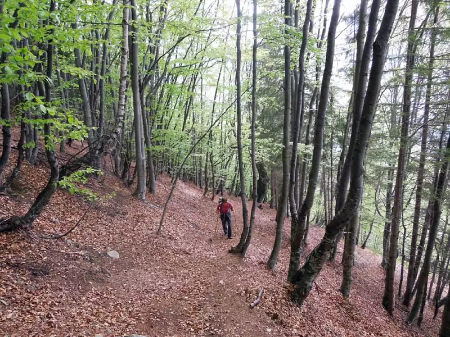
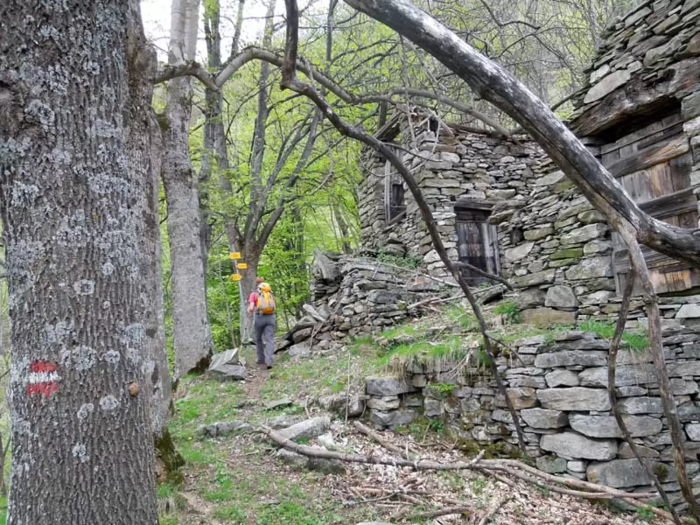
From the barrier, continue along the road that climbs up the low wooded slope with a few hairpin bends, eventually cutting across some of them on the trail that branches off from them. This brings us to Alpe Quaggiui (968m), where there is a post indicating that we should continue to the right; we cross the meadow heading towards the huts on the left, which we cross to rejoin the road just above. The road is crossed in the direction of a large boulder to which the metal cable of a cable car is attached, and the path continues along narrow tracks in the direction of two huts that are clearly visible higher up, passing first by a small chapel. Reaching the huts (1058m), pass between them and continue on towards two other huts above (1088m) where you pass between the buildings, arriving at a small barren clearing that you cut across to the left, without re-entering the woods, to climb a short steep stretch that leads to Alpe Camurè (1146m). Beyond the huts, the path gets lost and, to find it again, climb up a short slope of grass and earth, heading towards a large beech tree at the edge of the upper wood, where there is a trail marker on the trunk. Now the route, ascending the steep slopes with numerous hairpin bends, winds its way for a long stretch through a splendid beech wood inside which you pass a small chapel, arriving at a junction with a track coming from the left, which you ignore; having come out of the wood, you pass a second small chapel from which you reach the visible upper huts of Alpe Cimalbosco (1436m). Crossing the now ruined buildings to the right, we reach the highest of them and, shortly afterwards, arrive in a clearing where we find a metal post indicating that we should continue to the left and briefly re-enter the woods. After ascending a short stretch through the vegetation, the trail gets a little lost and, trying to find the faint trace, we go directly over a steep grassy rise that takes us, out of the vegetation, onto the grassy ridge. Now the track disappears, but the route is now clear, and so we ascend the wide ridge, which gradually becomes steeper until we arrive just below the summit where the slope becomes excessive; from here we move to the left where it flattens out a little, and immediately afterwards, still on a sustained slope, a wide bend to the right that takes us to the summit cross.
.Signposts: B6, white-red stamps
Galleria fotografica