Believe me, from Zéngji


Edited by:
Gian Mario Navillod
Updated at: 05/07/2025
Introduction
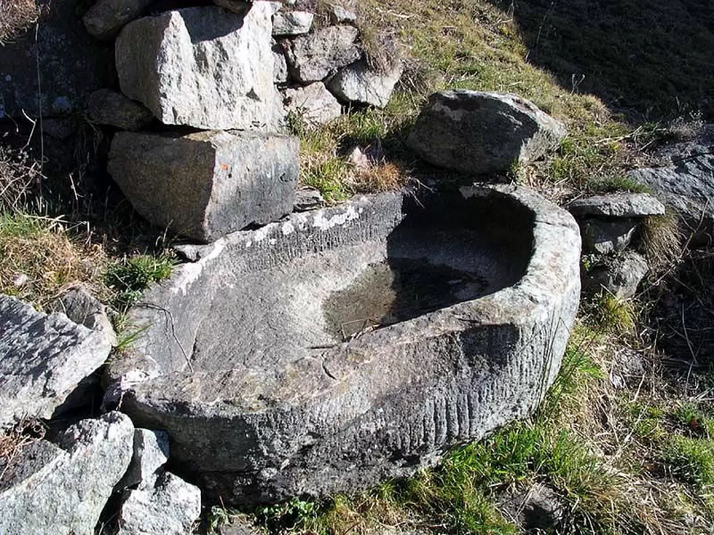
This pleasant hike leads to the beginning of the Tourrison valley, an enchanted valley that knows no motorised vehicles on the orographic left of the Gressoney valley. The architectural heritage is still intact. In the village of Lion (Leiun) an old stadel resists the ravages of time, the one in the Tourrison alpine pasture has already been restored. The most interesting building, the destination of this excursion, is the Credemi alpine pasture, which is protected upstream by an avalanche guard made of stones and boulders. Below the most beautiful house in Lion (Leiun) is a drinking trough carved into the rock that is well worth a diversion.
Description
After leaving the car, follow the signpost
for Colle del Lupo along a beautiful paved mule track that enters the broadleaf scrub, cross the canal bridge that conveys the waters of the Lys to the loading basin of the hydroelectric power station of the Compagnia Valdostana delle Acque (Aosta Valley Water Company) and continue in the shade of the chestnut trees until you reach a real stone staircase that passes next to the large Lassiti house (1060m).
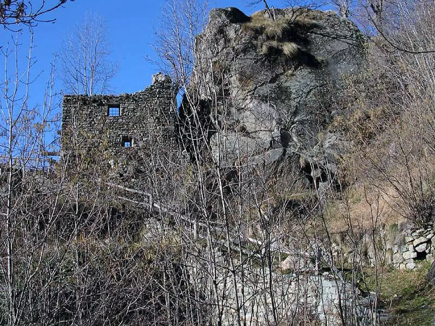
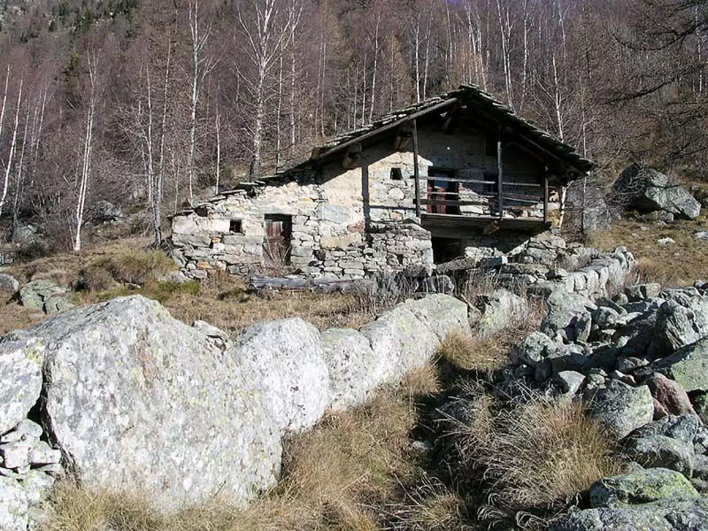
Under a window you can see the hole for the sink drainage. In old houses, the kitchen sink was simply a stone basin placed under the window to make better use of natural light. Since there was no sewer, the dirty water went directly outside through a hole in the wall. After a short flat stretch, a bend leads to the foot of a ruin silhouetted against the blue sky; the stone structures are still perfectly legible, the wooden ones have long since collapsed.
One enters the pastures surrounding the village of Bioley (Bioule, 1127m), the beautiful stone houses are desolately empty, the path crosses them and right at the exit of the hamlet, it touches on the restored chapel that bears the date 1780 engraved on the ridge. Behind the hamlet, the path has been refurbished, is wide and has well-connected paving stones. A little higher up, there is still a section bordered in the valley by large stone slabs set vertically into the ground in the Walser manner.
As soon as one reaches the small plateau of Vasir (1280m), one can see on the left a beautiful stone house with the peak of Mont Nery behind it and on the right the arrival of the cable car connecting with the valley floor. As you approach the edge of the cliff, a good part of the path can be seen from the viewpoint: the start of the path where you leave your car, the loading channel of the hydroelectric power station, the dam on Lys, the roofs of the village of Bioley. The path narrows here, it is bordered by a few stone walls.
One step after another, we continue up the steep side of the valley. Little more than 10,000 years ago, pastures and scrubland did not exist, the entire valley was occupied by the Lys glacier, which was retreating after the expansion of the last ice age.
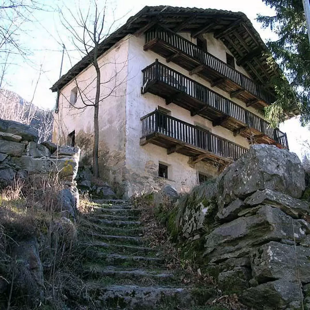
Almost without realising it, one arrives at the village of Lion (Leiun), which is built on the edge of a plateau suspended over the valley floor. It contains a handful of extremely interesting rural houses. The largest one has a ridge dated 1895, the main façade has four storeys and the first is accessed by a stone staircase with wide, well-connected steps, a thin stone wall acts as a handrail. A few steps away is the drinking trough carved from a single piece of irregularly shaped rock. It has been hollowed out and finished with chisel strokes until a small hollow is obtained with well-worked walls.
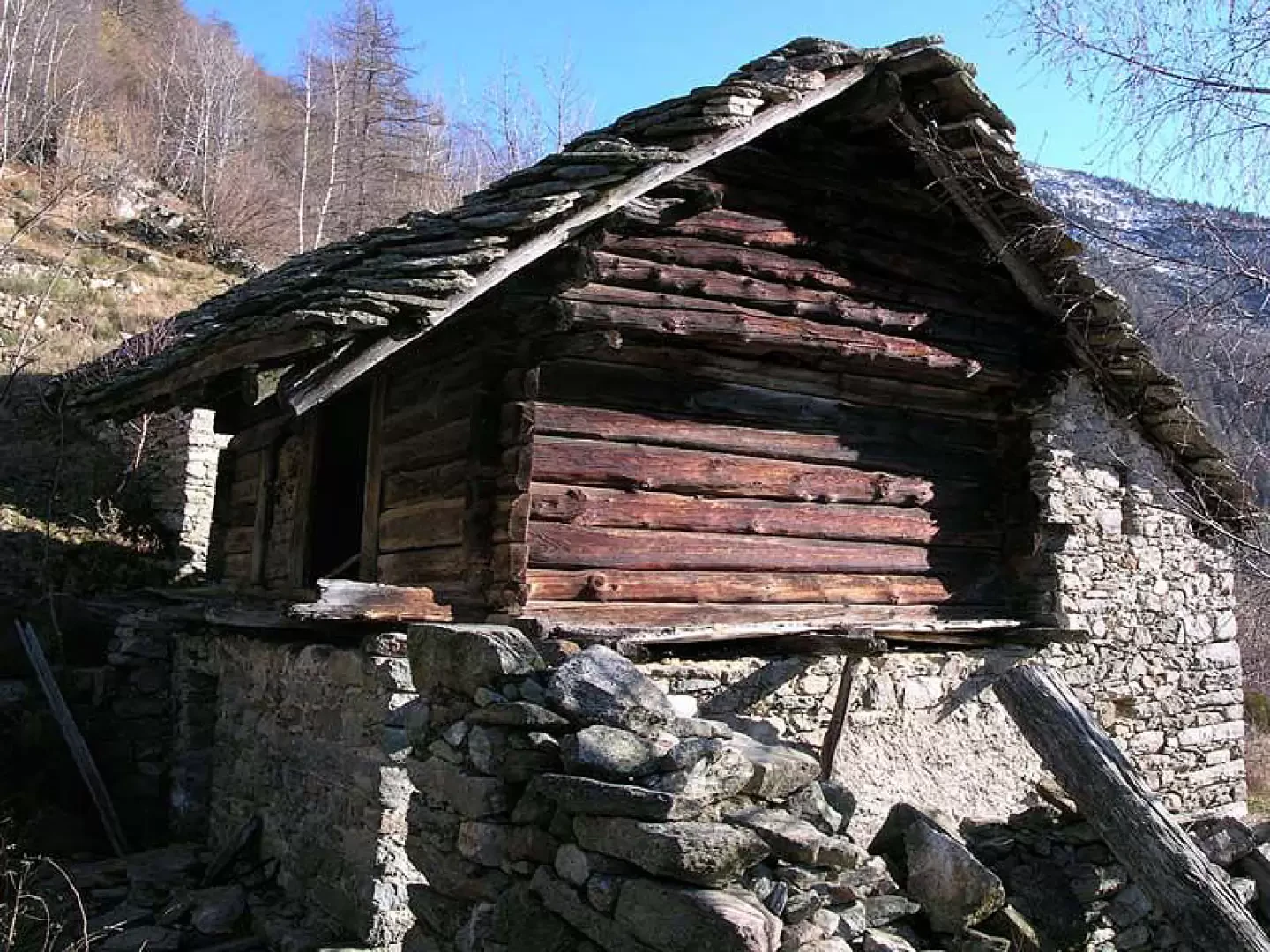
To get to the first stadel in the Tourrison valley, it is necessary to pass the low stone houses that occupy the centre of the village, and in the midst of some ruins appear the old larch logs of this typical wooden construction. It is precisely the material used in its construction that tells us that we are in front of an ancient house: such large larch trunks were common hundreds of years ago when man began to colonise the upper parts of the Gressoney valley, now they have almost disappeared because the woods have long since been cut down and replaced by fields and pastures.
For hundreds of years these constructions have followed the passing of the seasons lovingly guarded by the hand of man. Now the gutters made from thin logs hollowed out on the inside have fallen to the ground, a wooden door resists the carelessness of men but no longer defends the inside of the stadel into which the goats enter to seek refuge. From the roof, the first drops run down between the rafters, causing them to rot. For some years now, these splendid vestiges of rural architecture have been abandoned to their own devices, and the structures that have defied the centuries are in danger of disappearing in a few decades.
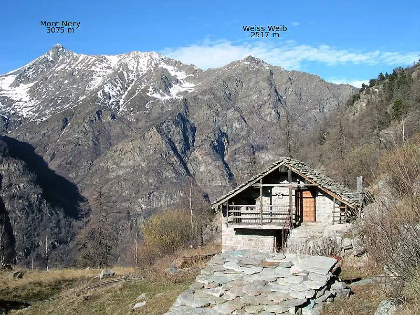
Those who wish to continue into the Tourrison valley must return to the beginning of the village and follow the track that passes to the left of Lion. In a few minutes, you reach the restored Crechtatz-Krechtatz alpine pasture (1400m), behind which the flattened pyramid of the Weiss Weib (2517m) appears on the right-hand side of Mont Nery. One ascends between the alpine pasture and a small basement building. After crossing the hazelnut scrub that narrows the path with a little effort, continue until you come in sight of the Tschnnevellj alpine pasture (1494m).
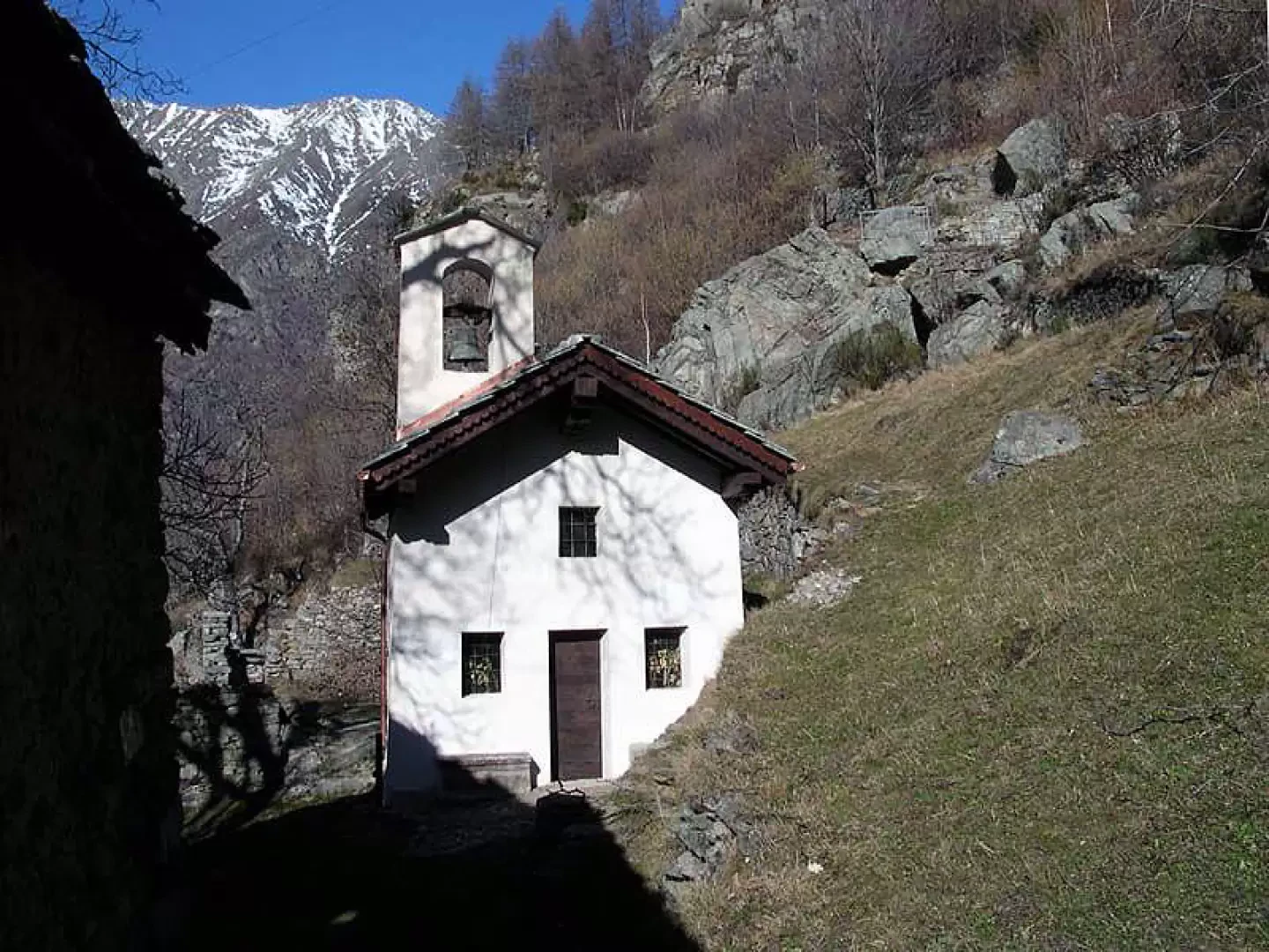
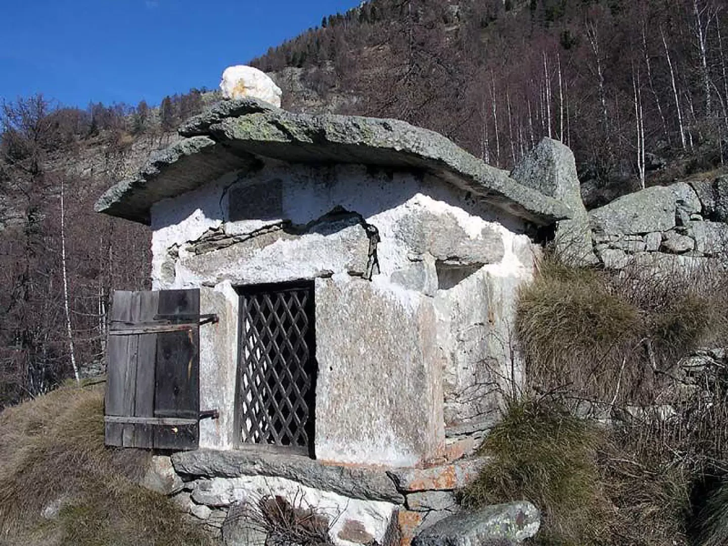
Here it is advisable to leave the path and head on level ground towards this beautiful, as yet unrestored rural building, whose ridge beam dates back to 1828. Down the valley, there is a piece of the old path embedded between the dry stone walls that are built with stones taken from the pastures piled up between the large boulders that mark the sides of the passage. A few dozen metres away is a small oratory in a panoramic position. A wooden door and a rhomboidal grille protect its now bare interior, a white stone serves as its hat.
Returning to the path, one continues through the scrub until reaching the beginning of a scree slope. You leave on the right a building dating from 1920 (1556m) with the arrival station of the cable car coming up from the bottom of the valley and a wooden fountain fed by a spring, then, walking on an uneven pavement, you head towards the Tourrison valley. The last broadleaves give way to alpine pastures. On the steep slope, a few old larches stand indifferent to the passing of time. The smooth boulder that cut the path has been tamed by man: a few steps have been carved into its slippery surface, similar to those seen on Mont Chétif in Courmayeur or under the Paretone di Arnad.
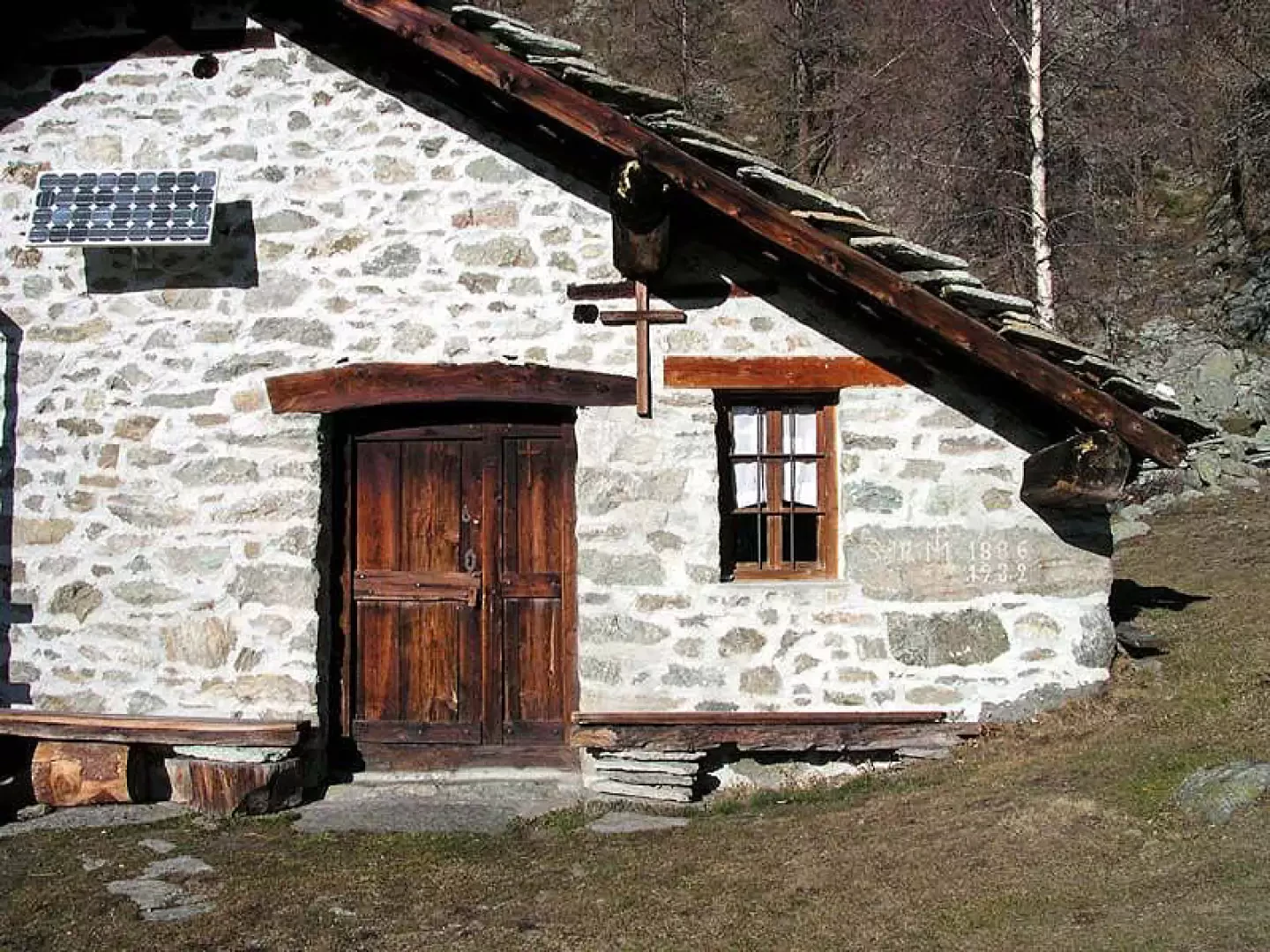
You pass a few ruins downstream, then the slope reduces, and without more effort you reach the Tourrison-Turrudschu alpine pasture below (1648m), dating from 1886-1932, which was carefully restored a few years ago. You walk between the two buildings and then descend a few metres, cross a stream and, passing over a grassy knoll, you can see the glacier-smoothed rocks peeking through the grass.
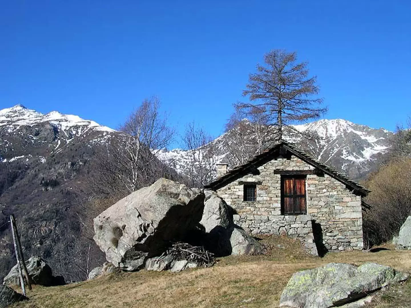
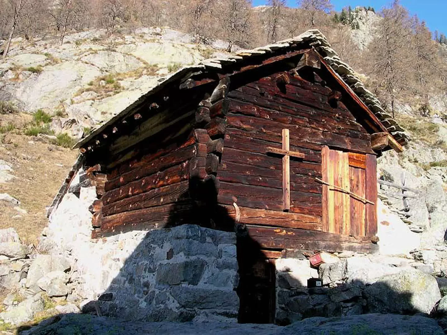
In just a few minutes you reach the Tourrison-Turrudschu alpine pasture above (1660m), where there is a large stone house built on three levels and behind it a small stadel used as a hayloft. The interior is perfectly preserved, the roof has been reinforced and the slate roof rebuilt. From restorations like this one understands how the spirit of the old Valdostan farmers, made up of respect for the work of their fathers and care for the land, has not yet been completely lost, overwhelmed by the rivers of money that are being spent on subsidies for this sector.
We continue through the pastures, the silence of this valley is only broken by the murmur of the water and the sound of the wind among the larches. When you reach a band of rhododendrons and junipers, the path becomes less obvious, you turn left and climb the slope with a few sharp bends. Then the slope decreases, we pass at the foot of a stone pine tree of monumental dimensions and continue through the alpine meadow dotted with large boulders to reach the Credemi-Kredemi alpine pasture (1770 m).
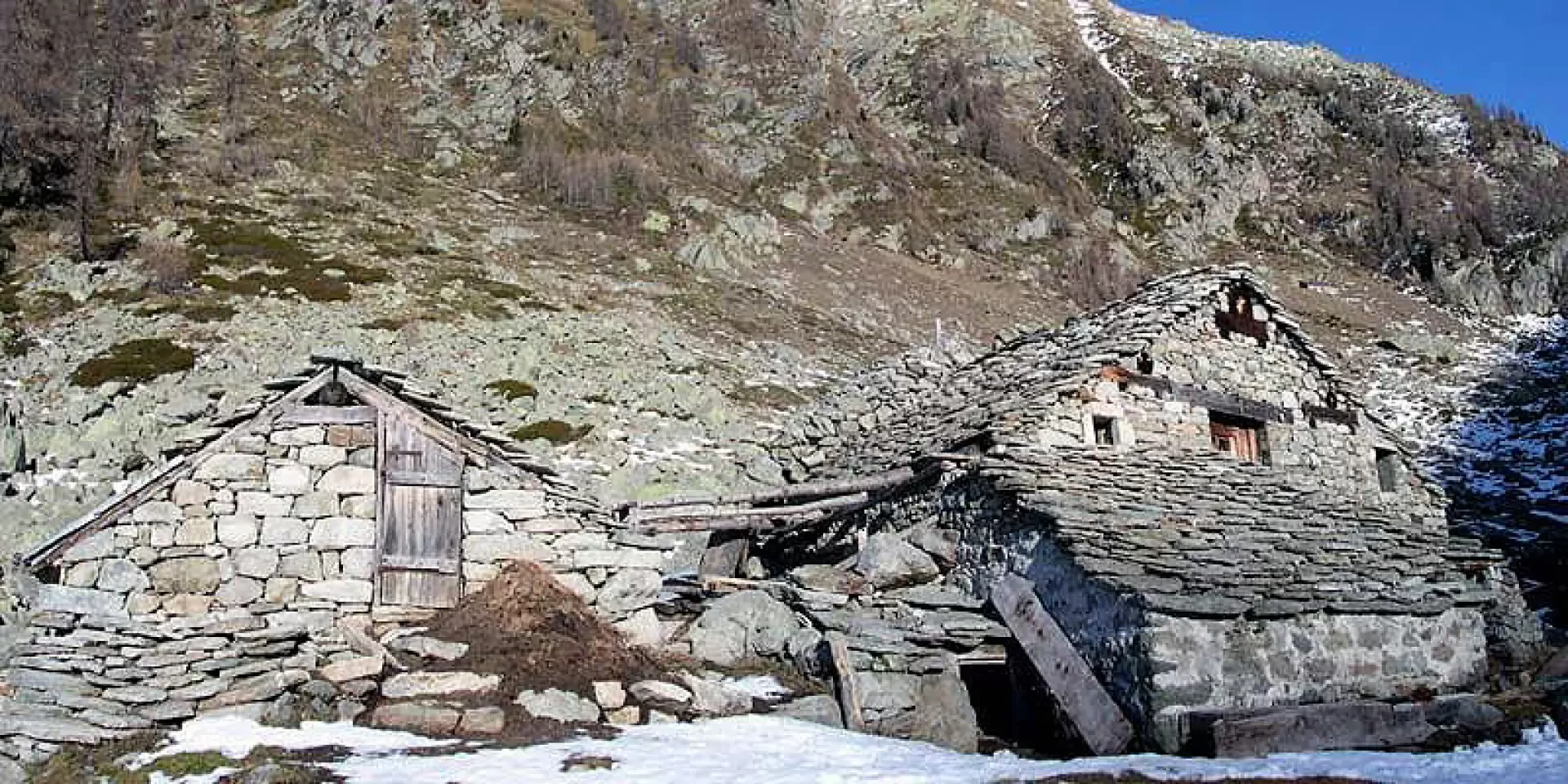
This unusual-looking construction, the destination of this route, deserves an explanation. At first glance, it is just one of many alpine pastures built of dry stone, whose solidity and almost mimetic integration into the landscape is appreciated. Passing behind it, however, one notices an enormous mound of stones reminiscent of the graves of long-lost heroes. This curious structure was not built to honour the dead but to protect the work of the living: it is the avalanche guard that protects the malga. Without it, avalanches and their blow would seriously damage the roof and the upper part of the building. Instead, this large mass of boulders cuts off the flow of snow and air displacement, keeping the main structure of the alpine pasture sheltered.
Those who wish can continue the itinerary towards Lago Chiaro (approx. 2090m) or towards Colle del Lupo (approx. 2342m).
Photo gallery
Comments (0)
Sign in to leave a comment