Col Duc, from Ru

Edited by:
Benedetto Lorusso
Updated at: 04/05/2025
Access
Leaving the motorway at the Aosta Est barrier, turn right and take the dual carriageway to follow for 8.4 kilometres. At Signayes, turn right onto the regional road following the signs for Bionaz/Laravoire. Pass a roundabout and continue on the regional road along the entire length of Valpelline. Pass through the villages of Valpelline and Oyace until, after about 27 kilometres, you reach the hamlet of Dzovennoz. Turn left, following the signs for Chez Leo Merloz Ru, Ley Cretes. Go up the little communal road for 1.3 kilometres until you reach the free car park 🅿️ before the village of Ru.
[0h39'] - [29.2km
How to get there with GMaps
How to get there with Apple Maps
The directions given here were verified on the date of the route survey. Before setting off, it is advisable to ensure that no substantial changes have occurred on the route to the starting point. We therefore recommend the use of the satellite navigation apps provided by Google or Apple for up-to-date and detailed directions.
Introduction
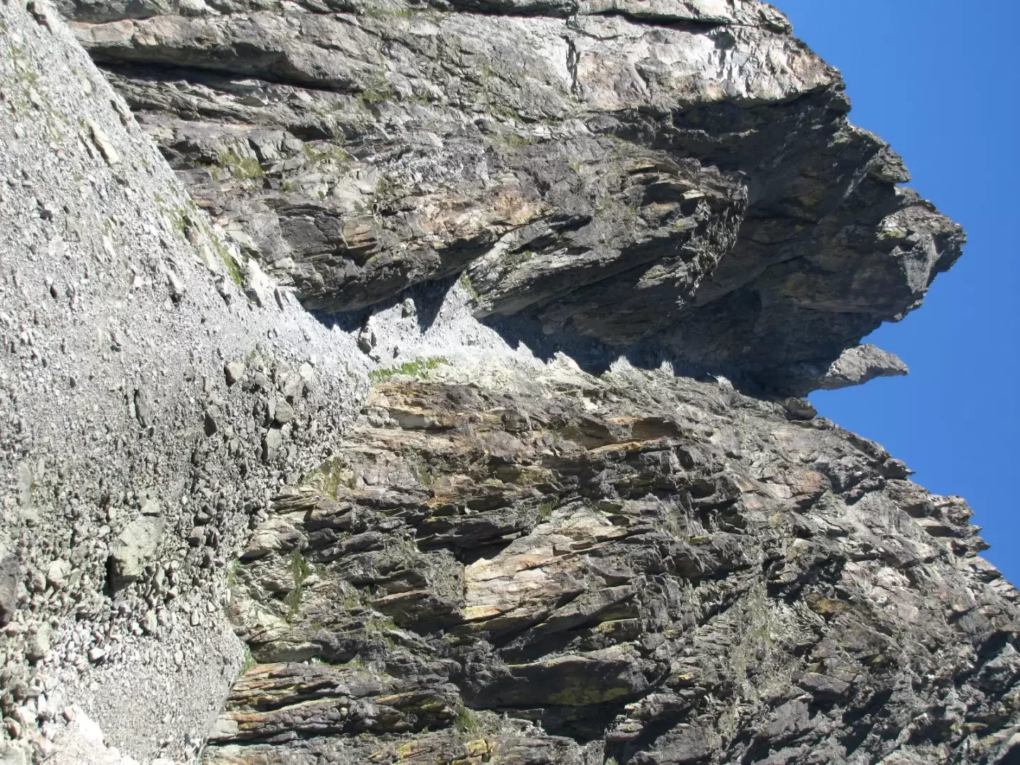
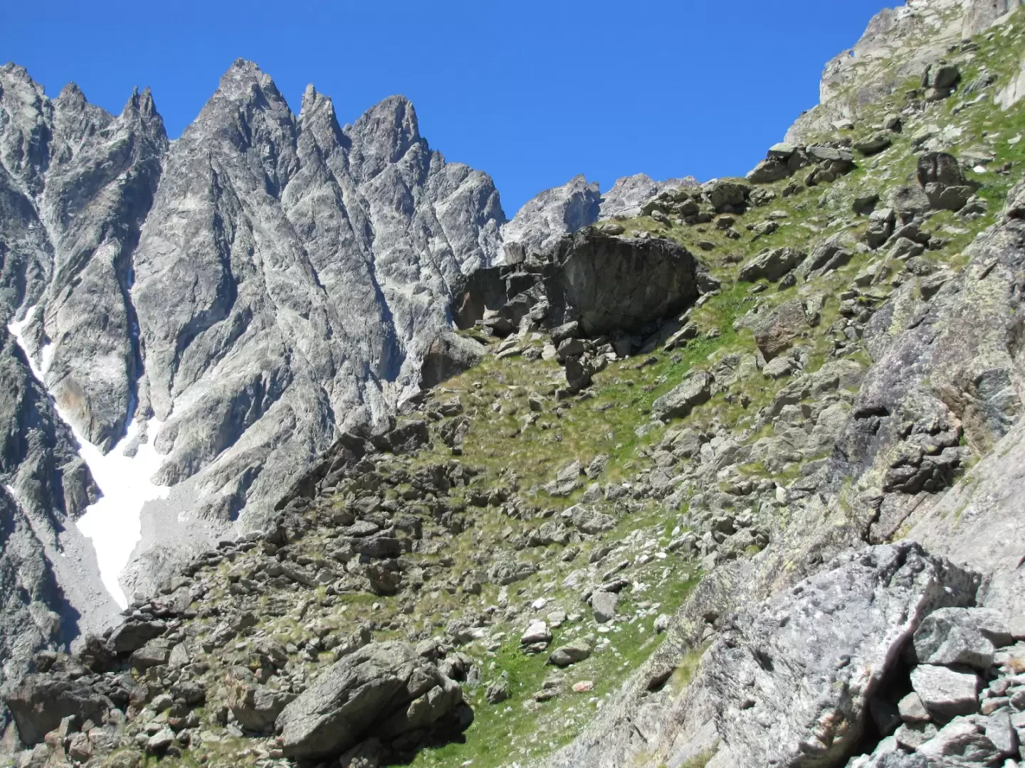
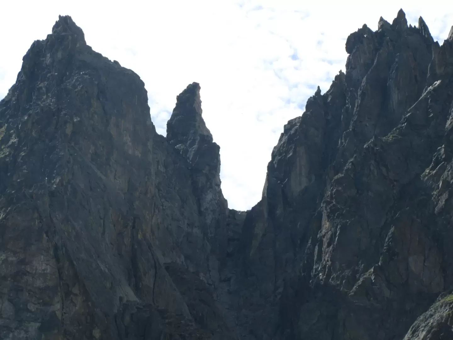
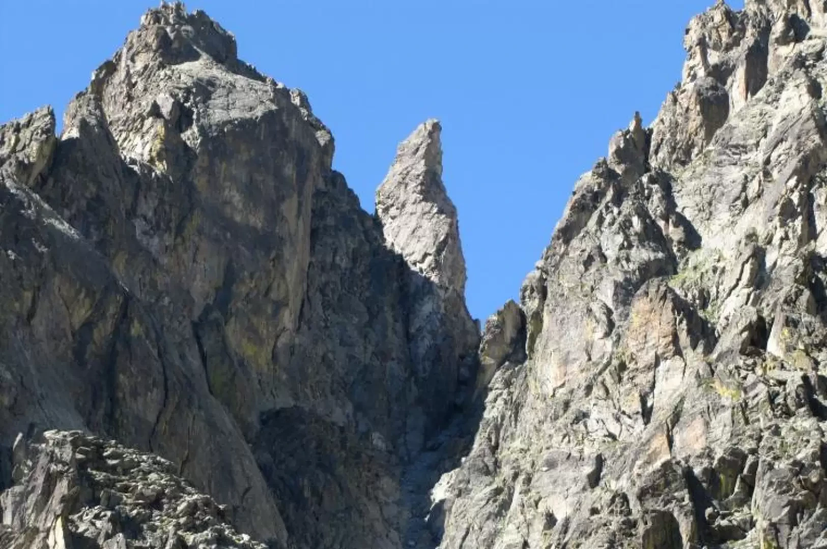
The Col Duc connects the coma of Crête Sèche to the east with that of Faudery to the west and opens up between the Guglia de l'Aroletta (or rather the Berger de l'Aroletta, a sixty-metre monolith that divides the hill from the spire) and the Duc peak. It was crossed for the first time by Abbé Henry, who dedicated it to Monsignor Joseph-Auguste Duc, Bishop of Aosta, author of a ten-volume "Histoire de l'Eglise d'Aoste", where the names of all the localities in Valle d'Aosta are noted in their exact spelling. This is a demanding pass for the hiker, both for the gradients and for some rocks, easy but not elementary, on both slopes. The western slope is more supported and less stony. The eastern one has a 45° slope and a height of about two hundred metres.
Description
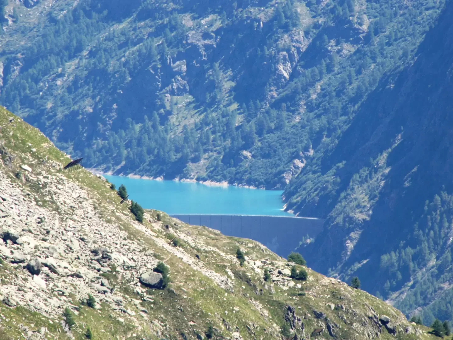
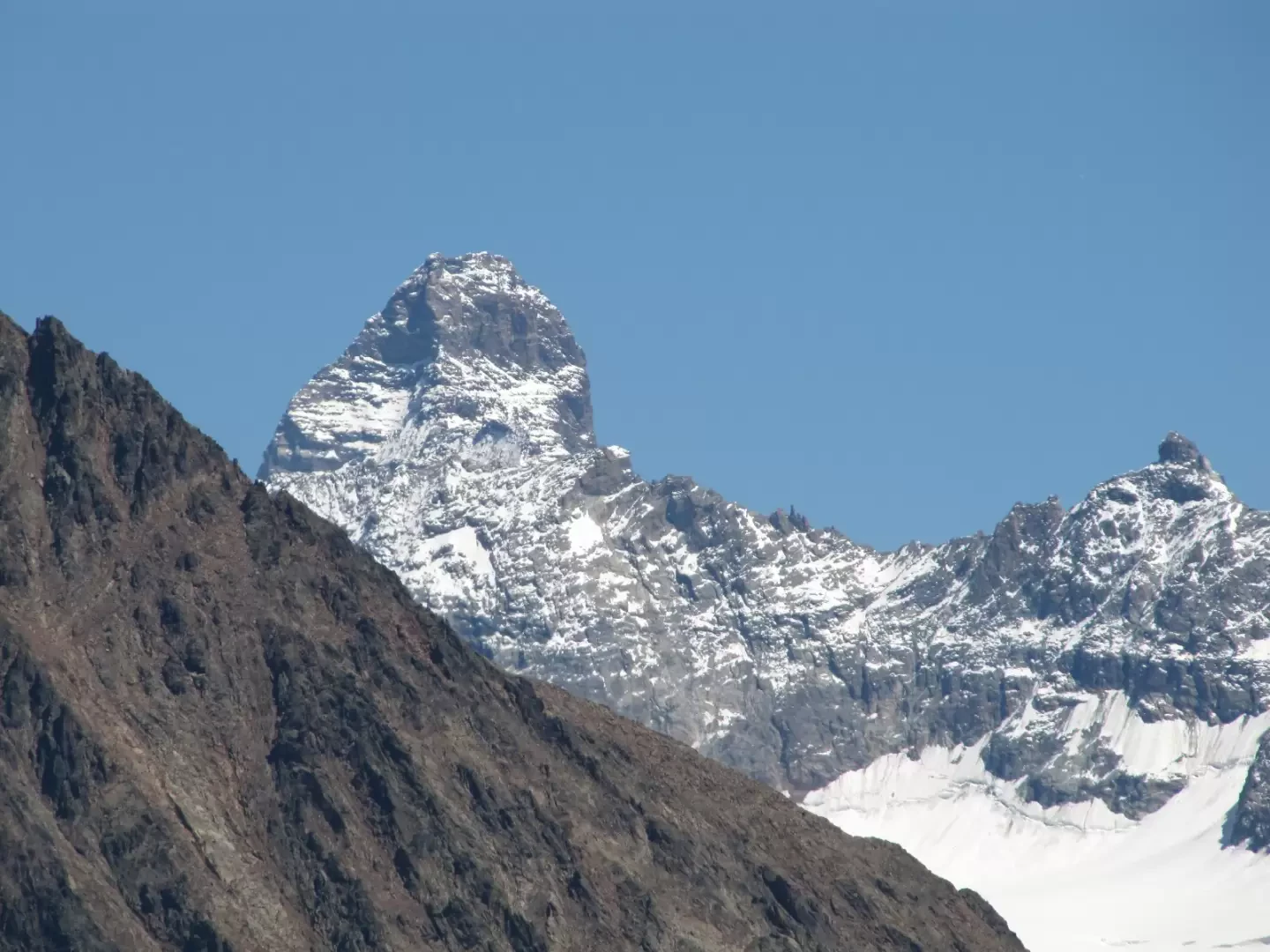
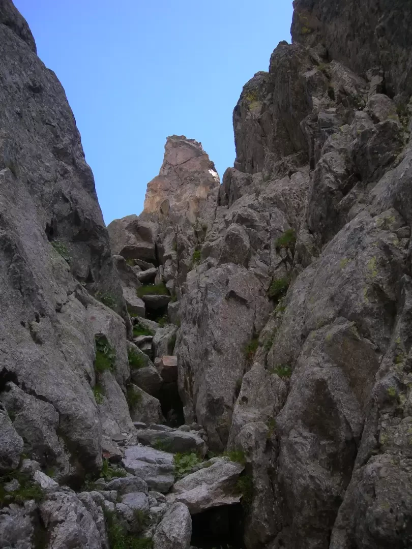
From Ru, follow the path that leads to the Crête Sèche refuge in about two hours. From the hut, ignore the path going up to the Bivacco Spataro to take the little path to the left, indicated by yellow bolts and the sign "Aiguille de l'Aroletta". This path crosses a stream on a shabby bridge, beyond which it becomes a track through debris. Follow it until it approaches the mouth of the gully above and then leave it behind to climb up the debris leading to its mouth. One ascends it laboriously, keeping mostly to the bottom, looking for the most stable terrain. About thirty metres from the mouth, the gully is interrupted by a rocky curtain. A boulder with good handholds is passed to the right to reach some more supported rocks beyond which the last scree slope leads to the narrow notch of the col. The panorama is narrow, the refuge dominates and the Matterhorn can be seen in the distance. On the descent it is unavoidable to drop many stones, caution if you have companions.
General information
Path:from Ru
Signposts:
then s.n.
Type of route: a/r
Recommended period: June, July, August, September, October
Objective danger:fall of stones in the gully
Mountaineering level I°
Maximum slope: 45°
Exposure to the sun: east
Exposed sections:no
Water: Crête Sèche Refuge
Galleria fotografica