Col de Paramont, from Planaval


Edited by:
Benedetto Lorusso
Updated at: 21/05/2026
Access
Dalla barriera dell'autostrada di Aosta-Ovest tenere la sinistra seguendo le indicazioni per Aosta - Saint-Pierre. Dopo un chilometro, alla rotonda, prendere la seconda uscita per immettersi sulla strada statale . Procedere sulla statale per 4,3 chilometri superando l'abitato di Saint-Pierre sino a raggiungere una nuova rotonda con l'effige del Parco Nazionale del Gran Paradiso. Prendere la prima uscita e continuare sempre sulla strada statale per 4,2 chilometri sino a ragginungere Arvier e la sua rotonda dedicata al ciclista Maurice Garin. Prendere la seconda uscita e proseguire su Via Corrrado Gex fino a raggiungere l'abitato di Leverogne, un chilometro più avanti, dove alla biforcazione bisogna tenere la sinistra ed imboccare la strada regionale [SR25]. Risalire la regionale per 9,3 chilometri sino ad incontrare un incrocio: svoltare a destra seguendo le indicazioni per Planaval. Proseguire ancora per 550 metri sino ad incontrare, sulla destra, il parcheggio gratuito 🅿️ di Planaval dove è possibile lasciare l'auto.
Planaval è raggiungibile anche in autobus 🚌 con la compagnia Arriva, con la linea Villeneuve - Valgrisenche.
Distanza e tempo di percorrenza
🕒 Tempo di percorrenza: 28 minuti
📏 Distanza: 20,3 km
Navigazione GPS
📍 Come arrivare con Google Maps
📍 Come arrivare con Apple Maps
ℹ️ Nota importante
Le indicazioni fornite sono state verificate alla data del rilievo dell’itinerario. Prima della partenza, è consigliabile verificare eventuali variazioni del percorso. Per ottenere indicazioni aggiornate e dettagliate, si consiglia l’uso di Google Maps o Apple Maps.
Description
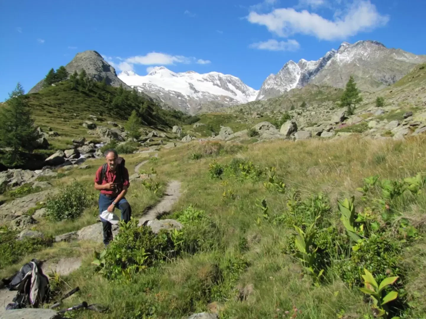
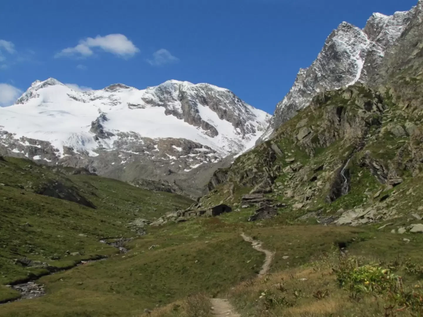
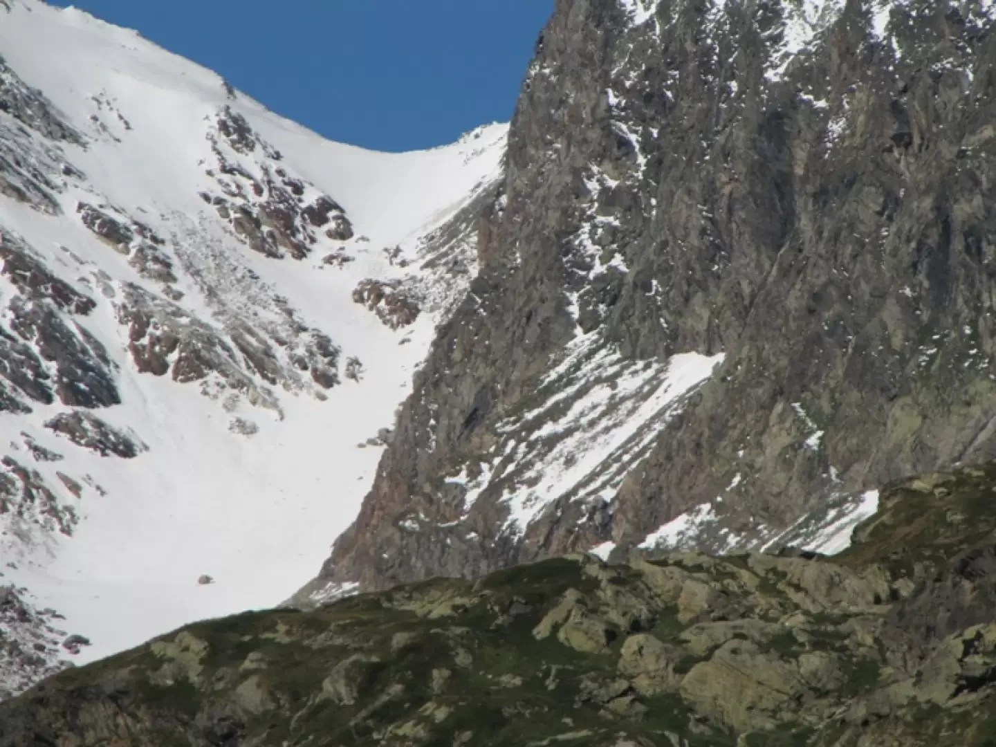
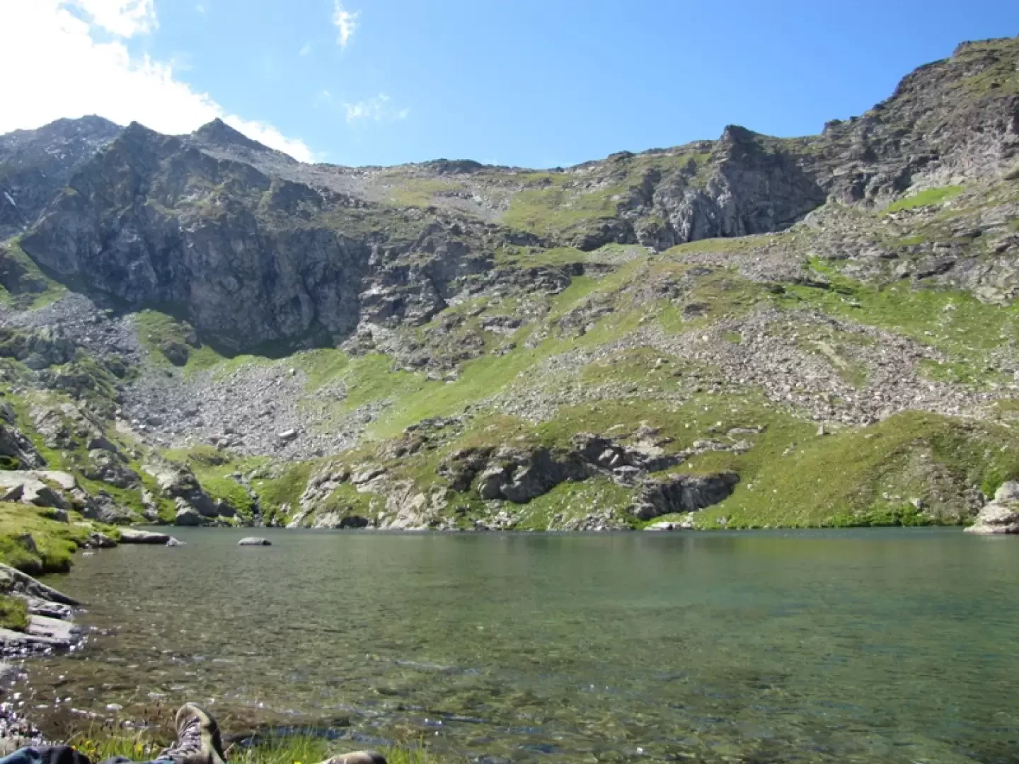
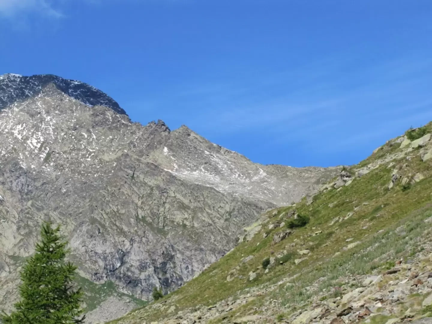
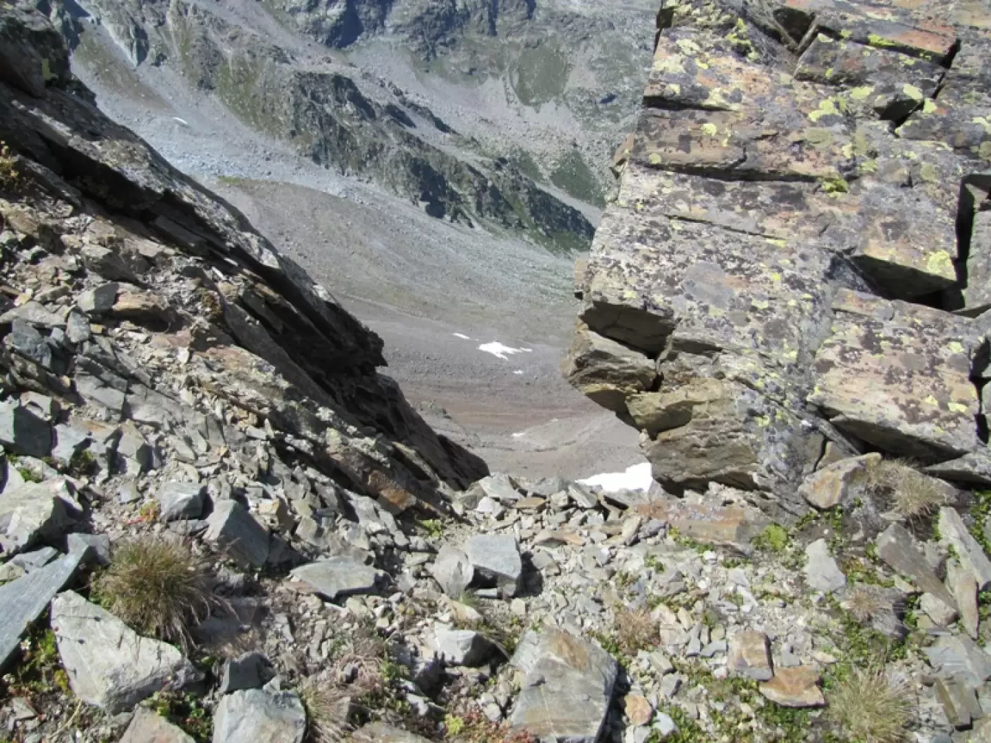
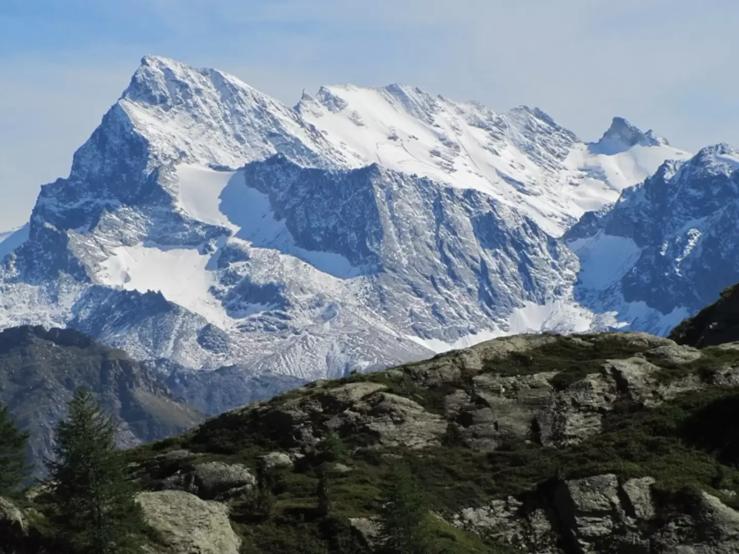
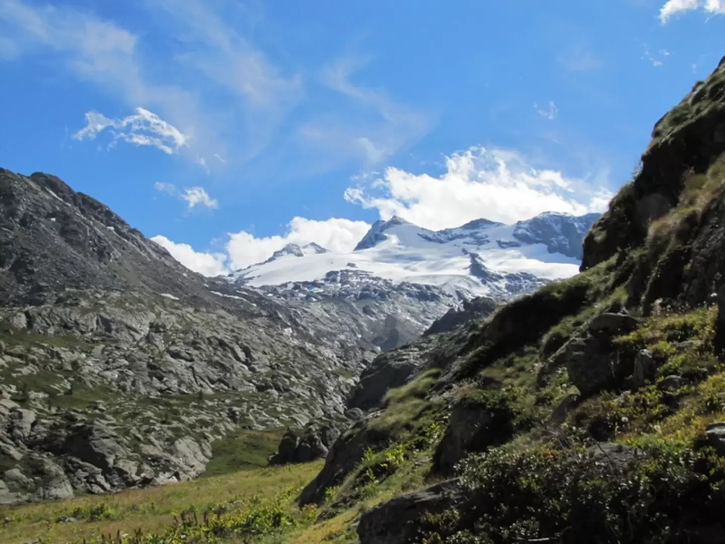
The Col de Paramont (2773 m) is the lowest part of the stretch of ridge dividing the Valgrisenche from the Lantaney valley and stretching from the Col de la Crosatie to Mt Pit, the first spur of the NE ridge of Mt Paramont. According to the Central Graian Alps guidebook, a path should reach this pass (also known as Colle delle Molette) at an altitude of 2783 (a little to the south-west) from Lac de Fond (itinerary 93a) and a path is marked on the L'escursionista (La Thuile-Piccolo San Bernardo) 1st edition map, whereas the 2nd edition and the Valgrisenche-Val di Rheme map do not show any path. In reality, the path no longer exists, only a few traces remain in the scree sections. The two maps mentioned (and the CTR VdA) attribute an altitude of 2814 m to Monte Pit, while the Central Graian Alps guidebook gives it an altitude of 2914 m (itinerary 92c). It is preferable to reach the NE crest of Paramont at the base of Monte Pit, at an altitude some fifty metres higher than the lowest depression. Our altimeters marked an altitude of over 2800 metres for the col and over 2900 for Mount Pit (which can be reached in a few minutes by reaching its S ridge before the col). description: Follow the beautiful forest path with magnificent views (which become more beautiful the higher you go) of the Rutor and the Grande Rousse, pass a ruined alpine pasture to reach a pastureland plateau crossed by a stream (Alpage Glacier nearby) to leave it immediately and ascend to the equally beautiful plateau of the Baraques du Fond. Leave the path up to Col de Planaval on the left, cross a scree slope to reach the beautiful Lac du Fond, in about three hours from La Clusaz. Up to here, a beautiful hiking tour, all on footpath. You continue to follow the path along the lake, but at the first bend you abandon it to follow a track that crosses a boulder slope and then gets lost when the slope becomes grassy. One then continues in the direction of a grassy gully that allows one to cross a rocky strip. Tracks are found on the channel that lead to the upper slopes. If you want to reach the lower altitude, you must turn right and reach it on steep grassy slopes. It is more convenient to climb the detrital slopes in the direction of the NE ridge of the overhanging Mont Pit, at the foot of which one reaches the narrow pass window (which cannot be crossed) that opens up in front of Mont Blanc. Allow four to five hours from La Clusaz. If you wish, you can climb up to Mont Pit with an easy climb.Photo gallery
Comments (0)
Sign in to leave a comment