Ancient chestnut trees of Chioraira


Edited by:
Maurizio Loconti
Updated at: 03/11/2025
Access
From Ormea's main square, continue along the stream. From the bridge, go left with signs for Chionea/Chioraira. Further on, at the next two forks, always choose the left branch.
Introduction
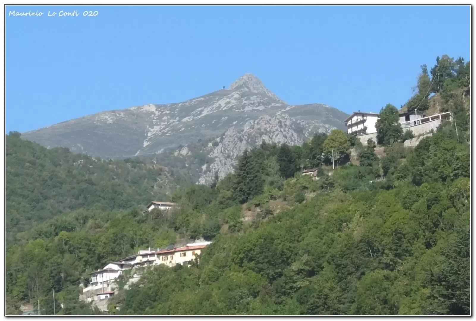
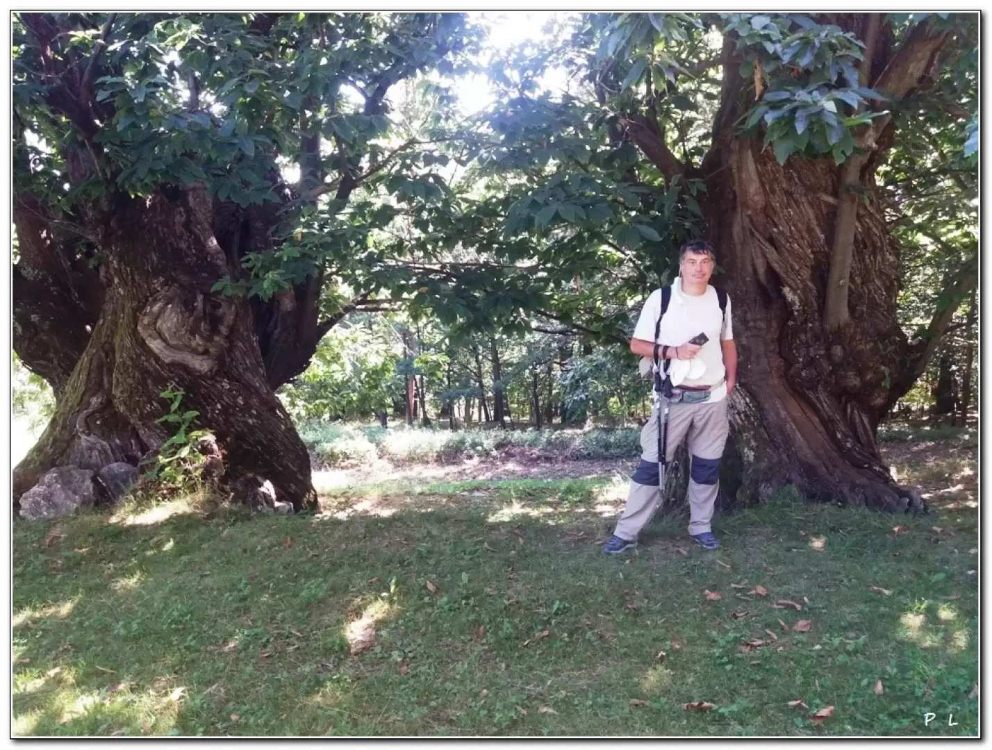
Chioraria is one of the many hamlets of Ormea, reached by a narrow road. This little tour is a search for the most interesting trees, in a sort of open-air museum; some estimates by experts in the field speak of five hundred years of age for the oldest specimens!
Description
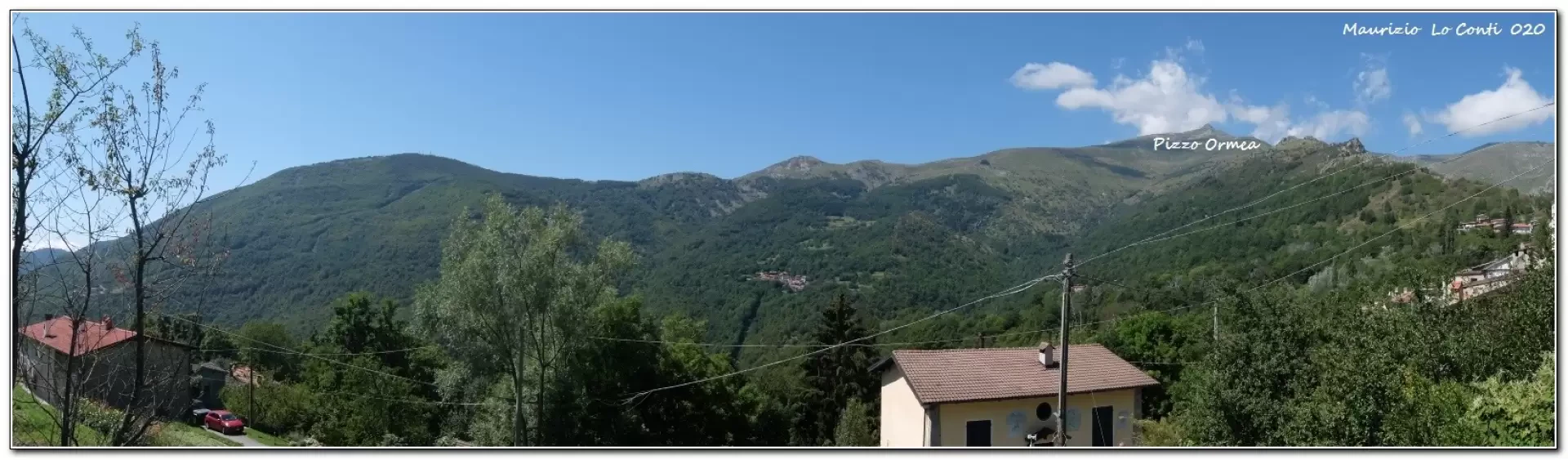
We return to Chioraira (1100 m), to see the various monumental chestnut trees in the area. From the village, follow the signs for the Balconata d'Ormea variant uphill, following a wide cart track. The monumental trees are truly numerous and manifold... We observe them all, with the necessary in-depth studies. We continue to gain altitude with a series of hairpin bends. Higher up, the vegetation tends to thin out for a short distance. We pass the remains of Stalle Colletto 1326 m (1h ) and if we continue climbing, we reach the little church of San Giovani Battista, at an altitude of about 1500 m (at a fork just above, we must leave the dirt road (1350 m ). Unfortunately, this time you turn back and in 45 minutes you are at the car.
In short: Diff. T - height difference 230 m - 1h45 - Average walking time: good -- Best time: from spring to autumn, avoiding the hottest days.
as well as the pdf photo file, with a bit more info:
http://www.cralgalliera.altervista.org/Chioraira020.pdf
http://www.cralgalliera.altervista.org/anno2020.htm
http://www.cralgalliera.altervista.org/altre2020.htm
Previous visits to the area: http://www.cralgalliera.altervista.org/GiteValTanaro.htm
NB: In the case of an excursion, always check with Fie, Cai, any park authorities or other institutions, pro loco, etc., that there have been no changes in the area, that there have been no changes that have increased the difficulties! No liability is accepted. This text is purely indicative and not exhaustive.
General information
Trail signposting: CAI
Type of route: a/r
Recommended period: March, April, May, June, September, October, November
Sun exposure:south
Objective Danger:none
Exposed Tracts:none
Useful Equipment:normal daily hiking equipment
Water: n.r.
Photo gallery

Comments (0)
Sign in to leave a comment