Camino Francés de Santiago from O'Pino to Santiago


Edited by:
Maurizio Loconti
Updated at: 01/11/2025
Introduction
The devotional route has several possibilities and the so-called 'French' route starts in the Pyrenees. In the summer of 2022, the last six stages were covered, arriving in Santiago... below is a summary description of the sixth one.
Description
The Camino Francés de Santiago, the last 120 km. Stage 6. From O'Pino to Santiago
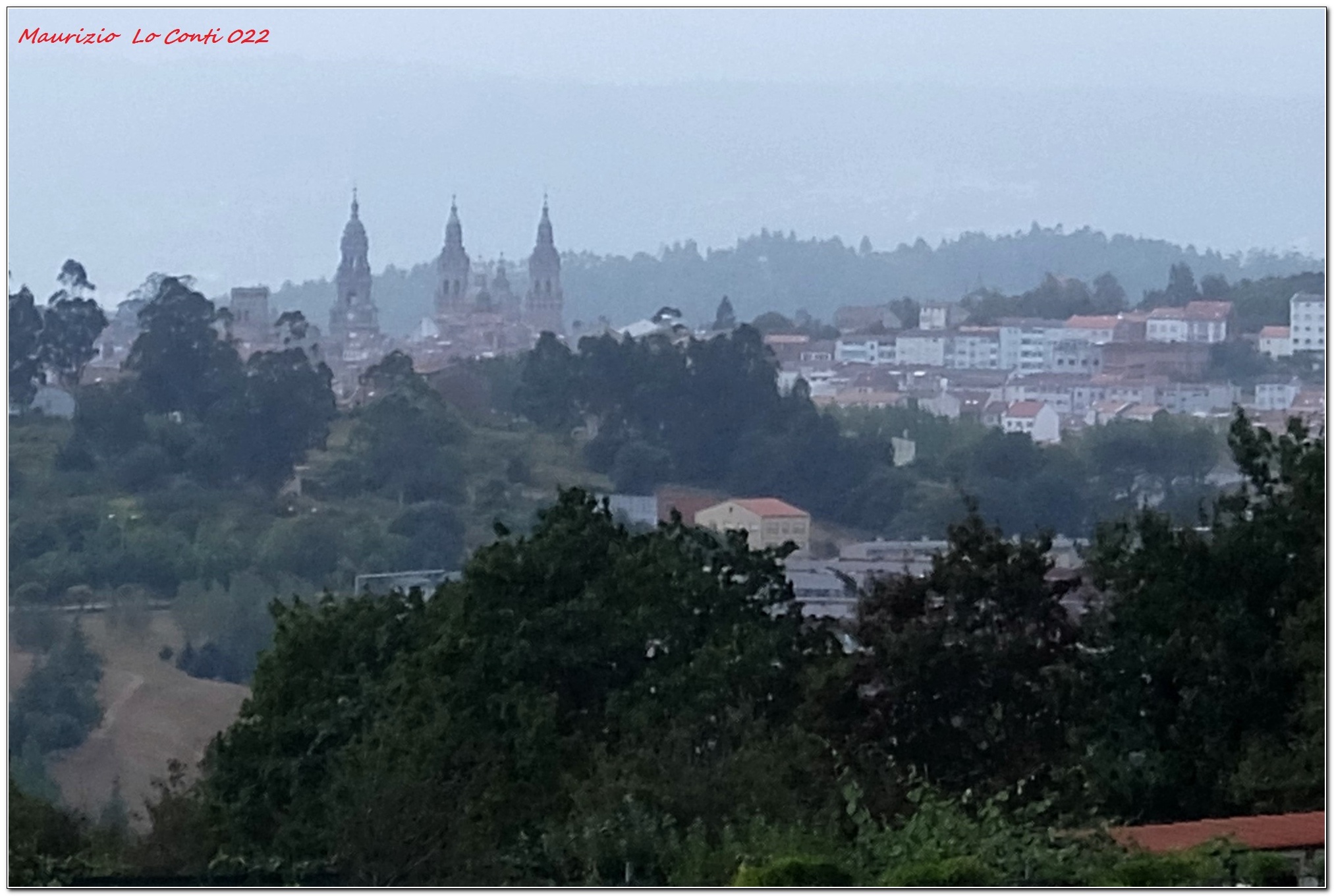
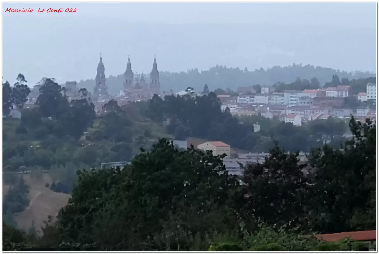
This time, the weather is cloudy, but the forecast is unfavourable: rain is certain, expected by all the channels consulted (more or less abundant). We set off at around 8.30 a.m. and, like all previous mornings, it was cooler than at home: 14 degrees! The fog rolls in and it starts to rain. The stop is compulsory, to cover up with cloaks and take a few shots to capture the event. The air is crisp and wearing them does not cause any discomfort... The experience of the devotional walk is complete! Short splashes, interspersed with pauses. From a stone (carved a large shell), pilgrims take a souvenir photo, in the place where many leave something for their now imminent arrival. The church of Santa Lucia is touched. Inside, the distribution of stamps is handled by Italian volunteers linked to the Guanellian Fathers. Further on is the sacred building dedicated to San Paio de Sabugueira, with an adjoining fountain. A footbridge crosses the Rio Sionlla and Santiago is 10 km away! The climb follows the asphalt road towards Villamaior and it starts to rain again. Refreshment is at the bar of the San Marcos campsite. In the afternoon, we pass the chapel of San Marcos on Monte De Gozo. Hovering to the left on the bare hill, the sight of the three bell towers of the basilica of St James of Compostela, amidst the looming clouds, announces that the finish line is not far away! As we descend, slowly, towards the town, we get to the spectacle of the cathedral...
In a nutshell. From the hotel to the centre of Santiago: 21.7 km, approximately 7h15 of walking + 1h45 of breaks, 3 km/h, 200 m of altitude difference.
Single shot:
http://www.cralgalliera.altervista.org/DSCF3123BasilicaSanGiacomoDaMonteDoGozo.jpg
Pdf file with many shots:
http://www.cralgalliera.altervista.org/VacEst022K.pdf
http://www.cralgalliera.altervista.org/VacEst022T.pdf
Other holiday files with photos and miscellaneous info: http://www.cralgalliera.altervista.org/SantiagoBuenCamino022.htm
Approvided on pages 1, 2 and 4 of http://www.cralgalliera.altervista.org/67.pdf
NB: In the case of a trip, always check that there have been no changes that have increased the difficulty! No liability is accepted. This text is purely indicative and not exhaustive.
Info Hiking Section Cral Galliera: http://www.cralgalliera.altervista.org/esc.htm
trips 2022 at the link: http://www.cralgalliera.altervista.org/gite022.pdf
General information
Signposts: Yellow arrows and milestones, very numerous
Type of route:
Recommended period:
Photo gallery
Comments (0)
Sign in to leave a comment