Bivacco Sambugo, from Arenzano


Edited by:
Maurizio Loconti
Updated at: 22/03/2026
Access
From the Arenzano exit, drive up towards the hospital, which you pass. Take first Via Pecorara and then Via Chichelli, leaving the car near a dog training centre (clearing on the left, very few places available, no more than seven/eight).
Introduction
A wonderful tour of the immediate Arenzano hinterland, which touches on various points of interest and has as its main theme the various streams, always with at least a fair flow.
Description
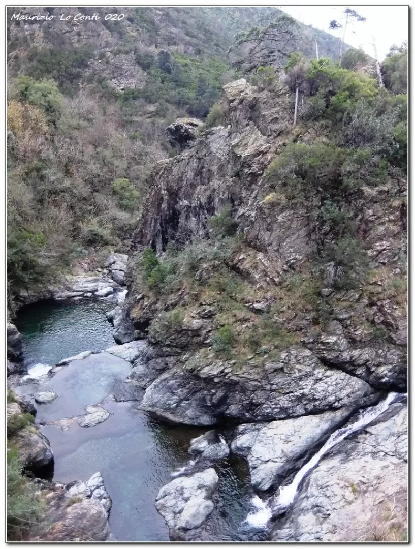
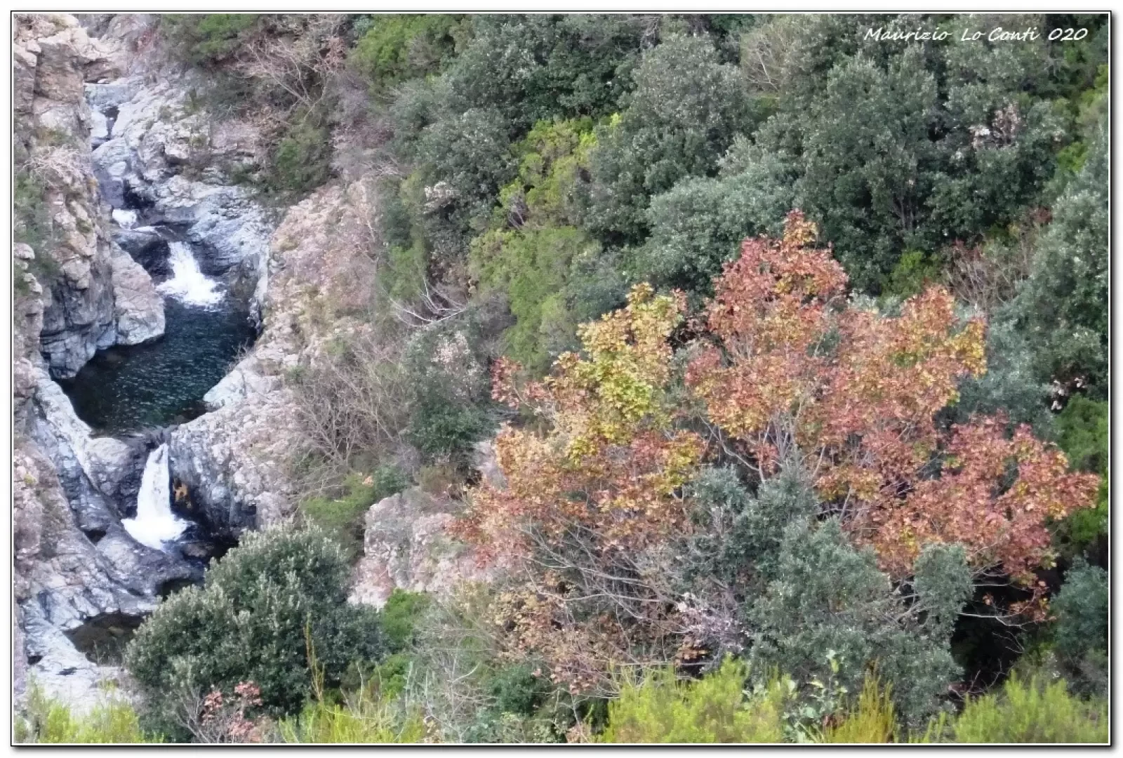
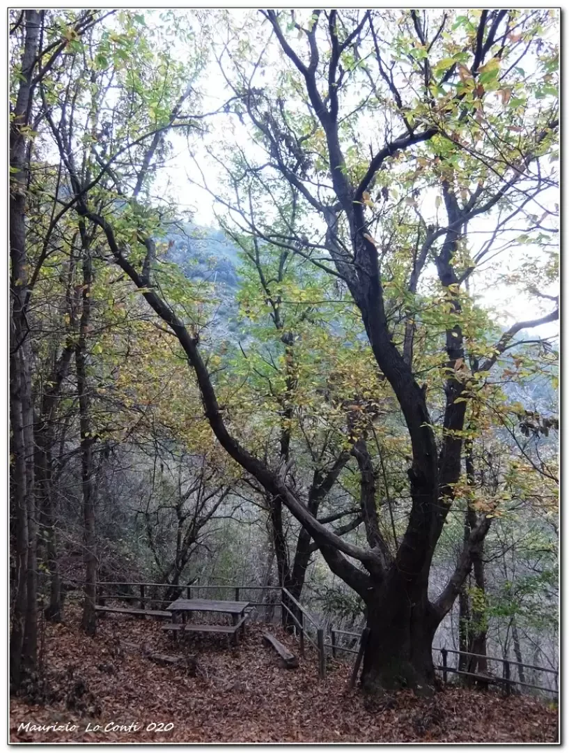
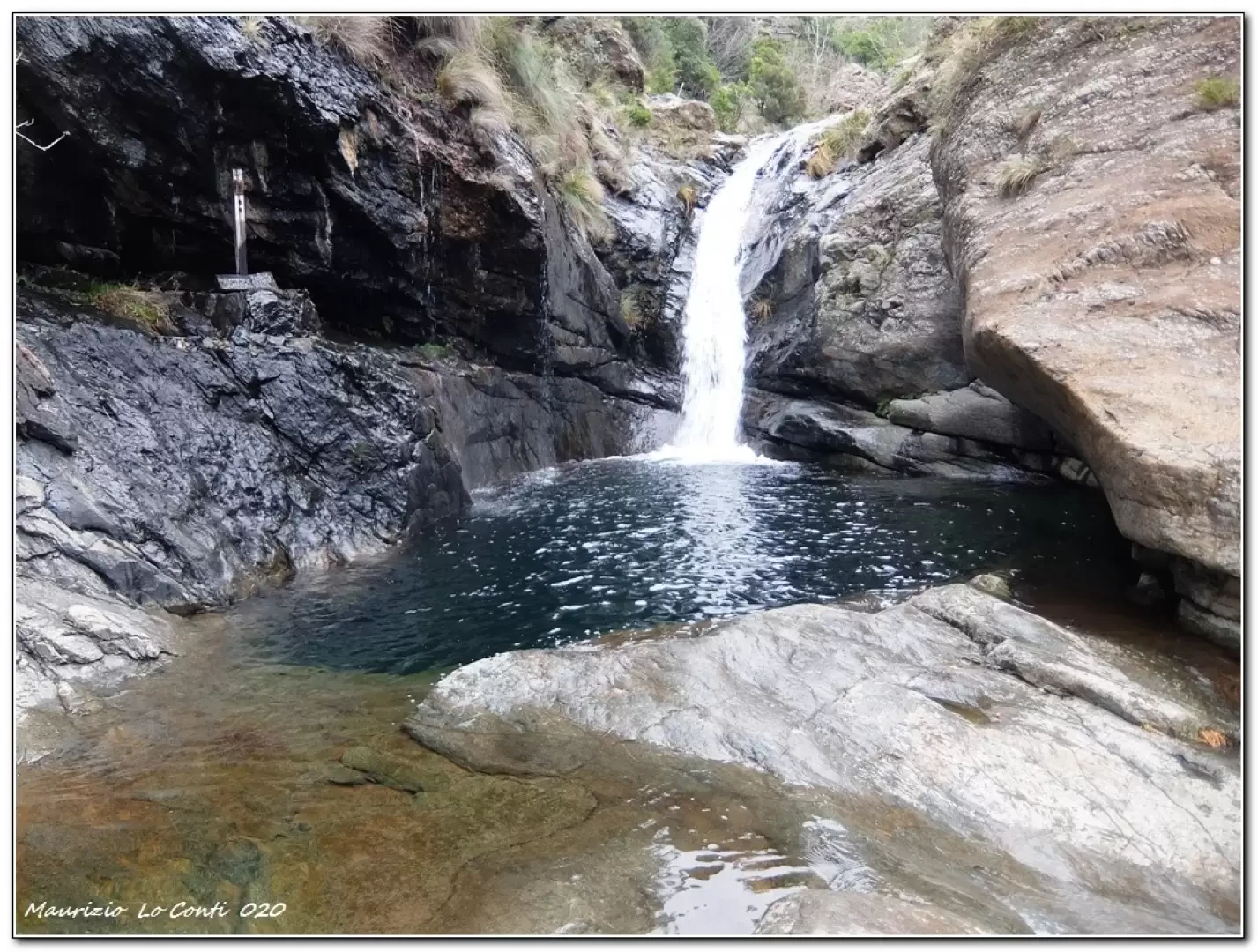
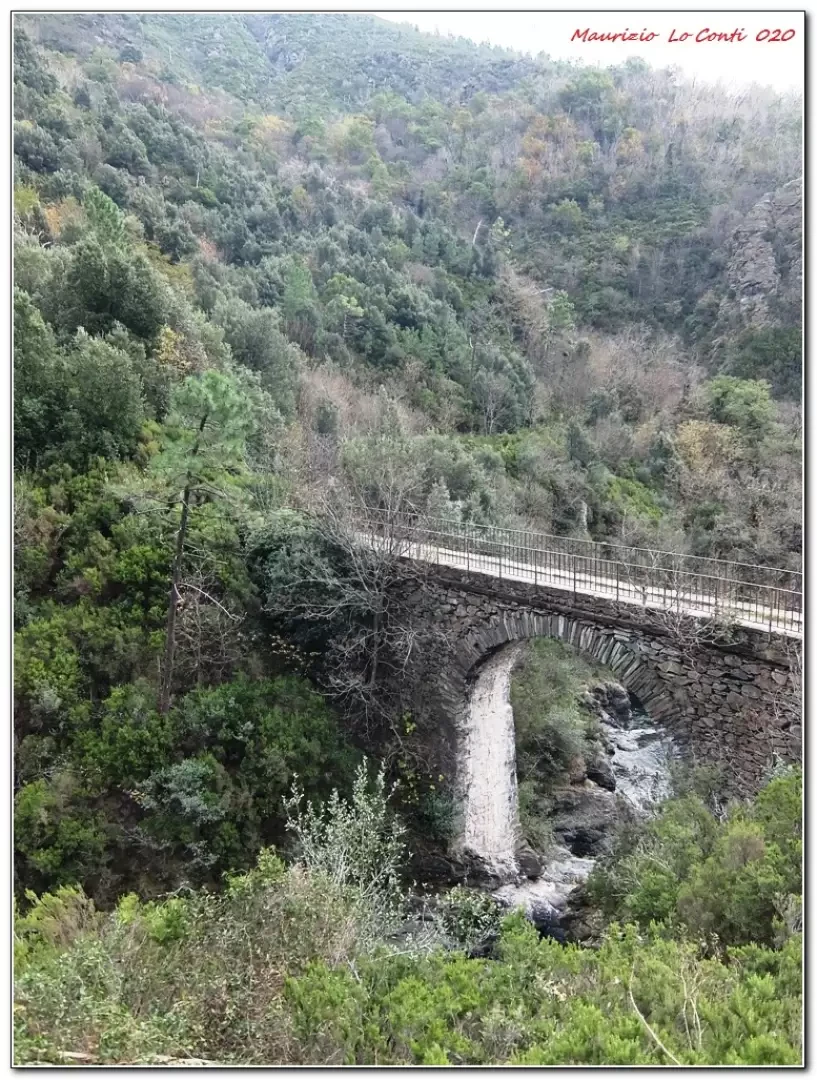
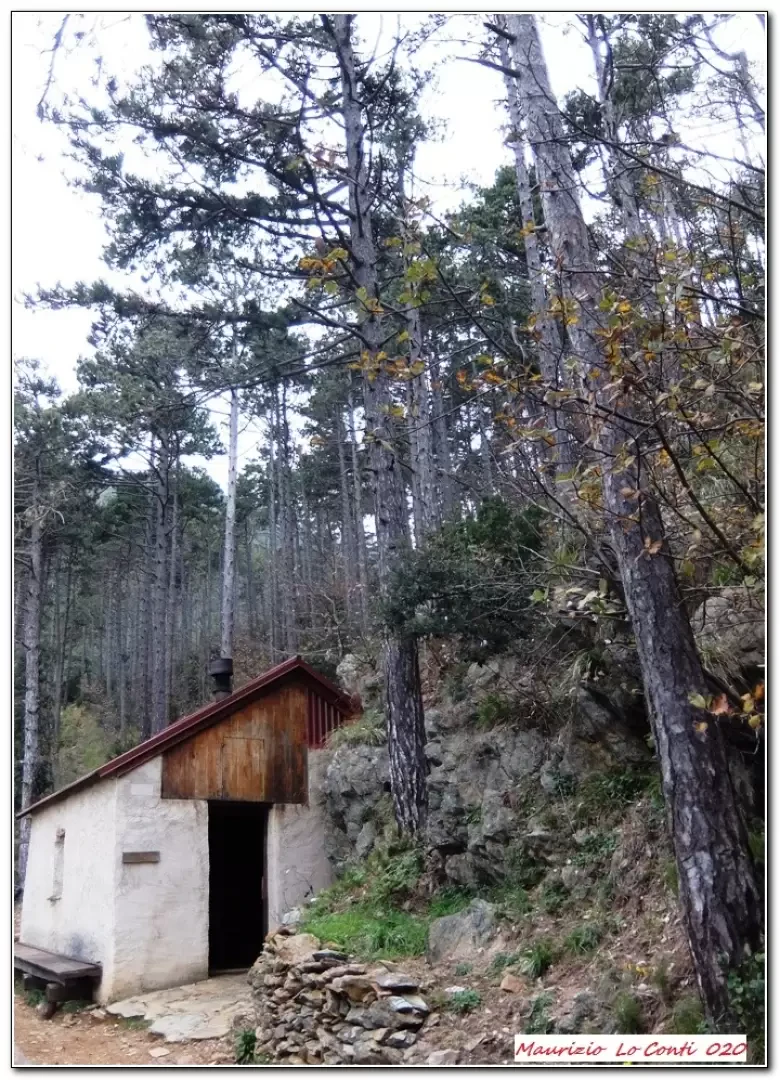
You continue on foot on tarmac, ignoring an uphill fork to the right. The road descends and several signs warn that you are on private property. You see a mule track to the right (illegible signs) and take it. You continue almost straight ahead and pass a renovated cottage with a spring. There is a crossroads and you descend to the left. At a further crossroads, there is the aqueduct track and you turn right. Quite quickly, you reach the stone bridge called Negrone, which is very imposing... You turn off, to see the crystal-clear lakes from the starting point of the 'Bricassu' diversions (a little abandoned). They are only a couple of minutes away. Back, we climb up the Engineer's path. The roar of the torrents is loud and pleasantly relaxing. You find the diversions of the new track. One then faces the path that flanks two high, imperious towers. One ascends in an unambiguous manner and eventually comes out of a crossroads: above, a couple more minutes, is the Sambugo bivouac (443 m - source). Return along the ascent route.
Alternative return route: descend to the Figo pass and from there climb up to the crossroads for the Area Castagno from where you lose height by drawing several zeta's on the ground until near the Negrone bridge (about +30' compared to the basic route).
In short: Diff. T/E - height difference approx. 300 m - 3h15 tot. - somewhat cloudy weather with pleasant temperatures.
If you would like, here is the pdf photo file, with some more news:
http://www.cralgalliera.altervista.org/BivaccoSambugo020.pdf
http://www.cralgalliera.altervista.org/anno2020.htm
http://www.cralgalliera.altervista.org/altre2020.htm
NB: in the case of an excursion, always check with FIE, Cai, any park authorities or other institutions, pro loco, etc, that there have been no changes that have increased the difficulties! No liability is accepted. The present text is purely indicative and not exhaustive.
Info Hiking Section Cral Galliera: http://www.cralgalliera.altervista.org/esc.htm
Trips 2020 at the link: http://www.cralgalliera.altervista.org/gite020.pdf
General Information
Signposting:
Type of route: a/r
Recommended period: March, April, May, September, October, November
Sun exposure:southwest
Galleria fotografica