Farello Bivouac, from the Simplon Hospice


Edited by:
Giancarlo Beretta
Updated at: 04/05/2025
Access
Leaving the motorway, take the motorway and follow it for 73.2km to Ornavasso. Exit at Premosello Chiovenda and take the Simplon state road up the Ossola and Divredo valleys. After crossing the border follow the road [9] for another 19 kilometres until you reach the Simplon Pass where, on the right, a small road starts that after 300m reaches the large car park 🅿️ in front of the hospice.
[1h48'] - [137km]
How to get there with GMAPS
How to get there with Apple Maps
The information provided here has been verified as of the date of the survey of the route. Before setting off, it is advisable to ensure that no substantial changes have occurred on the route to the starting point. Therefore, we recommend the use of the satellite navigation apps provided by Google or Apple to obtain up-to-date and detailed directions.
Introduction
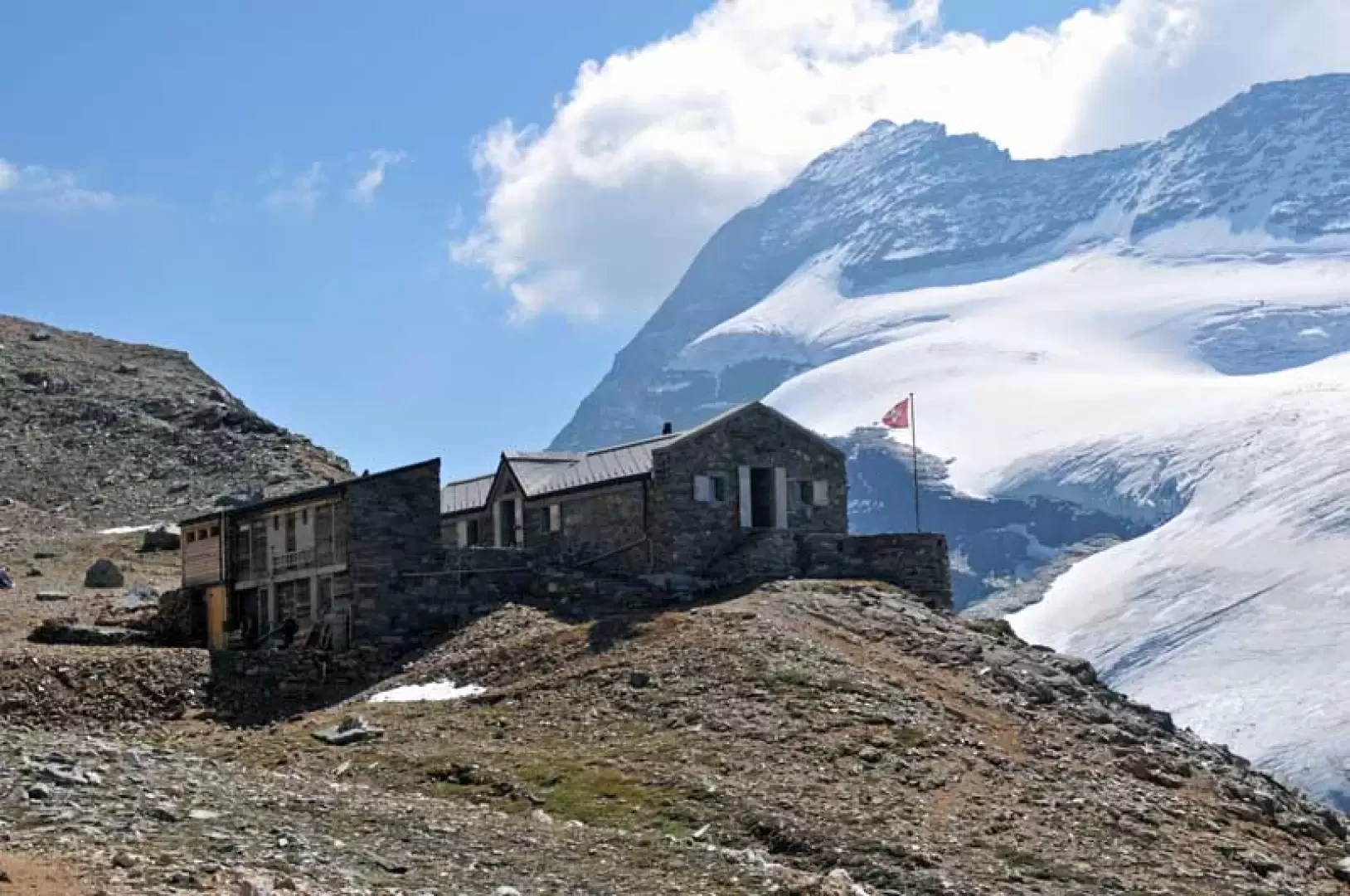
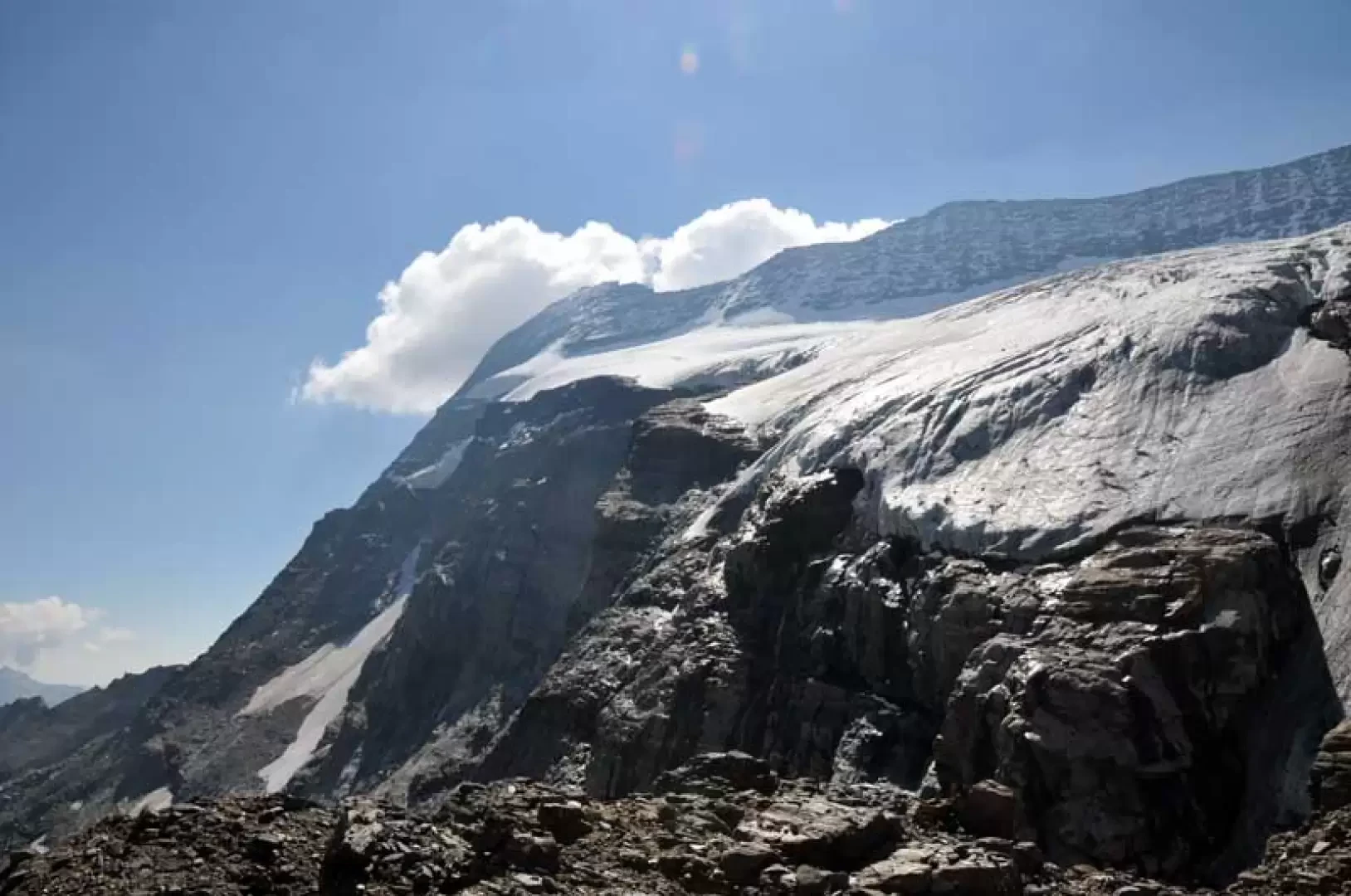
The destination of this excursion is a bivouac managed by the CAI section of Varzo and is situated like an eagle's nest on a small rocky promontory next to the Chaltwasser glacier seraccades that descend directly from the summit of Monte Leone; it is situated on Italian territory, from where it can be reached by an equipped route, but the easiest way to reach it is up the Simplon Pass. Its location is exceptionally panoramic, both over the valley of Alpe Veglia dominated at the bottom by the Helsenhorn and over the steep rock faces below the glacier seracs. During the ascent, you can also see the northern slope of the Hubschhorn behind you and, to the right below it, a beautiful panorama of the pass plateau.
Description
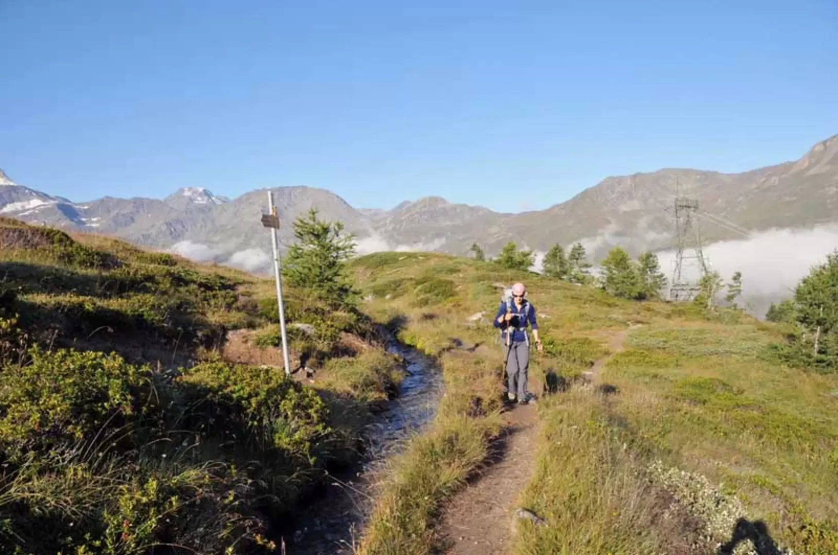
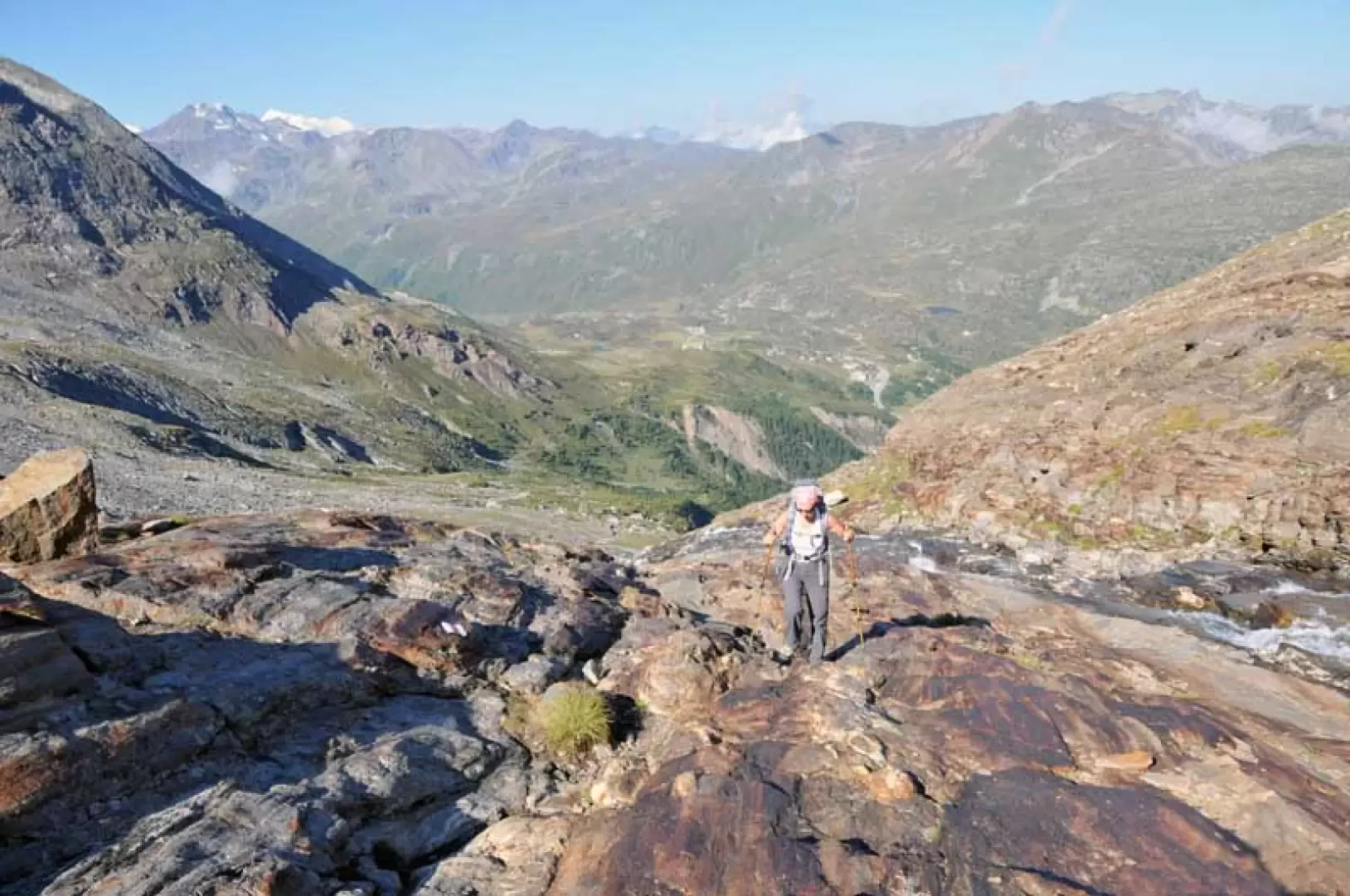
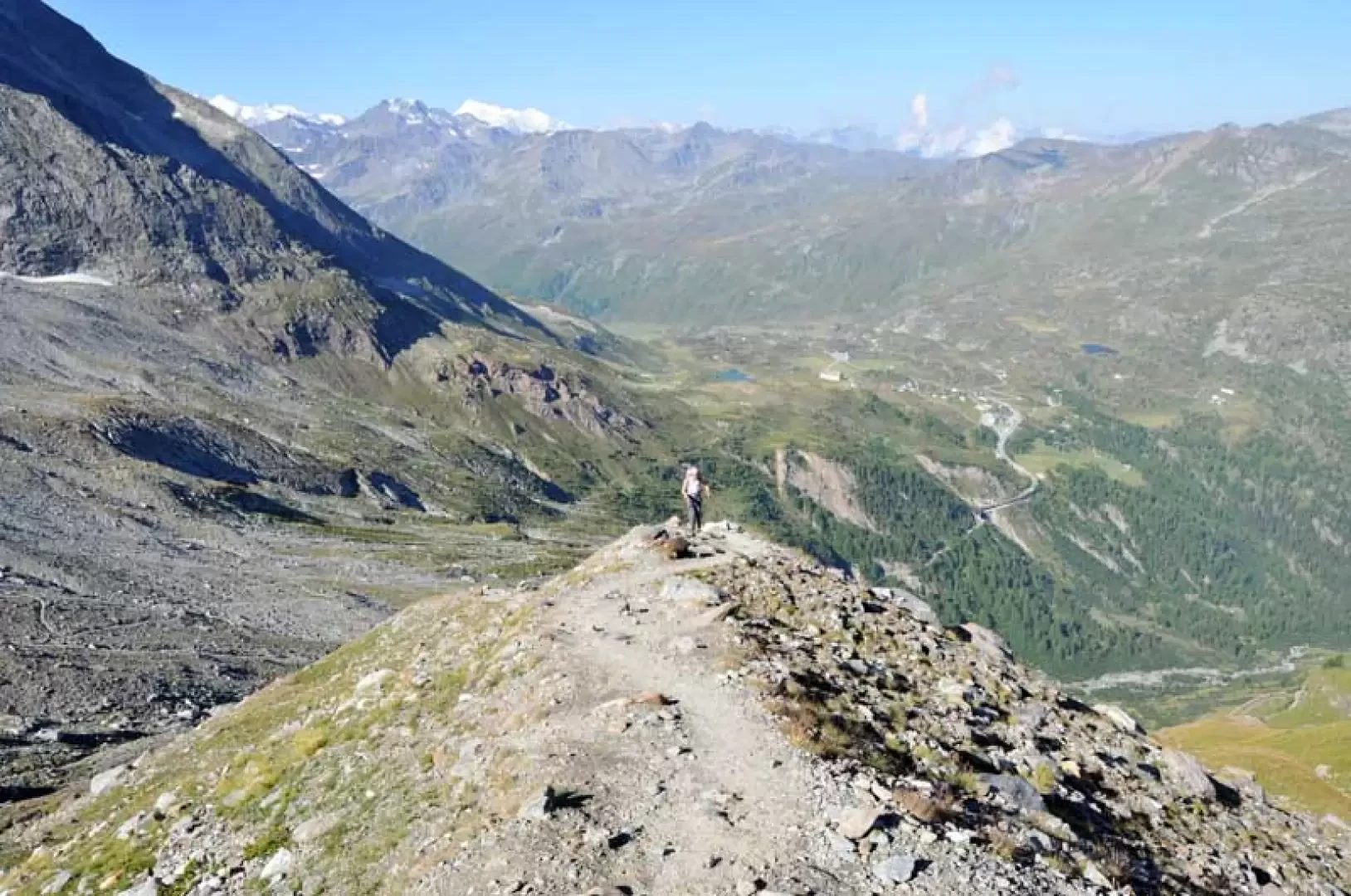
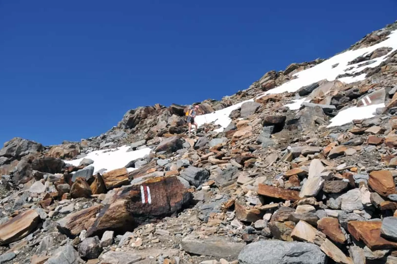
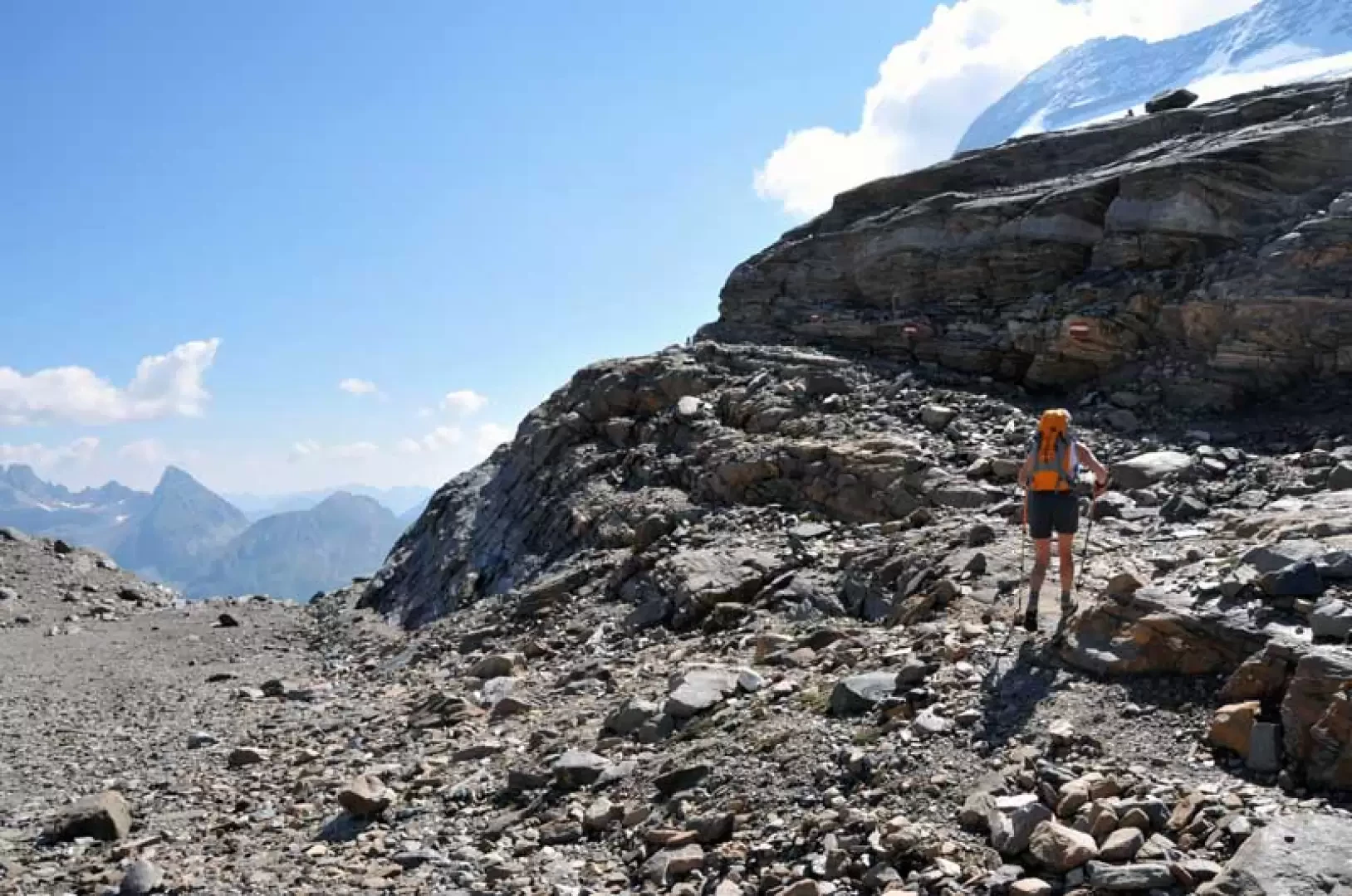
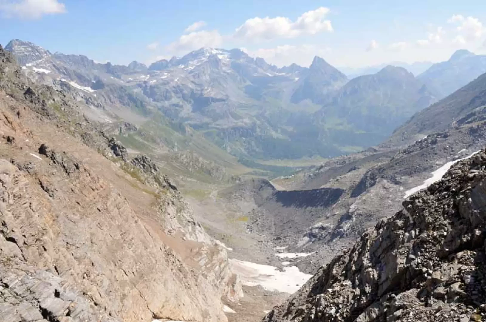
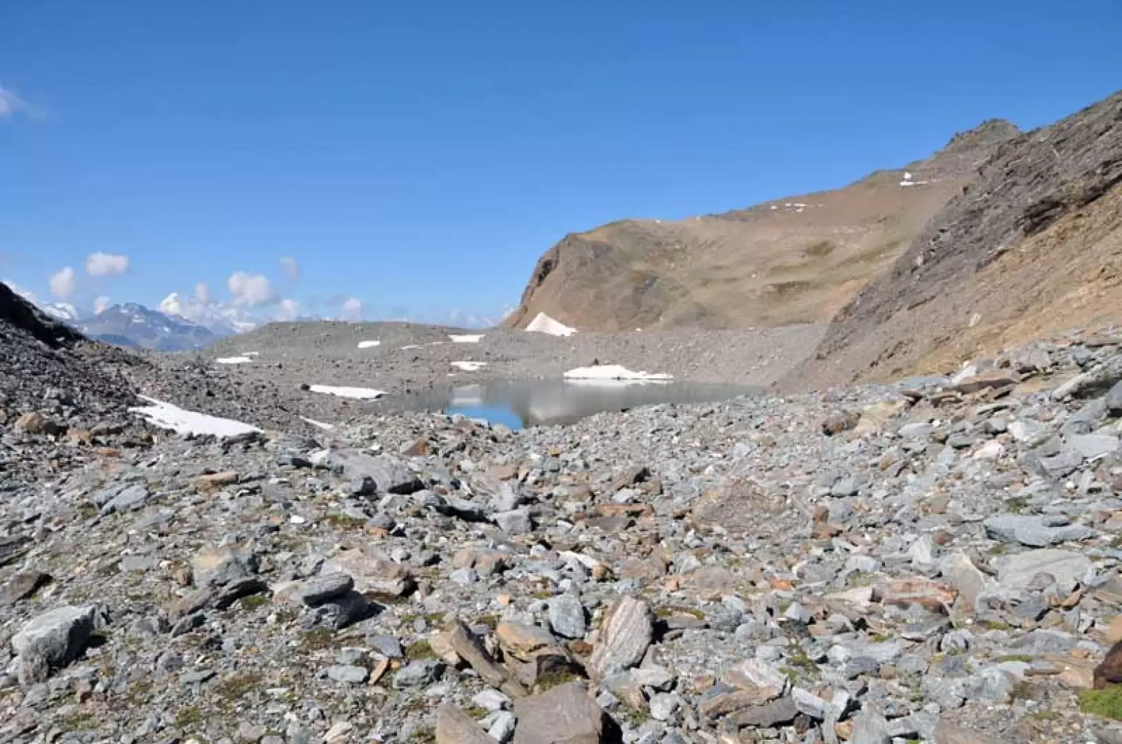
To the left of the hospice, next to a large wooden panel, are the markers for the start of the itinerary, which at first passes for a short distance on a small asphalted road heading towards some mountain huts; having passed them, you pass under a ski lift and then, after passing a high voltage pylon, you arrive near a marker (2152 m) where the path continues along a small artificial canal. Then, having gone around a wide ridge, it continues slightly uphill, traversing halfway up the side of the mountain where it crosses a stream on a first small wooden bridge and, shortly afterwards, crosses a second small bridge to cross another stream that is a little wider than the first. The path then passes to the right of the remains of a stone pylon and, continuing to climb with a few hairpin bends, reaches a small stone cairn (2459 m), where a track branches off to the right towards the Homattugletscher moraines and is used for the ascent to the lion's mountain; Having ignored the track, continue to the left of it, first crossing a small stream and then an area of smooth stones that leads to another small bridge beyond which you ascend, now more directly, another area of smooth stones. Having crossed a couple more small bridges, we head towards a rampart that, after crossing its base, we climb up again, continuing fairly steeply on the broad edge of a grassy ridge. At its summit, keep to the left and climb up some grassy rises to reach a fork (2,726 m) where, ignoring the track on the right, continue towards a clearly visible moraine that you ascend, sloping to the left; At its summit, the upper part of the stony Chaltwasser valley opens up before us, where there is a large glacial lake with the Bocchetta di Aurona and Punta Terrarossa at the bottom, on the left, and Monte Leone with the Chaltwasser glacier on the right. The path remains a little high above the lake and continues, contouring the slope to the left, passing immediately afterwards at a crossroads (2786 m), where you leave the path that climbs to the left, and continue halfway up to the visible Monte Leone Hutte, which is located at the base of the flank of the Punta Terrarossa. When you reach the hut, go past it a little further and take a track that goes to the right to descend a steep slope of loam and loose stones, aiming for a small stony plateau a little further down; from here, walk towards a low rocky rampart, with visible red and white marks, and along a short ledge you will soon reach just above the bivouac.
Photo gallery


Comments (0)
Sign in to leave a comment