Bättelmatthorn, from Riale


Edited by:
Giancarlo Beretta
Updated at: 11/11/2025
Access
Take the Genoa-Gravellona motorway, exiting at its end at Gravellone Toce and continuing on the dual carriageway in the direction of the state border. After passing the Domodossola exit and two other junctions, you exit at Crodo and Val Formazza. Follow the long valley floor to its end, where you will find the village of Riale and from here, keeping to the left, go uphill for a short distance until you reach the Lake Morasco dam, where there is a no-transit sign and where you can leave your car at the side of the road; however, it seems that the continuation to the upper end of the lake, that is, until the start of the Enel cableway service, is quite tolerated, gaining about ten minutes of walking and an almost zero difference in height.
.Introduction
The ascent to this mighty mountain offers the opportunity to complete a beautiful ring-route of around 20 km, the route of which runs along the Swiss-Italian border in the upper Formazza Valley to the west of the Griespass. During the course of the excursion, all types of alpine environments are crossed, passing through the green pastures of the Morasco Lake basin and the upper areas of the Bättelmatt plain to arrive at the moraine areas beside the Gries glacier, leading to the panoramic ridge that leads to the summit. The route of the ridge is, apart from the first tens of metres, steep and exposed even though it follows a track: this is made of loam and fine detritus with a slippery bottom, as is the exposed traverse beyond its middle section. In the initial part of the return, moreover, you pass a few points where there is a metal cable, but it is better to ignore this given the poor state of the anchorages, which are sometimes non-existent.
Description
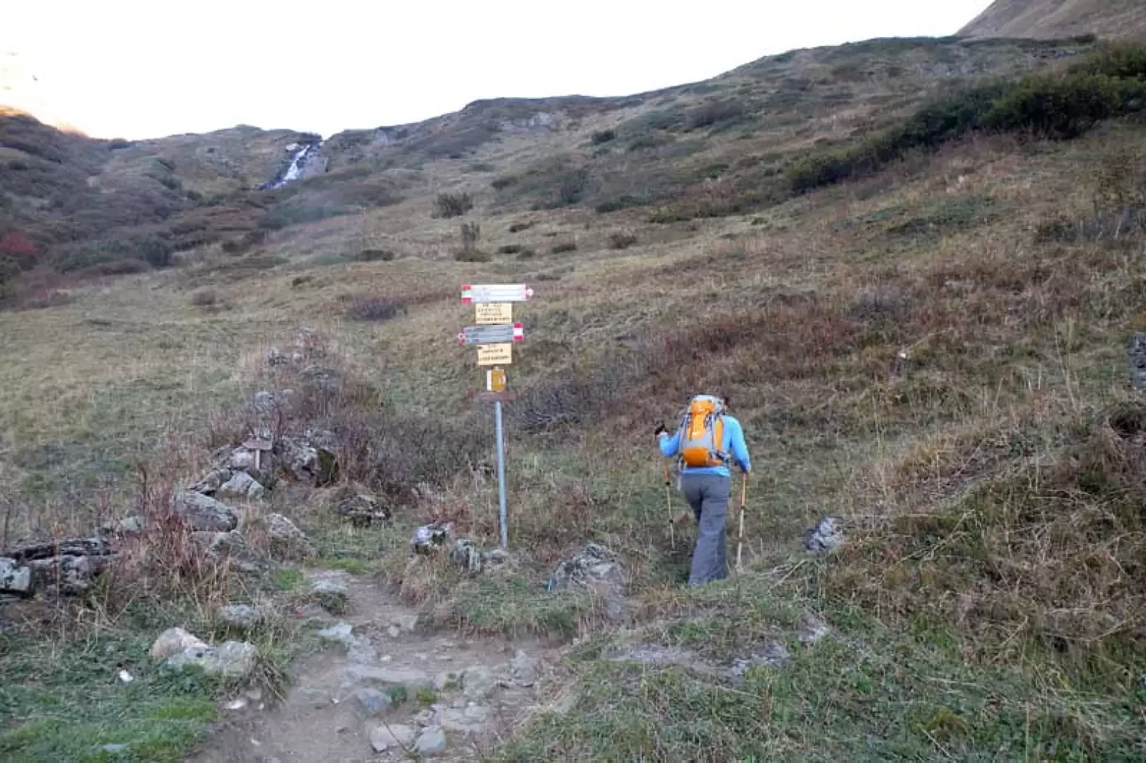
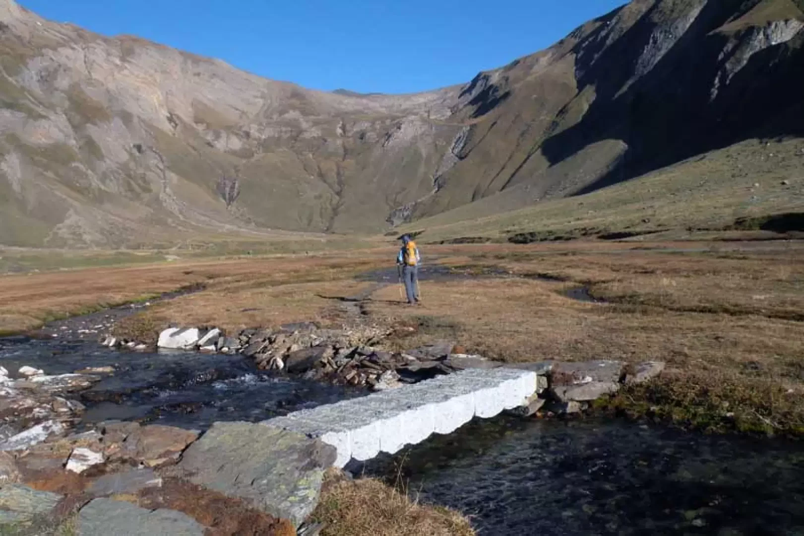
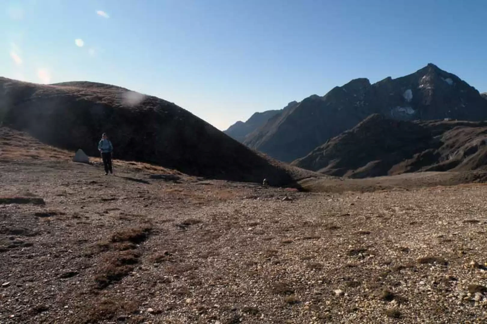
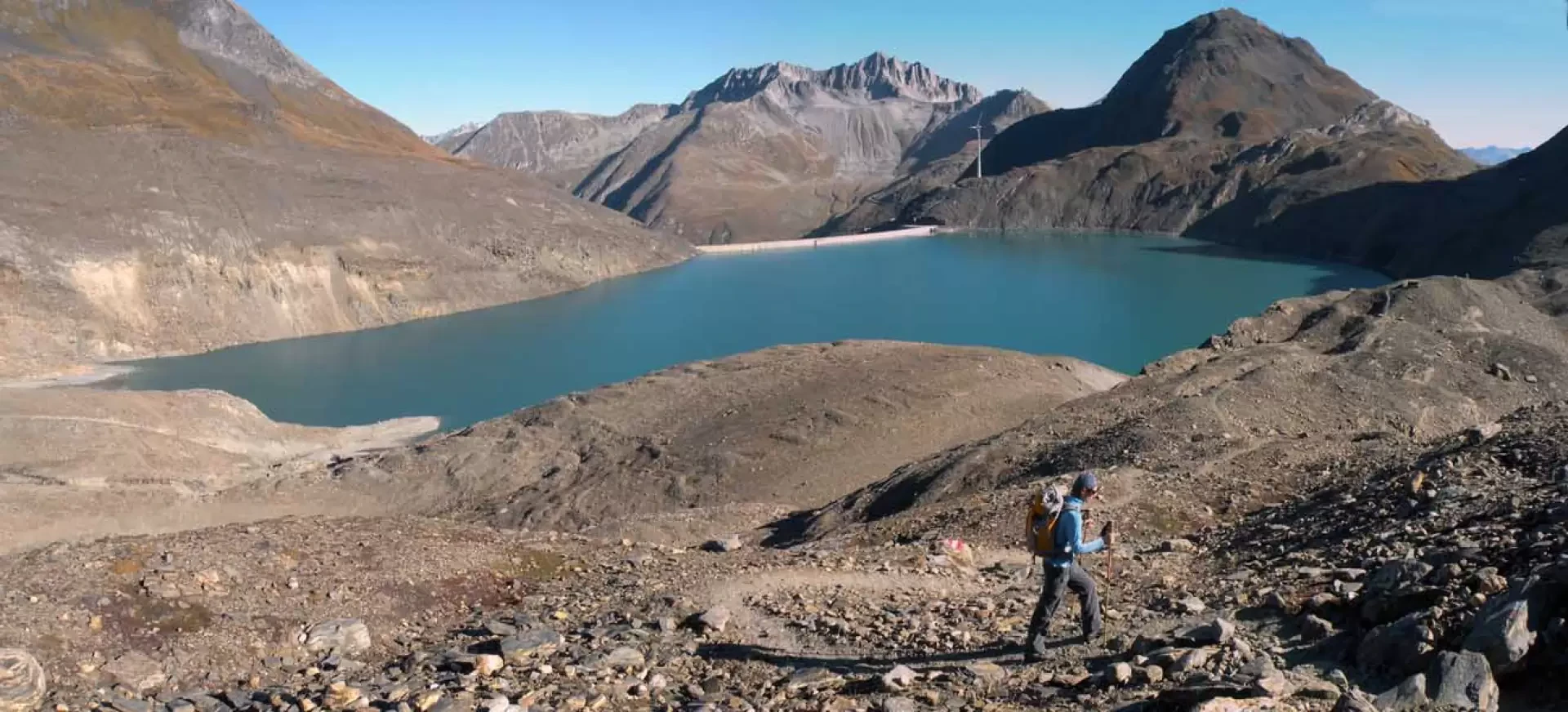
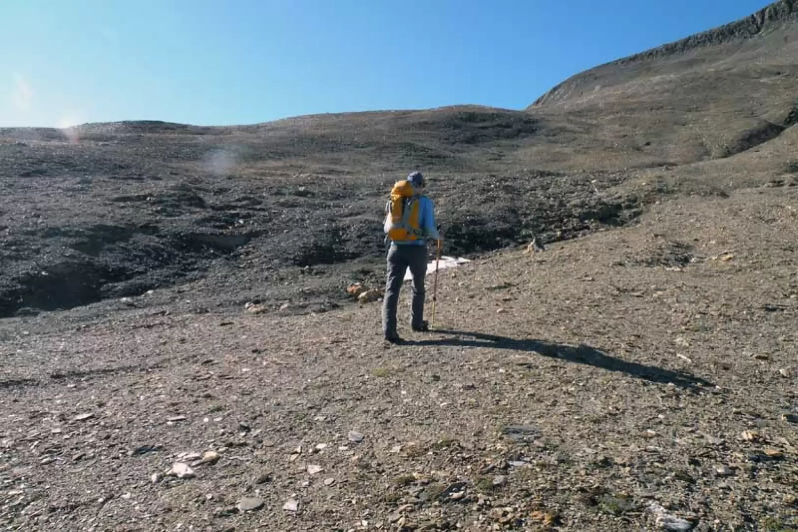
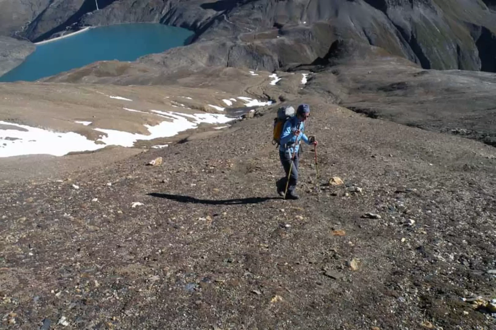
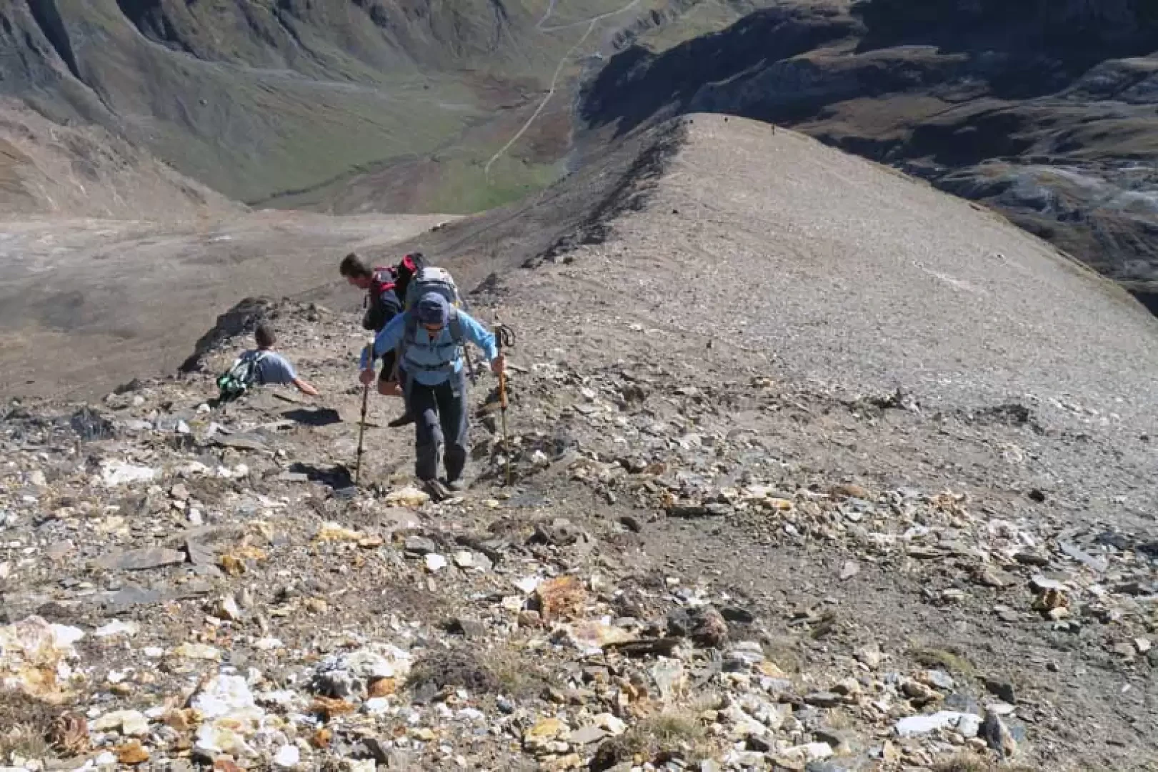
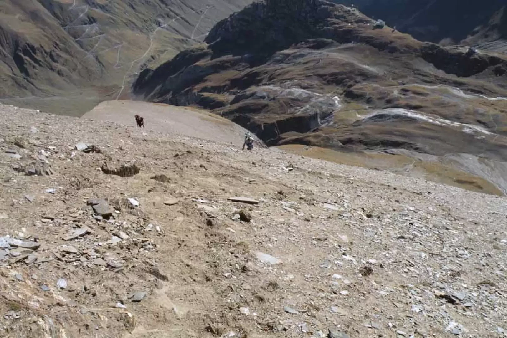
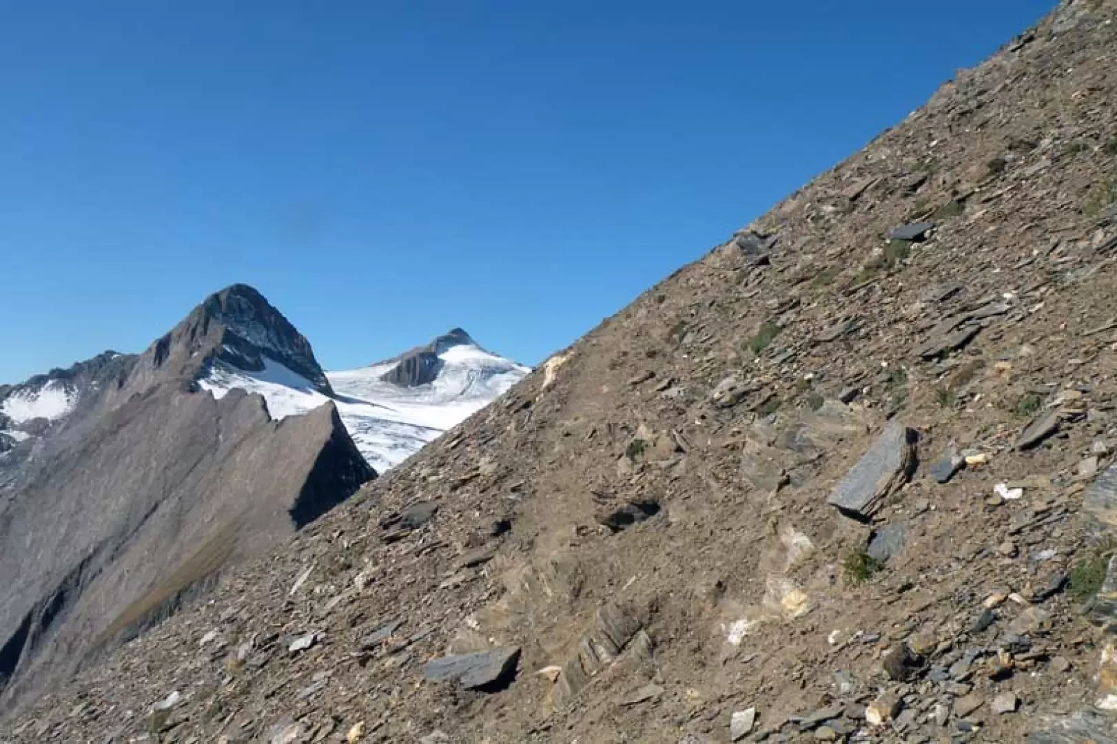
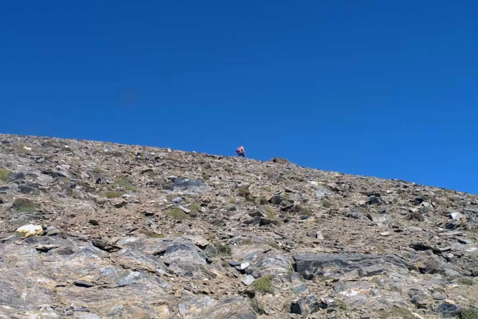
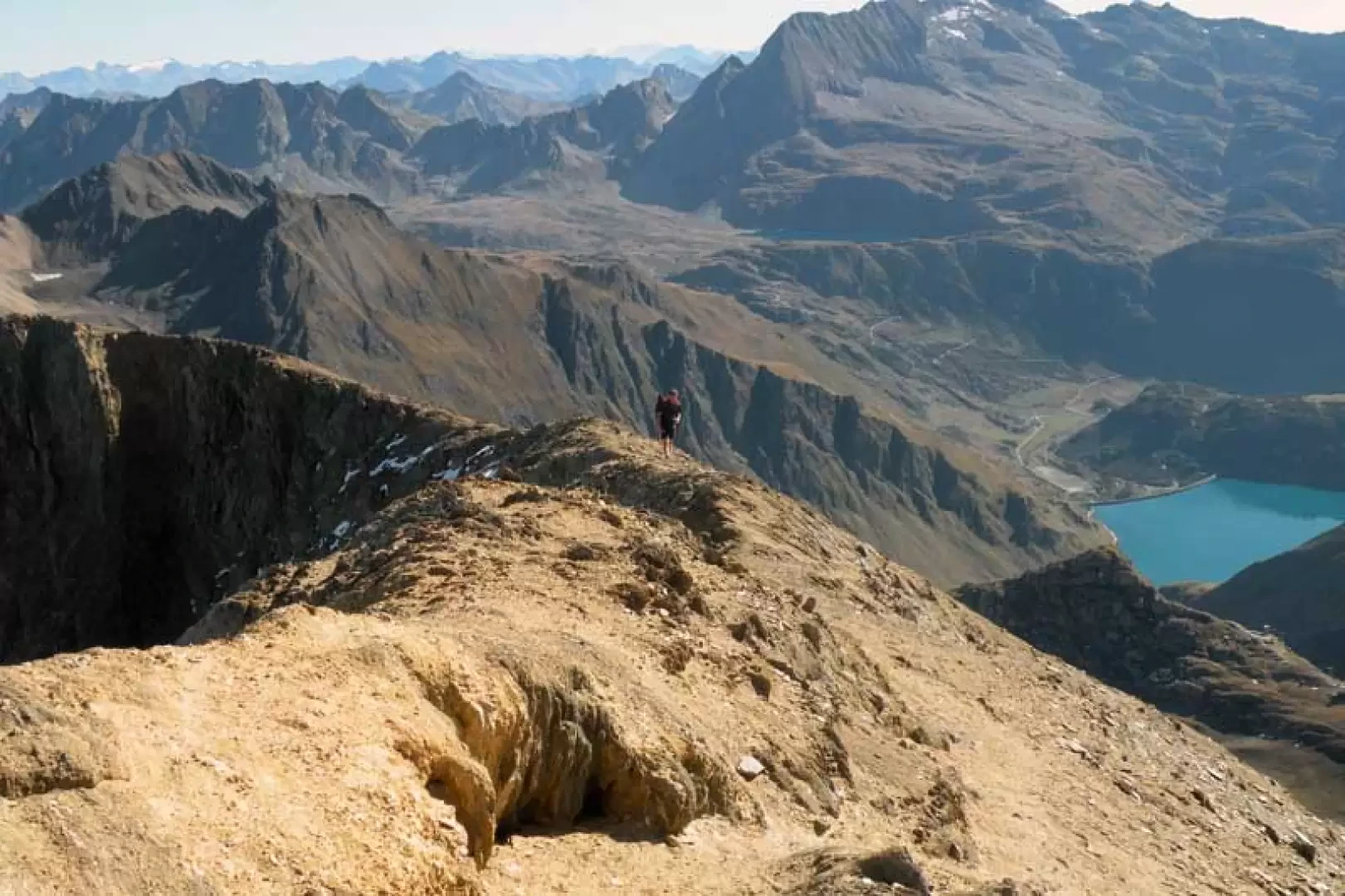
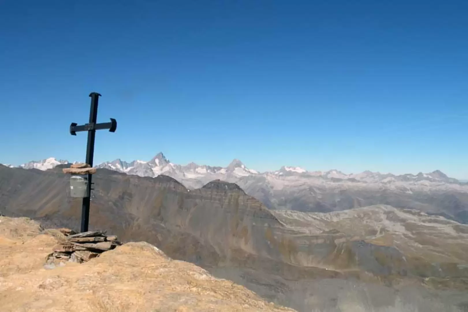
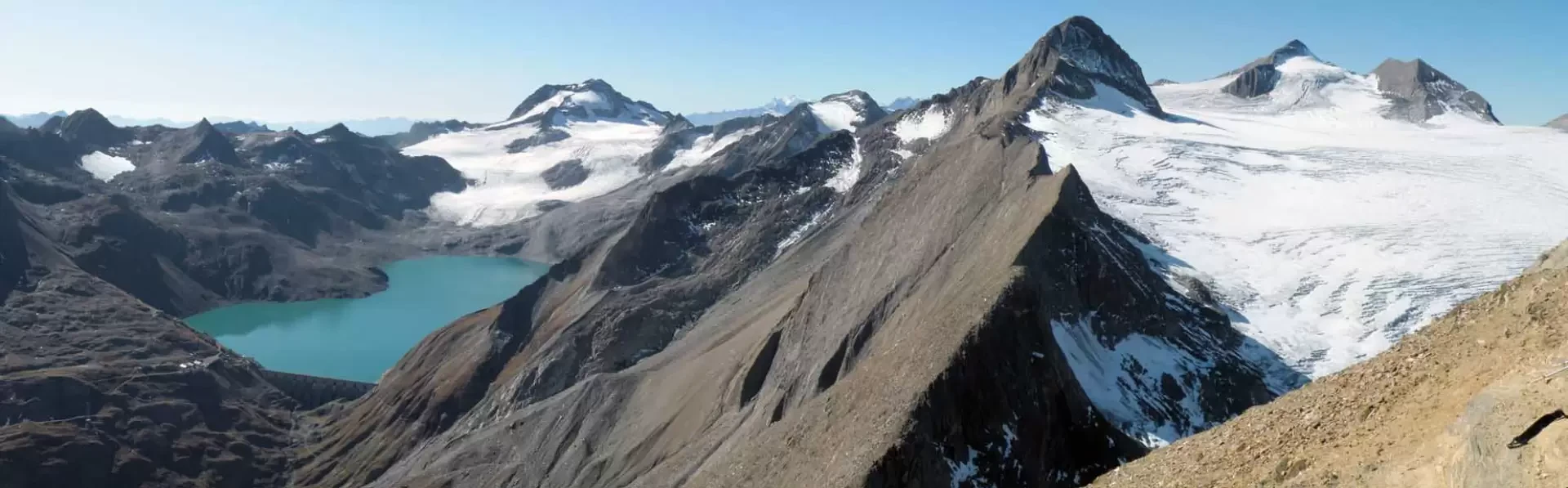
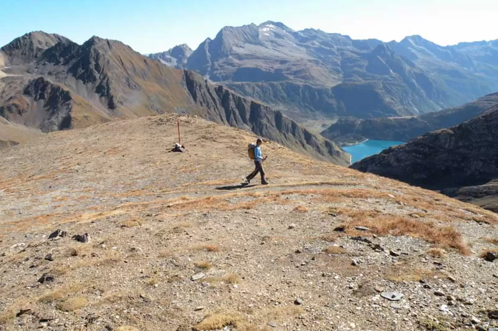
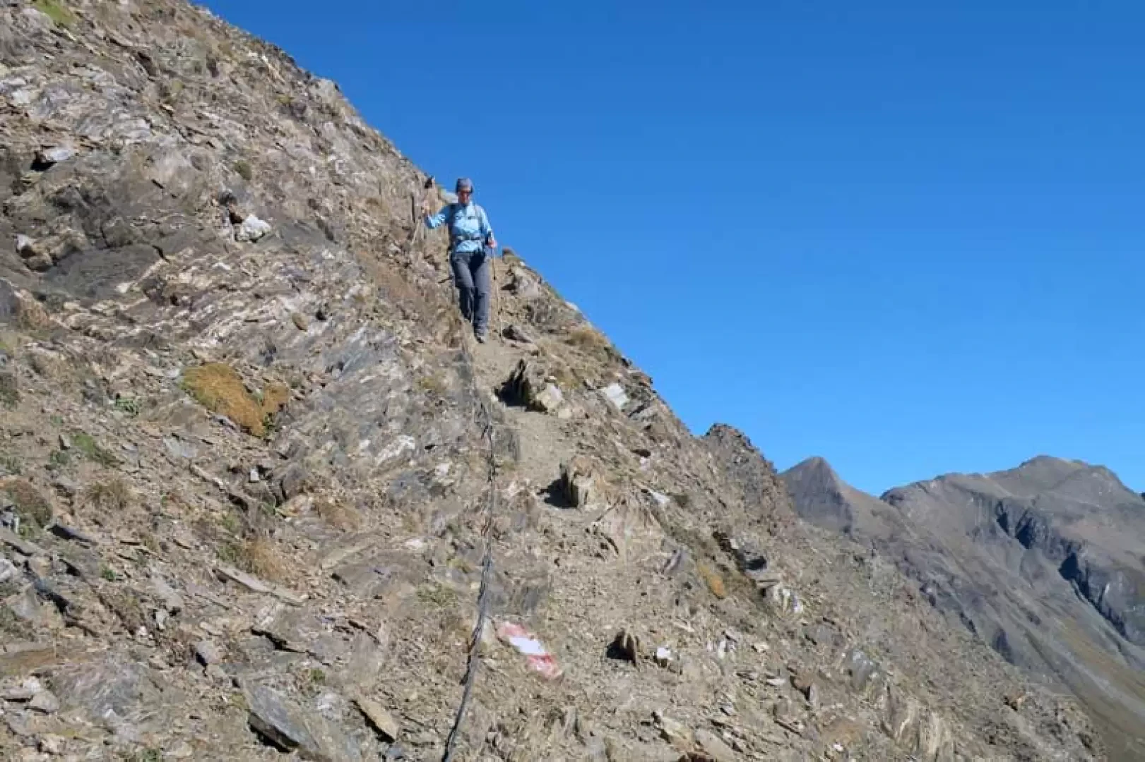
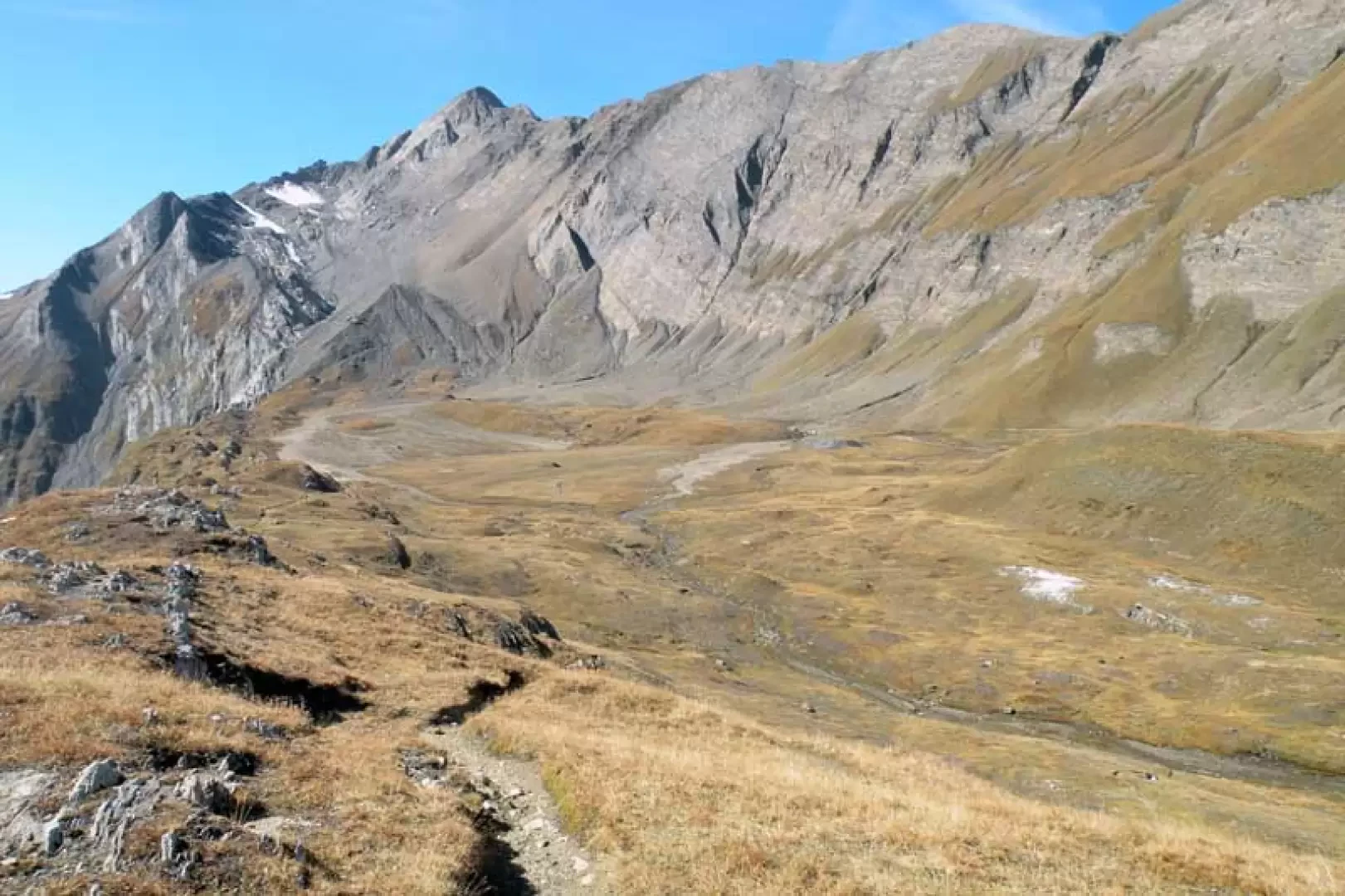
From the dam, go alongside the lake on the dirt track, arriving after a few minutes at the building where the Enel service cableway starts and where the road also ends. You now take the path that from the right approaches a small stream that you cross on the left going up a slope scattered with low bushes where, almost immediately, you come to a fork signposted by a post (1933 m) where you take the right-hand branch. After passing a small stone bridge and leaving the wide mule track, cross the entire length of the Bättelmatt plateau, staying to the right of the Bättelmatt alpine meadow. At the head of the valley, the path is clearly visible, diagonally to the right and a few hairpin bends, and rises sharply up the steep grassy slopes. After passing a small col, you lose a few metres in altitude and cross a stream, from which, with a few slightly steep hairpin bends, you make a traverse to the left, arriving at the wide Griespass (2464 m). Now, following a visible track, continue to the left, passing in front of a small wooden chapel and heading towards a moraine area, the bumps of which are overcome with a few ups and downs; in this section, you pass just above the shores of Lake Gries, which, as you ascend, is on the right, as is the end of the glacier of the same name that feeds it. After passing a small post (2544 m), we make a few more hairpin bends and, reaching the vicinity of a small stone cairn and an arched post (2669 m), we turn right and take a track that climbs a low ridge to the left of a snowfield; After a somewhat steeper section, take a traverse to the left, heading towards the lower part of the ridge that descends to the left of the Bättelmatthorn, which is reached after crossing another track coming from the left and where there is a small stone cairn (2814 m). From here, the track starts off to the right, first in a straight line and then with a few hairpin bends up the ridge to reach a point where the ridge steepens decisively and the progression becomes more tiring, also due to the slippery terrain of fine debris; once these narrow hairpin bends have been completed, there is an exposed traverse, still on the same type of terrain, about a hundred metres long that leads below the vertical of the peak. Now, still on a sustained slope, we climb the last few tens of metres that bring us just below the ridge line; having reached it, we take a short aerial stretch that brings us to the metal cross on the summit.
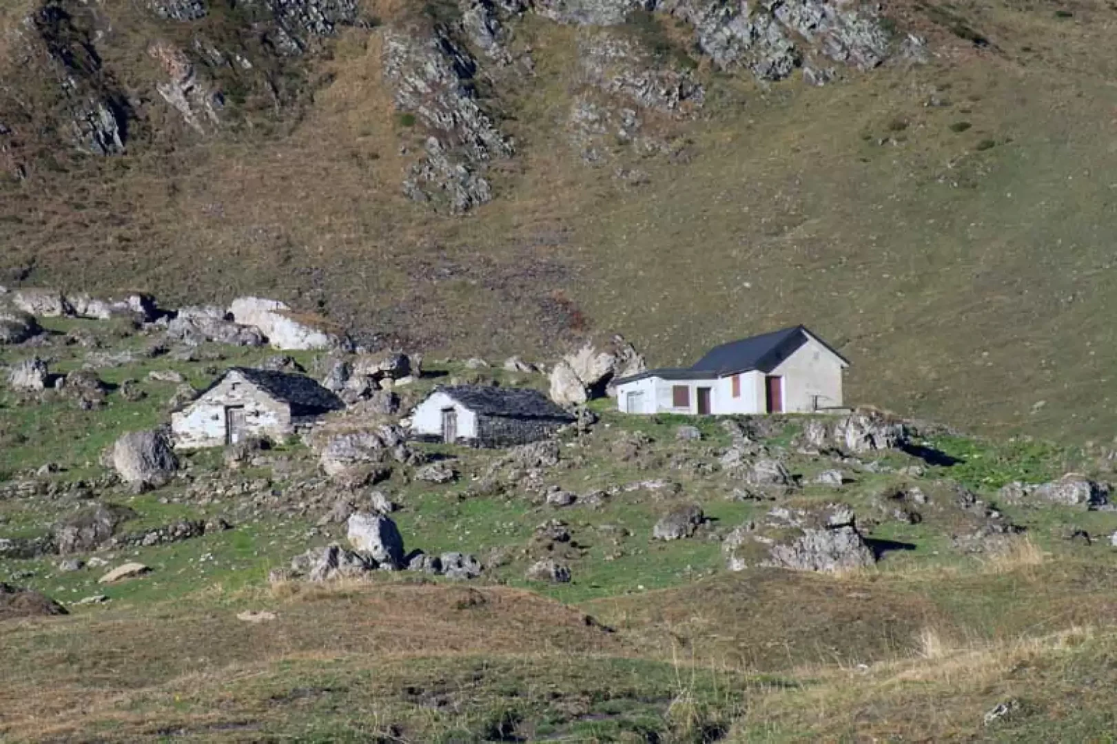
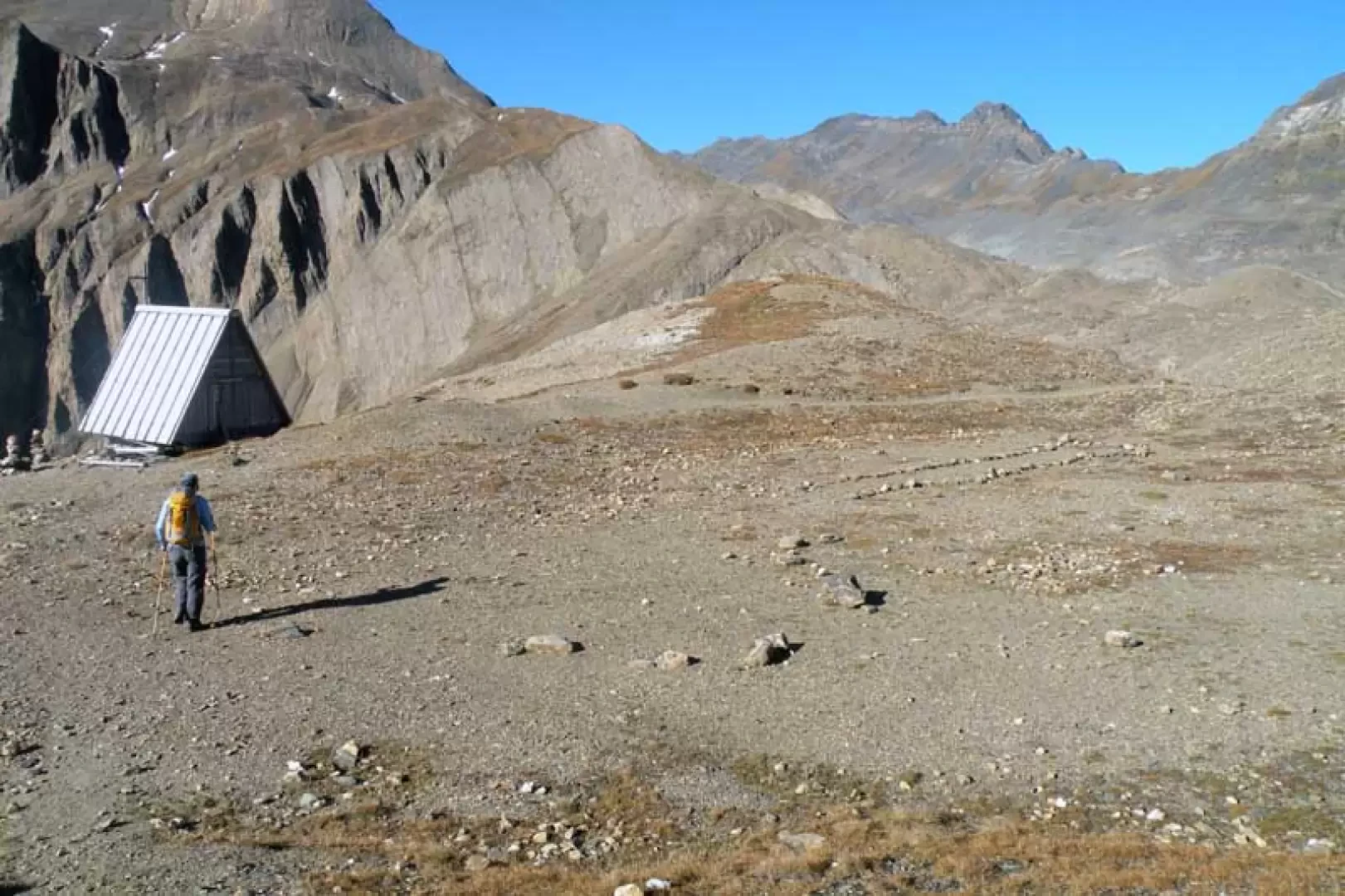
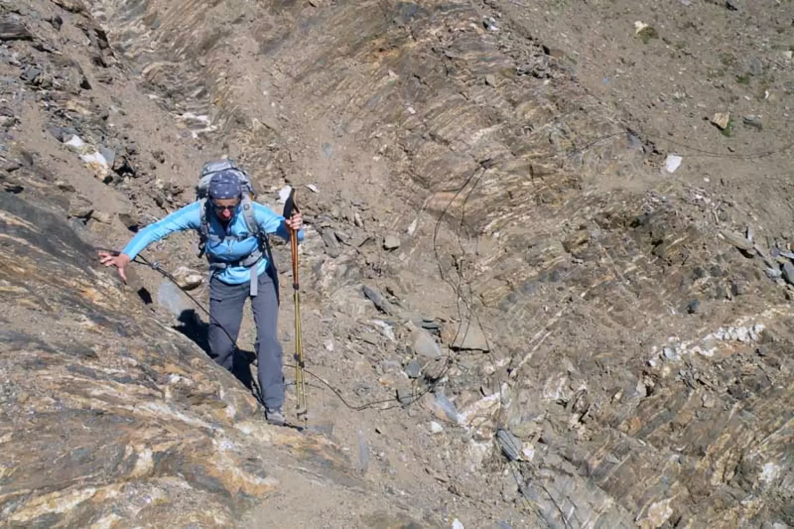
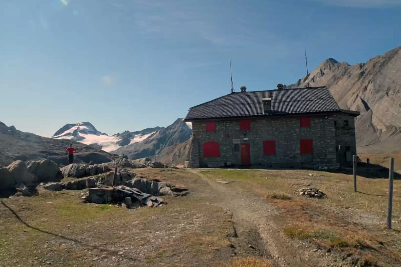
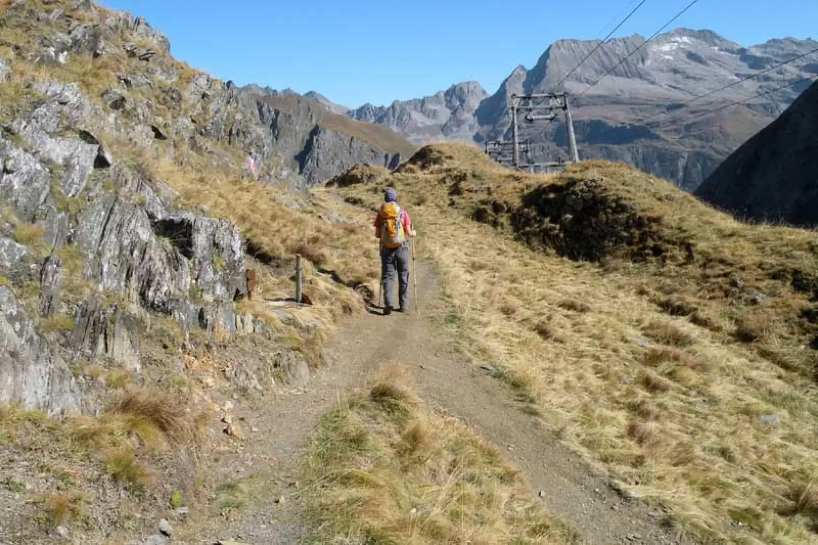
For the descent, go back to the beginning of the crest and, after a few metres of the ascent track, turn right at the crossroads with the other track coming from below; quickly losing height, you arrive at a stake, already clearly visible from above, and which is at the end of the wide ridge (2687 m); now turn right, descending a few metres on the path and immediately face a steep and exposed section equipped with a metal cable: it is not recommended to use it because the support anchorages are not reliable at the moment. At the end of this passage, we continue with a downward traverse halfway along the slope that crosses a gully where, here too, there is a wire rope that should not be used due to the poor condition of the anchorages, which have even been torn away. Having also passed this critical point, we continue on safer ground with the path continuing its descent towards the Piana dei Camosci below, where there is also the memorial stone reminding us that we are walking along the Sentiero Castiglioni; after touching the lowest part of the plateau, we begin a brief ascent towards the Città di Busto hut located on a panoramic promontory (2493 m). Passing to the right of the building, there is a path that descends into a valley, again on the right, where at the bottom you can see the pylons of the Enel cable car; rapidly losing height with many hairpin bends, you arrive at a fork (2253 m) where you stay to the left and continue the descent in a wide, and at times steep, grassy gully. When you come out of the gully you move to the left, still on the path, and arrive at the fork at an altitude of 1933 m, already passed on the way up, from where, turning right, you soon return to the shores of Lake Morasco.
Objective Danger:
slippery path, unreliable equipped sections
Exposed Sections:
traverse below the summit and final part of the ridge
Photo gallery
Comments (0)
Sign in to leave a comment