Alpe Seura, from Pré


Edited by:
Maria Grazia Schiapparelli
Updated at: 06/05/2025
Access
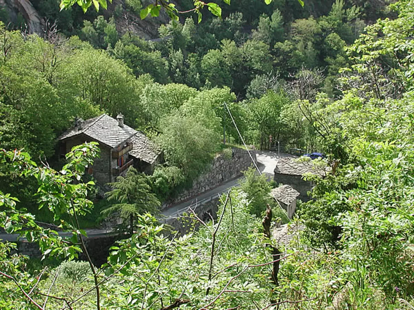
Take the Pont Saint Martin motorway exit, and the Val d'Aosta state road 26 in the direction of Aosta; once in Arnad, enter the village at the height of the church of San Martino and continue along the little road that leads to Machaby. After a few hundred metres, at the fork in Machaby, leave the turning on the right and continue straight on towards Vachères; all the branches of the little road leading upwards have signs at some point forbidding access. Follow the only one without restrictions, taking it at a hairpin bend near Vachères (immediately after the hairpin bend to the right, there is another ban). This road is narrow but asphalted, and is free to drive for a few hundred metres, until you come to a terrace near a group of chalets, where there are four parking spaces. You are in Pré. Immediately after the bend, to the right at the top, barely visible, is the ban. By the way, from here on there is no indication of the name of the villages. Park here.
Introduction
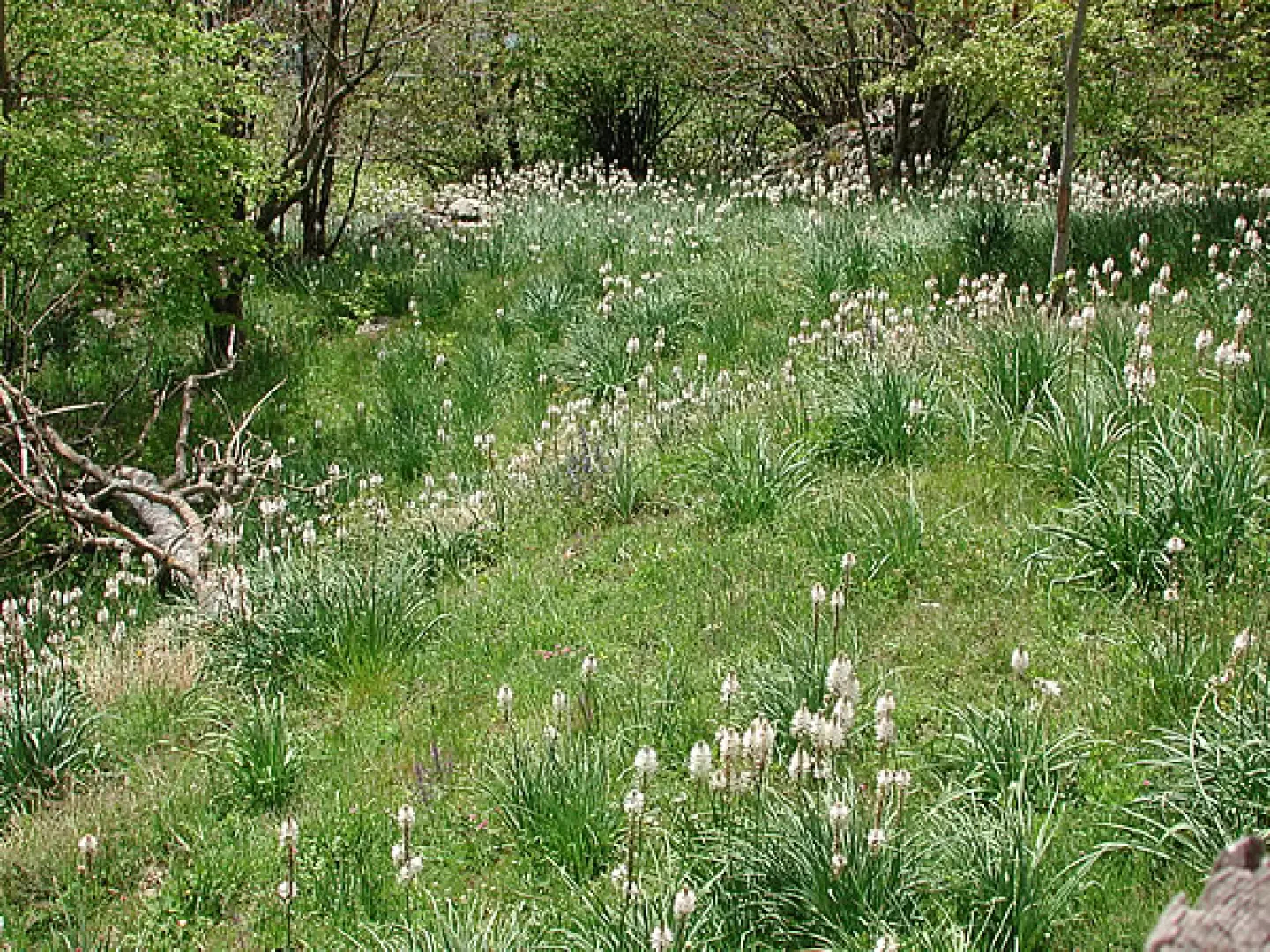
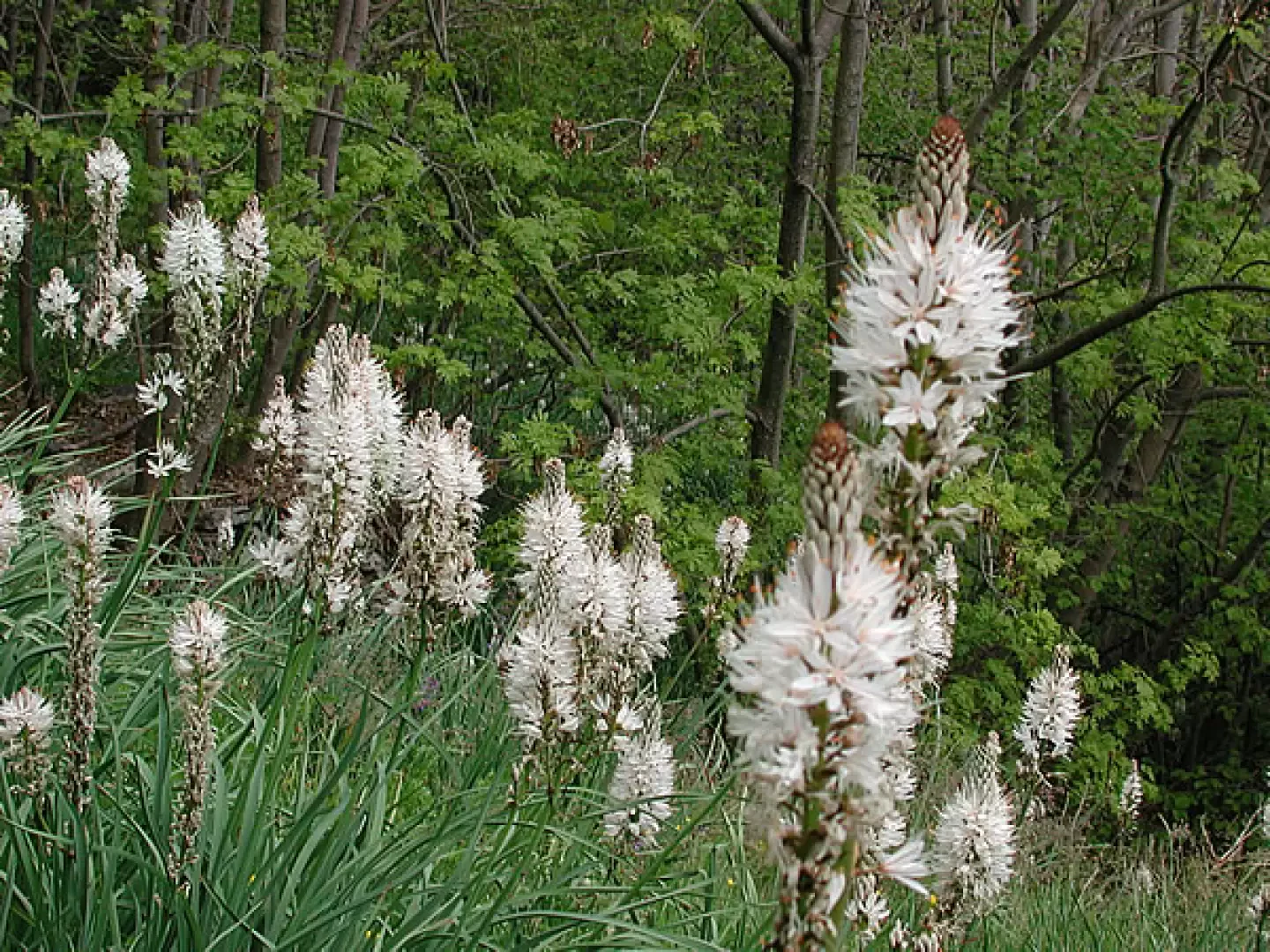
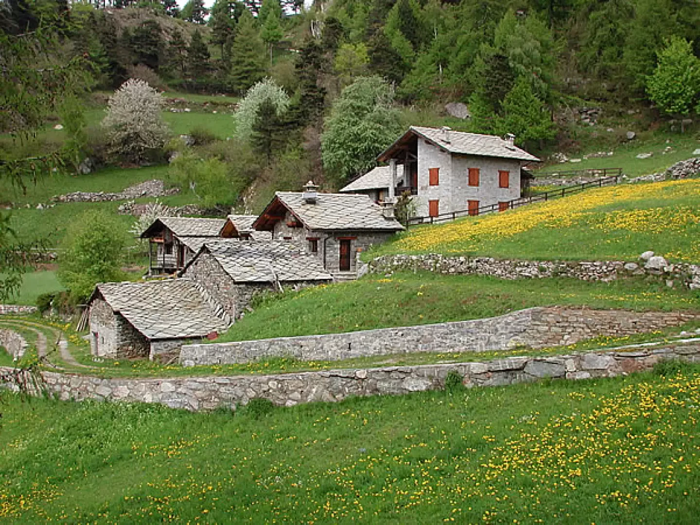
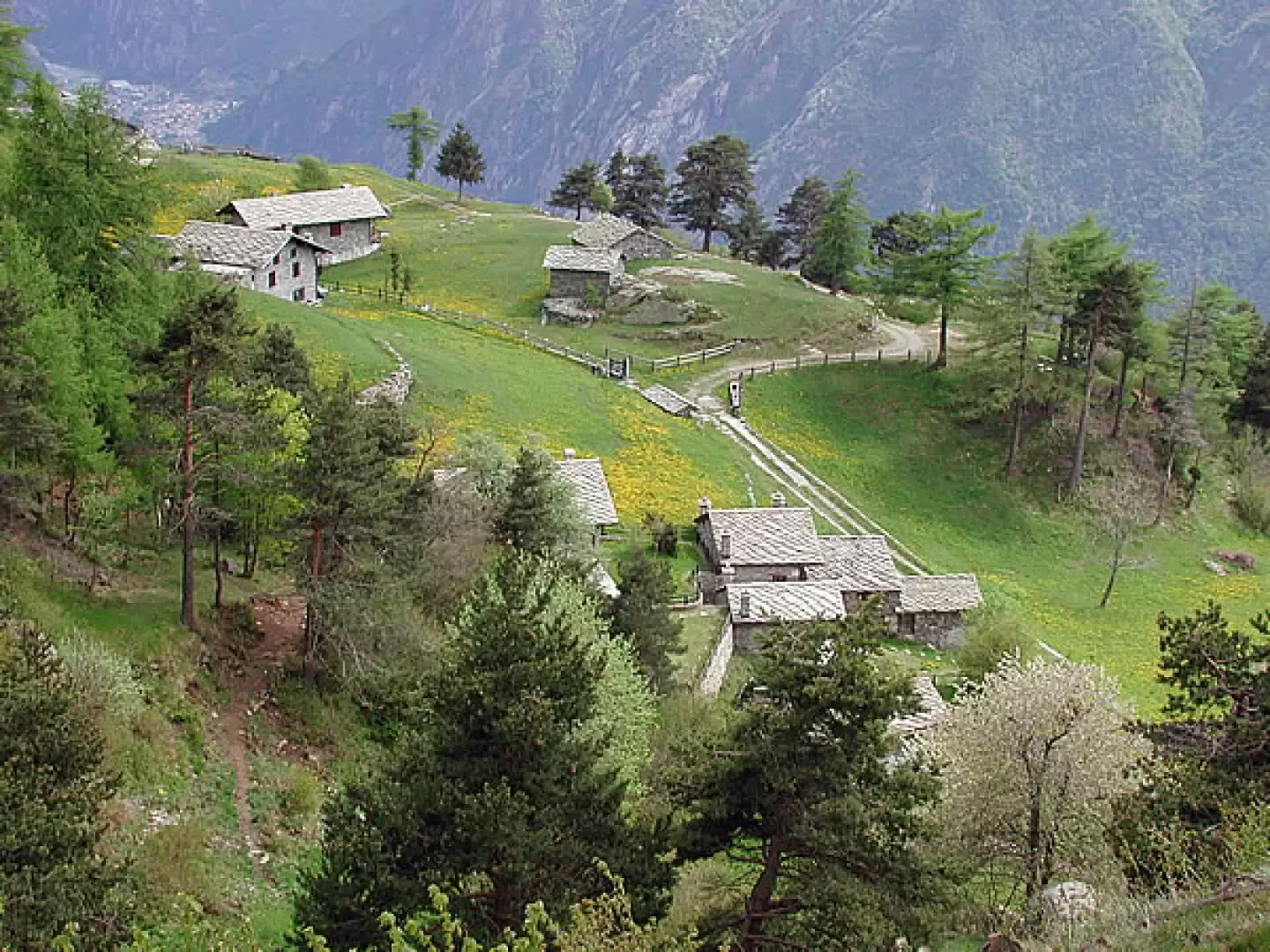
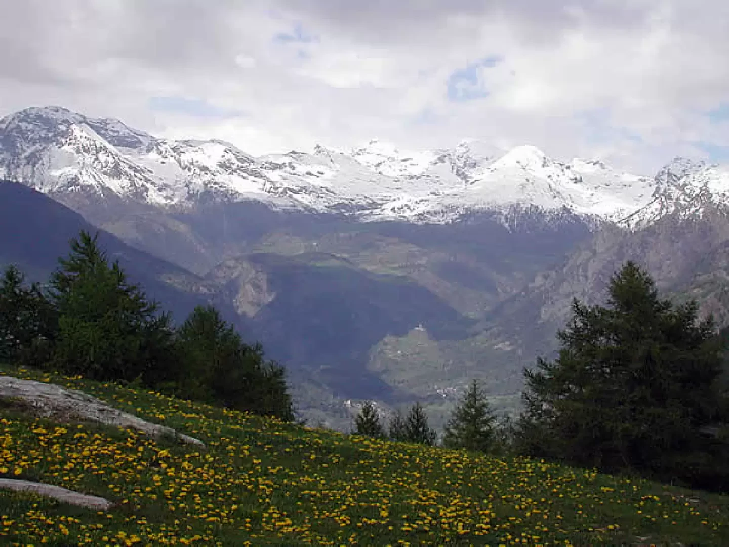
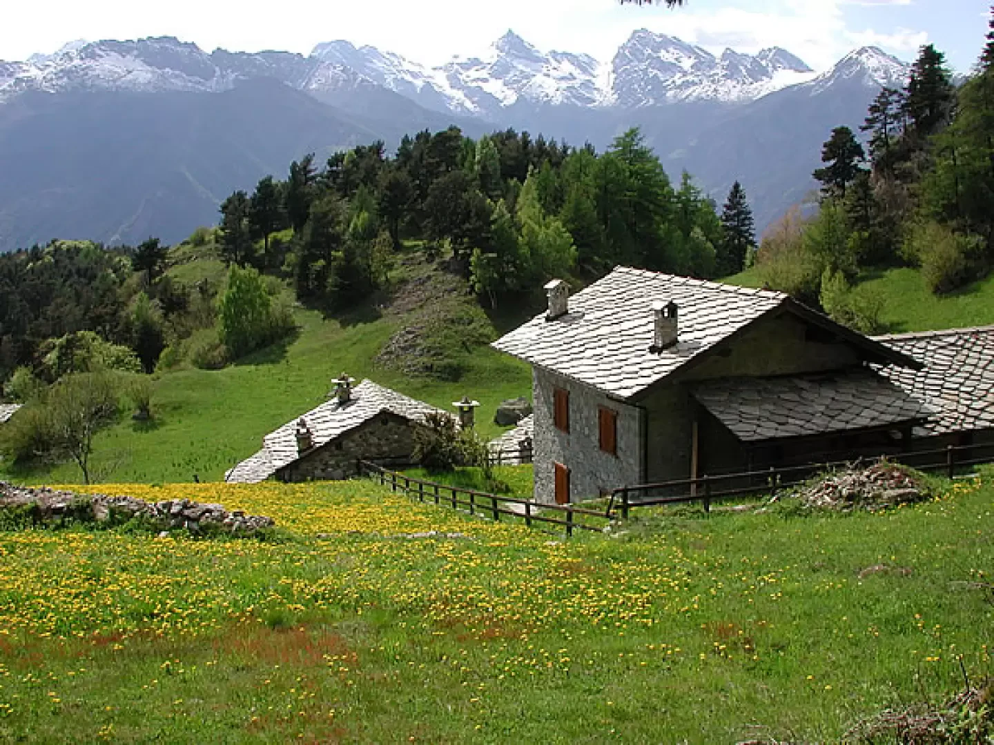
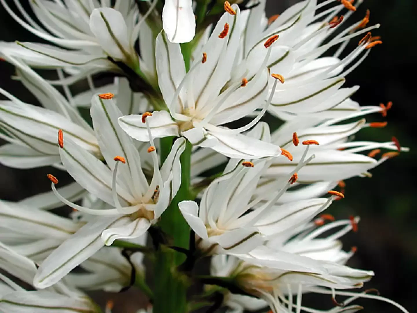
The itinerary takes place in an area that was inhabited up to 50 years ago. The whole area was furrowed by paths and mule tracks, I realised this in my attempts to find the one indicated by Zavatta to reach Montagne Verdoyen. Unfortunately, the paths have not been used for years, the few signs that were there have disappeared, the signs that indicated the forks, which were present last year, have disappeared, which makes it quite uncertain how to proceed. one arrives at Fornelle, where some houses are being renovated, there is a working fountain and a beautiful stone basin carved out in one piece. All around, in spring, from early May to the end, depending on the weather, hundreds of asphodels with long white spikes. Above Fornelle, beyond the col Vert, served by an inter-modal road that climbs up from near the fortress of Verres, which is also closed to traffic from a certain point onwards, is the beautiful village of Prà Usse, and beyond, the alpe Seura, from which there is a splendid panorama over the whole of the val d'Ayas, from the castle of Graines, just opposite, with the crown of peaks above Estoul, to the Zerbion and Monte Rosa, and on the orographic right of the lower Val d'Aosta.
Description
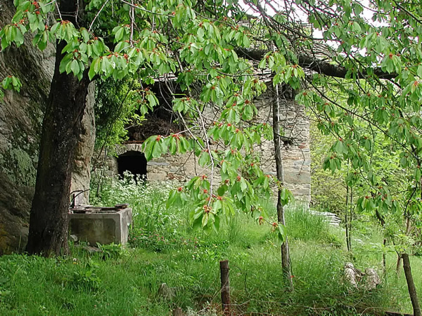
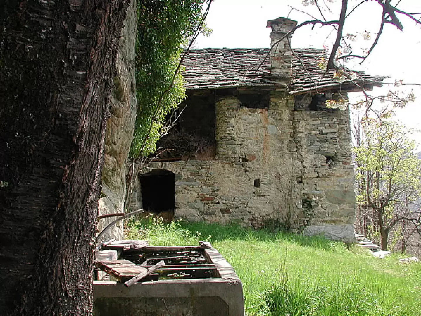
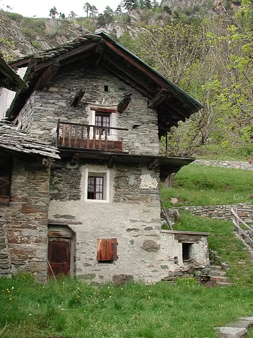
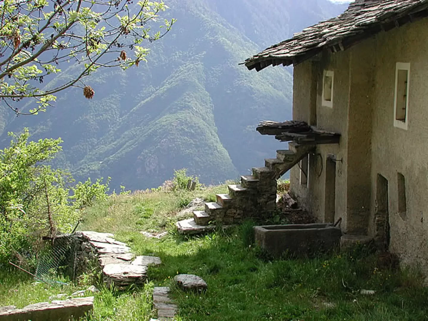
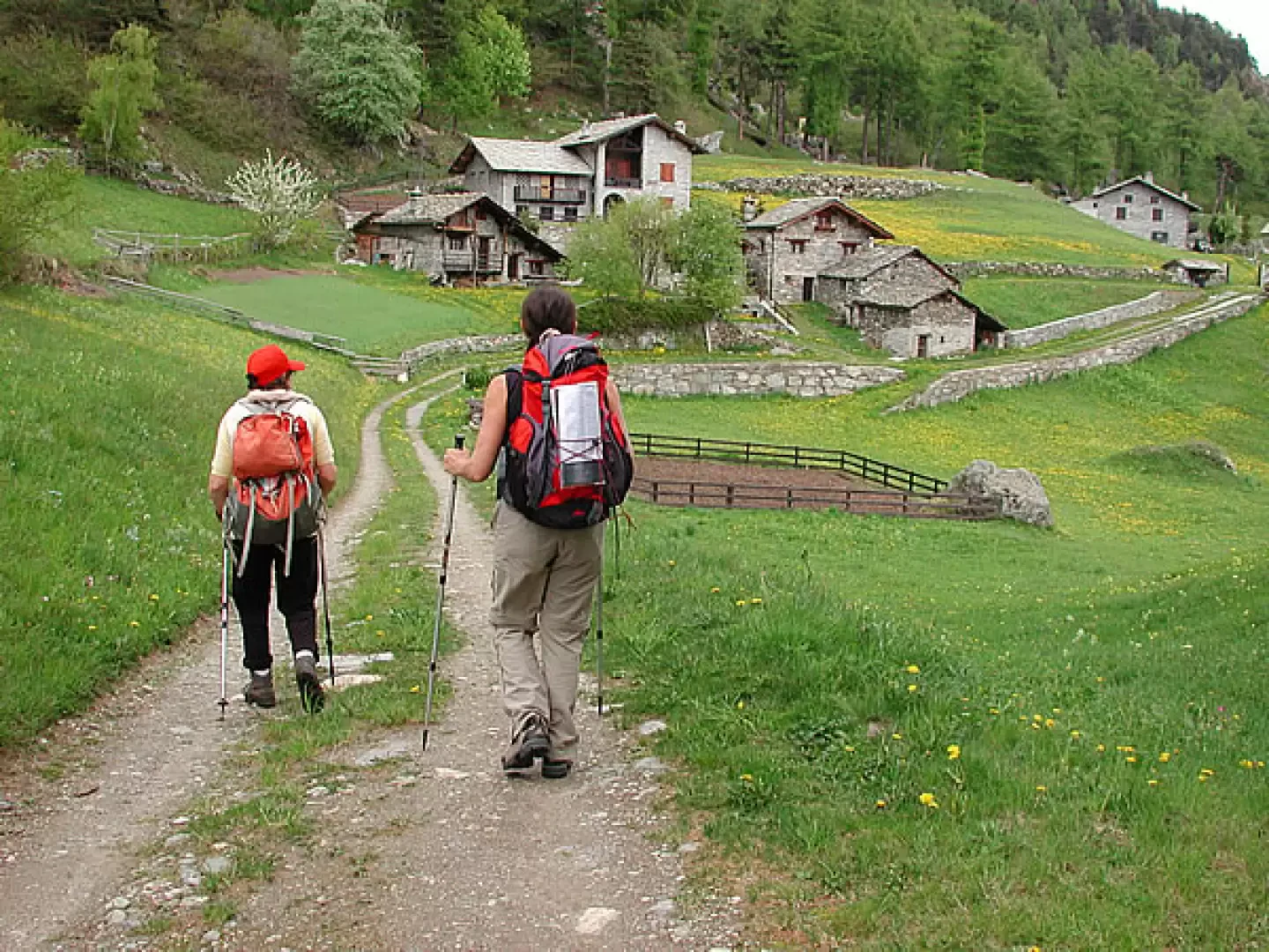
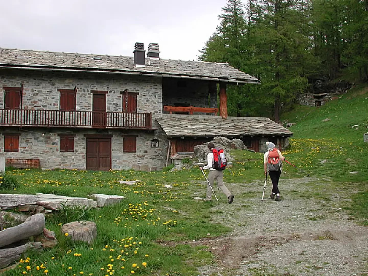
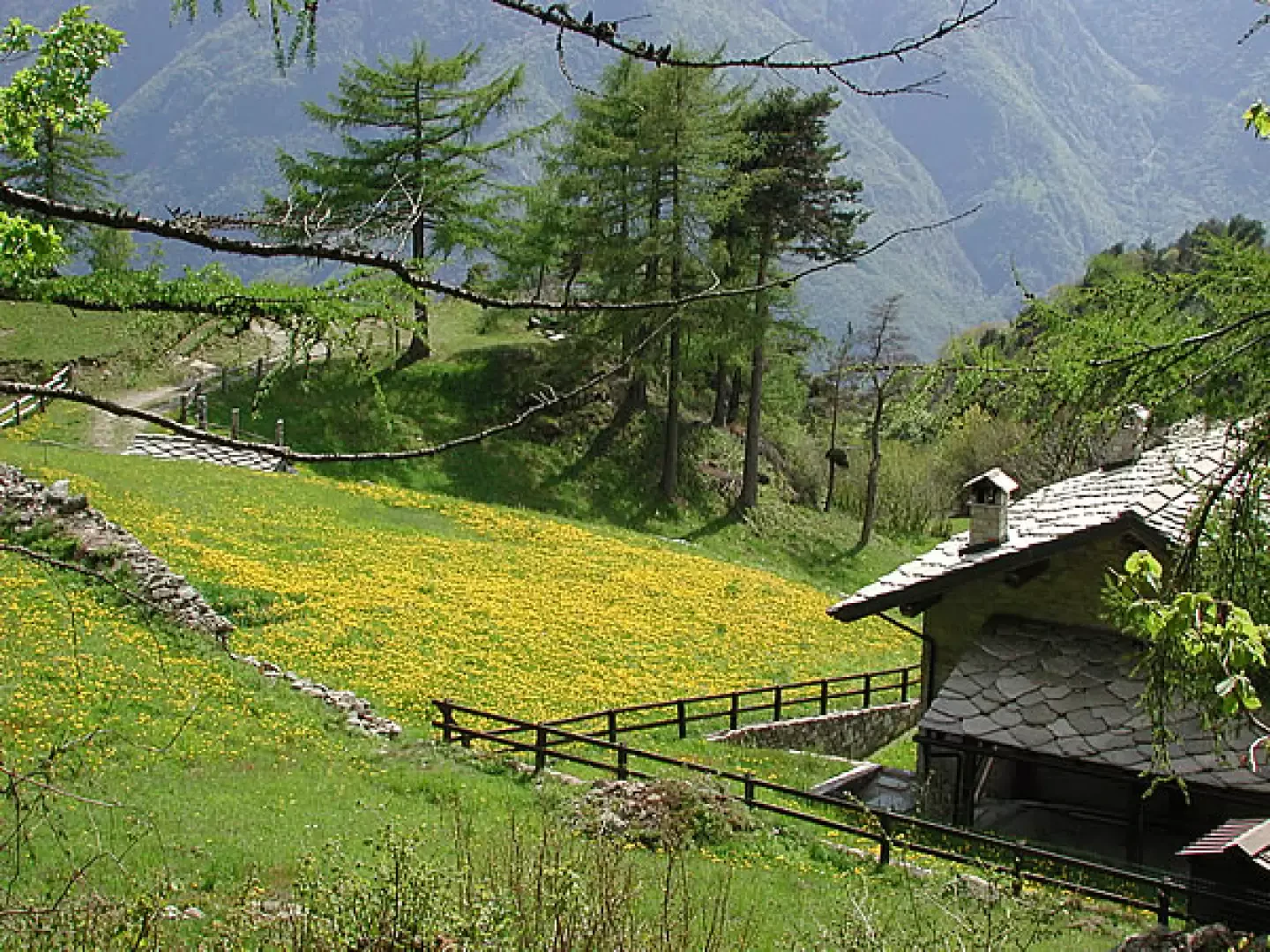
Leaving the car behind, we set off along the small asphalt road. On 1 May 2008, the asphalt had just been renewed, so this stretch was a little unpleasant because of the smell of fresh bitumen; on the other hand, the blackness was marked by the small, splayed paws of all the small animals that had crossed it after the rainy week before; we recognised the tracks of foxes and deer. The road passes over a small bridge and then climbs steeply with a couple of hairpin bends through the chestnut trees, until it reaches a level stretch, with a meadow and a vineyard to the left and the few houses of Champurney to the right. I do not recommend trying to follow Zavatta's report by looking beyond the village for the path to Montagne Verdoyen: even the locals we met working in the woods say that this path is very difficult to locate and to follow; bear in mind that beyond the terraces now invaded by chestnut trees, there are small rocky walls, so getting the wrong path uphill can mean having problems retracing one's steps. There are no landmarks, the terrain is very similar everywhere. So we give up the urge to emulate Indiana Jones and content ourselves with continuing on the safe asphalt road, which after a while veers to the right, while a dirt road continues on the flat as far as Anvieil. We continue on the asphalt road for a short distance more, until we find the remains of a ruin on the right: if no one has removed the signs, immediately after the ruin, on a large stone, on the ground, there are the first red marks indicating the start of the trail. The path, however, points decisively north, next to a chestnut forest, and is well identifiable. Once taken, it is easy to follow. It climbs steeply, in hairpin bends, into the chestnut forest, and higher up the forest is coniferous. We arrive at the Barmalunga huts, 1047 metres above sea level, also with a beautiful stone fountain. On the wall of the hut we leave to the left, a red sign indicates the directions: look carefully because they are the only ones you will find on the entire route. Continue along the path, in places with a few red marks; there are several small paths that deviate from the main one: ours is always the one that goes uphill, passes next to a circular lime kiln, until we enter a coniferous forest. After a few hairpin bends in the forest and about 200 metres of elevation gain from Barmalunga, which is about forty minutes, we find a T-junction marked with a pile of stones: here last year there was a signpost to the right for Montagne Verdoyen, now it has disappeared. We continue left, flat and then uphill again to Fornelle (1282 m, 1h40' from Pré), which is now close by. We catch a glimpse of the village houses among the trees, and as we proceed, on the terraces around us and along the path, hundreds of asphodels with long white stems. At the village, a dirt road arrives, which at col Vert joins the cross-country road that climbs from Verres. Immediately after Fornelle, at a bend, in the rock is the entrance to what was probably a mine. The road continues with a few hairpin bends until reaching the pass, m. 1405, 20 minutes from Fornelle. The pass has no significant views, for the gaze to wander beyond the trees it is necessary to continue climbing for a quarter of an hour, arriving at the village of Prà Usse, or Pratsse (1460 m). A beautiful fountain with Eau de la Mine, water gushing from a mine to the north-east, is in the centre of some recently restored stone houses. The lawns are manicured, last year they were yellow with dandelion flowers, this year the season is still behind. The location of the village is beautiful, a terrace facing the valley of Champorcher. We will pass through the village later on our way back from Alpe Seura; now we continue along the inter-podal road for another twenty minutes or so: the conifers give way to terraces and pastures, with a few flowering cherry trees: Alpe Seura (1544 m, 1h35' from Pré) comes out above us on the ridge: here too there is a beautiful fountain and a spectacular view over the val d'Ayas, the Dondeuil valley and the lower Aosta valley. Descent: along the inter-modal road, keeping to the left to locate the col above Prà Usse: from here a beautiful path starts on the left, which descends directly into the middle of the village, giving us the opportunity to visit it at our leisure. After a tour around the mountain huts, take the road back to Fornelle and from here retrace the ascent route back to the car; I know that there are paths that allow you to descend in a wider circle: frankly, given the current total absence of indications, I didn't feel like trying to follow them.
General information
Trail:from Pré
Signposts:
Type of route:
Recommended period: April, May, June, July, August, September, October, November
Exposure to the sun:
Objective Danger:
Exposed Trails:
Useful Equipment
Water:
Photo gallery Alpe Seura (1544 m) © 2008 Maria%20Grazia%20Schiapparelli Alpe Seura (1544 m) © 2008 Maria%20Grazia%20Schiapparelli Alpe Seura (1544 m) © 2008 Maria%20Grazia%20Schiapparelli Alpe Seura (1544 m) © 2008 Maria%20Grazia%20Schiapparelli Alpe Seura (1544 m) © 2008 Maria%20Grazia%20Schiapparelli Pré and the small car park Barmalonga (06.05.07) Barmalonga (01.05.08) Asfodeli Fornelle Alpe Seura (1544 m) © 2008 Maria%20Grazia%20Schiapparelli Alpe Seura (1544 m) © 2008 Maria%20Grazia%20Schiapparelli Alpe Seura (1544 m) © 2008 Maria%20Grazia%20Schiapparelli Alpe Seura (1544 m) © 2008 Maria%20Grazia%20Schiapparelli Alpe Seura (1544 m) © 2008 Maria%20Grazia%20Schiapparelli Fornelle Asfodeli Prà Ussé Prà Ussé Alpe Seura (1544 m) © 2008 Maria%20Grazia%20Schiapparelli Alpe Seura (1544 m) © 2008 Maria%20Grazia%20Schiapparelli Alpe Seura (1544 m) © 2008 Maria%20Grazia%20Schiapparelli Alpe Seura (1544 m) © 2008 Maria%20Grazia%20Schiapparelli Alpe Seura (1544 m) © 2008 Maria%20Grazia%20Schiapparelli Alpe Seura The Estoul basin Dandelion at Prà Ussé The beautiful terrace of Prà Ussé Seen from close up Bibliography * Le valli del Monte Rosa - Zavatta Cartography: * IGC Biella Ivrea and Bassa Vda 1:50000
Photo gallery
Comments (0)
Sign in to leave a comment