Pontboset

Access
L’accesso al comune avviene prevalentemente in auto, risalendo da Hône lungo la strada regionale per la valle di Champorcher . Non sono presenti grandi parcheggi, ma è possibile trovare posti auto vicino al municipio e nei pressi del ponte. I collegamenti con i mezzi pubblici dipendono dalle linee di autobus che raggiungono Hône, dove si trova la stazione ferroviaria più vicina e da cui si può proseguire verso Pontboset tramite servizio automobilistico locale; in periodo estivo possono esserci alcune limitazioni, pertanto è utile verificare gli orari aggiornati.
Introduction
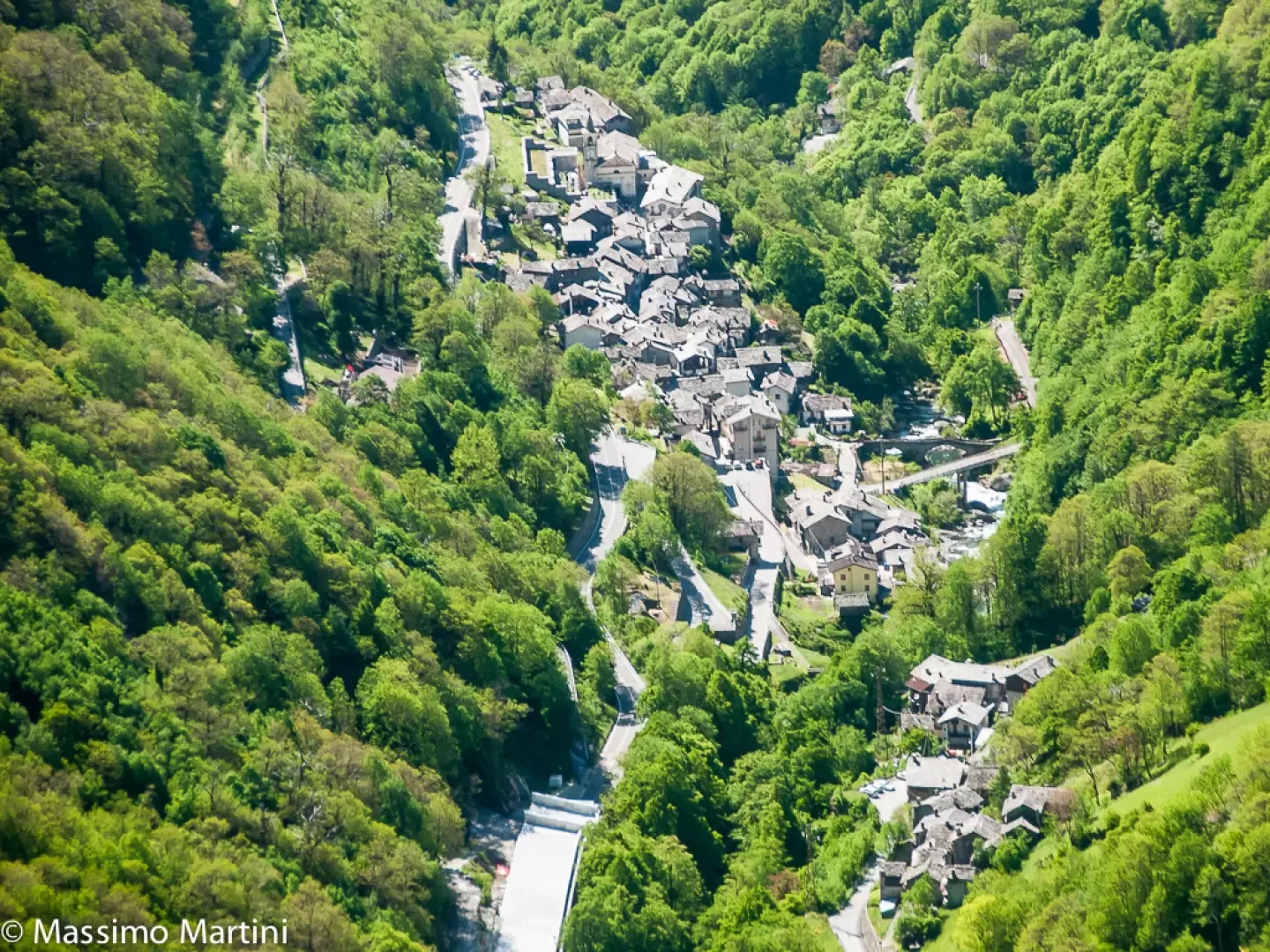
A small village at the beginning of the Champorcher valley and situated in an unusually steep position between a huge rock face on one side and the Ayasse stream on the other. The place name obviously derives from the ancient humpback bridge that joins the main town with the mule track that climbs the Manda valley to the village of Bozet, a word of uncertain etymology.Description
While in past centuries the village enjoyed a certain prestige and economic prosperity due to its intermediate position between the upper Champorcher valley, the passes for the Valchiusella and the Valle d'Aosta valley floor, in recent decades it has heavily suffered from the phenomenon of mountain depopulation, due to the changed economic dynamics. Agriculture itself, while being able to count on a practically uncontaminated environment, is certainly not favoured by the harsh, ungenerous and not particularly sunny terrain.
Because of all these conditions, the municipality of Pontboset can be considered an oasis of peace, an ideal destination for excursions in the surrounding woods, up to the highest pastures or to the sanctuary of Retempio, one of the most venerated Marian sites in Valle d'Aosta. A small village at the beginning of the Champorcher valley and situated in an unusually steep position between an enormous rock face on one side and the course of the Ayasse stream on the other. The place name obviously derives from the ancient humpback bridge that joins the main town with the mule track that climbs the Manda valley to the village of Bozet, a word of uncertain etymology. While in past centuries the village enjoyed a certain prestige and economic prosperity due to its intermediate position between the upper Champorcher valley, the passes for the Valchiusella and the Valle d'Aosta valley floor, in recent decades it has heavily suffered from the phenomenon of mountain depopulation, due to changing economic dynamics. Agriculture itself, although it can count on a practically uncontaminated environment, is certainly not favoured by a harsh, ungenerous and not particularly sunny terrain. Precisely because of all these conditions, the commune of Pontboset can be considered an oasis of peace, an ideal destination for hikes in the surrounding woods, up to the highest pastures or to the sanctuary of Retempio, one of the most venerated Marian sites in Valle d'Aosta.
Information
Commune information sheet
Area: 33.76 sq km
Altitude: 780m
Maximum elevation: Monte dei Corni (2778m)
Number of inhabitants: 197
Name in dialect: Ponboset
Name of inhabitants: Pontbosards, Ponbosètin, Ponbosètine or Ponbosar, Ponbosarde
Patron Saint: Saint-Grat (7 September)
Website: www.comune.pontboset.ao.en
Webcam:
Bordering municipalities: Arnad, Champorcher, Donnas, Hône, Issogne, Traversella, Vico Canavese
Villages and hamlets: Barmacrepa, Barmafumo, Barmelle, Borettas, Bouillas, Chateigne, Cotetta, Crest damon, Crest desot, Creux, Delivret, Divine, Foliettaz, Fontanette, Fournier, Fraissiney, Fries, Frontière, La Bourney, La Place, Pialemont, Pianet, Piollt, Pont-Bozet, Precelette, Savin, Terisse, Trambesère, Valvieille, Vareisa, Verney
Alpeggi:
Points of interest
Itineraries
- hiking in Pontboset - map