Bard

Access
The municipality can be reached along the state road of Valle d'Aosta, which runs along the foot of the rocky spur, or via the Turin-Aosta motorway, with recommended exits at Pont-Saint-Martin or Verrès, from where to continue along the valley floor until the signs for Bard. Public transport connections are provided by regional bus lines on the Pont-Saint-Martin-Aosta route, with stops near the village. The nearest railway stations are located in the neighbouring towns on the valley floor, easily reached by short transfers by road, while the nearest airport is Turin-Caselle, connected to Valle d'Aosta via the motorway network.
.Introduction
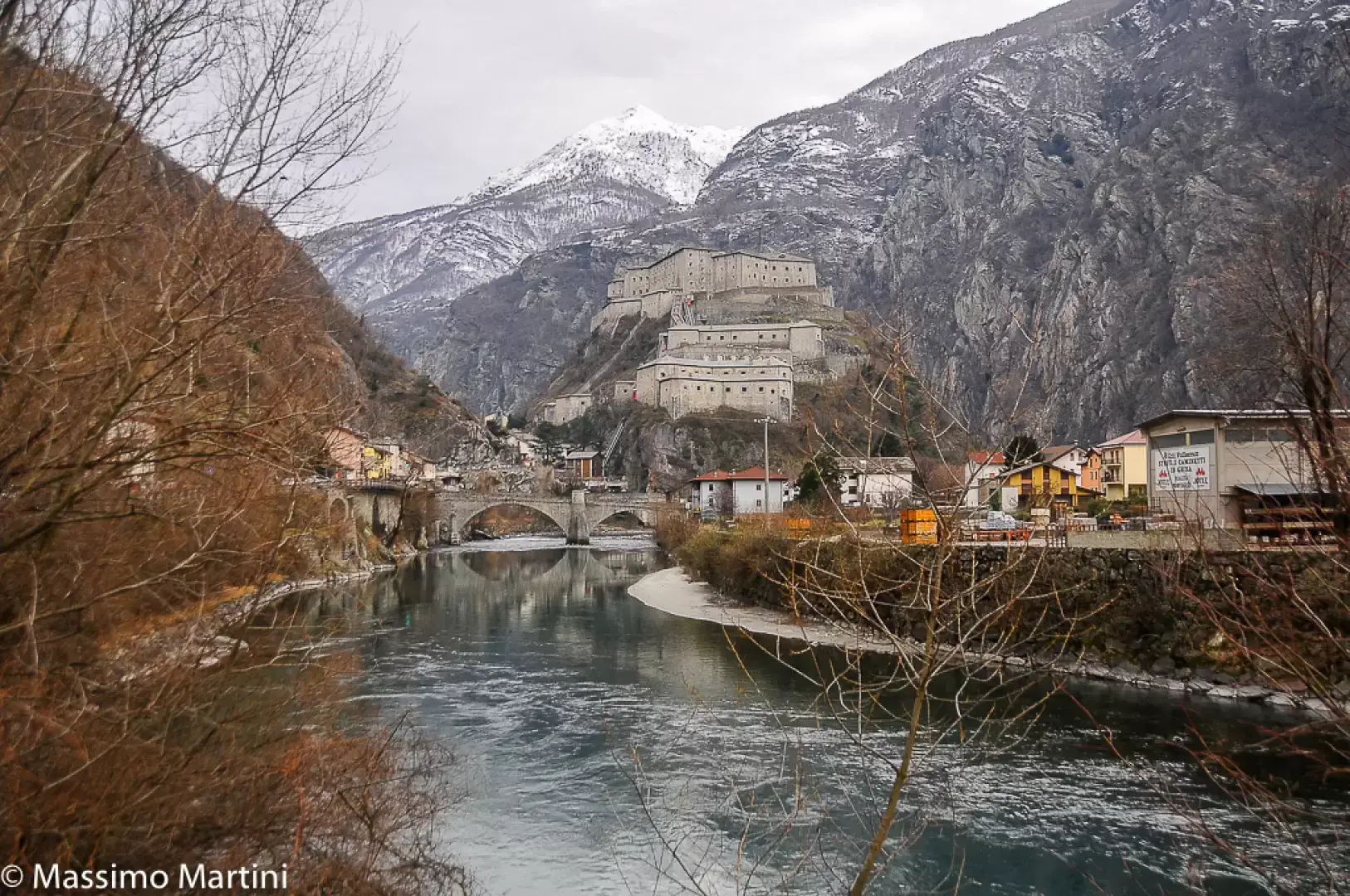
Bard is a small municipality in the lower Valle d'Aosta, lying at the base of a rocky spur that narrows the valley of the Dora Baltea at its narrowest point. Its strategic position at this point of obligatory passage has determined, since antiquity, the defensive and commercial vocation of the place, dominated by the presence of the Fortress of Bard, a 19th-century fortified complex built on the site of the ancient medieval castle. Despite its reduced surface area and small population, the village has retained a significant cultural role and is now part of the circuit of the "Most Beautiful Villages in Italy", thanks to its intact historical layout and the special relationship between the village, the mountains and the river gorge.
Description
The geographical context is characterised by the contrast between the valley floor crossed by the Dora Baltea river and the steep slopes rising towards the Albard slope and the hamlets located halfway up the mountainside. The rocky spur that almost completely bars the valley gives the landscape a character of strong verticality, with the village developed along the old road route and the fort located in a dominant position. The natural environment has elements typical of alpine gorges, with steep slopes, abandoned terraces and vegetation that varies rapidly with altitude. The area is also sensitive to hydrogeological phenomena linked to the orography, while offering close views of the gorge and the fortified structure.
Human presence in the area has been documented since the Neolithic period, as indicated by the rock carvings on the geo-site above the settlement. In Roman times, the consular road of Gaul travelled along the passageway at the foot of the cliff, favouring the development of a settlement that in part still corresponds to the present village. The Middle Ages marked the birth of the local seigniory and the castle-fortress that guarded the valley floor; the seigniory declined in the 13th century, but the defensive role remained central in the following centuries. In May 1800, the fort was a fundamental obstacle to the descent of Napoleon's army, which was delayed for about two weeks, and Napoleon subsequently ordered its demolition. The complex that can be seen today was rebuilt between 1830 and 1838 by the Savoy family, becoming a modern military garrison, then progressively decommissioned as strategic needs and transit infrastructure changed, diverting commercial traffic away from the historic centre.
The local economy has always been affected by the transit position, with activities related to trade, mobility and hospitality. The gradual loss of the village's military and commercial importance, due to the new road routes that bypass the cliff, has contributed to a transformation of the economic fabric, which is now mainly oriented towards culture, tourism and services linked to the fort's museum centre. Agricultural production is modest and concentrated on small terraces, while a tradition of craftsmanship linked to woodworking and small building remains.
Bard's cultural identity is closely linked to its fortified history and the presence of the medieval village. The historic dwellings, some of which have been declared a national monument, feature carved portals, loggias, balconies and a compact building layout that testifies to the continuity of settlement along the ancient road axis. Today, the Fortress of Bard hosts permanent museums, temporary exhibitions and initiatives dedicated to the history of the Alps, fortifications and mountain culture; among the events that enliven the village is the Marché au Fort, an autumn event dedicated to the traditional food products of the Aosta Valley, which uses the village as a diffuse backdrop. Religious life is linked to the parish church and the rural chapels, integrated into the historical fabric and the routes that connect the valley floor to the terraces.
The area offers short but suggestive hiking opportunities, taking advantage of the steep slopes that allow for close views of the fort and the Dora gorge. The paths leading up towards Albard bear witness to the ancient system of mule tracks also used during the Napoleonic campaign to bypass the fort's defences. Some stretches still retain elements of the historic paving, while themed trails lead to the geological site with rock engravings and to observation points on the fortified structures. Hiking is thus intertwined with a reading of the cultural landscape, made recognisable by the interweaving of rock, water and military architecture.
Information
Area: 3.03 km²
Altitude: 400m
Maximum elevation: between about 1,300 and 1,400 m on the Albard mountain flank
Number of inhabitants: 99 as of 31.07.25
Name in dialect: Bar (French-Provençal patois)
Inhabitants' name:Bardesi
Patron Saint: Santa Maria Assunta, celebrated on 15 August
Bordering municipalities: Arnad, Donnas, Hône
Website: www.comune.bard.ao.it