Genoa

Edited by:
redazione
Access
Genoa can be reached via the [A7] Genoa–Milan, [A10] Genoa–Ventimiglia, [A12] Genoa–Livorno and [A26] Genoa Voltri–Gravellona Toce, with several toll booths distributed around the city, including Genoa West, Genoa East, Genoa Airport, Genoa Pegli and Genoa Nervi. The Aurelia road runs through the municipal area along the coast, heading west towards Ventimiglia and east towards La Spezia, whilst the dei Giovi and the di Val Trebbia connect the city to theApennine hinterland and the Po Valley. The railway serves the stations of Genoa Piazza Principe and Genoa Brignole, a junction for the Turin–Genoa, Milan–Genoa and Genoa–Rome lines, with Trenitalia (TI) as the main operator. Urban and metropolitan public transport is managed by AMT Genova S.p.A., which covers the city and neighbouring municipalities with a network of buses, the metro and vertical transport systems. The main airport with scheduled flights is ‘Genoa – Cristoforo Colombo Airport’. Traffic on the ring road and at the city’s main motorway junctions is subject to frequent delays during peak hours; in autumn, hydrogeological issues may arise on the city’s streams, resulting in traffic restrictions.
Introduction
Genoa is the capital of Liguria and of the metropolitan city of the same name, overlooking the Ligurian Sea along a stretch of coastline between the western and eastern parts of Genoa. The municipal area extends from the coastal strip up to the mountains of theLigurian Apennines, from sea level to an altitude of over 1,100 metres towards the watershed ridge between the Tyrrhenian and Po Valley sides. It borders Arenzano, Campomorone, Ceranesi, Mignanego, Serra Riccò, Sant’Olcese, Montoggio, Davagna, Bargagli, Sori and Bogliasco along the hilly arc, and with Masone, Mele, Tiglieto, Bosio, Sassello and Urbe towards the Apennine hinterland. The city, which was the capital of the Republic of Genoa for over eight centuries, owes its identity to its relationship with the sea and to a harbour that remains, even today, the largest in Italy.
Description
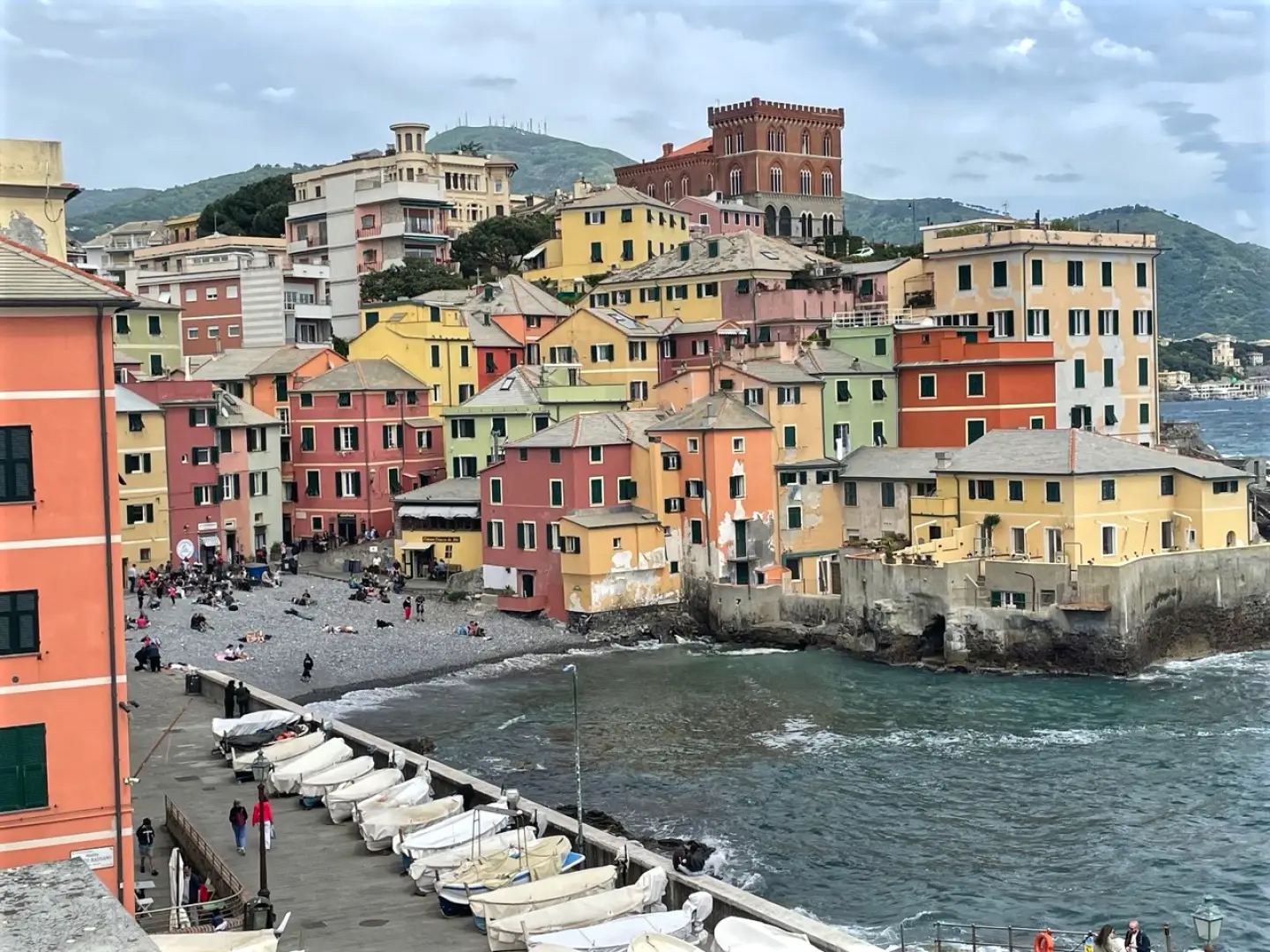
The municipal area stretches along a narrow and rugged stretch of coastline, where urban development has historically taken place vertically along the slopes leading down to the sea. Two main watercourses border the historic centre: the Polcevera stream to the west and the Bisagno stream to the east, both of which flow into the Ligurian Sea. Behind the city, the Apennine mountains rise steeply, with ridges and valleys separating the hillside neighbourhoods from those on the coast. The highest point within the municipal area is Monte Reixa, on the border with the municipalities of Arenzano and Sassello.
A port settlement since pre-Roman times, Genoa reached the height of its development as the capital of the Maritime Republic, a commercial and financial power that for centuries controlled routes and ports throughout the Mediterranean. Testimony to that era is provided by the system of the Palazzi dei Rolli along Via Garibaldi, recognised as a UNESCO World Heritage Site, and the historic centre of the ‘caruggi’, one of the largest medieval districts in Europe. The port, a constant feature of the city’s history, has undergone periods of decline and revival, eventually becoming, in modern times, Italy’s principal commercial port. The urban landscape also preserves a system of nineteenth-century fortifications stretching along the hilltops, built to defend the city and now accessible as a walking route.
The city’s economy has historically revolved around the port, shipbuilding and industrial and port-related activities, alongside the service sector, the university and tourism. Among the typical local produce is Genoese Basil (PDO), traditionally grown on the Tyrrhenian coast of Liguria and, in particular, in the Genoese district of Prà; it is the key ingredient in Genoese pesto. The municipality is also home to the Genova Trail, featuring a main route of 46 km and 2,655 m of elevation gain (D+) winding through the city’s forts and theAlta Via dei Monti Liguri, alongside a shorter route, the Genova City Trail, covering 20 km with 909 m of elevation gain.
The hillside and Apennine slopes of the municipal area form part of the Beigua Regional Nature Park, which stretches along the watershed ridge towards the west. Within the city, the Parco delle Mura preserves a large stretch of Mediterranean vegetation along the ancient 19th-century fortified walls. The coastal strip is characterised by thermophilic Mediterranean vegetation, with species such as the holm oak (Quercus ilex) and the strawberry tree (Arbutus unedo), whilst the higher elevations of theinland are home to mixed deciduous woodland.
The hiking opportunities within the municipal area are mainly concentrated on the hills and Apennine ranges behind the town, with routes taking in panoramic ridges, inland villages and the network of 19th-century forts. Among the most popular destinations are Monte Fasce, Monte Reixa and the Sambuco area, which can be reached via circular or through-hiking routes of moderate difficulty.
Information
General information
Area: 240.65 km²
Altitude of the administrative centre: 34 m
Highest point: 1,182 m – Mount Reixa
Population: 566,247 (as at 1 January 2026, ISTAT estimate)
Name in the local dialect: Zena
Name of the inhabitants: Genoese
Patron saint: St John the Baptist, celebrated on 24 June
Neighbouring municipalities: Arenzano – Bargagli – Bogliasco – Bosio – Campomorone – Ceranesi – Davagna – Masone – Mele – Mignanego – Montoggio – Sant’Olcese – Sassello – Serra Riccò – Sori – Tiglieto – Urbe
Province: Metropolitan City of Genoa
Region: Liguria
Country: Italy
Official website: comune.genova.it
Points of interest
Itineraries
Itineraries by activity